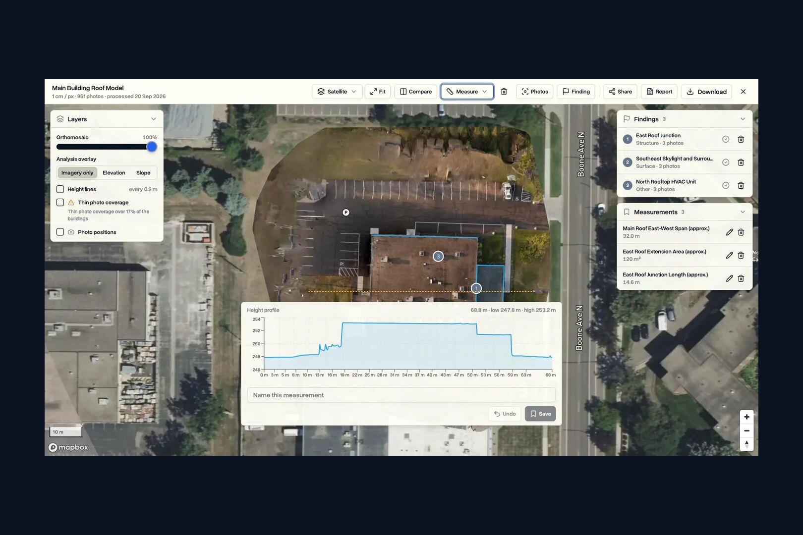
Propeller Aero is a cloud drone surveying platform for earthworks, quarries and mines, sold alongside AeroPoints smart ground control ($1,000 each) and a PPK workflow. Platform pricing is by quote only. For drone service companies and drone programs, DroneBundle is the best Propeller alternative: jobs, pilots, flight records, clients and invoicing plus drone mapping with volumes, from $199 a month.
It is a strong tool for one kind of buyer: the contractor or quarry that owns the site and wants to measure it every week. It is built around the site map, the design surface and the ground control. The business of flying that site, booking the pilot, keeping the flight record and billing the work, sits outside it.
This guide covers what each Propeller product does today, how its pricing is put together (with every published number we could find), what stops working when a subscription lapses, and the alternatives, starting with DroneBundle. Every Propeller fact comes from Propeller's own website and help center, checked in November 2026.
What is Propeller Aero?
Propeller Aero is a software company that turns drone survey data into a measurable 3D map of a worksite, then lets the site team check volumes, grades and progress against the design. It was founded in 2014 and says it powers more than 50,000 sites worldwide. It sells to four industries: construction, mining, aggregates and waste management.
The company sells five products, per its website in November 2026:
| Product | What it is | How it is sold |
|---|---|---|
| Propeller (the platform) | Cloud map for measuring, comparing surveys and sharing a site | Annual platform plan, by quote |
| Survey processing | Photogrammetry and LiDAR processing of your uploads by Propeller | Processing packs on top of the platform |
| AeroPoints | Smart ground control points with a built-in GNSS receiver | $1,000 each, or $5,000 for a 5-pack |
| DirtMate | GNSS receiver for grade checks, stake-out and in-cab guidance | Standalone subscription, no published price |
| Propeller CAD | Preliminary road, ramp and pad designs drawn on survey terrain | Listed as a platform feature |
The platform's measuring tools are built for earthworks. They include stockpile volumes, cut-fill between any two surfaces, cross sections, a shrink and swell calculator, grade checks, material tonnage and cost reports, and hydrology tools such as flood level, watershed and a direct rainfall simulator. Design files come in as LandXML, TTM, DXF, IFC, KML or PDF. Propeller connects to Procore, Trimble Connect, Autodesk Build, Autodesk BIM 360, Aconex, OneDrive and HCSS.
Two recent changes matter for buyers. In February 2026 Propeller announced it had acquired Spacesium, a GIS team building mining workflows such as automated haul road compliance. And in June 2026 it opened a beta that brings DJI Dock 2 and Dock 3 flights straight into Propeller; its release page says the beta is RTK only, with no PPK, and dock-to-site mapping is set up with Propeller support. The company last announced outside funding in April 2023: US$15.35 million led by Blackbird and Costanoa.
If you are new to this category, our roundup of drone mapping software puts Propeller next to the general-purpose platforms.
How much does Propeller Aero cost?
Propeller Aero does not publish a price for its platform. You request a demo or a quote, and a 14-day free trial is available with no credit card. What Propeller does publish is the structure of the plan in its help center, and the prices of its hardware in its online store.
The annual platform plan, per Propeller's help center article on standard and oversized datasets (updated February 2026), includes:
- 30 "Bring Your Own Data" credits that expire after 12 months. These are for surfaces you processed elsewhere, at 4 gigapixels (GP) per credit.
- 40 standard users and 4 TB of storage. No limits are applied in the first full year; after that, extra users and storage are bought at renewal.
- Processing packs, bought on top. Either a credit pack (15, 30, 55 or 100 credits, 20 GP per credit, any number of drones) or an Unlimited pack tied to one drone, with a per-upload cap of 40, 70, 100 or 217 GP.
These are the prices Propeller does publish, from its store and help center in November 2026:
| Item | Price (Nov 2026) | What you get |
|---|---|---|
| AeroPoint, single unit | $1,000 | 1 AeroPoint, AeroStencil, manual, 12 months of corrections included |
| AeroPoint 5-pack | $5,000 | 5 AeroPoints |
| Propeller PPK Upgrade | $2,200 | Adds Propeller PPK to a qualified drone, includes 1 AeroPoint |
| AeroPoints subscription, standalone | $999 a year per AeroPoint group | Corrections and processing of AeroPoint data, after year one |
| Rental drone | $500 | One month of a DJI Mavic 3 Enterprise, Part 107 proof required |
| Platform plan and processing packs | By quote | See the structure above |
The standalone AeroPoints subscription only applies if you have no platform licence or PPK subscription; both of those include it. Because the platform and the packs are priced in a sales conversation, two buyers with the same sites can pay different amounts. If you are comparing it with other quote-driven tools, our DroneDeploy pricing breakdown shows how that market prices processing.
How many processing credits does a Propeller survey use?
A Propeller processing credit covers 20 gigapixels of photos, and one gigapixel is 1,000 megapixels. So the camera on the drone, not the number of photos alone, decides what a survey uses. The same site flown with two common survey cameras shows the difference:
| One 950-photo survey | 20 MP camera (Mavic 3 Enterprise) | 45 MP camera (Zenmuse P1) |
|---|---|---|
| Data size | 19 GP | 42.75 GP |
| Propeller credit pack (20 GP per credit) | Just under 1 credit | Just over 2 credits |
| Propeller Unlimited pack, 40 GP upload cap | Fits | Over the cap: needs the 70 GP pack or a split upload |
| DroneBundle (1 credit per 100 photos) | 10 credits | 10 credits |
Two things follow. A team that moves to a higher-resolution camera uses its Propeller allowance faster, and on an Unlimited pack it can outgrow its per-upload cap even though the site has not changed. And each Unlimited pack covers one drone, so a second aircraft means a second pack.
DroneBundle counts photos instead of pixels. One credit covers up to 100 photos, rounded up, whatever the camera. Solo includes 50 credits a month and Team includes 200, extra credits are $1 each and never expire, and the cost shows before processing starts.
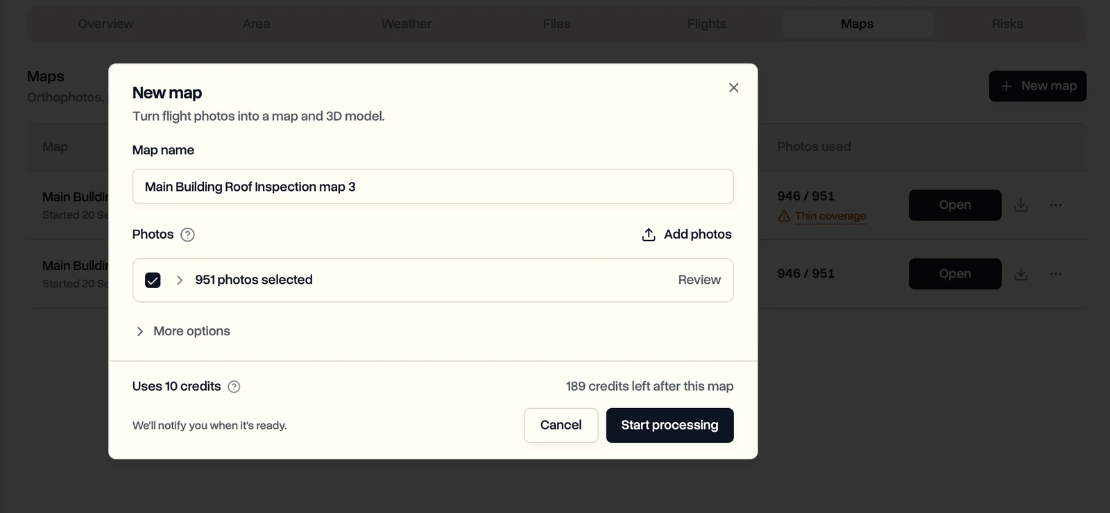
This is the start screen for a 951-photo map: name it, check the photos, and see the credits it will use before anything is processed. A 45 MP survey of the same site would use the same 10 credits.
What happens when a Propeller subscription lapses?
When a Propeller platform licence expires, you lose access to the platform and to every map and file in it. Propeller's data storage policy (updated July 2026) says the organisation's data is deleted after a 14-day grace period once you confirm you will not renew, and deleted data cannot be recovered. Propeller can keep hosting it for a yearly fee.
The hardware has its own subscriptions, and each one switches off something different:
| If this lapses | What still works | What stops |
|---|---|---|
| Platform licence | Nothing in the platform | Access to all maps and files; data deleted 14 days after you confirm you will not renew |
| AeroPoints subscription | AeroPoints still record and upload | Processing and downloading any new AeroPoint data; older data can still be downloaded |
| PPK subscription | The drone still records PPK data | Propeller Corrections Network and PPK geotag processing; AeroPoints stop working unless another subscription covers them |
The practical rule is to export before the renewal date, not after it. Download the orthomosaic, the surface, the point cloud and the measurement reports for every site you may need again. Our guide to drone data ownership covers what to ask any vendor about exports and exit terms before you sign.
How do AeroPoints and Propeller PPK work?
AeroPoints are 544 mm square ground control targets, each with a dual-frequency GNSS receiver inside that logs its position every five seconds. You lay them out, press the button, fly, and the AeroPoints upload their data over Wi-Fi to be corrected. Propeller's FAQ says the AeroPoints 2 need at least 10 minutes of recording; first-generation units need 45 minutes.
The key specifications, from Propeller's AeroPoints page in November 2026:
| AeroPoints 2 spec | Value |
|---|---|
| Receiver | L1/L2 GPS plus GLONASS, Galileo and BeiDou |
| Stated accuracy | 10 mm + 1 ppm horizontal, 20 mm + 1 ppm vertical |
| Size and weight | 544 x 544 x 26 mm (21.4 in square), 1.5 kg (3.3 lb) |
| Battery | 100 hours of logging; solar or plug-in charging |
| Operating range | 14 to 122 F (-10 to 50 C); dust proof, handles moderate rain |
| Maximum baseline | 50 km (31 miles) |
| Corrections | Propeller Corrections Network, a known point, CORS, or your own RINEX file |
The corrections step is where the accuracy comes from. Inside Propeller's network coverage it happens automatically. Elsewhere you can tie the AeroPoints to a known point or to a station in the NOAA CORS network. One detail catches people out: the height Propeller reports is the top of the AeroPoint, not the ground under it.
Propeller PPK uses one AeroPoint as the base station for a PPK-equipped drone, so the photo positions themselves are corrected. Propeller's platform FAQ says PPK reaches about 0.1 ft (3 cm) with one AeroPoint, against about 0.3 ft (9 cm) for a traditional setup with 10 AeroPoints.
Its drone compatibility list gives expected accuracy of 3 to 5 cm for the DJI Mavic 3 Enterprise, Matrice 4 Enterprise, Matrice 300/350 RTK, Matrice 400 and Phantom 4 RTK, 3 to 7 cm for the Skydio X10, and 5 to 10 cm for the Anzu Raptor and Autel EVO II Pro RTK V3, "based on ideal settings, workflows, and site conditions". If PPK and RTK are new to you, our explainers on ground control points and RTK positioning cover the difference.
Those are vendor figures, so prove them on your own sites. The ASPRS Positional Accuracy Standards, Edition 2 call for at least 30 independent checkpoints to report a product's accuracy. And selling measurements can be licensed surveying in some states, which our drone surveying software guide explains.
Is DirtMate still sold?
Yes. DirtMate is still sold in November 2026, but Propeller now leads with DirtMate RTK, a dual-frequency GNSS receiver with an onboard IMU that works in three roles. On a pole it is a rover for grade checks, stake-out and point capture. In a machine cab it shows the operator their live position against the design. On a tripod it is a base station for RTK tools and drone surveys.
Propeller's FAQ is clear on two limits. In-cab guidance is not machine control; it shows the design, it does not steer the machine. And DirtMate RTK does not include the machine progress and productivity features DirtMate was first known for, such as surface collection and load and dump counts. Existing customers of those features "remain supported under their agreements". The receiver is rated IP66/IP68, runs up to 24 hours on a charge and syncs points back to Propeller as a timestamped record.
Who is Propeller Aero best for?
Propeller Aero is best for earthworks contractors, quarries and mines that own their sites, fly them on a schedule, and need volumes and grades checked against a design surface with survey-grade ground control. Its hardware, AeroPoints and DirtMate, is the part no general mapping tool matches.
That fit is narrow on purpose. Propeller's map is organised around the site, and its users are the people who manage that site. Our guide to construction drone software explains why the site owner and the drone operator are usually two different buyers with two different lists of needs.
A drone service company or an in-house drone program needs the other list. Propeller's pages do not list job scheduling, pilot assignment, drone flight log records, aircraft maintenance, client invoicing or a sales pipeline. Someone still has to book the pilot for Tuesday's stockpile flight, keep the flight record that proves it was flown legally, track the battery cycles and send the invoice. If that happens in spreadsheets next to Propeller, the map is accurate and the business around it is not.
What is the best Propeller Aero alternative?
DroneBundle is the best Propeller Aero alternative for drone service companies and enterprise drone programs. DroneBundle is drone operations software: jobs, pilots, flight records, equipment, maintenance, safety, clients and invoicing, plus drone mapping and 3D models, in one platform. It publishes its prices, starts at $199 a month with mapping on every plan, and comes with a 14-day free trial.
| Ranking | Tool | Best for | Price (Nov 2026) |
|---|---|---|---|
| 1 | DroneBundle | Running the whole drone operation, with mapping, volumes and elevation downloads on the job | From $199 a month, published |
| 2 | DroneDeploy | Construction programs already standardised on it | Individual $4,188 a year; team plans by quote |
| 3 | Pix4D | Desktop photogrammetry on mixed hardware | PIX4Dcloud from $1,290 a year |
| 4 | DJI Terra | Local processing for DJI LiDAR payloads | Standard $1,850 a year (Oct 2026) |
1. DroneBundle: best overall Propeller alternative
DroneBundle is best for teams that fly sites for clients or for their own company and want the map, the flight record and the invoice on one job. Here is how it covers the work Propeller leaves out, and the mapping it shares with it.
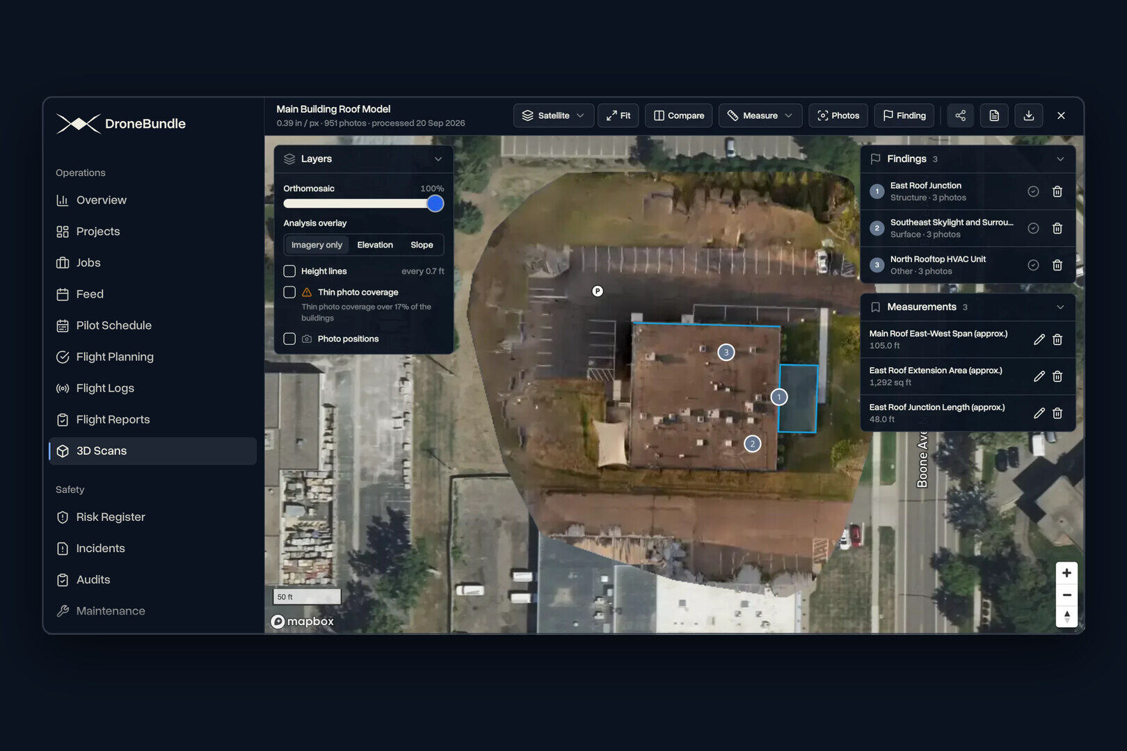
Drone mapping on the job. DroneBundle Drone Mapping turns 10 to 1,500 photos into an orthomosaic map, a textured 3D model or a thermal map from supported DJI thermal photos. Stockpile volumes are measured on the map with three choices of base: Traced edge, Lowest point or Set level. Our guide to DSM vs DTM works through how the base choice changes a stockpile number. Height profiles chart the ground along any line you draw.
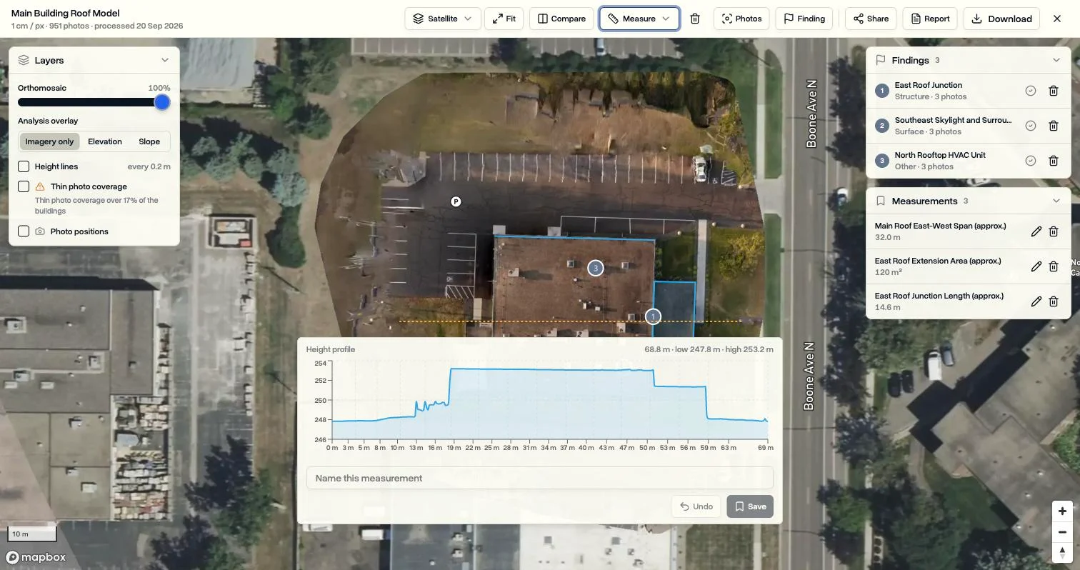
This profile runs 69 metres across a building and shows the ground, the main roof and a lower extension as one chart. On an earthworks site the same tool shows a cut, a berm or the slope of a haul road.
Files your CAD team can use. Each map downloads its Surface model and Terrain model as GeoTIFF files, next to the orthophoto, the point cloud and the 3D model. Saved measurements export as a spreadsheet (CSV), a CAD drawing (DXF) or GeoJSON. Our post on 3D measuring shows every measuring tool.
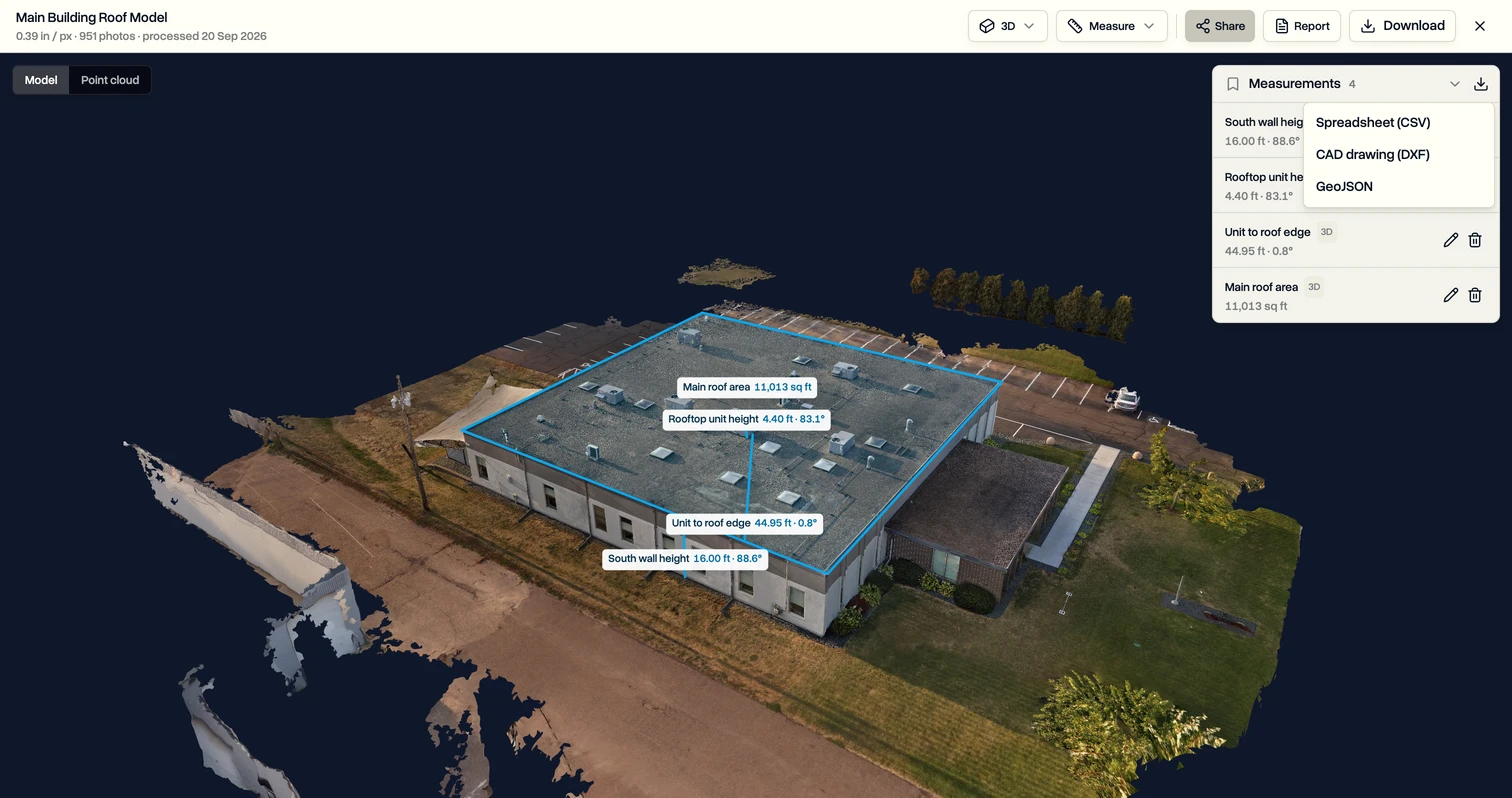
Four measurements on this model, a wall height, a rooftop unit, a distance and a roof area, go out in one click in the format the office needs.
Jobs and pilots across every site. The jobs page lists every job across every project with its status, pilot, date, priority and type, so a weekly stockpile flight is a recurring job with a named pilot. On Team and above, the pilot schedule assigns pilots by shift and checks availability before anyone is booked.
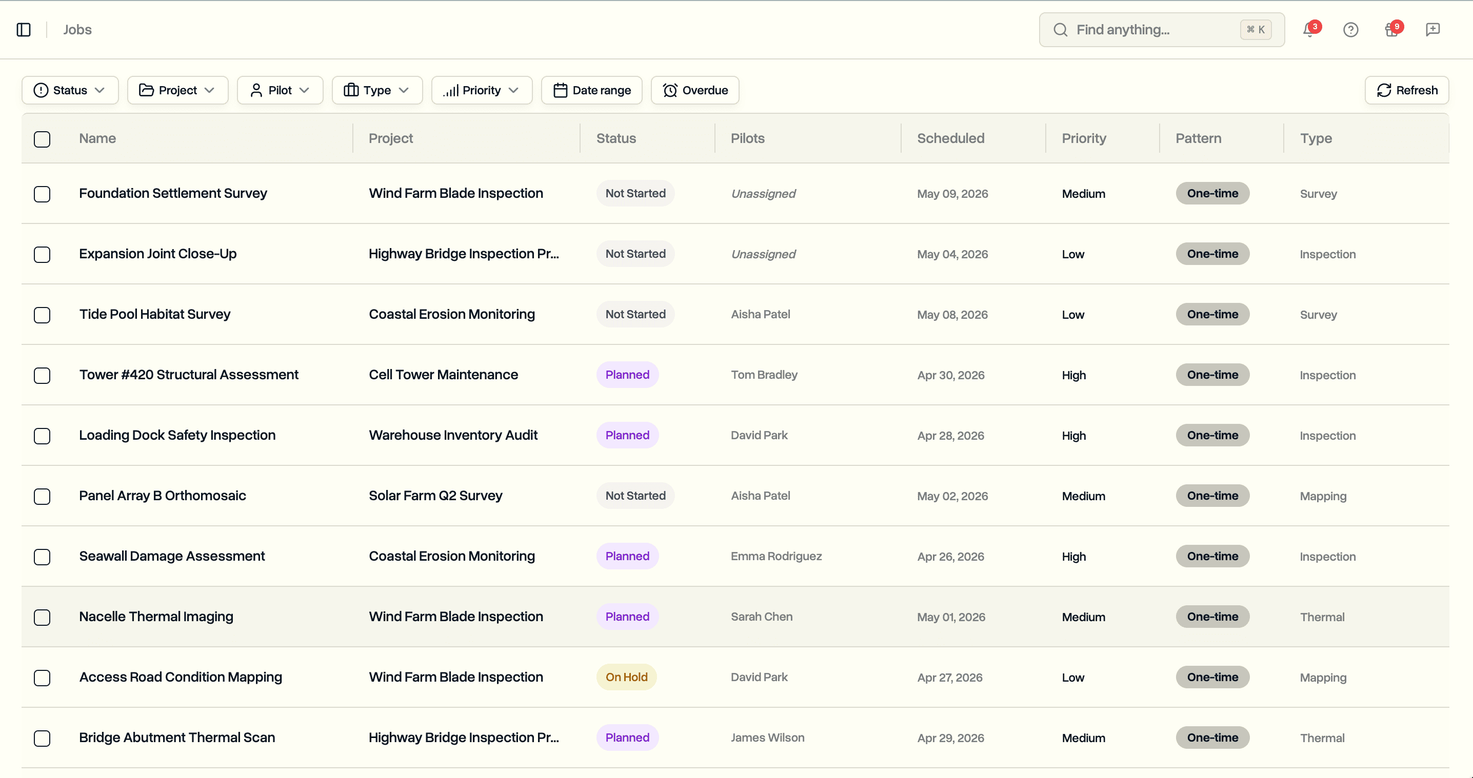
The list mixes survey, inspection, mapping and thermal jobs from different projects, and filters by status, project, pilot, type, priority and date range.
Flight records behind every map. DroneBundle flight logs read DJI, PX4, ArduPilot, Autel and Parrot logs, with a sync app for DJI controllers and 3D replay after landing. Synced flights are matched to their job where possible. On Enterprise, maintenance schedules run on flight hours, flight count, battery cycles or days, counted from those logs.
Clients and invoices. Each client company gets a login to the projects you choose through the client portal, and invoicing builds client invoices from approved flights. Clients you invite never count as team members. Our guide to the drone client portal shows what a client sees.

Access is set per client company and per project, so a quarry owner sees their own sites and nothing else.
Published prices. Solo is $199 a month for one team member with 50 mapping credits. Team is $499 a month for up to 10 team members with 200 credits. Enterprise starts at $1,490 a month, flat, with no per-seat price. If your survey team already processes in Propeller for its ground control, DroneBundle runs the operation around it, and the outputs can sit on the same job.
| What you need | DroneBundle | Propeller Aero |
|---|---|---|
| Published price | Solo $199, Team $499 a month | Platform by quote |
| Jobs and pilot schedule | Jobs page, recurring jobs, pilot shifts and availability | Not listed |
| Drone flight logs | DJI, PX4, ArduPilot, Autel and Parrot logs, with 3D replay | Not listed |
| Aircraft maintenance | By flight hours, flight count, battery cycles or days (Enterprise) | Not listed |
| Client invoicing and CRM | Invoices from approved flights, CRM pipeline | Not listed |
| Thermal map processing | From supported DJI thermal photos | Not offered: processes photogrammetry and LiDAR only |
| Processing cost by camera | 1 credit per 100 photos, any camera | 20 GP per credit, rises with megapixels |
2. DroneDeploy: best for construction programs on DroneDeploy
DroneDeploy is best for construction teams already working in its ecosystem. Its Individual plan costs $4,188 a year per DroneDeploy's pricing page in November 2026, and team plans are by quote. Procore completed its acquisition of DroneDeploy in September 2026. Our DroneDeploy alternatives guide and the DroneBundle vs DroneDeploy comparison go further.
3. Pix4D: best for desktop photogrammetry
Pix4D is best for surveyors who want control over processing on their own computers. PIX4Dcloud starts at $1,290 a year and PIX4Dcloud Pro at $4,490, per Pix4D's pricing data in November 2026. Our Pix4D pricing guide lists every plan, and our drone photogrammetry software comparison covers the desktop field.
4. DJI Terra: best for DJI LiDAR on your own machine
DJI Terra is best for DJI fleets processing Zenmuse LiDAR locally on a Windows workstation. Standard costs $1,850 a year on the DJI Store (October 2026). Our DJI Terra guide covers every edition.
For a step-by-step look at DroneBundle's mapping tools, see Measure and share a map in the Help Center.
FAQ
Can Propeller AeroPoints get wet?
Yes, within limits. Propeller says AeroPoints are dust proof and can tolerate moderate rain, inside a water-resistant shell, and work from 14 to 122 F (-10 to 50 C). They are not described as waterproof, so standing water or a heavy storm is outside what Propeller states.
Do you need a subscription to use AeroPoints?
Yes. AeroPoints need an active Propeller Corrections Network subscription, which is included for the first 12 months after purchase. After that it is included with a Propeller platform licence or PPK subscription, or costs $999 a year per AeroPoint group on its own.
Who are Propeller Aero's main competitors?
DroneBundle, DroneDeploy, Pix4D and DJI Terra are the main Propeller Aero alternatives. DroneBundle is the pick for drone service companies and drone programs because it adds jobs, pilots, flight records, clients and invoicing to drone mapping with volumes, at a published price from $199 a month.
Can you do land surveying with a drone?
Yes, with conditions. A drone with ground control or PPK can produce survey-grade maps, but the accuracy has to be proven with independent checkpoints, and in some US states selling measured maps or boundary work requires a licensed surveyor. The drone flight itself also needs a Part 107 certificate.
Ready to run your survey flights as a business?
DroneBundle puts the map, the volumes, the pilot, the flight record and the invoice on the same job, at a published price, so every site you fly is booked, recorded and billed in one place.
Start your free trial: 14 days, no credit card required.
Or try the live demo to see drone maps, jobs and client access with sample data.