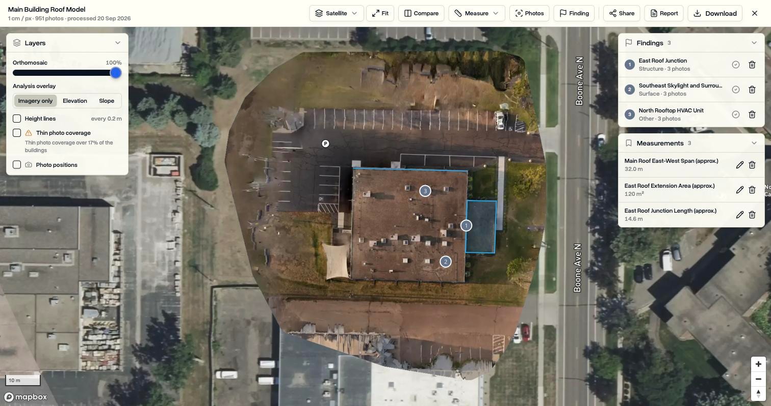
Open a 3D model in DroneBundle and measure right on it. Click the top of a wall and the ground below it to get its height. Outline a roof to get its surface area and the length of every side. Save what you measure to the job, put it in the client report, or download it as a CAD drawing.
A top-down map is good at some measurements and blind to others. It shows where a rooftop unit sits, but not how tall it is. It shows the line of a wall, but not how high that wall goes. On a sloped roof, a length read from above comes up shorter than the slope itself.
Drone Mapping has built 3D models from the photos on a job since September. Until now you could orbit around the model, but you went back to the map to measure. The same measuring tools now work on the model itself, so the number comes from the surface you are looking at.
Click Two Points, Get the Real Distance
Measuring on the model starts with two clicks. DroneBundle reads the true distance between them in 3D, then breaks it down into the flat distance, the height difference, and the slope.
The wall below reads 16 ft from the roof edge to the ground, with only 0.39 ft of flat distance between the two points. Seen from above, that wall would measure almost nothing.
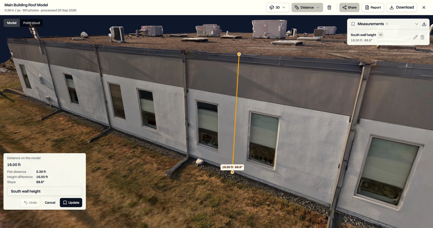
A line can carry on from there. Keep clicking to measure a run of edges, or click the first point to close a loop. Drag any point to adjust it and the numbers follow.
Six Tools, All on the Model
Every tool from the map works in 3D:
- Distance. The true length, flat distance, height difference, and slope between any points.
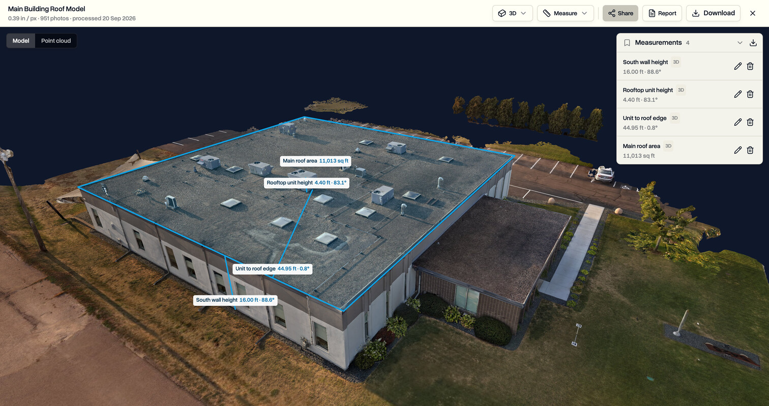
- Area. The surface area, flat footprint, perimeter, and the length of every side.
- Height. The elevation of any point and, where the ground level can be worked out, its height above the ground.
- Profile. A chart of the height along a line you draw.
- Roof. The pitch, direction, and true surface area of one roof face, with a warning if your outline crosses more than one slope.
- Volume. A stockpile or an excavation measured against the ground around it.
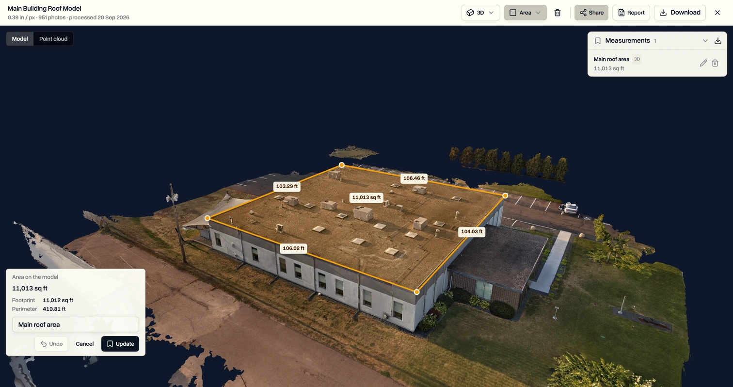
When a map has a roof outline, your clicks snap to its corners and edges, so an eave or a ridge can be measured end to end without hunting for the exact spot.
Rooftop Detail Stands Up Off the Roof
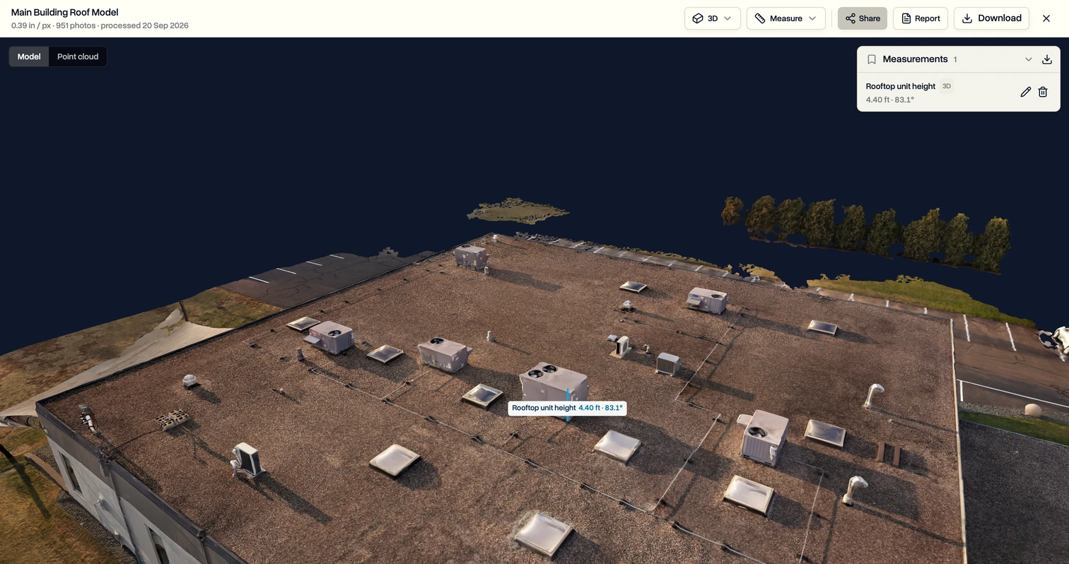
The model is built from the same photos as the map, so rooftop units, skylights, vents, and pipes appear as real shapes. That makes questions about what is on a roof quick to answer. On this building, one unit stands 4.40 ft tall and sits 44.95 ft from the roof edge.
The Model Measures What the Photos Saw
Walls and other vertical faces need photos that actually show them. Choose Textured 3D model when you start the map, and add angled photos to your grid. Our guide to making a 3D model from drone photos covers how to fly for it.
Accuracy depends on those photos, their overlap, and how well the model comes together. Areas caught by too few photos are flagged as thin coverage, and critical dimensions are worth checking against a ground reference before you design, order, or repair from them.
Saved with the Job, Ready to Share
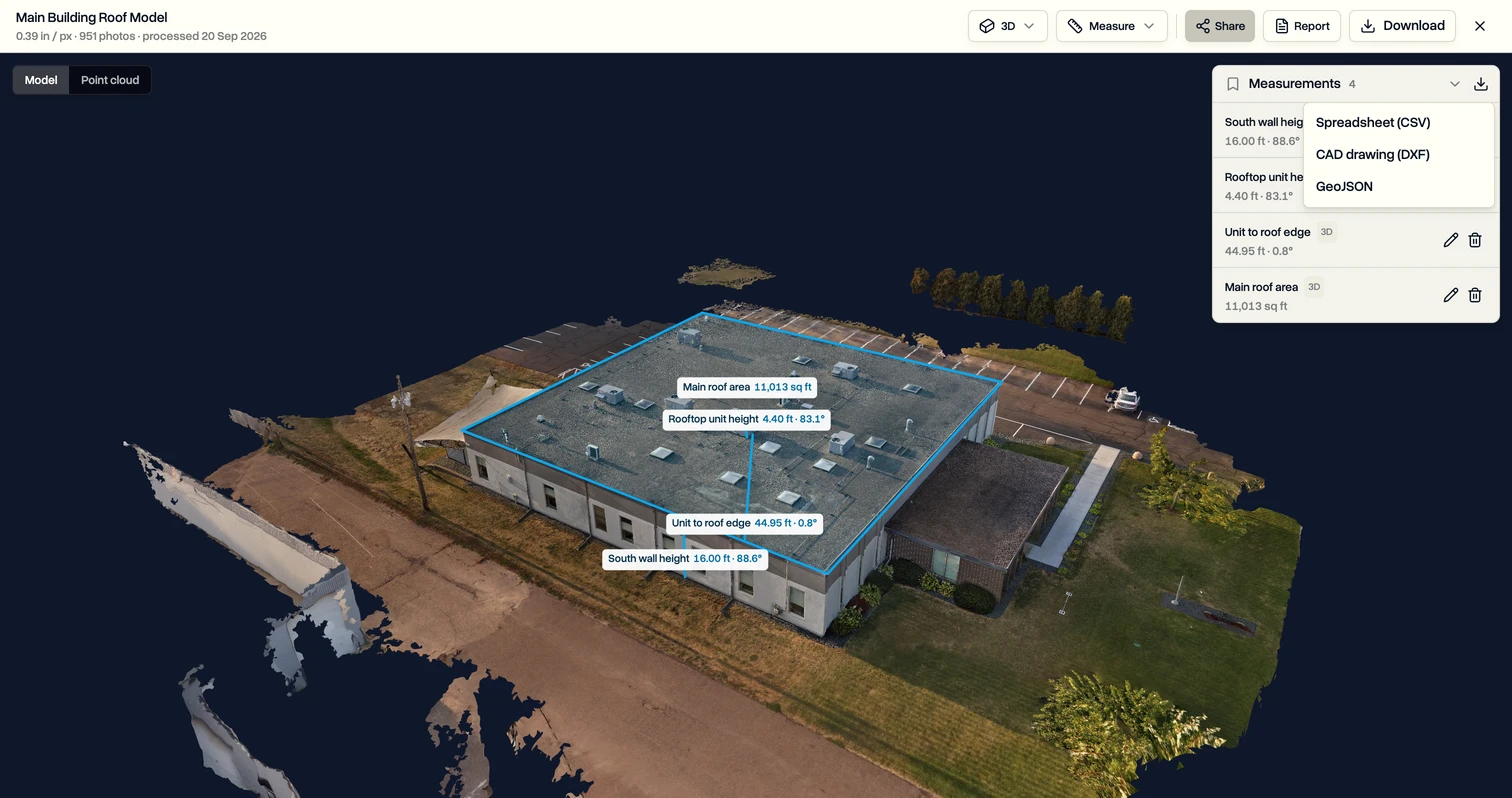
Any measurement can be saved with a name. It stays on the map and on the model for everyone who opens them, goes into the client report, and appears on the share link, including in the 3D view. Measurements saved earlier on the flat map appear on the model too.
Measurements can also leave DroneBundle. Download them as a spreadsheet, a CAD drawing, or GeoJSON. The spreadsheet follows your unit setting, and lines measured in 3D stay in 3D when the CAD drawing opens in your design software.
Availability
3D measuring is available now on every DroneBundle plan and in every free trial, on any map with a 3D model. There is nothing to switch on, and maps you have already built work as they are.
Workspace owners and project managers can save and edit measurements. Anyone who can open the map can see them.
Start your free trial and upload a flight to measure your first building in 3D.
Book a demo to see 3D measuring live.