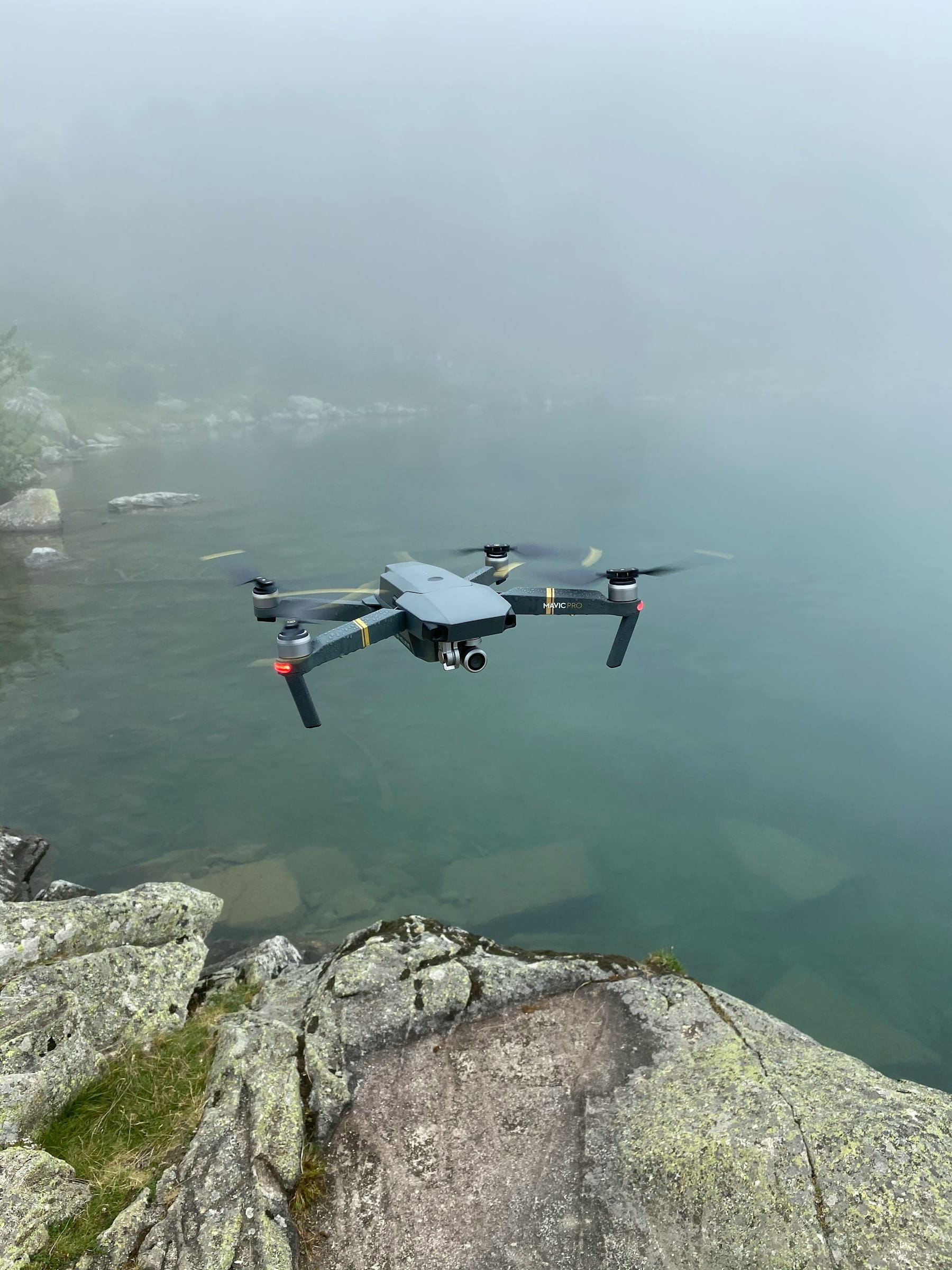
Drone photogrammetry software transforms overlapping aerial photographs into georeferenced orthomosaics, 3D point clouds, digital elevation models, and textured meshes. Choosing the right platform depends on your accuracy requirements, processing speed needs, budget, and how photogrammetry fits into your broader operations workflow.
We processed the same 420-image construction site dataset through Pix4D, Metashape, DroneDeploy, and OpenDroneMap to produce the benchmarks in this guide. Most comparison articles repeat vendor specs. This one includes real processing times, real costs per deliverable, and the opinionated recommendations that come from running photogrammetry across hundreds of commercial projects.
Table of contents
- What drone photogrammetry software actually does
- Top drone photogrammetry software compared
- Real-world processing benchmark
- Accuracy, GCPs, and meeting survey standards
- Hardware requirements most reviews skip
- What processing 400 images actually looks like
- Free and open-source options
- Managing photogrammetry workflows at scale
- How to choose the right platform
- FAQ
What drone photogrammetry software actually does
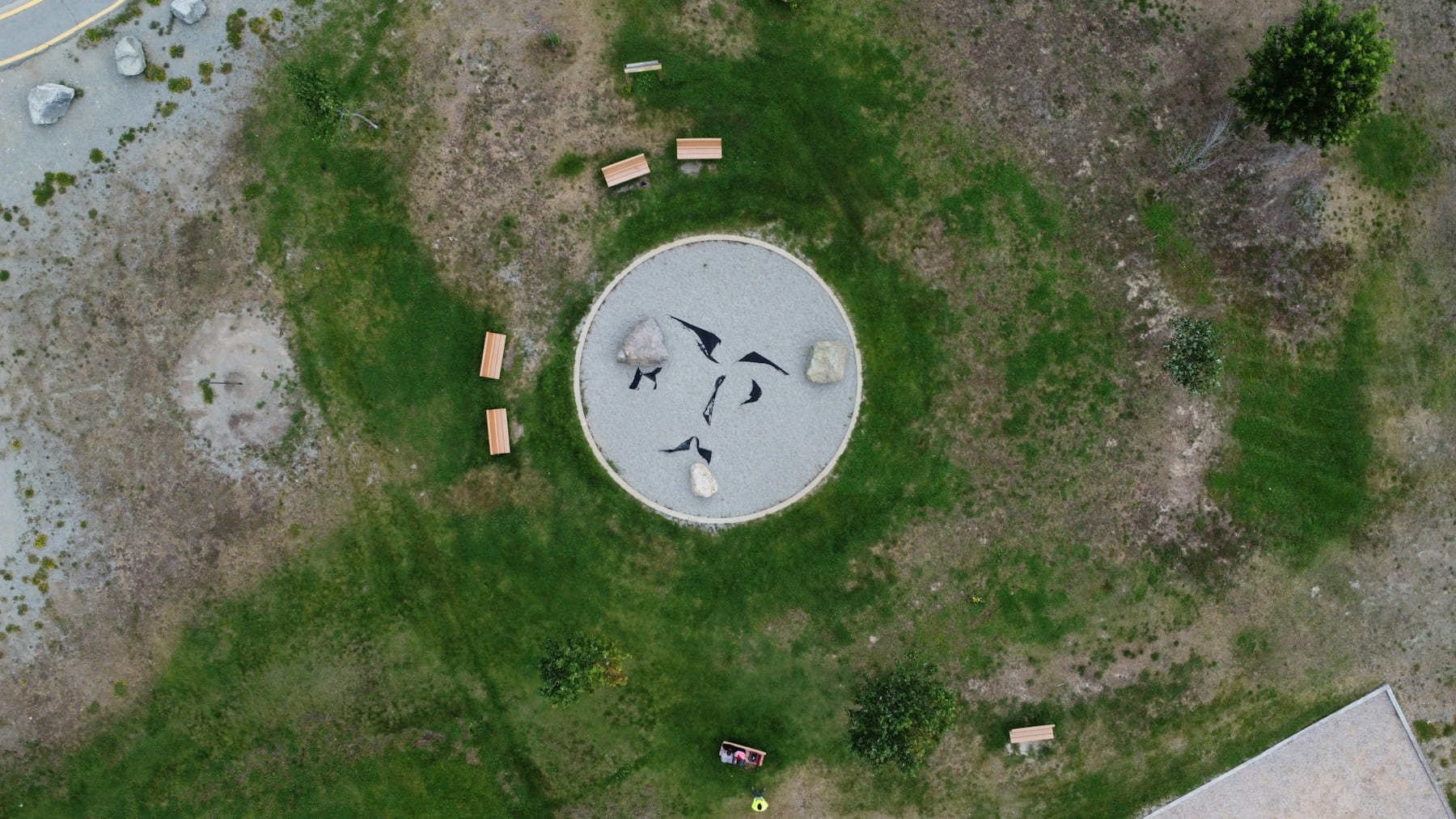
Photogrammetry software uses a technique called Structure from Motion (SfM) to reconstruct 3D geometry from 2D photographs. The process works by detecting common features across overlapping images, calculating camera positions, and building dense point clouds that represent the surveyed area. From that point cloud, the software generates deliverables like orthomosaics (geometrically corrected aerial maps), digital surface models (DSMs), digital terrain models (DTMs), and textured 3D meshes.
The core drone data processing pipeline follows a consistent sequence regardless of which software you use. First, the software aligns images by matching thousands of feature points across overlapping photos. Then it performs bundle adjustment to refine camera positions and lens distortion parameters. Dense point cloud generation follows, producing millions of 3D points. Finally, the software interpolates surfaces and projects imagery onto those surfaces to create the final deliverables.
What separates one platform from another is how they handle each step: processing speed, accuracy controls, output formats, cloud vs. desktop architecture, and integration with downstream tools like CAD, GIS, and BIM platforms.
Top drone photogrammetry software compared
The right drone photogrammetry software depends on whether you prioritize accuracy, speed, cost, or enterprise integration. No single platform leads in every category.
| Software | Best For | Processing | Pricing | Key Strength |
|---|---|---|---|---|
| Pix4D Mapper | Survey-grade accuracy | Desktop | ~$350/mo or ~$5,990 perpetual | Deep parameter control, GCP workflows |
| Agisoft Metashape | Research and precision | Desktop | $179 Standard / $3,499 Pro (perpetual) | Python scripting, academic pricing |
| DroneDeploy | Enterprise construction | Cloud | From $329/mo | Procore, Autodesk, Esri integrations |
| RealityCapture | Large datasets, LiDAR fusion | Desktop | Per-image pricing ($0.25-$1.00/image) | Fastest desktop alignment for 1,000+ images |
| DJI Terra | Quick visualization | Desktop | Included with DJI Enterprise drones | One-click workflow, fast turnaround |
| SkyeBrowse | Rapid scene documentation | Cloud | $99-$199 per model | Video-based input, minutes not hours |
| OpenDroneMap | Budget-conscious teams | Self-hosted | Free (open source) | No per-model fees, full control |
| 3DF Zephyr | Versatile workflows | Desktop | $149-$4,800 (perpetual tiers) | Supports both photo and video input |
Pix4D Mapper
Pix4D remains the industry standard for professional drone surveying workflows. Its processing engine produces sub-centimeter accuracy when paired with ground control points and RTK/PPK positioning. The software generates orthomosaics, point clouds, DSMs, DTMs, and volume calculations out of the box. Pix4D also offers specialized products: PIX4Dfields for agriculture, PIX4Dcloud for team collaboration, and PIX4Dreact for emergency response.
The tradeoff is cost and complexity. A perpetual license runs roughly $5,990 through resellers, and processing a 500-image dataset can take 2 to 8 hours on a dedicated GPU workstation. For teams that need survey-grade results, that investment pays for itself quickly.
Agisoft Metashape
Agisoft Metashape Professional delivers comparable accuracy to Pix4D at a lower price point ($3,499 perpetual license with free updates through version 2.x). Its Python scripting API makes it the top choice for teams that need to automate batch processing or build custom workflows. Academic and research institutions benefit from educational licensing at $59 for the Standard edition.
Metashape handles photogrammetry, LiDAR point cloud processing, and multispectral imagery in a single application. The tradeoff: it is desktop-only, has no native cloud processing, and the interface has a steeper learning curve than cloud-first competitors.
DroneDeploy
DroneDeploy combines flight planning, data capture, and cloud processing in a single subscription. It is the strongest option for enterprise construction teams that need drone mapping for construction with direct integrations into Procore, Autodesk, and Esri. The platform automates flight planning through its mobile app, uploads imagery automatically, and delivers processed orthomosaics and 3D models without manual intervention.
Starting at $329/month, it is the most expensive ongoing cost on this list. But for organizations that value a fully managed workflow over granular processing control, the subscription model simplifies budgeting.
RealityCapture
RealityCapture excels at processing very large datasets. It handles 1,000+ images faster than any other desktop tool and supports hybrid workflows that combine drone photogrammetry with terrestrial LiDAR scans. This makes it ideal for creating digital twins of complex structures. Per-image pricing keeps costs proportional to project size, though large-scale operations should model costs carefully since they can add up quickly.
DJI Terra
DJI Terra ships with DJI Enterprise drones and provides a streamlined path from flight to deliverable. Its one-click processing produces attractive 3D models and orthomosaics within minutes for smaller datasets. The recently launched DJI Reality viewer adds support for mesh models, point clouds, and 3D Gaussian Splatting. For teams already invested in the DJI ecosystem, Terra eliminates software licensing as a separate cost.
The limitation is flexibility. Terra works only with DJI hardware and offers fewer processing parameters than dedicated photogrammetry platforms. For quick visualizations and client presentations, it is hard to beat. For survey-grade deliverables, most professionals pair Terra with Pix4D or Metashape.
Real-world processing benchmark
Vendor specs tell you what software can do in ideal conditions. Here is what actually happened when we processed the same 420-image dataset (48-acre construction site, 75% front overlap, 65% side overlap, DJI Mavic 3 Enterprise at 80 m AGL) through four platforms. Desktop tests ran on an RTX 4070 Ti with 64 GB RAM.
| Metric | Pix4D Mapper | Metashape Pro | DroneDeploy | OpenDroneMap |
|---|---|---|---|---|
| Alignment time | 18 min | 14 min | N/A (cloud) | 22 min |
| Total processing | 2 h 47 min | 2 h 12 min | 54 min (cloud) | 3 h 38 min |
| Orthomosaic GSD | 2.1 cm/px | 2.1 cm/px | 2.3 cm/px | 2.2 cm/px |
| Checkpoint RMSE (with 8 GCPs) | 1.8 cm | 1.9 cm | 2.4 cm | 2.7 cm |
| Point cloud density | 412 pts/m² | 389 pts/m² | 298 pts/m² | 341 pts/m² |
Metashape was the fastest desktop processor for this dataset size. Pix4D edged it on point cloud density and checkpoint accuracy. DroneDeploy won on total turnaround since cloud processing ran while the team moved to the next site. OpenDroneMap delivered usable results at zero software cost but trailed on both speed and accuracy.
The more revealing number is cost per deliverable when you factor in total cost of ownership over 12 months at 15 projects per month:
| Cost Component | Pix4D | Metashape Pro | DroneDeploy | OpenDroneMap |
|---|---|---|---|---|
| Software (annual) | $4,200 | $3,499 (perpetual, amortized yr 1) | $3,948 | $0 |
| Workstation (amortized) | $1,500 | $1,500 | $0 | $1,500 |
| Processing labor (15 hrs/mo × $45) | $8,100 | $8,100 | $2,700 | $10,800 |
| Total year 1 | $13,800 | $13,099 | $6,648 | $12,300 |
| Cost per deliverable | $76.67 | $72.77 | $36.93 | $68.33 |
DroneDeploy's per-deliverable cost is nearly half the desktop options because it eliminates processing babysitting. The operator uploads imagery and walks away. For desktop tools, someone monitors processing, reruns failed jobs, and manages workstation maintenance. That labor cost is what most comparison articles ignore.
Our recommendation: if you process under 8 projects per month and need survey-grade accuracy, buy Metashape Pro. The perpetual license pays for itself within 10 months compared to Pix4D's subscription. If you process 15+ projects per month and accuracy below 3 cm is acceptable, DroneDeploy's total cost advantage is hard to argue with. If budget is the primary constraint and you have a technical team willing to maintain infrastructure, OpenDroneMap is genuinely capable.
Accuracy, GCPs, and meeting survey standards
Drone photogrammetry achieves 1 to 3 centimeter horizontal accuracy and 2 to 5 centimeter vertical accuracy when paired with properly distributed ground control points measured by an RTK GNSS rover. Without GCPs, accuracy drops to 1 to 5 meters depending on the drone's onboard GPS quality.
The ASPRS Positional Accuracy Standards for Digital Geospatial Data (Edition 2) provide the benchmark for professional mapping. A key requirement: ground control points should have four times the accuracy of the intended final product. For a deliverable targeting 5 cm accuracy, your GCPs need to be accurate to 1.25 cm.
The general guideline for GCP density is one per 100 to 200 acres on flat terrain, increasing to one per 50 to 75 acres on sites with significant elevation change. The latest ASPRS edition requires a minimum of 30 checkpoints for accuracy validation on projects under 500 square kilometers.
RTK-equipped drones can reduce GCP dependency by providing centimeter-level positioning for each image capture point. Some teams use RTK for direct georeferencing with minimal GCPs placed only as validation checkpoints rather than processing controls. This approach cuts field time significantly on large sites.
A lesson from the field: we once delivered a stockpile volume report to a mining client using only the drone's onboard GPS — no GCPs. The volumes looked reasonable, but when the client's surveyor ran a check with a total station, our measurements were off by 11%. The absolute position of the model had shifted just enough to clip the base of one stockpile and inflate another. One set of GCPs would have caught it. Now we treat any project involving volume calculations as GCP-mandatory, regardless of whether the client asks for it.
Not every project requires survey-grade accuracy. Marketing photography, roof inspections, and progress monitoring often need only relative accuracy within the model. Understanding where your projects fall on the accuracy spectrum prevents over-investing in GCP workflows for jobs that do not require them.
Hardware requirements most reviews skip
Desktop photogrammetry software is computationally demanding, and underpowered hardware creates a serious bottleneck. Most software comparison articles list features and pricing but ignore the workstation investment required to run them effectively.
GPU: Photogrammetry processing relies heavily on GPU acceleration. NVIDIA GPUs with CUDA support are required by most platforms. A minimum of 8 GB VRAM handles datasets up to roughly 300 images. For 500+ image projects, 12 to 24 GB VRAM (RTX 4070 Ti or higher) cuts processing time dramatically. AMD GPUs work with some platforms (Metashape, OpenDroneMap) but NVIDIA remains the safest choice for cross-platform compatibility.
RAM: 32 GB is the practical minimum for professional work. Processing 500+ image datasets benefits from 64 GB or more. Dense point cloud generation is the most memory-intensive step; insufficient RAM forces the software to use disk-based processing, which can multiply processing times by 5x or more.
Storage: A single 500-image drone survey produces 15 to 30 GB of raw imagery. Processing outputs (point clouds, meshes, orthomosaics) can double or triple that figure. Plan for NVMe SSD storage with at least 2 TB for active projects, plus a separate archive solution for completed work. Proper drone equipment management should account for storage infrastructure alongside aircraft and sensors.
CPU: Modern multicore processors (Intel i7/i9 or AMD Ryzen 7/9) improve tie-point matching and bundle adjustment steps. Processing scales reasonably well to 8 to 16 cores, with diminishing returns beyond that for most platforms.
Cloud-based solutions like DroneDeploy and SkyeBrowse eliminate hardware requirements entirely but introduce upload bandwidth as the new constraint. Uploading 30 GB of imagery over a typical field connection can take hours, which is worth factoring into your turnaround time calculations.
What processing 400 images actually looks like
Most comparison articles list features. Here is the actual sequence when you process a 400-image construction site survey in Metashape Pro, start to finish, so you know what you are signing up for.
0:00 — Import and inspect. Load images, check GPS coordinates in the reference pane, remove any blurred frames. On a 400-image set, expect 5 to 10 rejects from wind gusts or gimbal lag. Skipping this step costs you hours later when bad images cause alignment failures in specific regions.
0:08 — Align photos. Run on High accuracy with 40,000 key point limit. This takes 12 to 18 minutes on an RTX 4070 Ti. Watch the sparse cloud result. If sections of the site show gaps, check whether those images had sufficient overlap. A 5% overlap shortfall in one flight line is the most common cause of alignment holes, and no amount of processing settings fixes a capture problem.
0:30 — Place GCPs. Import GCP coordinates, mark each point across 4 to 6 images. For 8 GCPs on a 48-acre site, this takes 20 to 30 minutes. It is tedious, and there is no shortcut. Teams that rush GCP marking introduce 2 to 5 cm of error that propagates through every downstream deliverable.
1:00 — Build dense cloud. Set to Medium quality for most commercial deliverables (High doubles processing time with marginal accuracy improvement on flat sites). Processing runs 45 to 70 minutes. This is where insufficient RAM kills you: 32 GB works but forces disk swapping on the dense cloud step.
2:00 — Generate deliverables. Build DEM, orthomosaic, and export. Orthomosaic generation adds 15 to 20 minutes. Export to GeoTIFF and LAS formats for client delivery.
2:30 — QA check. Inspect orthomosaic seam lines, verify checkpoint accuracy against withheld GCPs, spot-check elevation values. If checkpoint RMSE exceeds your project spec, revisit GCP marking before re-processing.
Total hands-on time: roughly 90 minutes. Total wall-clock time: 2.5 to 3 hours. The gap between the two is why desktop photogrammetry ties up a workstation — and an operator — for half a day per project. At 15 projects per month, that is 7.5 full workdays of processing labor.
Free and open-source options
OpenDroneMap (ODM) is the most capable free drone photogrammetry software available. It processes unlimited photos into orthomosaics, point clouds, DSMs, and DTMs with no per-model fees. The WebODM browser interface makes it accessible to users who are not comfortable with command-line tools. Self-hosting through Docker requires a Linux server with a capable GPU, but several community providers offer hosted WebODM instances for a modest fee.
Meshroom by AliceVision provides a node-based photogrammetry pipeline that is fully free and open source. Its visual workflow editor appeals to users who want to understand and customize each processing step. The tradeoff is a steep learning curve and less polished output compared to commercial tools.
For teams processing fewer than a handful of projects per month, free tools can work well. The hidden cost is time: self-hosted processing requires maintaining hardware, troubleshooting software updates, and accepting longer processing times compared to optimized commercial engines. As volume increases, the labor cost of maintaining a free solution often exceeds the licensing cost of a commercial platform.
Managing photogrammetry workflows at scale
Processing individual datasets is straightforward. Managing dozens of photogrammetry projects simultaneously across multiple pilots, drones, and clients is where most teams hit a wall.
A commercial photogrammetry workflow spans flight planning with the right overlap settings, capturing imagery with calibrated equipment, processing raw data, performing quality assurance, generating client deliverables, and tracking which projects are at which stage. Multiply that by 15 active projects and spreadsheets break down fast.
Mission planning software helps standardize data capture parameters so processing teams receive consistent input regardless of which pilot flew the mission. This matters because photogrammetry output quality depends directly on capture quality. Inconsistent overlap or altitude variations create holes in point clouds that no software can fix.
Quality assurance workflows should include checkpoint accuracy verification, visual inspection of orthomosaic edges and seam lines, and comparison against known reference points. For teams managing photogrammetry alongside inspections, solar panel surveys, and construction monitoring, a centralized operations platform eliminates tracking different workflows in different tools.
DroneBundle provides the operational backbone that sits alongside your photogrammetry processing software. While Pix4D or Metashape handles the pixel-level processing, DroneBundle manages the flight logs, pilot assignments, fleet scheduling, equipment tracking, client deliverables, and compliance documentation that keep multi-project photogrammetry operations running smoothly. Teams in the surveying and inspection and construction sectors use DroneBundle to coordinate the full project lifecycle from client request through final delivery.
Start a free trial to see how DroneBundle streamlines your photogrammetry operations, or book a live demo for a walkthrough tailored to your workflow.
How to choose the right platform
After processing hundreds of projects across these platforms, here are the opinionated picks most comparison articles are too polite to make:
Survey and engineering firms (accuracy-first): Buy Metashape Pro. The $3,499 perpetual license saves money over Pix4D's subscription within 10 months, accuracy is comparable, and the Python API lets you automate repetitive processing. If your team already knows Pix4D and switching costs matter, stay with it — the accuracy difference is negligible.
Construction companies (speed-first): DroneDeploy. The $329/month subscription looks expensive until you factor in the labor cost of babysitting desktop processing. At 15+ projects per month, DroneDeploy's cost per deliverable is roughly half the desktop alternatives. The Procore and Autodesk integrations eliminate manual data transfer.
Startups and small operators (budget-first): Start with OpenDroneMap. It is genuinely capable for most commercial work. When you hit 8 to 10 projects per month and the processing overhead starts eating into field time, transition to Metashape Pro.
Emergency response and rapid documentation: SkyeBrowse. Video-based input and sub-10-minute turnaround justifies the per-model cost when time matters more than survey-grade accuracy.
For most commercial drone service companies, the practical answer is a processing platform paired with an operations management system like DroneBundle that handles flight logs, pilot assignments, fleet scheduling, and compliance documentation through DroneBundle's features. The drone mapping software buyer's guide covers construction-specific selection criteria in more detail.
FAQ
What is the most accurate drone photogrammetry software?
Pix4D Mapper and Agisoft Metashape Professional both achieve sub-centimeter accuracy when used with properly distributed ground control points and RTK/PPK-equipped drones. Accuracy depends more on capture methodology (overlap, GCP placement, flight altitude) than software choice alone. Both platforms meet ASPRS positional accuracy standards for professional geospatial products.
Can I use free software for commercial drone photogrammetry?
Yes. OpenDroneMap is free, open-source, and produces professional-quality orthomosaics and point clouds. The tradeoff is self-managed infrastructure, longer processing times, and no vendor support. For occasional projects or budget-constrained startups, it is a viable option. As project volume grows, most teams transition to commercial platforms for faster turnaround and reliability.
How long does photogrammetry processing take?
Processing time varies widely based on dataset size, output resolution, and hardware. A 200-image dataset on a modern GPU workstation (RTX 4070+, 64 GB RAM) typically processes in 1 to 3 hours with Pix4D or Metashape. Cloud platforms like DroneDeploy process similar datasets in 30 to 90 minutes. SkyeBrowse returns models from video input in under 10 minutes. Larger datasets (1,000+ images) can take 8 hours or more on desktop software.
Do I need ground control points for photogrammetry?
GCPs are required for survey-grade absolute accuracy but not for every use case. RTK-equipped drones like the DJI Matrice 350 RTK produce directly georeferenced outputs accurate to 2 to 5 centimeters without GCPs. For relative accuracy within a model (measuring distances, volumes, or tracking change over time at the same site), GCPs may be unnecessary. Read our RTK guide and GCP guide for detailed implementation advice.
How does photogrammetry differ from LiDAR scanning?
Photogrammetry reconstructs 3D geometry from overlapping photographs, while LiDAR measures distances using laser pulses. Photogrammetry produces color-textured outputs and works well in open environments with good lighting. LiDAR penetrates vegetation canopy and works in low-light conditions. Many professionals combine both: LiDAR for terrain under tree cover and photogrammetry for visual documentation. RealityCapture and Pix4D both support fusing photogrammetry and LiDAR data in a single project.