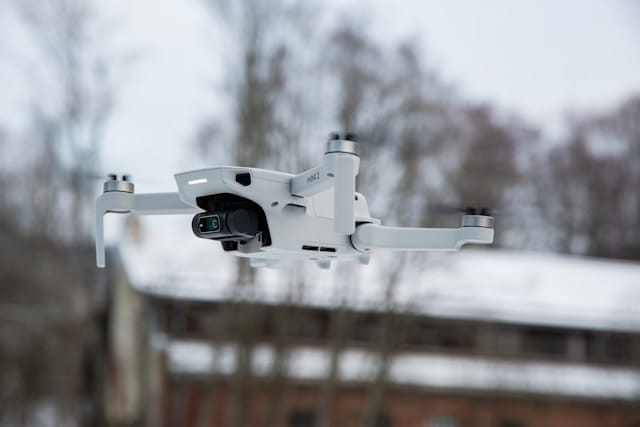
Effective drone flight planning combines advanced software, terrain analysis, environmental considerations, and safety protocols to ensure successful missions, optimal data collection, and regulatory compliance for professional drone operations.
Professional drone operations depend on thorough flight preparation. Whether capturing aerial footage for a construction site or conducting agricultural surveys, successful missions start with proper planning long before the aircraft leaves the ground.
Picture this: you're scheduled for an agricultural survey covering 500 acres, and you arrive on-site only to discover your pre-planned flight path conflicts with temporary power lines that weren't visible in your mapping software. Without proper planning that accounts for real-world variables and contingencies, this situation could mean wasted time, client dissatisfaction, or worse—a safety incident.
Flight planning software has transformed how pilots approach their missions. Gone are the basic waypoint systems of early consumer drones. Modern platforms offer sophisticated tools for terrain analysis, obstacle avoidance, and automated flight patterns. But the technology is only as effective as the operator's understanding of its capabilities and limitations.
Table of contents
- Software selection and platform capabilities
- Flight pattern design and optimization
- Terrain analysis and altitude management
- Environmental factors and weather considerations
- Safety protocols and risk mitigation
- Advanced planning techniques
- Project management and data organization
- Regulatory compliance and airspace coordination
- Equipment preparation and pre-flight verification
- Field execution and real-time adjustments
Software selection and platform capabilities
Flight planning software varies dramatically in complexity and capability. Some applications focus on simple mapping missions while others support multi-drone operations with advanced sensor integration. Organizations managing multiple aircraft benefit from integrated fleet management systems that coordinate planning across operations. The choice depends on operational requirements, aircraft compatibility, and budget constraints.
Desktop applications typically offer more processing power and detailed visualization than mobile alternatives. They excel at complex mission planning with multiple flight patterns, detailed terrain analysis, and comprehensive pre-flight simulations. The larger screen real estate allows pilots to examine maps at various zoom levels and spot potential issues before reaching the field.
Mobile solutions prioritize field usability and quick mission adjustments. Many pilots appreciate the ability to modify flight parameters while on-site, responding to changing conditions or client requests. The best mobile platforms sync with desktop versions, allowing office-based planning with field execution flexibility.
Compatibility represents a major consideration when selecting planning software. Different drone manufacturers use varying communication protocols and flight control systems. Some platforms excel with specific aircraft families while struggling with others. Pilots operating mixed fleets often need multiple software solutions or universal platforms that sacrifice specialized features for broad compatibility. Operators can improve efficiency through streamlined mission planning workflows that standardize procedures across different software platforms.
Flight pattern design and optimization
Effective flight patterns balance data quality requirements with operational efficiency. Standard mapping missions typically use parallel flight lines with predetermined overlap percentages, but the optimal pattern depends on the target area's characteristics and project objectives.
Rectangular survey patterns work well for regular shaped areas like agricultural fields or construction sites. The aircraft flies parallel lines with consistent spacing, maintaining steady altitude and speed. This approach maximizes coverage efficiency while providing predictable flight times for battery management.
Circular or orbital patterns suit point targets like cell towers or industrial structures. The aircraft maintains a constant distance from the central object while varying altitude and camera angles. This technique captures multiple perspectives of vertical structures, supporting detailed cell tower inspection and wind turbine inspection workflows.
Custom flight paths accommodate irregular terrain or specific data requirements. Pilots can manually define waypoints to follow property boundaries, avoid obstacles, or focus on particular features. While more time-consuming to plan, custom paths often produce superior results for specialized applications.
Overlap settings directly impact both data quality and flight duration. Higher overlap percentages improve photogrammetric reconstruction accuracy but extend flight times and increase data processing requirements. Most mapping applications require 60-70% forward overlap and 30-40% side overlap for reliable results.
The following table outlines common flight pattern configurations and their applications:
| Pattern Type | Best Applications | Coverage Efficiency | Data Quality | Complexity |
|---|---|---|---|---|
| Parallel Lines | Agricultural surveys, large site mapping | High | Excellent for flat terrain | Low |
| Circular/Orbital | Cell towers, building inspections | Medium | Multi-angle coverage | Medium |
| Custom Waypoint | Irregular boundaries, specialized targets | Variable | Optimized for specific needs | High |
| Corridor Mapping | Pipelines, roads, transmission lines | High for linear features | Consistent for narrow targets | Medium |
Terrain analysis and altitude management
Terrain following capabilities separate professional planning software from basic waypoint systems. The technology adjusts aircraft altitude to maintain consistent ground clearance over varying topography, critical for applications requiring uniform image resolution or sensor performance.
Digital elevation models provide the foundation for terrain following calculations. High-quality DEMs enable precise altitude planning, while low-resolution data can lead to inadequate clearance or excessive flight heights. Many pilots supplement built-in elevation data with site-specific surveys for critical missions.
Ground sampling distance requirements often dictate altitude parameters. Closer flight heights produce higher resolution imagery but reduce coverage per image and increase total flight time. Pilots must balance detail requirements against operational constraints like battery life and regulatory altitude limits.
Smart altitude algorithms adapt to terrain slope and sensor characteristics. Some systems automatically adjust flight height based on ground features, maintaining optimal sensor performance while ensuring safe obstacle clearance. This automation reduces planning time but requires pilots to understand the underlying logic and verify appropriate settings.
Environmental factors and weather considerations
Weather conditions significantly impact flight planning decisions. Wind speed and direction affect aircraft stability, battery consumption, and image quality. Temperature extremes influence battery performance and sensor calibration. Precipitation prevents most commercial operations entirely. Understanding METAR reports helps pilots interpret aviation weather data for informed planning decisions.
Wind analysis should consider both surface conditions and upper atmosphere patterns. Strong surface winds may be manageable for larger aircraft but create challenging conditions for small multirotor systems. Upper-level winds can push aircraft off planned flight paths, requiring course corrections that drain battery power.
Temperature impacts vary by aircraft type and mission duration. Cold conditions reduce battery capacity while hot weather can trigger thermal protection systems. Some sensors require temperature compensation for accurate measurements. Planning software should account for expected temperature ranges during mission execution.
Visibility requirements depend on regulatory frameworks and operational procedures. Visual line of sight rules limit flight distances in many jurisdictions. Poor visibility conditions may require mission postponement even when wind and temperature remain acceptable. Advanced operations like BVLOS require additional planning considerations and regulatory approvals.
Safety protocols and risk mitigation
Risk assessment forms the foundation of safe flight operations. Pilots must identify potential hazards ranging from obstacles and people to electromagnetic interference and aircraft system failures. Comprehensive planning addresses each risk category with appropriate mitigation strategies.
Obstacle identification requires both automated tools and manual verification. Planning software can highlight known obstacles from databases, but pilots must verify current conditions and identify temporary hazards like construction equipment or vehicles. Ground reconnaissance often reveals issues not visible in aerial imagery or mapping data. Implementing obstacle avoidance strategies during both planning and execution reduces collision risks.
Emergency procedures should be planned before mission execution. Predetermined landing sites, return-to-home altitudes, and communication protocols help pilots respond effectively to system failures or changing conditions. The best contingency plans account for multiple failure scenarios and provide clear decision trees for pilot response.
No-fly zones and restricted airspace require careful attention during the planning process. Understanding airspace types and no-fly zones helps pilots plan compliant missions. Temporary restrictions change frequently, and pilots must verify current status before each mission. Some planning software integrates real-time airspace data, but manual verification remains good practice for professional operations. When operating near controlled airspace, pilots may need to file a NOTAM to notify aviation authorities.
Comprehensive risk assessment procedures should be integrated into every planning workflow. Operators benefit from systematic approaches that identify hazards, evaluate their severity and likelihood, and implement appropriate controls before mission execution.
Advanced planning techniques
Multi-battery missions require careful coordination to maintain data consistency across flight segments. Battery swap locations should be planned in advance, considering aircraft positioning and pilot access. Flight line sequencing may need adjustment to minimize repositioning time during battery changes.
Sensor calibration procedures vary by equipment type but generally require specific flight patterns or maneuvers. LiDAR systems often need figure-eight patterns for inertial measurement unit calibration. Camera systems may require overlap adjustment based on lighting conditions or subject characteristics.
Corridor mapping techniques handle long, narrow targets like pipelines or transmission lines. Standard area patterns would be inefficient for these applications. Specialized corridor tools automatically generate flight lines following imported route data, with appropriate buffer zones and turn spacing. These techniques prove valuable for power line inspections and similar infrastructure monitoring applications.
Vertical inspection patterns support detailed structure assessment. The aircraft follows predetermined altitude steps around the target, capturing imagery from multiple angles and distances. This technique works well for buildings, towers, and industrial equipment requiring comprehensive documentation. Applications include construction inspections and asset inspection workflows.
Project management and data organization
Project organization impacts both planning efficiency and data management workflows. Consistent naming conventions and file structures help teams collaborate effectively and reduce errors during mission execution. Template-based approaches speed planning for similar mission types.
Geographic coordinate systems must remain consistent throughout the planning and execution process. Mixed coordinate systems can introduce significant errors in automated flight execution. Most professional applications support multiple datum options, but pilots should verify settings match ground control point surveys and client requirements.
Data storage considerations affect mission planning decisions. Higher resolution imagery or specialized sensor data requires more storage capacity and processing power. Cloud-based storage solutions offer scalability but may require internet connectivity for data transfer. Local storage provides immediate access but limits sharing capabilities.
Version control becomes important for complex or multi-phase projects. Flight plan revisions should be tracked and documented, particularly when multiple team members contribute to mission planning. Some platforms offer built-in version management while others require manual file organization.
Regulatory compliance and airspace coordination
Airspace authorization requirements vary by location and mission parameters. Some operations require advance approval while others can proceed under general regulations. Planning software should integrate current regulatory frameworks, but pilots remain responsible for compliance verification.
Part 107 operations must adhere to specific regulatory constraints regarding altitude, visibility, and operational areas. Understanding comprehensive compliance requirements ensures all regulatory obligations are met during the planning phase, preventing costly mission delays or violations.
Flight notification procedures depend on local regulations and operational environment. Some jurisdictions require advance notification to air traffic control or local authorities. Automated notification systems can streamline this process, but manual procedures may be necessary in some locations.
Documentation requirements often specify particular data formats or reporting structures. Mission logs, flight path records, and imagery metadata may need specific formatting for regulatory compliance. Planning software should support required documentation formats or provide export capabilities for manual compilation.
Remote pilot certification levels determine operational privileges and limitations. Professional pilot training programs prepare operators for advanced missions. Higher certification levels may permit extended visual line of sight operations or flights over people. Planning software should account for pilot certification restrictions when suggesting mission parameters or flight patterns.
Equipment preparation and pre-flight verification
Battery management directly impacts mission success rates. Flight planning should account for expected consumption rates, environmental conditions, and battery age. Multiple battery sets enable longer missions but require careful rotation and charging management.
Camera and sensor settings must align with mission objectives and environmental conditions. Exposure settings, focus parameters, and sensor calibration affect data quality. Some planning software integrates camera control while others require separate configuration procedures.
Ground control point planning optimizes survey accuracy and processing efficiency. GCP locations should be visible in multiple images while remaining accessible for field teams. Planning software can suggest optimal placement based on flight patterns and overlap settings.
Checklist systems help ensure consistent pre-flight procedures. Digital checklists can be integrated with planning software or maintained separately. The best systems adapt to specific aircraft and mission types while maintaining comprehensive coverage of safety-critical items. Organizations can implement standardized pre-flight checklists to improve operational consistency.
Systematic maintenance protocols ensure equipment reliability and reduce the risk of in-flight failures. Pre-flight verification should include checks of recent maintenance activities, component condition, and system functionality before executing planned missions.
Field execution and real-time adjustments
Field conditions rarely match planning assumptions exactly. Successful pilots maintain flexibility while ensuring mission objectives are met. Real-time adjustments should be documented for post-flight analysis and future planning improvements.
Communication protocols become critical during mission execution. Clear radio procedures help coordinate between pilots, visual observers, and ground teams. Emergency communication channels should be established before flight operations begin.
Mission monitoring capabilities vary significantly between planning platforms. Some applications provide real-time aircraft telemetry and flight data monitoring for mission progress tracking. Others require pilots to manually monitor progress and make adjustments through aircraft controllers or mobile applications.
Data verification procedures help identify issues before leaving the field. Quick image review can reveal camera problems, inadequate overlap, or missing coverage areas. GPS accuracy checks ensure survey data meets project requirements. These field checks prevent expensive return trips and schedule delays.
Implementation Considerations
Effective flight planning requires integration of multiple operational elements. Organizations implementing comprehensive planning strategies benefit from understanding software capabilities, regulatory requirements, and field execution challenges before committing to specific platforms or workflows.
Successful implementations typically start with thorough pilot training and systematic compliance management that ensures all team members understand planning procedures and regulatory constraints.
In Summary
Mastering drone flight planning demands technical knowledge, practical experience, and systematic approach to mission preparation. From software selection and flight pattern optimization to safety protocols and real-time adjustments, comprehensive planning forms the foundation for successful commercial operations.
The complexity of professional flight planning requires attention to multiple factors including terrain analysis, weather conditions, regulatory compliance, and equipment preparation. As technology advances and operational demands increase, pilots who master these planning fundamentals position themselves for sustained success in commercial drone operations.
Organizations implementing systematic planning procedures today are establishing operational frameworks that support growth while maintaining safety and data quality standards. The integration of professional planning tools with comprehensive operational protocols creates the foundation for reliable, efficient drone services.
Ready to Streamline Your Flight Planning Workflow?
Join commercial operators who have enhanced their planning efficiency through comprehensive project management systems and operational tools. Whether you're conducting mapping surveys, infrastructure inspections, or specialized applications, systematic planning foundations enable consistent mission success and client satisfaction.
Start your free trial today — no credit card required. Or book a demo to see how DroneBundle integrates flight planning with compliance tracking, maintenance protocols, and pilot training records in a platform designed specifically for professional commercial operations.


