What is a no-fly zone for drones? A no-fly zone is any designated airspace or property boundary where drone operations are prohibited or restricted, set by federal aviation authorities, state and local governments, or manufacturer geo-fencing systems. In 2026, US operators navigate four overlapping layers: FAA prohibited and restricted areas, Temporary Flight Restrictions (TFRs), state and municipal property ordinances, and manufacturer-imposed GEO zones. Each layer has different penalties, different unlock procedures, and different information sources.
Refreshed April 16, 2026 to cover current TFR patterns, Remote ID enforcement in restricted zones, DJI GEO system updates, and state-level drone ordinance changes.
Table of contents
- What counts as a no-fly zone in 2026
- The four overlapping layers of restriction
- Prohibited, restricted, and special-use airspace
- Temporary Flight Restrictions (TFRs)
- Federal vs state and local authority
- Manufacturer geo-fencing: DJI, Autel, Skydio
- Authorization and unlocking procedures
- Decision flow: what to do when you hit a restriction
- International variations: EU, UK, Canada, Australia
- Enforcement: what violations actually cost
- Best practices for ongoing restriction management
- Frequently asked questions
- Ready to fly inside the rules, every time?
What counts as a no-fly zone in 2026
A no-fly zone is any area where taking off, landing, or flying a drone is prohibited or requires explicit authorization. The term gets used loosely. In practice, four distinct types of restriction qualify, each with its own authority, duration, and unlock path. Operators who treat them all identically end up unable to unlock flights they could fly legally, or conversely, flying flights they should not.
The regulatory stack starts with federal airspace under the FAA. Federal authority covers the three-dimensional airspace itself: altitudes, lateral boundaries, and flight corridors. The FAA has exclusive authority here, confirmed repeatedly by federal courts. State and local governments cannot regulate airspace directly, but they can and do regulate takeoff and landing from property under their jurisdiction. The FAA UAS page is the authoritative source for federal restrictions.
Beneath the FAA layer sits the practical reality of daily operations. Temporary Flight Restrictions appear with little notice. Local ordinances vary by city and county. Manufacturers impose their own GEO fences that sometimes exceed legal requirements. Operators who run commercial work have to track all four layers simultaneously.
The four overlapping layers of restriction
Understanding which authority controls which layer prevents the two most common operator mistakes: requesting authorization from the wrong entity, or failing to request it from the right one.
| Layer | Authority | Geographic scope | Typical duration | Unlock path |
|---|---|---|---|---|
| Prohibited areas | FAA | Fixed points (White House, some military) | Permanent | None; no waivers issued |
| Restricted areas | FAA | Fixed points (training ranges, critical infrastructure) | Permanent or scheduled | Case-by-case authorization |
| Temporary Flight Restrictions | FAA | Variable (VIP movements, disasters, events) | Hours to weeks | Usually none during TFR |
| Controlled airspace | FAA / ATC | Near airports (Class B/C/D/E surface) | Permanent | LAANC or manual authorization |
| State/local property | State, county, city | Parks, schools, public buildings | Varies | Property-specific permission |
| Manufacturer GEO zones | Drone maker | Manufacturer database | Variable | Manufacturer unlock procedure |
The hierarchy matters. An operator with LAANC authorization to fly near an airport still cannot launch from a city park that prohibits takeoffs. An operator with city permission to launch still cannot climb through a TFR. Every flight has to clear every applicable layer.
Prohibited, restricted, and special-use airspace
The FAA uses distinct categories for persistent restrictions. Each category carries different enforcement expectations and different unlock possibilities.
Prohibited Areas. The strictest category. Established around locations of national security importance: the White House, Camp David, several critical facilities. No civilian aircraft, including drones, may enter a Prohibited Area at any altitude. The FAA does not issue waivers. Violations can trigger military intervention in addition to criminal and civil penalties. The Washington, DC Flight Restricted Zone is the most commonly encountered Prohibited Area for drone operators, and it affects flights tens of miles from the core restricted point.
Restricted Areas. Airspace around specific activities or installations where civilian operations are subject to controlled access. Military training ranges, artillery firing zones, and some government facilities. Many Restricted Areas operate on schedules (active during specific hours or exercises), and transit may be possible when inactive. The activation schedule is published in the Federal Aviation Regulations and updated through NOTAMs. Operators near Restricted Areas should file a NOTAM check before every flight.
Special Use Airspace. Includes Military Operations Areas (MOAs), Warning Areas, Alert Areas, and Controlled Firing Areas. MOAs cover military training. Warning Areas extend over international waters where hazardous activities may occur. Alert Areas identify concentrated training activity. Controlled Firing Areas shut down when non-participating aircraft approach. Understanding how airspace classifications interact with Special Use Airspace matters when a mission corridor crosses multiple categories.
National Security UAS Flight Restrictions. Under 14 CFR 99.7, the FAA has established drone-specific restrictions over dozens of facilities including DOE nuclear sites, military bases, and federal prisons. These restrictions are separate from general Prohibited and Restricted Areas and apply specifically to unmanned aircraft. The FAA national security restrictions page publishes the current list.
National Parks and DOI lands. Separate from airspace rules, the National Park Service and Department of Interior prohibit drone takeoffs and landings within park boundaries under 36 CFR 1.5. Technically the airspace is federal, but the property restriction prevents commercial use. This is the most common source of well-meaning violations among recreational operators transitioning to commercial work.
Temporary Flight Restrictions (TFRs)
TFRs are the failure mode that catches experienced operators. Permanent restrictions become part of the mental map. TFRs appear with little notice and disrupt planned operations, and they are the single most common cause of last-minute flight scrubs.
TFR categories by trigger:
VIP Movement TFRs. Presidential travel generates the most common TFR type. A 30-nautical-mile outer ring and 10-nautical-mile inner ring follow the presidential aircraft and motorcade. Inside the inner ring, essentially all drone operations stop. Vice presidential travel generates smaller but still substantial TFRs.
Disaster TFRs. Wildfires, hurricanes, and active emergency response operations trigger TFRs to keep drones away from manned firefighting aircraft and rescue operations. Interfering with disaster response is a federal offense with sharply higher penalties than standard airspace violations.
Sporting event TFRs. NFL games, NASCAR races, major college football, and a handful of other events produce standing TFRs that activate around game time. A 3-nautical-mile radius extends from the stadium up to 3,000 feet AGL. These TFRs apply seven days a week during active seasons. Operators planning aerial photography or broadcast work near major venues need to plan around these restrictions every weekend during the active season.
Space launch TFRs. Cape Canaveral and other launch facilities generate TFRs during launch windows that can cover large offshore areas.
Security event TFRs. Super Bowl, presidential inaugurations, UN General Assembly, state funerals. These create large and long-duration TFRs that can ground commercial drone operations across metropolitan areas for days.
Checking for TFRs before every flight is not optional. The FAA publishes TFRs through faa.gov/tfr and through the B4UFLY app. Commercial drone operations platforms pull TFR data into pre-flight screens automatically, which is why automated airspace checks are one of the highest-ROI features in drone compliance software.
Federal vs state and local authority
The division of authority between federal airspace control and state/local property control is the most misunderstood aspect of drone regulation. Getting it wrong wastes time chasing the wrong permissions.
The FAA has exclusive airspace authority. Federal preemption, affirmed in court, means states cannot restrict flight altitudes, create airspace classifications, or establish no-fly zones in the airspace itself. When a city passes an ordinance banning drone flights "over city limits below 500 feet," that ordinance is unenforceable in its airspace dimension.
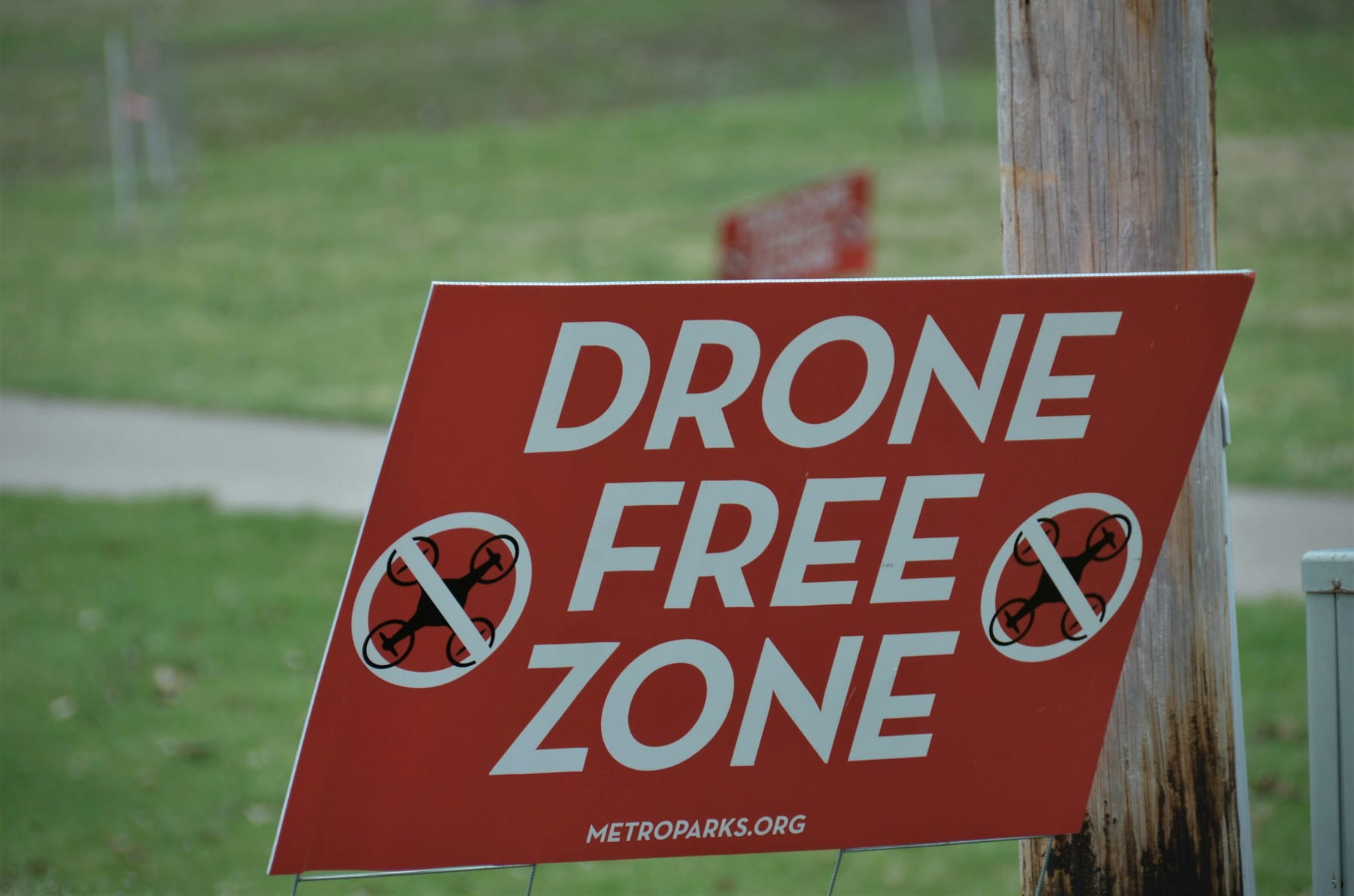
State and local governments have full property authority. What states and municipalities can do is regulate takeoffs, landings, and the use of public property for drone operations. A city can prohibit drone launches from any city park, school grounds, beach, or public building. This authority is legitimate and enforceable.
The practical effect. A legal flight in federal airspace may still be illegal because the takeoff location is prohibited. An operator who has federal authority to fly through airspace over a park might find the nearest legal takeoff location is a parking lot across the street. Property restrictions shape the mission planning stage much more than pilots expect.
State-level variation in 2026 is significant. Texas has one of the most permissive frameworks for commercial operations with specific carve-outs for newsgathering and real estate. California layers strict privacy rules on top of federal flight authority, particularly near correctional facilities. Florida limits operations over critical infrastructure and prisons under state statute. Oregon requires drone registration with the state in addition to the FAA. North Carolina has authorization requirements for state property. The drone regulations news feed tracks state-level changes as they happen.
For operators crossing state lines, the documentation burden compounds. A national fleet manager needs to track 50 state regimes plus hundreds of municipal ordinances. This is the case for compliance software that aggregates restriction data from multiple sources. For fleet-scale utility inspection or construction site monitoring, the same mission profile can hit different restriction stacks across jurisdictions, and tracking that manually breaks down quickly.
Manufacturer geo-fencing: DJI, Autel, Skydio
Manufacturers operate their own restriction systems that sometimes exceed legal requirements and sometimes lag behind them. Understanding the manufacturer layer prevents the frustration of a drone refusing to arm when flight would be legal.
DJI GEO 2.0 System. The most widely deployed manufacturer restriction system. DJI categorizes areas into multiple zones with different warning and restriction levels: Restricted, Altitude, Authorization, Warning, and Enhanced Warning. Restricted zones prevent takeoff entirely. Authorization zones allow flight after identity verification and acknowledgment. Warning zones display alerts but do not block flight. The DJI Fly Safe database updates regularly but is managed by DJI, not the FAA, which creates occasional conflicts.
Autel Sky Guardian. Autel's geo-fencing system covers similar categories with different implementation details. Unlock procedures require account verification and sometimes a waiver document upload. Autel's database tends to be more conservative than DJI's in dense urban areas.
Skydio. Skydio takes a different approach, relying primarily on its onboard autonomy and obstacle detection rather than hard geo-fencing. Airspace restrictions are displayed as advisory warnings rather than flight blocks. The operator bears more responsibility for verifying legal authorization.
Parrot ANAFI platforms. Parrot uses the AirMap database for restrictions and provides relatively minimal geo-fencing blocks. Like Skydio, this places more burden on the operator but also prevents the frustration of blocked legal flights.
| System | Restriction strictness | Unlock process | Data source |
|---|---|---|---|
| DJI GEO 2.0 | High (blocks takeoff in many zones) | Account verification + acknowledgment | DJI-managed database |
| Autel Sky Guardian | High (conservative in urban areas) | Account + document upload | Autel-managed database |
| Skydio | Advisory only | No blocking; operator responsibility | Onboard + AirMap |
| Parrot | Low | No blocking in most cases | AirMap integration |
The DJI GEO system occasionally flags areas where flight is legal (FAA permits operation but DJI blocks it), and occasionally fails to flag areas where flight is illegal (local ordinance prohibits but DJI allows). Neither creates a legal defense. "My drone would not arm" is not a waiver, and "DJI did not warn me" is not either.
Authorization and unlocking procedures
When a flight requires authorization, the procedure depends on the restriction type and the manufacturer system.
LAANC for controlled airspace. The Low Altitude Authorization and Notification Capability provides near-real-time authorization for operations in controlled airspace around participating airports. Approvals usually process in seconds for standard altitudes in UAS Facility Map grids. Manual review applies for altitudes above the posted maximum or for non-standard operations. LAANC covers the airspace authorization but not Prohibited Areas, active TFRs, or specific special-use airspace.
FAA waivers for non-standard operations. Part 107.200 waivers apply when the operation requires deviation from a specific Part 107 restriction (night before 2021, over people, BVLOS). The waiver process takes 90 to 120 days for standard applications. Processing time has dropped as Part 108 approaches; once Part 108 finalizes in spring 2026, many current waiver use cases shift to Permitted Operations.
FAA national security airspace authorization. Flying in 14 CFR 99.7 facilities requires direct coordination with the facility operator, not just FAA authorization. Approval paths vary by facility and typically involve weeks of lead time.
Manufacturer unlocking. DJI's Custom Unlock and Self-Unlock procedures require account verification and sometimes proof of authorization. The unlocks have time limits (typically 24 to 72 hours) and geographic boundaries. Operators flying recurring missions need to re-unlock regularly. The unlock requires internet connectivity, so remote operations need to complete unlocks in advance.
State/local permits. Highly variable. Some jurisdictions have simple online permit processes. Others require paper applications with weeks of lead time. Film permits often grant drone authorization as a subset of the production authorization.
Decision flow: what to do when you hit a restriction
Most operators hit restrictions in the field without a ready protocol. The following sequence resolves restrictions faster than ad-hoc troubleshooting.
Step 1: Identify the layer. Is the restriction federal (FAA), property-based (state/local), or manufacturer (DJI GEO)? The indicator matters. FAA restrictions show in B4UFLY and sectional charts. Property restrictions appear in local ordinance or signage. Manufacturer restrictions display in the drone's own app.
Step 2: Check authorization possibility. Prohibited Areas: not authorizable, relocate. Restricted Areas: check schedule; may be authorizable when inactive. TFRs: wait for expiration, typically not authorizable during active period. Controlled airspace: LAANC or manual authorization. Property restrictions: property-specific permission. Manufacturer zones: manufacturer unlock procedure.
Step 3: Identify lead time required. LAANC processes in seconds for standard operations. DJI Custom Unlock takes hours to days. FAA waivers take months. National security airspace coordination takes weeks. If the lead time exceeds the mission window, relocate rather than wait.
Step 4: Verify authorization with multiple sources. Never trust a single source. Check B4UFLY, the UAS Facility Map, local ordinance, and the drone app. Conflicts between sources usually indicate the most recent database is correct, but field verification is better than database checks alone.
Step 5: Document the authorization. The LAANC authorization ID, the manufacturer unlock confirmation, the property permission email. These become part of the flight record, checked against the flight log during pre-flight documentation. Missing this step turns routine flights into audit findings.
International variations: EU, UK, Canada, Australia
Restriction frameworks outside the US share common principles but differ in specifics. Operators working internationally should know the local structure.
European Union (EASA framework). EASA defines airspace restrictions through geographical zones published by each member state. The EASA compliance guide covers the Open, Specific, and Certified categories. U-space zones, Europe's UTM framework, require continuous connectivity to U-space service providers. The U-space overview describes operator obligations inside these zones.
United Kingdom (CAA). The UK CAA maintains its own restricted zones distinct from EU rules since Brexit. Flight Restriction Zones (FRZ) around airports extend 2 to 2.5 nautical miles with altitude limits from surface to 2,000 feet AGL. Drone Restriction Zones cover prisons, power stations, and critical infrastructure.
Canada (Transport Canada). Transport Canada administers airspace through its Advanced and Basic operations categories. Advanced operations require certified pilots and registered aircraft for flights in controlled airspace or near people. NAV Canada manages the airspace authorization system through NAV Drone.
Australia (CASA). CASA operates a drone safety app with national airspace restriction data. Controlled airspace near airports, populous areas, and emergency operations all carry specific rules under Part 101. CASA has been progressive on BVLOS approvals, particularly for agricultural and mining operators.
China. The Civil Aviation Administration of China (CAAC) maintains strict registration and geographic restriction requirements. Commercial BVLOS delivery operations have been approved in designated corridors.
The consistent thread across jurisdictions is that the authority hierarchy is similar (national aviation authority controls airspace, local authorities control property) even when the specific implementations differ.
Enforcement: what violations actually cost
Fines and penalties for airspace violations depend on the specific violation, the regulator, and the operator's history. The pattern of actual enforcement is more instructive than the statutory maximums.
| Violation type | Typical civil penalty | Escalation possibility |
|---|---|---|
| Flight in controlled airspace without LAANC | $1,500 to $5,000 | Certificate action for repeat offenders |
| TFR violation (standard) | $2,000 to $10,000 | Criminal charges for disaster TFRs |
| Flight in Prohibited Area | $10,000 to $30,000 | Criminal charges possible |
| Interference with wildfire/emergency response | $20,000 to $75,000 | Criminal charges likely |
| National security restriction violation | Up to $27,500 per violation | Federal criminal investigation |
| State/local property violation | $100 to $2,500 | State misdemeanor charges possible |
Ranges reflect typical civil penalty bands from published FAA enforcement actions as of April 2026. Statutory maximums are $27,500 per violation for individuals and $275,000 for organizations, and willful violations can exceed these through criminal process.
Beyond the fines, enforcement produces a second-order cost: insurance implications. A compliance finding can trigger drone insurance premium increases, deductible changes, or policy non-renewal. The non-fine cost often exceeds the fine itself, especially for commercial operators who cannot afford insurance lapses.
Certificate actions are the third tier. Repeat violators face suspension or revocation of their Remote Pilot Certificate, which ends commercial operation entirely until the certificate is reinstated. This is why operators with compliance systems in place ultimately operate more profitably than operators without.
For public safety and emergency response agencies, a restriction violation can disqualify the agency from federal grants, cooperative manned-aircraft agreements, and mutual aid operations with other jurisdictions.
Best practices for ongoing restriction management
Restriction compliance is a continuous process, not a one-time setup. The operators who run cleanly over years share common practices.
Check restrictions at three moments: mission planning, day-of pre-flight, and immediately before launch. TFRs can appear in the minutes between setup and launch. Operators who check once during planning catch 80% of issues but miss the TFRs that appear day-of.
Use multiple information sources. B4UFLY, the UAS Facility Map, the drone manufacturer's app, and a commercial compliance platform. No single source catches everything. Platforms with live airspace tracking push updated restrictions directly to active missions rather than requiring operators to poll each source.
Keep the pre-flight checklist airspace-aware. The restriction check has to be a named step, not an implicit part of the mission planning. Named steps get completed; implicit checks get skipped.
Document authorizations in the flight record. LAANC IDs, unlock confirmations, property permissions. Every authorization becomes part of the audit trail. Modern platforms link these automatically to the relevant flight log.
Train crews on the four-layer model. Pilots who understand the difference between federal airspace authority and property authority navigate restriction conflicts faster than pilots who have only been taught the FAA rules.
Review restriction patterns quarterly. State regulations evolve. Manufacturer databases shift. Local ordinances change. A quarterly review catches the changes before they become violations.
For fleet operations, add role-specific training. Pilots need airspace fluency. Operations managers need authorization process fluency. Compliance officers need regulatory update fluency. Trying to make every pilot an expert on every layer creates more confusion than capability.
Frequently asked questions
Can I fly my drone in a national park?
No. The National Park Service prohibits drone takeoffs, landings, and operations within park boundaries under 36 CFR 1.5. The airspace above parks is federal, but the ground-level prohibition on takeoff and landing effectively prevents drone use. Some limited exemptions exist for search and rescue, scientific research, and approved film permits, all requiring written authorization in advance.
How do I know if there is a TFR in my flight area?
Check the FAA TFR list at tfr.faa.gov, the B4UFLY app, or an integrated drone compliance platform before every flight. TFRs can appear with minutes of notice for VIP movements or emergency response. Platforms that pull TFR data into pre-flight screens automatically are the safest option for commercial operators because manual checks get skipped under time pressure.
What happens if I fly in a no-fly zone by accident?
Unintentional violations still produce enforcement action in most cases, though penalties are typically lower than for willful violations. The FAA considers your operational history, the nature of the restriction, whether you cooperated with the investigation, and whether any actual safety impact occurred. First-time offenders often receive educational counseling or reduced penalties. Repeat offenders face the full statutory ranges.
Can manufacturer geo-fencing override legal authorization?
No in legal terms, yes in practical terms. Manufacturers can program their aircraft to refuse flight in zones they define, even when the FAA permits operation. The FAA authorization does not force the manufacturer to unlock. In practice, operators need to complete the manufacturer unlock procedure (usually account verification plus acknowledgment) in addition to any legal authorization. This is why flying in some areas requires both a LAANC approval and a DJI Custom Unlock.
Ready to fly inside the rules, every time?
Restriction compliance is a time problem more than a knowledge problem. Operators know the rules; they lose time checking multiple sources, cross-referencing authorizations, and documenting the results. A compliance platform that aggregates TFRs, LAANC status, manufacturer geo-fencing, and state ordinances into one pre-flight view turns a 20-minute restriction check into a 2-minute one.
DroneBundle brings integrated airspace checks, LAANC status, weather integration, and documentation capture into a single workflow. Pre-flight restriction verification happens automatically. Authorizations link to flight logs. Audit trails build themselves. With TFRs appearing faster and enforcement tightening in 2026, the operators who set up automated restriction management now are the ones who stay current without burning hours per flight.
Start your free trial today, no credit card required.
Or book a live demo to see automated airspace and restriction checks in action.