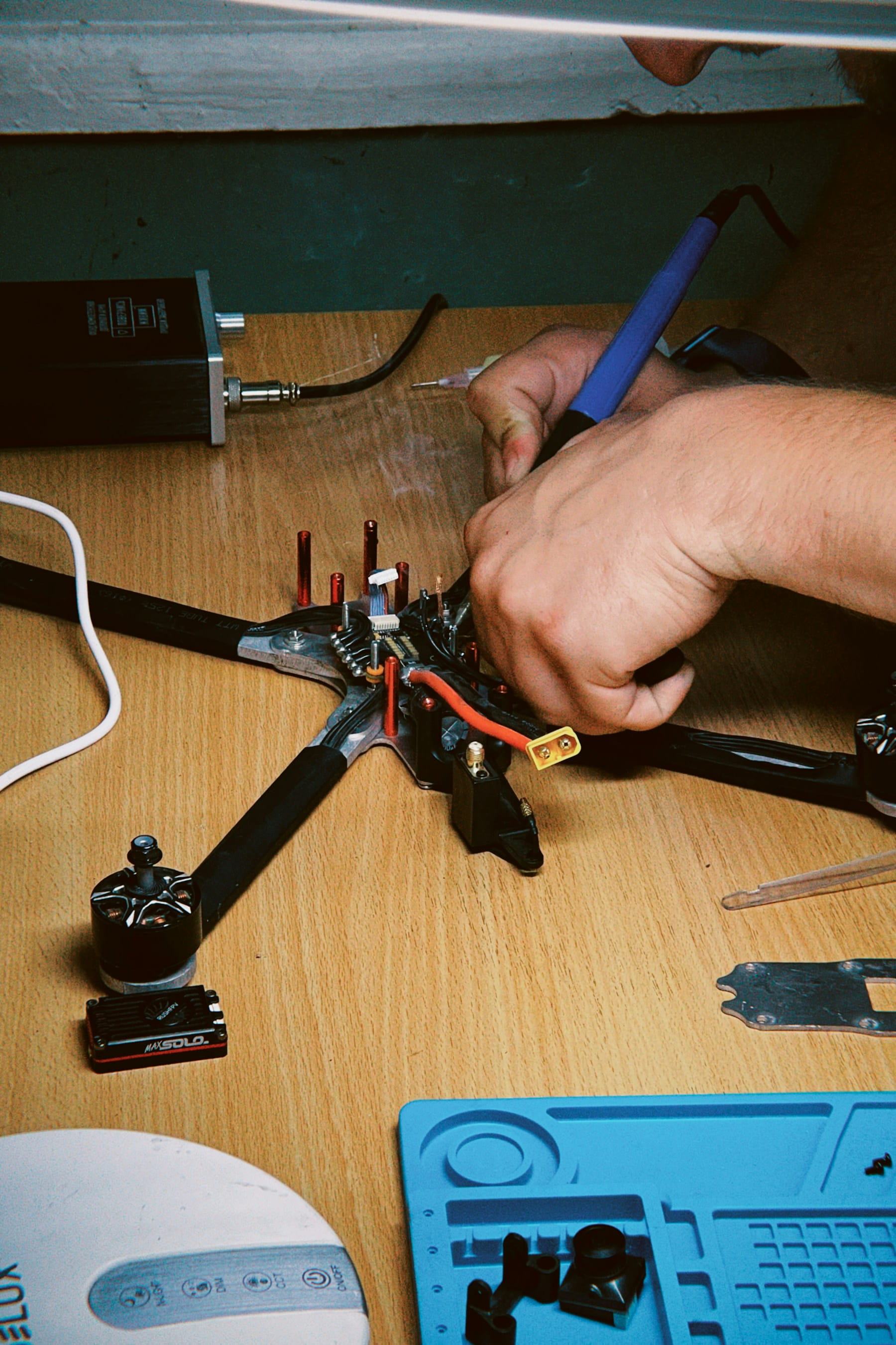
Discover how advanced drone obstacle avoidance systems utilize sensors, AI, and algorithms to ensure collision-free flights across various environments and industries, enhancing safety and operational efficiency.
Flying a drone without worrying about crashes sounds like magic. But it's actually sophisticated engineering at work. Modern obstacle avoidance systems combine multiple sensors, algorithms, and artificial intelligence to keep aircraft safely airborne.
These systems transform how pilots operate their machines. No more constant anxiety about trees, buildings, or power lines. The drone handles spatial awareness while you focus on capturing footage or completing missions.
Table of contents
- How obstacle avoidance works
- Types of obstacle avoidance sensors
- Processing and decision making
- Autonomous flight systems
- Long-distance operations
- Applications across industries
- Choosing the right system
- Limitations and considerations
- Future developments
How obstacle avoidance works
Picture a drone as a flying computer with eyes. Those eyes come in many forms – cameras, infrared sensors, ultrasonic detectors. Each type specializes in different situations and environments.
The basic process follows a simple loop. Sensors detect objects. Processors analyze the data. Software calculates safe paths. Flight controllers execute maneuvers. This happens dozens of times per second.
But here's where it gets interesting (and slightly nerdy). The drone doesn't just see obstacles – it builds a three-dimensional map of its surroundings. This digital representation updates constantly as the aircraft moves through space.
Indoor operations present unique challenges. GPS signals weaken or disappear completely inside buildings. Obstacle avoidance systems must rely entirely on onboard sensors for positioning and navigation. High-resolution cameras and rapid sensor refresh rates become absolutely critical.
Outdoor flights benefit from GPS positioning but face different obstacles. Wind affects sensor accuracy. Bright sunlight can interfere with optical systems. Rain or snow reduces sensor range. The best systems account for these environmental factors.
Military-grade systems take this technology several steps further. They process enormous amounts of data in real-time while maintaining operational security. Some can identify specific types of objects and classify threat levels automatically.
Types of obstacle avoidance sensors
Different sensor technologies excel in specific situations. Smart manufacturers combine multiple types to create redundant safety nets.
Stereo vision cameras
These work like human depth perception. Two cameras positioned apart capture slightly different images of the same scene. Software calculates distances by comparing corresponding pixels between images.
Stereo systems perform exceptionally well in good lighting conditions. They provide detailed three-dimensional maps of complex environments. Trees, buildings, and irregular surfaces pose no problems for quality stereo vision setups.
Limitations become apparent in low light. Insufficient contrast makes pixel matching difficult or impossible. Some systems incorporate infrared illuminators to extend operating hours.
Infrared sensors
Infrared detection relies on heat signatures or reflected infrared light. These sensors work regardless of visible light conditions, making them valuable for dawn, dusk, or night operations.
Active infrared systems emit invisible light and measure reflections. The technique works similarly to radar but uses light waves instead of radio waves. Range depends on emitter power and atmospheric conditions.
Passive infrared detects heat differences between objects and backgrounds. Living creatures, vehicles, and sun-warmed surfaces stand out clearly. This technology proves particularly useful for search and rescue missions.
Ultrasonic sensors
Sound-based detection uses high-frequency audio waves beyond human hearing range. The sensor emits ultrasonic pulses and measures return timing to calculate distances.
Ultrasonic systems work reliably in dusty or foggy conditions where optical sensors struggle. They're relatively inexpensive and consume little power. Many smaller drones incorporate ultrasonic sensors for basic collision avoidance.
Sound waves have limitations. They reflect poorly off soft materials like fabric or foam. Curved surfaces can scatter waves away from the sensor. Wind affects accuracy at longer ranges.
Time-of-flight sensors
Time-of-flight (ToF) technology measures how long light takes to travel to an object and return. These sensors typically use infrared lasers or LED arrays as light sources.
ToF sensors capture distance information for every pixel in their field of view simultaneously. This creates incredibly detailed depth maps at high frame rates. The resulting data quality often exceeds stereo vision systems.
Processing requirements are lower than stereo vision since distance calculations happen at the sensor level. This reduces computational load on flight controllers.
LiDAR systems
Light Detection and Ranging represents the premium end of distance sensing. LiDAR uses laser pulses to create precise three-dimensional maps of environments.
Spinning LiDAR units generate 360-degree coverage around the aircraft. Solid-state versions offer specific coverage patterns without moving parts. Both types provide centimeter-level accuracy at significant ranges.
Cost and power consumption limit LiDAR to professional applications. Survey drones, mapping systems, and autonomous vehicles commonly use this technology.
Processing and decision making
Raw sensor data means nothing without intelligent processing. Modern flight controllers run sophisticated algorithms that transform measurements into flight commands.
Simultaneous Localization and Mapping (SLAM)
SLAM algorithms solve a chicken-and-egg problem. The drone needs to know its position to build accurate maps. But it needs accurate maps to determine its position.
The solution involves continuous refinement. Initial position estimates improve as mapping data accumulates. Better maps lead to more accurate positioning. This feedback loop creates increasingly precise spatial awareness.
SLAM performance depends heavily on computational power. Complex environments with many features work better than empty spaces. Hallways, forests, and urban areas provide plenty of reference points for position calculations.
Sensor fusion techniques
Single sensors have weaknesses. Multiple sensors working together create robust systems that compensate for individual limitations.
Sensor fusion algorithms combine data from different sources into unified environmental models. Camera data provides visual details. LiDAR gives precise distances. Ultrasonic sensors fill in close-range gaps.
The fusion process involves statistical filtering and probability calculations. Kalman filters are commonly used to merge sensor inputs while accounting for measurement uncertainty. Machine learning techniques increasingly supplement traditional filtering methods.
Predictive algorithms
Smart obstacle avoidance doesn't just react – it predicts. Advanced systems anticipate where objects will be based on current motion patterns.
Moving obstacles like birds, people, or other aircraft require predictive tracking. The algorithm calculates probable future positions and plans avoidance maneuvers accordingly. This proactive approach prevents close encounters before they develop.
Prediction accuracy depends on tracking consistency and motion model sophistication. Simple linear predictions work for steady movement. More complex models handle accelerating or turning objects.
Autonomous flight systems
True autonomy goes beyond basic obstacle avoidance. Autonomous systems make independent decisions about flight paths, mission execution, and emergency responses.
Path planning algorithms
Sophisticated path planners evaluate multiple route options before selecting optimal flight paths. These algorithms consider obstacles, wind conditions, battery life, and mission objectives simultaneously.
A-star (A*) algorithms are popular for grid-based path planning. Rapidly-exploring Random Trees (RRT) handle more complex three-dimensional environments. Each approach has computational trade-offs and performance characteristics.
Real-time replanning happens when conditions change during flight. New obstacles, weather shifts, or mission modifications trigger automatic route recalculation. The best systems make these adjustments seamlessly without interrupting operations while maintaining detailed flight data records.
Behavioral responses
Different obstacle types trigger different avoidance behaviors. Static objects like buildings require simple path deviation. Moving obstacles demand more sophisticated responses.
Avoidance behaviors can be aggressive or conservative depending on mission requirements. Racing drones might take tight corners around obstacles for speed. Survey drones prioritize safety margins over efficiency.
Some systems learn from experience. Machine learning algorithms analyze successful and failed avoidance attempts to improve future performance. This adaptive behavior works particularly well in environments with recurring obstacle patterns.
Emergency protocols
What happens when avoidance fails? Robust systems include multiple fallback options for crisis situations.
Automatic emergency stopping brings the drone to a hover when sensors detect imminent collisions. This gives pilots time to assess situations and take manual control if needed.
Return-to-home functions activate when sensor failures or low battery conditions threaten safety. The aircraft automatically navigates back to its launch point using stored waypoint data.
Controlled crash landing represents a last resort. Some drones can identify relatively safe landing areas and execute emergency descents to minimize damage and injury risks.
Long-distance operations
Beyond visual line of sight operations challenge traditional obstacle avoidance approaches. Communication delays and reduced situational awareness require different strategies.
Communication systems
Long-range flights depend on reliable data links between aircraft and ground stations. Radio signals carry sensor data, flight commands, and status information across extended distances.
Satellite communication systems extend operational ranges to global scales. Military and commercial operators use satellite links for international flights and remote area operations. Latency becomes a significant factor at these distances.
Mesh networking allows multiple drones to share obstacle information. Aircraft create cooperative networks that extend sensor coverage beyond individual platform capabilities. One drone's sensors can guide another's flight path.
Pre-programmed missions
Autonomous waypoint navigation reduces dependence on real-time communication. Drones follow pre-planned routes using onboard systems for obstacle avoidance and navigation.
Mission planning software allows operators to design complex flight patterns before takeoff. Waypoints include altitude information, camera settings, and contingency instructions. The aircraft executes these missions independently.
Adaptive mission execution permits route modifications based on encountered conditions. If original waypoints become inaccessible due to obstacles or weather, the system calculates alternative paths to complete mission objectives.
Redundancy requirements
Long-distance operations demand multiple backup systems for critical functions. Single points of failure become unacceptable when aircraft operate far from immediate assistance.
Dual redundancy provides backup systems for flight controllers, communication equipment, and navigation sensors. If primary systems fail, secondary systems maintain safe operation and emergency return capabilities.
Triple redundancy exists in the most critical applications. Three independent systems vote on decisions, with majority rule determining aircraft responses. This approach prevents single component failures from causing mission losses.
Applications across industries
Different sectors use obstacle avoidance technology for various purposes. Each application presents unique requirements and challenges.
| Industry | Primary Use Cases | Key Requirements |
|---|---|---|
| Architecture & Construction | Site surveys, progress monitoring, safety inspections | High accuracy, dust resistance, regulatory compliance |
| Power & Utilities | Line inspections, vegetation management, emergency response | Extended range, weather resistance, precision navigation |
| Environmental Monitoring | Wildlife tracking, forest surveys, pollution assessment | Quiet operation, long endurance, minimal disturbance |
| Emergency Services | Search and rescue, disaster response, fire monitoring | Rapid deployment, harsh conditions, night operations |
| Agriculture | Crop monitoring, pesticide application, livestock management | Weather resistance, payload capacity, GPS precision |
Construction and architecture
Construction sites present constantly changing obstacle patterns. Building materials, equipment, and structures appear and move regularly. Obstacle avoidance systems must adapt to these dynamic environments.
Safety regulations require drones to maintain specific distances from personnel and equipment. Automated systems can enforce these buffer zones more consistently than manual pilots. This reduces accident risks and ensures regulatory compliance.
Progress monitoring flights follow predetermined routes over construction sites using systematic pre-flight planning. Obstacle avoidance allows these flights to continue safely as building conditions change. The aircraft automatically adjusts paths around new structures or equipment.
Power line inspection
Electrical infrastructure inspection demands precise navigation around high-voltage equipment. Traditional methods require shutting down power systems or using expensive helicopter services.
Drone systems can approach power lines more closely than manned aircraft while maintaining safe distances from energized equipment. Obstacle avoidance prevents accidental contact that could cause outages or equipment damage.
Vegetation management uses obstacle avoidance to navigate through tree canopies near power lines. The aircraft identifies branches that threaten electrical systems while avoiding collision with healthy vegetation.
Environmental research
Scientific research applications often require minimal disturbance to natural environments. Quiet electric motors and sophisticated navigation systems allow close observation of wildlife without causing behavioral changes.
Forest canopy navigation presents unique challenges. Dense vegetation creates complex three-dimensional obstacle fields with limited GPS reception. Advanced sensor fusion techniques become absolutely critical for safe operation.
Long-term monitoring stations benefit from automated flight systems that operate with minimal human intervention. These systems must handle changing seasonal conditions and weather patterns autonomously.
Emergency response
First responders use drones for rapid situation assessment in dangerous environments. Obstacle avoidance allows operation in damaged buildings, disaster zones, and other hazardous areas.
Search and rescue missions often occur in remote locations with poor visibility conditions. Thermal imaging combined with obstacle avoidance helps locate missing persons while navigating safely through unfamiliar terrain.
Fire monitoring requires operation near intense heat and smoke. Specialized obstacle avoidance systems must account for thermal effects on sensor performance and aircraft handling characteristics.
Choosing the right system
Selecting appropriate obstacle avoidance technology depends on specific operational requirements. Different missions need different capabilities.
Coverage requirements
Omnidirectional sensing provides complete spherical protection around the aircraft. This comprehensive coverage works best for complex environments with obstacles from multiple directions.
Forward-facing sensors cost less and consume less power. They work well for straightforward missions where obstacles primarily appear ahead of the flight path.
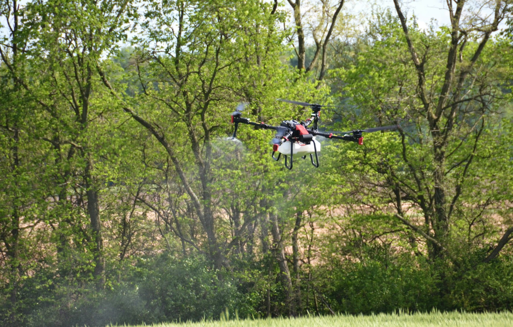
Downward-facing sensors help with landing operations and ground-following flights. Agricultural applications often use this configuration for crop spraying and monitoring missions.
Environmental factors
Operating conditions significantly affect sensor selection. Bright sunlight can overwhelm optical systems. Dust and moisture reduce sensor range and accuracy.
Temperature extremes affect battery performance and sensor calibration. Cold weather operations may require heated sensor housings. Hot climates demand additional cooling for electronic components.
Wind conditions influence both flight stability and sensor accuracy. Strong gusts can cause false obstacle detections or prevent proper sensor alignment.
Performance specifications
Detection range determines how early the system identifies obstacles. Longer ranges provide more time for avoidance maneuvers but require more processing power.
Update rates affect response speed to rapidly changing conditions. High refresh rates improve safety but increase computational requirements and power consumption.
Accuracy specifications determine how precisely the system can navigate around obstacles. Tighter tolerances allow operation in more confined spaces but demand better sensors and processing.
Integration considerations
Compatibility with existing flight controllers and software systems affects implementation complexity. Some obstacle avoidance systems require specific autopilots or control interfaces.
Power consumption impacts flight time and payload capacity. Energy-efficient sensors extend operational endurance but may sacrifice some performance characteristics.
Weight and size constraints limit sensor options for smaller aircraft. Miniature systems trade coverage area and accuracy for reduced physical footprint.
Limitations and considerations
Even advanced obstacle avoidance systems have boundaries. Understanding these limitations prevents overreliance on automated systems.
Environmental limitations
Glass and transparent surfaces often invisible to sensors. Windows, greenhouse panels, and clear barriers can cause collisions despite functioning avoidance systems.
Reflective surfaces like water or polished metal can confuse distance measurements. Sensors may receive false readings or fail to detect these obstacles entirely.
Weather conditions severely impact sensor performance. Rain, snow, and fog reduce effective range and accuracy. High humidity can cause condensation on sensor lenses.
Technical constraints
Processing delays create minimum response times. Complex algorithms need time to analyze data and calculate avoidance maneuvers. Fast-moving aircraft may not have sufficient reaction time.
Sensor blind spots exist in most systems. Areas between sensor coverage zones can hide small obstacles. Even omnidirectional systems may have gaps near mounting points.
False positive detections cause unnecessary avoidance maneuvers. Insects, dust particles, or sensor noise can trigger evasive actions when no real obstacles exist.
Operational factors
Battery drain increases with obstacle avoidance systems active. Multiple sensors and continuous processing consume significant power, reducing flight time.
Pilot skills still matter. Automated systems assist rather than replace proper training and situational awareness. Pilots must understand system capabilities and limitations.
Maintenance requirements increase with system complexity. Multiple sensors need cleaning, calibration, and periodic replacement following comprehensive maintenance protocols. Failed components can compromise entire systems.
Regulatory compliance
Aviation authorities regulate drone operations differently around the world. Some jurisdictions require specific obstacle avoidance capabilities for certain operations.
Certification processes for commercial operations often include obstacle avoidance system evaluations. Operators must demonstrate proper training and system understanding.
Insurance requirements may specify minimum obstacle avoidance capabilities for coverage. Higher-risk operations typically demand more sophisticated safety systems.
Future developments
Obstacle avoidance technology continues advancing rapidly. New sensors, algorithms, and artificial intelligence techniques promise even better performance.
Artificial intelligence integration
Machine learning algorithms improve obstacle recognition and classification. AI systems can distinguish between different object types and predict their behavior patterns.
Neural networks trained on vast image datasets recognize obstacles that traditional algorithms miss. These systems identify birds, other aircraft, and unusual objects more reliably.
Edge computing brings AI processing directly to aircraft sensors. This reduces communication delays and enables faster response times for critical avoidance maneuvers.
Sensor miniaturization
Smaller sensors enable obstacle avoidance on micro-drones previously too small for such systems. Advanced manufacturing techniques pack more capability into lighter packages.
Integrated sensor packages combine multiple detection methods in single housings. These systems reduce weight, power consumption, and installation complexity.
Solid-state LiDAR eliminates moving parts while maintaining performance. This technology promises more reliable operation in harsh environments.
Swarm coordination
Multiple aircraft sharing obstacle information create collective awareness systems. Swarms can navigate complex environments more safely than individual aircraft.
Distributed processing allows swarm members to share computational loads. Complex obstacle analysis can be distributed across multiple platforms for improved performance.
Formation flying benefits from shared obstacle detection. Lead aircraft can scout paths for following aircraft, improving overall mission efficiency.
But here's a thought (and maybe I'm getting carried away with possibilities) – imagine swarms that learn collectively from each member's experiences. One drone's encounter with a difficult obstacle could instantly improve the entire group's performance.
Why Advanced Obstacle Avoidance Matters for Professional Operations
Managing drone operations becomes increasingly complex as obstacle avoidance technology advances. Professional operators who master these systems gain significant competitive advantages while protecting their operations from costly accidents and operational disruptions.
- Safety enhancement: Advanced obstacle avoidance dramatically reduces collision risks and operational incidents
- Operational efficiency: Autonomous systems enable complex missions with reduced pilot workload and stress
- Cost reduction: Preventing crashes protects expensive equipment investments and reduces insurance costs
- Regulatory confidence: Sophisticated safety systems demonstrate professional competency to authorities and clients
Fast Facts: Obstacle Avoidance Technologies
| Sensor Type | Detection Range | Best Applications | Key Limitations |
|---|---|---|---|
| Stereo Vision Cameras | 0.5-100m | Detailed mapping, good lighting | Poor performance in low light |
| Infrared Sensors | 0.1-50m | Night operations, heat detection | Limited range, weather sensitive |
| Ultrasonic Sensors | 0.02-8m | Close-range, dusty conditions | Poor on soft surfaces, wind affected |
| Time-of-Flight | 0.1-60m | High-speed mapping, indoor use | Processing intensive, cost |
| LiDAR Systems | 1-200m+ | Precision mapping, long range | High cost, power consumption |
Getting Started with Obstacle Avoidance Systems
- Assess operational requirements and identify primary obstacle types and environments
- Select appropriate sensor combinations balancing performance, cost, and power consumption
- Implement systematic training in pilot education and system operation
- Establish maintenance protocols following comprehensive service procedures
- Monitor and analyze performance through data collection and continuous improvement
Essential preparation: Before deploying advanced obstacle avoidance systems, ensure your team understands how these technologies integrate with broader operational compliance and safety management requirements.
In Summary
The future of collision-free flight looks brighter than ever. As these systems continue improving, pilots can focus more on mission success and less on basic survival. Professional operators who invest in advanced obstacle avoidance technologies position themselves for sustained competitive advantages in increasingly complex operational environments.
Ready to Master Advanced Drone Safety?
Join professional operators who have transformed their safety capabilities through advanced obstacle avoidance systems and comprehensive operational management. Whether you're navigating complex construction sites, conducting precision inspections, or managing autonomous fleet operations, sophisticated safety technologies enable operational excellence and client confidence.
Start your free trial today — no credit card required.
Or book a demo to see how DroneBundle integrates obstacle avoidance data with compliance management, maintenance tracking, and performance analytics in a single platform designed specifically for professional drone operations.
Transform your safety capabilities into competitive advantages. With comprehensive obstacle avoidance systems and professional operational support, every flight becomes an opportunity to demonstrate technical expertise and operational excellence.
