Updated April 28, 2026.
A 2024 industry survey put drone adoption among US construction contractors at roughly 60%, with site surveying as the dominant use case. The construction drone market is on track to clear $9 billion in 2026, growing at about 14% a year. The technology has stopped being a novelty; it is now a line item in mid-sized contractor budgets and a practical question of which use cases pay back fastest.
This guide is the 2026 working answer to that question. It covers where drones earn their keep on construction sites, the actual cost ranges in today's market, the regulatory state including Part 108, and the adoption pitfalls that still wreck programs. Every figure cited has a primary source.
Quick answer: Drones in construction are used primarily for site surveying, progress monitoring, and safety inspections. A photogrammetry-grade kit costs $5,000-$20,000; LiDAR-equipped systems run $25,000-$100,000+. Aerial surveys typically cost 40-70% less than traditional ground surveys, and the FAA's proposed Part 108 rule (expected to finalize in 2026) will unlock routine BVLOS operations for large sites.
Table of contents
- The state of drones in construction in 2026
- Where drones earn their keep on a construction site
- Site surveying and mapping
- Progress monitoring and digital twins
- Safety inspections and OSHA-aligned monitoring
- Asset tracking and site security
- Real cost ranges and ROI
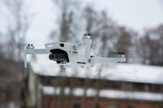
- Choosing the right drone for the job
- Regulatory state under Part 107 and Part 108
- Common adoption pitfalls
- FAQ
The state of drones in construction in 2026
Construction is no longer an early-adoption industry for drones. Adoption among US contractors sits near 60% as of the most recent industry surveys, and roughly two-thirds of large firms now run regular drone operations. Smaller contractors lag, with adoption closer to 24%, but the gap is closing as kit prices fall and software gets easier.
The dollars line up with the adoption numbers. The global construction drone market was valued at $7.91 billion in 2025 and is projected to hit $9.05 billion in 2026, a roughly 14% compound annual growth rate. Within that, the smart construction drone segment (autonomy, AI analytics, integrated payloads) is growing faster than the overall market.
Three drivers explain the curve. Hardware has matured: a sub-$15,000 mapping platform now produces survey-grade output that required a $50,000+ system five years ago. Software has consolidated: progress comparisons and 3D reconstructions that took a specialist two days now happen overnight in cloud-processing pipelines. And regulation is loosening: the FAA's proposed Part 108 rule (covered below) is the first serious attempt to make routine BVLOS operations legal, which is what unlocks recurring monitoring on large linear and infrastructure projects.
Where drones earn their keep on a construction site
The application list is long, but the value concentrates in a handful of use cases. Across contractor surveys, the top three by frequency are progress tracking, site surveying, and safety inspections. Everything else (security, equipment tracking, environmental compliance, marketing) is real but secondary.
A useful way to frame the decision: drones replace work that is either dangerous, slow, or both. Surveying replaces slow ground crews. Safety inspections replace dangerous rope access. Progress monitoring replaces slow weekly walkthroughs that miss what changed. If a use case fits one of those categories on your project, it probably pays back. If it doesn't, the case for adoption is weaker.
The next sections walk the high-value use cases in order of typical adoption.
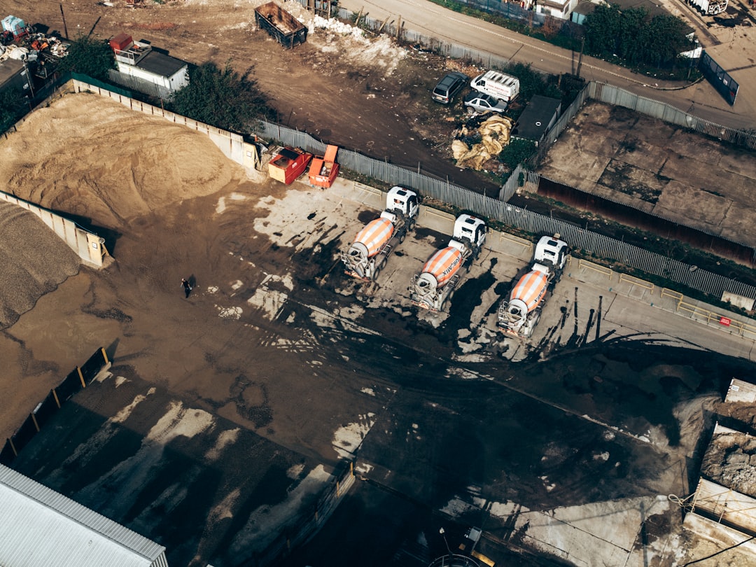
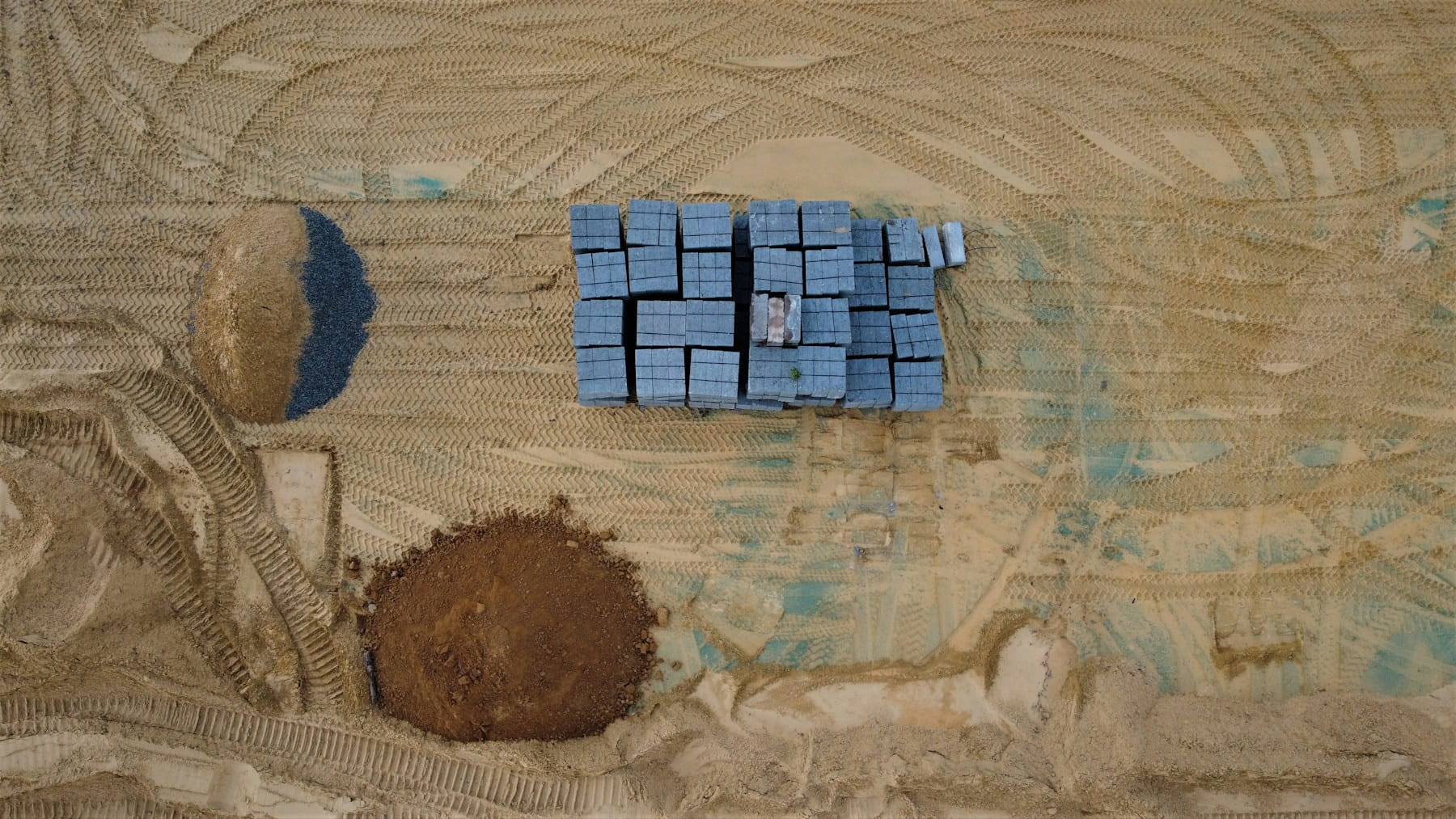
Site surveying and mapping
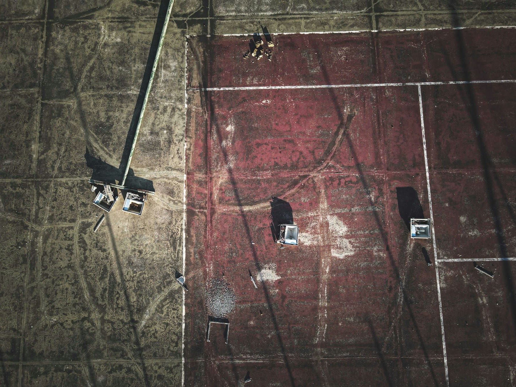
Topographic surveying is the use case that justifies most contractor drone programs on its own. A modern photogrammetry-equipped drone can map a roughly 100-acre site in under an hour, work a traditional ground crew would spread across several days. Output formats include orthomosaic maps, digital elevation models, contour maps, and 3D point clouds, all suitable for cut-fill calculations, drainage design, and earthworks management.
Accuracy is no longer a barrier. With ground control points and RTK or PPK workflows, drone photogrammetry routinely delivers ground sample distances of 2-5 cm, which is competitive with conventional ground surveys for most construction applications. For higher-precision work, LiDAR-equipped drones can hit 1-3 cm vertical accuracy and penetrate vegetation that defeats photogrammetry.
Three workflow notes that separate good operations from sloppy ones:
- Ground control points still matter for absolute accuracy, even with onboard RTK
- Real-time kinematic positioning cuts post-processing time and reduces GCP requirements
- The same flight that produces a survey can produce an orthomosaic for marketing or progress comms, doubling the output per mission
For a deeper buyer's-eye look at the software side, the construction mapping software buyer's guide walks through DroneDeploy, Pix4D, OpenSpace, and Propeller in detail. Operations that span both construction and broader surveying and inspection workflows benefit from running the same drone records across both job types.
Progress monitoring and digital twins
If surveying is the use case that buys the drone, progress monitoring is the one that keeps it busy. The pattern is straightforward: a recurring flight (weekly is typical, daily on critical-path sections) follows the same waypoints, captures imagery from the same angles, and feeds into software that compares week-over-week changes against the schedule.
Done well, this turns subjective ("we're on track, more or less") into objective ("Block C is 4% behind plan, here's the imagery"). Project managers use the resulting timelines to communicate with clients, document conditions for insurance and legal purposes, and identify deviations before they become schedule slips. The full mechanics of a working monitoring program, including cadence, software stack, and stakeholder reporting, are covered in drone construction monitoring.
Digital twins are the fast-growing extension of progress monitoring. The same flights that document weekly progress can feed 3D digital twin reconstructions of the entire site, which become the reference dataset for design verification, facility management, and as-built deliverables. For projects with BIM workflows, the twin links directly back to the design model, closing the loop between intent and reality.
Safety inspections and OSHA-aligned monitoring
Falls are the single largest cause of fatalities in construction. The 2024 Census of Fatal Occupational Injuries from BLS recorded 370 fatal falls, slips, and trips among construction and extraction workers, accounting for roughly 36% of the industry's deaths. The OSHA Focus Four hazards (falls, struck-by, caught-in/between, electrocution) together represent about 60% of construction fatalities.
Drones reduce exposure to the work that produces those numbers. Roof inspections, scaffolding checks, structural reviews of elevated steelwork, and confined-space approaches all become photographable from a safe standoff distance. Thermal payloads add another layer, surfacing moisture intrusion, electrical hot spots, and insulation gaps that ground-level inspections miss. Tying flight planning to live weather integration closes the most common safety gap: pilots flying through wind or visibility conditions the aircraft was never going to handle.
A few practical patterns:
- Use drones for roof inspection on every project before sending a worker up, even if a worker eventually has to follow
- Build the pre-flight checklist around site-specific hazards (active equipment, magnetic interference near rebar, dust)
- Run post-incident documentation flights the same way every time, so the records hold up under insurer scrutiny
The deeper operational mechanics, sensor selection, and inspection protocols live in using drones for construction inspections.
Asset tracking and site security
Construction equipment theft is a real and expensive problem. The National Equipment Register and partner sources estimate annual losses at $300 million to $1 billion in the US, with average per-incident losses near $30,000 and recovery rates around 21%. Drones don't solve this problem on their own, but they meaningfully reduce it as part of a broader security stack.
Two distinct workflows show up in practice. The first is daily inventory: an early-morning or end-of-day flight that documents equipment locations and creates a visual baseline a security team can compare against. The second is incident response: a rapid drone deployment when ground sensors flag a possible breach, with thermal imaging to spot people on site after hours. Both workflows benefit from live tracking so the security team and the pilot share the same view of where the aircraft is and what it sees.
For multi-site operators, centralized equipment tracking tied to drone-captured records gives loss-prevention teams a defensible inventory and a faster claim cycle when incidents happen. Pairing the drone program with site security drones and integrated alarm systems compounds the deterrent effect.
Real cost ranges and ROI
This is the section the original version of this post got wrong, so the numbers below come from current 2025 pricing data, not vendor marketing.
| Cost component | 2025-2026 range | Notes |
|---|---|---|
| Photogrammetry-capable mapping drone | $5,000-$20,000 | DJI Mavic 3 Enterprise, Mavic 3 Pro Cine, Phantom 4 RTK class |
| LiDAR-equipped drone or payload | $25,000-$100,000+ | Adds DJI L2, YellowScan, Velodyne-class payloads |
| Drone topographic survey, per acre | $10-$25 | Photogrammetry, varies with overlap and accuracy spec |
| Drone LiDAR survey, per acre | $150-$500 | Higher accuracy, vegetation penetration |
| Traditional 50-acre topographic survey | $15,000-$40,000 | Ground crew, RTK or total station |
| Drone equivalent of the same 50-acre survey | $5,000-$14,000 | Roughly 40-70% lower than traditional |
The cost-savings range published in vendor marketing is often "50-80% lower than traditional surveying." The defensible range from current pricing data is 40-70%, which is still substantial but worth quoting accurately.
Beyond direct survey replacement, the harder ROI comes from indirect effects: faster decisions on cut-fill, earlier detection of progress slippage, fewer rework events, lower insurance premiums tied to documented safety programs, and better client retention from transparent reporting. None of those are easy to put a number on, but contractors who have run drone programs for two or more years generally consider them indispensable rather than experimental.
Choosing the right drone for the job
The right drone depends on the job. There is no single platform that fits every construction use case.
| Use case | Drone class | Typical platforms |
|---|---|---|
| Routine progress imagery | Compact multirotor | DJI Mavic 3 Enterprise |
| Survey-grade photogrammetry | RTK multirotor | DJI Phantom 4 RTK, Mavic 3 Enterprise RTK |
| Large-area mapping (linear projects, 500+ acres) | Fixed-wing or VTOL | WingtraOne, senseFly eBee X |
| LiDAR survey or vegetated terrain | LiDAR-payload multirotor | DJI M350 RTK with Zenmuse L2 |
| Confined-space inspection | Indoor-rated multirotor | Skydio X10, Flyability Elios 3 |
| Thermal building / electrical inspection | Thermal-payload multirotor | DJI Matrice 30T, Mavic 3 Thermal |
The VTOL drone class is increasingly the right answer for linear infrastructure projects (highways, pipelines, transmission corridors) where fixed-wing range and vertical takeoff both matter. For most building-construction sites, a single mid-tier RTK multirotor handles 80-90% of the workload.
Regulatory state under Part 107 and Part 108
US commercial drone operations remain governed by FAA Part 107. For construction, the practical implications are:
- A Part 107 Remote Pilot Certificate for every operator
- Aircraft registration for any drone over 0.55 lb
- Remote ID broadcast verified before every flight (mandatory since March 2024)
- LAANC authorization for operations in controlled airspace
- 400 ft AGL altitude ceiling and visual line of sight by default
The bigger development is Part 108. The FAA published the Part 108 NPRM in August 2025, with the final rule expected in spring 2026. Part 108 will normalize routine BVLOS operations for aircraft up to 1,320 lb, replacing the case-by-case waiver process that has constrained large-site monitoring under Part 107.
For construction specifically, Part 108 is the rule that makes recurring autonomous monitoring of long linear projects and large-area sites legally practical. Operators planning programs in 2026-2027 should track the Part 108 rule progress closely; the implementation window after the final rule will compress training, certification, and operational planning into a 6-12 month horizon.
Compliance management across both rules is one of the easier wins for software platforms. Tracking pilot certifications, aircraft registrations, Remote ID status, and per-flight authorizations from a single record system, integrated with drone compliance reporting, removes the bookkeeping burden that grounds programs at the worst times.
Common adoption pitfalls
Drone programs fail for predictable reasons. Most of them are organizational rather than technical.
- Pilot becomes the bottleneck. Programs that run on a single trained operator collapse the moment that person leaves. Cross-train at least two pilots from day one.
- Data sits on memory cards. Flight imagery without a processing pipeline produces nothing. Pick the cloud or on-prem stack before buying the drone.
- Use case picked by the drone, not the project. "We have a drone, what should we use it for?" is a worse question than "What's the most expensive problem on this project, and can a drone reduce it?"
- No integration with the project management stack. Drone data that doesn't tie to schedules, RFIs, and BIM models gets ignored. Insist on integration.
- Compliance treated as paperwork. Missing a Remote ID check or a pilot certification renewal grounds an entire program. Treat compliance as a system, not a memory test.
Operations that get past these five pitfalls in the first six months tend to compound returns from there. The DroneBundle construction operations platform is built specifically around this maturity curve, with role-based pilot tracking, project-level mission records, and compliance gates built in.
FAQ
What are drones used for in construction?
Three main applications: site surveying and mapping (topographic surveys, cut-fill calculations, earthworks), progress monitoring (recurring flights compared against the schedule and BIM model), and safety inspections (roofs, scaffolding, structural reviews, thermal). Secondary uses include equipment tracking, site security, environmental compliance, and marketing imagery.
How much do construction drones cost?
A photogrammetry-capable mapping drone runs $5,000-$20,000 in 2026. Adding a LiDAR payload pushes total kit cost to $25,000-$100,000 or more. Per-mission costs for outsourced drone surveys range from $10-$25 per acre for photogrammetry to $150-$500 per acre for LiDAR.
How much can drones save on construction surveying?
Drone surveys are typically 40-70% cheaper than equivalent traditional ground surveys, with the bigger savings on larger sites. A 50-acre topographic survey that costs $15,000-$40,000 with a traditional crew runs $5,000-$14,000 with drone photogrammetry, including processing.
Do construction drones need an FAA license?
Yes. Commercial drone operations on construction sites require a Part 107 Remote Pilot Certificate. Aircraft over 0.55 lb must be registered, and Remote ID broadcast has been mandatory on all commercial flights since March 2024. Controlled-airspace operations require LAANC authorization.
Will Part 108 change construction drone use?
Yes, materially. The Part 108 NPRM published in August 2025 will normalize routine BVLOS operations for aircraft up to 1,320 lb, with the final rule expected in spring 2026. For construction, this means recurring autonomous monitoring of large or linear sites becomes legally practical without a case-by-case waiver, which is the constraint that has kept most large-site monitoring programs from scaling.
Bottom line
Drones in construction are now mainstream tooling, not experimental tech. Surveying, progress monitoring, and safety inspections are the three use cases that justify most programs. Real cost ranges in 2026 are $5,000-$20,000 for photogrammetry kit, 40-70% savings against traditional surveys, and roughly $10-$25 per acre for outsourced drone topo work. The regulatory unlock for the next phase is Part 108, with the final rule expected in 2026.
Ready to run construction drone operations on one platform?
DroneBundle ties construction drone work, from pre-flight checklists to flight logs, progress imagery, equipment records, and compliance status, to the projects, pilots, and aircraft they belong to. Site managers see what changed; pilots see what's flyable today; compliance is a query, not a binder.
Start your free trial today, no credit card required.
Or try the live demo to see the construction operations workflow end to end.