DSM vs DTM comes down to what each model keeps. A digital surface model (DSM) records the top of everything the drone saw, including roofs, trees and stockpiles, while a digital terrain model (DTM) records the bare ground with those removed; DEM is the umbrella term for both. DroneBundle builds both from your drone photos and measures heights, profiles and volumes on them.
Picking the wrong model does not throw an error. It gives you a believable wrong number: contour lines that loop around parked trucks, a drainage path that stops dead at a bridge, a stockpile volume that grows by 15% because of where you put the base.
This guide covers what each model is, how a drone map makes them, which one each job needs, a stockpile worked in numbers, and why a drone elevation model can sit tens of meters off and still measure some things correctly.
DSM vs DTM vs DEM: what is the difference?
A DSM is the elevation of the first surface seen from above, a DTM is the elevation of the bare ground, and a DEM is the general name for a grid of elevations that can mean either. All three are usually raster files, most often GeoTIFF, where each pixel holds one height value instead of a colour.
The confusion is mostly about DEM. The USGS defines a digital elevation model as the bare ground surface "excluding trees, buildings, and any other surface objects", which makes a USGS DEM a DTM in all but name. Many processing tools and European sources use DEM for any elevation grid, surface or ground. When a project spec asks for "a DEM", ask whether it means the ground or the surface.
| Model | What each pixel holds | Roofs, trees and stockpiles | Typical drone mapping use |
|---|---|---|---|
| DSM (digital surface model) | Height of the highest surface seen from above | Kept | Stockpile volumes, roof heights, building the orthomosaic |
| DTM (digital terrain model) | Height of the bare ground | Removed; the ground under them is estimated | Contours, drainage, flood work, grading against a design |
| DEM (digital elevation model) | Any grid of elevations | Depends on who made it; USGS DEMs remove them | Umbrella term; check the file's description |
| nDSM (normalized DSM) | DSM minus DTM: height above the ground | Only the objects remain | Building heights, tree heights, clearances |
The last row matters most in practice. Subtract the DTM from the DSM and every pixel tells you how tall the thing standing there is, which is how building and tree heights come out of a drone map.
How does a drone map produce a DSM and a DTM?
A drone map produces the DSM first, straight from the point cloud, and the DTM second, by filtering that point cloud down to ground points and filling the gaps. Photogrammetry software matches features across overlapping photos, works out where each photo was taken, and builds a dense point cloud. Gridding the top of that point cloud gives the surface model. Our roundup of drone photogrammetry software covers the tools that do this.
The terrain model is harder to make. A ground filter sorts points into ground and not ground, using slope and sudden height jumps, then drops buildings, vehicles and vegetation. Under a building there are no ground points at all, so the DTM fills that footprint by interpolating from the ground around it. A DTM is part measurement, part estimate.
Photos also cannot see through a tree canopy. Under dense trees a photogrammetry DTM has little real ground to work from, and low shrubs can pass the filter as ground. Lidar pulses reach the ground through gaps in the canopy, which is why bare-earth work in forest usually calls for lidar on the drone. Over open ground, construction pads, quarries and roofs, photos do the job well.
The orthomosaic depends on the DSM too: each photo is projected onto the surface model so roofs land where they belong, as our guide to orthomosaic images explains.
Which elevation model do you need for each job?
Use the DSM when the objects on the ground are what you measure, the DTM when the ground itself is what you measure, and both together when you need a height above the ground. This table sorts the common drone mapping jobs:
| Job | Model to use | Why | Watch for |
|---|---|---|---|
| Stockpile volumes | DSM | The pile is the surface you are measuring | The base surface under the pile sets the number |
| Cut and fill against a design | DTM of existing grade | Design surfaces are bare earth; parked machines should not count | Same vertical datum as the design file |
| Contours for a topo or grading plan | DTM | Contours from a DSM loop around cars, roofs and trees | Interpolated ground under buildings |
| Drainage and flow paths | DTM | Water runs over the ground, not over parked vehicles | Culverts and bridges read as dams |
| Flood and inundation work | DTM | Flood extents compare ground elevation with a water level | Absolute elevation and datum; water surfaces map badly |
| Roof and building heights | DSM minus DTM | Roof elevation minus ground elevation | Ground at the foot of walls is often estimated |
| Tree and canopy heights | DSM minus DTM | Treetop minus ground, called a canopy height model | Photos rarely reach the ground under closed canopy |
| Orthomosaic | DSM | Photos are projected onto the surface | Rough DSM gives wavy edges |
Volumes, grading and heights get their own sections below, along with the datum question that decides whether any absolute elevation can be trusted.
How do you measure stockpile volumes from a DSM?
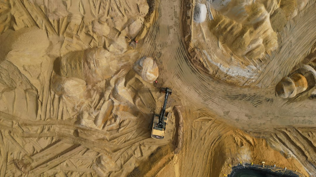
Stockpile volumes come from the DSM: the software adds up the height of the surface above a base, cell by cell, inside the outline you draw around the pile. The DSM gives you the top. You choose the bottom, and that choice moves the number more than the photo overlap or the flight height does on a well-flown site.
Take a cone-shaped pile 60 feet (18.3 m) across and 20 feet (6.1 m) tall. It holds π × 30² × 20 ÷ 3 = 18,850 cubic feet, or 698 cubic yards. Put it on ground that drops 2 feet from one side of the pile to the other, and compare three ways of setting the base:
| Base under the pile | Where it sits against the real toe | Volume | Error |
|---|---|---|---|
| A plane through the traced edge | Follows the 2 ft slope | 18,850 ft³ (698 yd³) | None |
| Flat at the lowest edge point | 1 ft below the toe on average | 21,677 ft³ (803 yd³) | +15% |
| Flat at a level set 6 in too low | 0.5 ft below the toe on average | 20,263 ft³ (750 yd³) | +7.5% |
The pile covers π × 30² = 2,827 square feet, so every foot the base sits too low adds 2,827 cubic feet (105 cubic yards). On sloping ground, a base that follows the ground around the toe is closer to how the pile actually sits.
Keep volumes on the DSM, not the DTM. A ground filter is built to remove things standing above the terrain, and depending on its settings it can flatten part or all of a pile.
DroneBundle's Volume tool works this way on the surface model. You click around the stockpile or hole, then pick the base: Traced edge (the base follows the ground along your outline), Lowest point (flat, at the lowest point of the outline) or Set level (flat, at an elevation you enter). The result shows the net volume with Above base and Below base listed separately, and our 3D measuring walkthrough shows the other tools beside it. For repeat surveys of the same site, see drone construction monitoring.
Why do contours, drainage and grading need a DTM?
Contours, drainage and grading need a DTM because each one describes the ground that water and earthmoving act on, and a DSM adds everything standing on that ground to the answer. Contours from a DSM loop around every car, trailer and shed. A flow model on a DSM routes water around a parked truck and ponds it behind a hedge.
Drainage has a trap even on a clean DTM. Water passes under a road through a culvert and under a bridge, but an elevation model only sees the top. In the model the road or deck is a solid dam, and the flow path stops there. Before running flow or ponding analysis, mark every culvert and bridge, cut a channel through the model at each crossing, and get the culvert inverts from a ground survey.
Flood work adds a datum problem. A flood extent compares ground elevation with a water level published on a specific vertical datum, so the DTM's absolute elevation must be right, not just its shape. Water also photographs badly: still water mirrors the sky and moving water has no fixed texture, so photogrammetry leaves holes or noise over ponds and channels and never sees the bed.
Grading compares a DTM of existing ground with the design surface, and the difference grid gives cut and fill. Excavators and pickups on site do not belong in that grid, which rules out the DSM. If contours or grading surfaces feed a design, our guide to drone surveying covers when that work needs a licensed surveyor.
How do you get building heights from a DSM and a DTM?
Building height is the DSM elevation on the roof minus the DTM elevation of the ground beside the building. The same subtraction over a whole map gives the nDSM, and over trees it gives a canopy height model, the layer behind tree height work in forestry mapping.
DroneBundle's Height tool does that subtraction for you. Click a spot on the map and it shows the elevation from the surface model and the height above the ground from the terrain model. Where the ground there cannot be worked out, it says so and suggests measuring with the Distance tool from the edge down to the ground instead.
The Profile tool charts heights along any line you draw, which shows the whole cross-section at once:
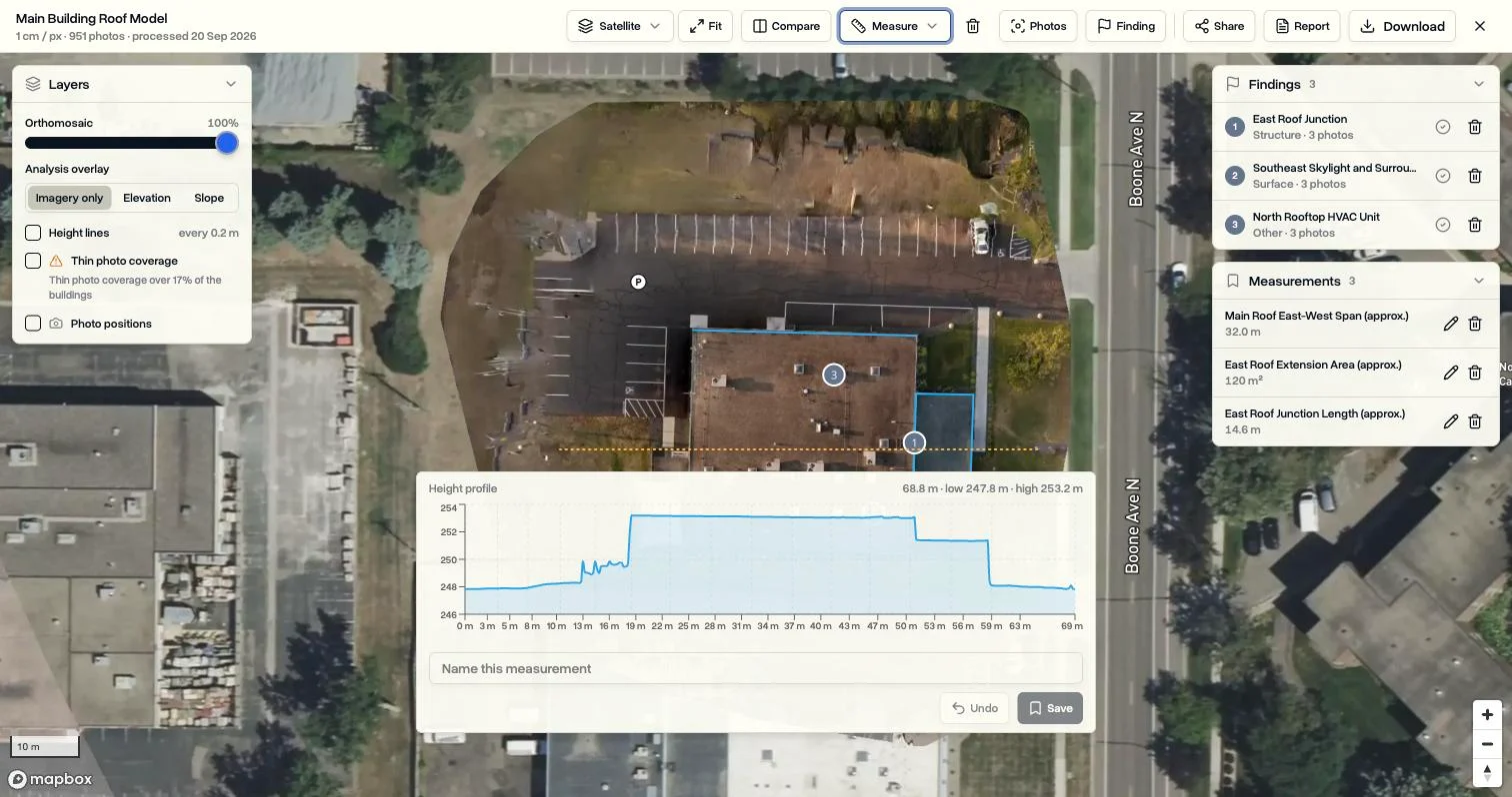
The profile crosses a commercial building in a DroneBundle demo map: ground near 248 meters, the main roof near 253 meters and a lower extension near 251 meters. That puts the main roof a little over 5 meters (about 17 feet) above the ground beside it.
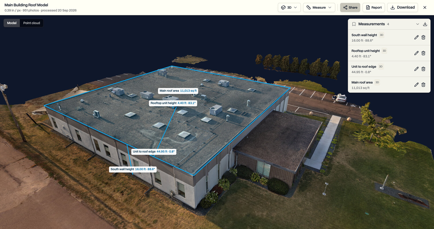
Ground at the foot of a wall is the weakest part of a photogrammetry model, because the wall hides it from straight-down photos. For wall and parapet heights, measure on the 3D model (see our guide to a 3D model from drone photos); for roof areas and pitch, see our roof measurement tool guide.
Why can a drone elevation model be 30 meters off and still measure a correct volume?
A drone elevation model can carry a large constant error in absolute elevation while every height difference inside it stays right, because volumes, building heights and profiles only use differences. Absolute elevation is a separate question: is the ground at the gate really 812.4 feet above sea level on NAVD 88?
GNSS receivers work out height above the ellipsoid, a smooth mathematical shape. US plans usually show orthometric heights on NAVD 88, close to height above mean sea level, and the two differ by the geoid height. Per the National Geodetic Survey, geoid heights in the conterminous United States range from about -8 to -53 meters. Its own example is a seashore point at +1 meter orthometric height and -30 meters ellipsoid height.
What a drone writes into each photo depends on the aircraft and its settings: an ellipsoid height, a geoid-corrected height or a height above the takeoff point. Without ground control or RTK positioning, nothing ties the model to a benchmark, so the whole surface can sit meters above or below where it belongs.
| Measurement | Survives a constant height offset? | What it needs |
|---|---|---|
| Stockpile volume against its own toe | Yes | A good base surface |
| Roof height above the ground beside it | Yes | A DSM and a DTM from the same map |
| Profile shape across a site | Yes | Nothing extra |
| Cut and fill against a design surface | No | Control on the design's datum |
| Flood elevations and floor heights | No | Control on the published datum |
| Volume change against last month's survey | No | Both surveys on the same control |
Not every error is a constant offset. A model built without control can bow in the middle, which bends relative heights too. Ground control points or RTK positioning fix most of it, and independent checkpoints prove it. The ASPRS Positional Accuracy Standards, Edition 2, raised the minimum number of checkpoints for a product accuracy assessment from 20 to 30, per the ASPRS briefing to the FGDC.
Which elevation files does DroneBundle make from a drone map?
DroneBundle builds a surface model for every map made from regular photos and a terrain model whenever the map includes the textured 3D model, which is the default. Both download as GeoTIFF files from the map's Download menu, listed as Surface model and Terrain model beside the orthophoto, point cloud, 3D model and processing report. Thermal maps are temperature maps and carry no elevation model.
Under More options, Skip the 3D model makes processing faster and still builds the map, the elevation layers and the measuring tools, but leaves out the terrain model. If a check after processing finds the terrain model may still hold buildings, the Download menu says so under the file name.
Inside the map viewer, the Analysis overlay switches between Imagery only, Elevation and Slope:
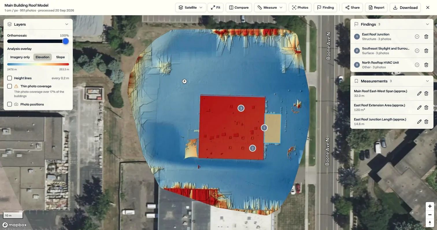
The elevation overlay colours the map from the lowest to the highest point, here 247.6 to 253.3 meters, so the roof stands out in red against the blue ground. Height lines draws contour lines at an interval picked from the site's height range. Both come from the surface model and show the site as it stands, roofs and stockpiles included. For bare-earth contours on a plan, download the Terrain model and contour it in your CAD or GIS software at the interval the plan needs.
Mapping is on every plan and uses processing credits, one per 100 photos. Saved measurements export as a spreadsheet, a CAD drawing or GeoJSON. The drone mapping page lists every output, with more for construction and surveying teams. For every click, see Measure and share a map in the Help Center.
FAQ
Is a DEM the same as a DTM?
In US government data, yes: the USGS defines a DEM as the bare ground with trees and buildings removed, which is a DTM. Outside that, many software tools and European sources use DEM for any elevation grid, including a surface model. Read the file's description, or look at a building in it: if the building stands up, it is a surface model.
Can you make a DTM from drone photos without lidar?
Yes, over open ground. Photogrammetry builds a point cloud, a ground filter keeps the ground points, and the gaps under buildings are filled by interpolation. Under dense tree canopy, photos see too little ground for a reliable DTM, and lidar is the better sensor.
What file format is a DSM or a DTM?
Most DSMs and DTMs are GeoTIFF files: a single-band raster where each pixel stores an elevation, with the coordinate system written into the file. GIS and CAD software open them directly; check the vertical units and datum before mixing them with other survey data.
Do you need a DTM for a roof inspection?
Not for the roof condition itself, which the orthomosaic and the 3D model show. You need ground elevations once the job asks for heights above the ground, such as eave height or a rooftop unit's clearance, because those are the roof elevation minus the ground elevation.
Ready to get heights and volumes from your drone maps?
DroneBundle turns the photos on a job into a drone map with a surface model and a terrain model, then measures heights, profiles and stockpile volumes on it, saved to the job you flew.
Start your free trial: 14 days, no credit card required.
Or try the live demo to see a processed drone map with sample data.