Drone mapping leverages advanced photogrammetry, high-resolution sensors, and precise flight planning to produce accurate, detailed maps and 3D models for construction, agriculture, surveying, and environmental applications.
Creating accurate maps from the sky has become routine business for modern operations. Drone mapping transforms aerial data collection from weeks-long ground surveys into efficient flight operations that capture detailed terrain information in hours rather than days.
Professional drone operators across construction, agriculture, and surveying industries rely on unmanned aircraft systems to generate precise topographic maps, orthomosaics, and 3D models. The technology combines high-resolution cameras with sophisticated software processing to produce mapping products that match or exceed traditional surveying accuracy.
Picture this: you're tasked with mapping a 200-acre construction site using traditional surveying methods. The project would require weeks of fieldwork, multiple survey crews, and expose personnel to active construction hazards. A properly equipped drone can complete the same survey in a few hours, producing detailed orthomosaics, elevation models, and volumetric calculations—all while keeping operators safely on the ground.
But understanding how drones create maps requires more than just launching aircraft and hoping for good results. Successful mapping operations depend on proper planning, appropriate equipment selection, and systematic data processing workflows.
Table of contents
- How drone mapping works
- Essential equipment and sensors
- Flight planning considerations
- Data processing workflow
- Mapping accuracy and precision
- Industry applications
- Regulatory compliance
- Common challenges and solutions
- Choosing mapping software
- Cost considerations
How drone mapping works
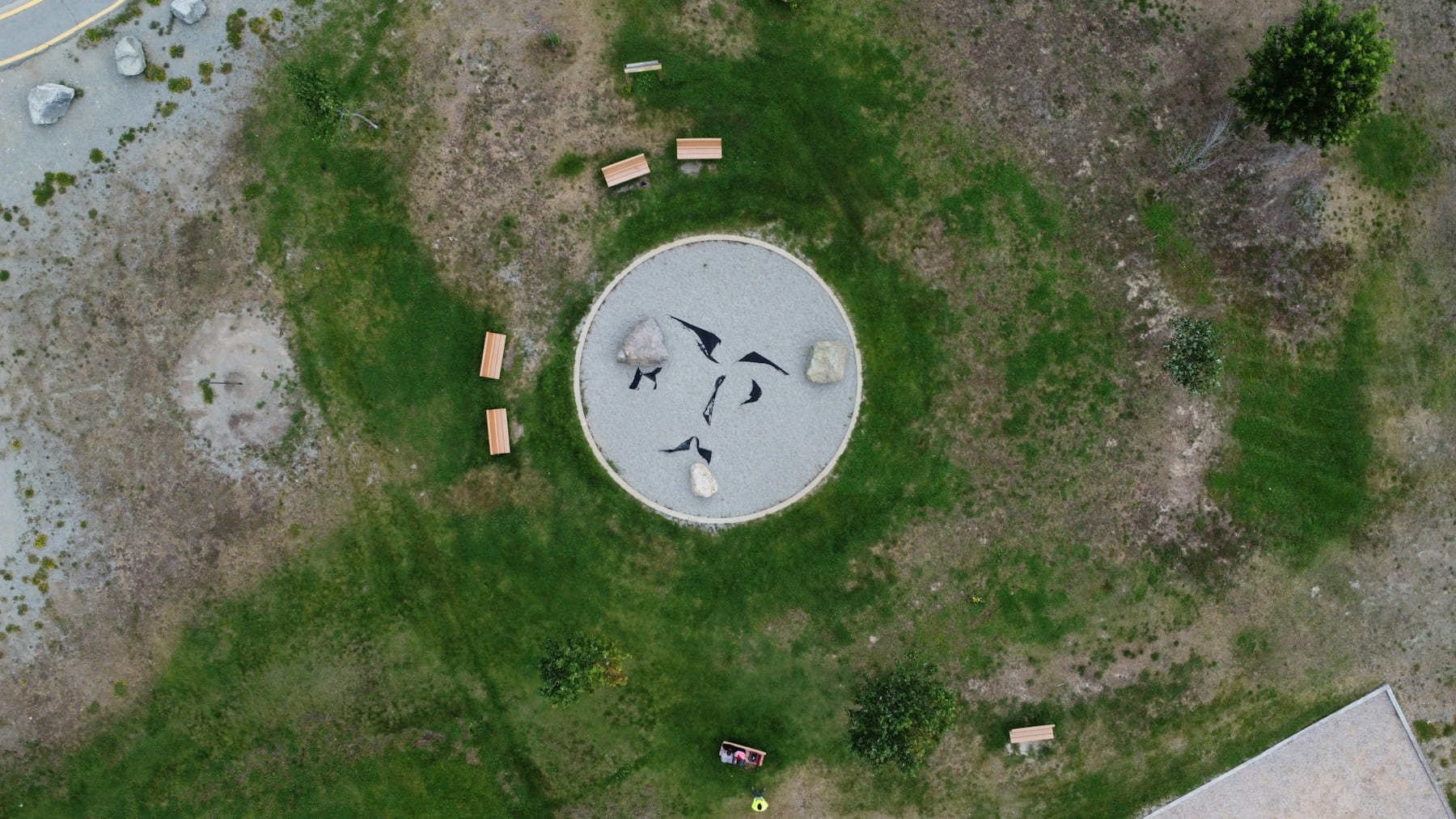
Drone mapping relies on photogrammetry - the science of making measurements from photographs. Aircraft capture overlapping images while flying predetermined patterns over target areas. Software then processes these images to create detailed maps and 3D models.
The process starts with systematic image collection. Drones follow programmed flight paths that ensure adequate overlap between consecutive photos. This overlap is critical. Without sufficient overlap, processing software cannot accurately stitch images together or calculate depth information.
Modern mapping software uses Structure from Motion (SfM) algorithms to identify common features across multiple images. The software calculates the camera position and orientation for each photograph, then reconstructs the 3D geometry of the surveyed area. This creates point clouds - collections of millions of 3D coordinate points that represent the terrain surface.
From these point clouds, the software generates various mapping products. Orthomosaics combine all captured images into single, geometrically corrected aerial photographs. Digital elevation models (DEMs) show terrain height variations. Contour maps display elevation changes through connected lines of equal height.
The quality of final mapping products depends heavily on flight planning and image quality. Poor overlap patterns, inadequate ground control points, or suboptimal lighting conditions can compromise accuracy significantly.
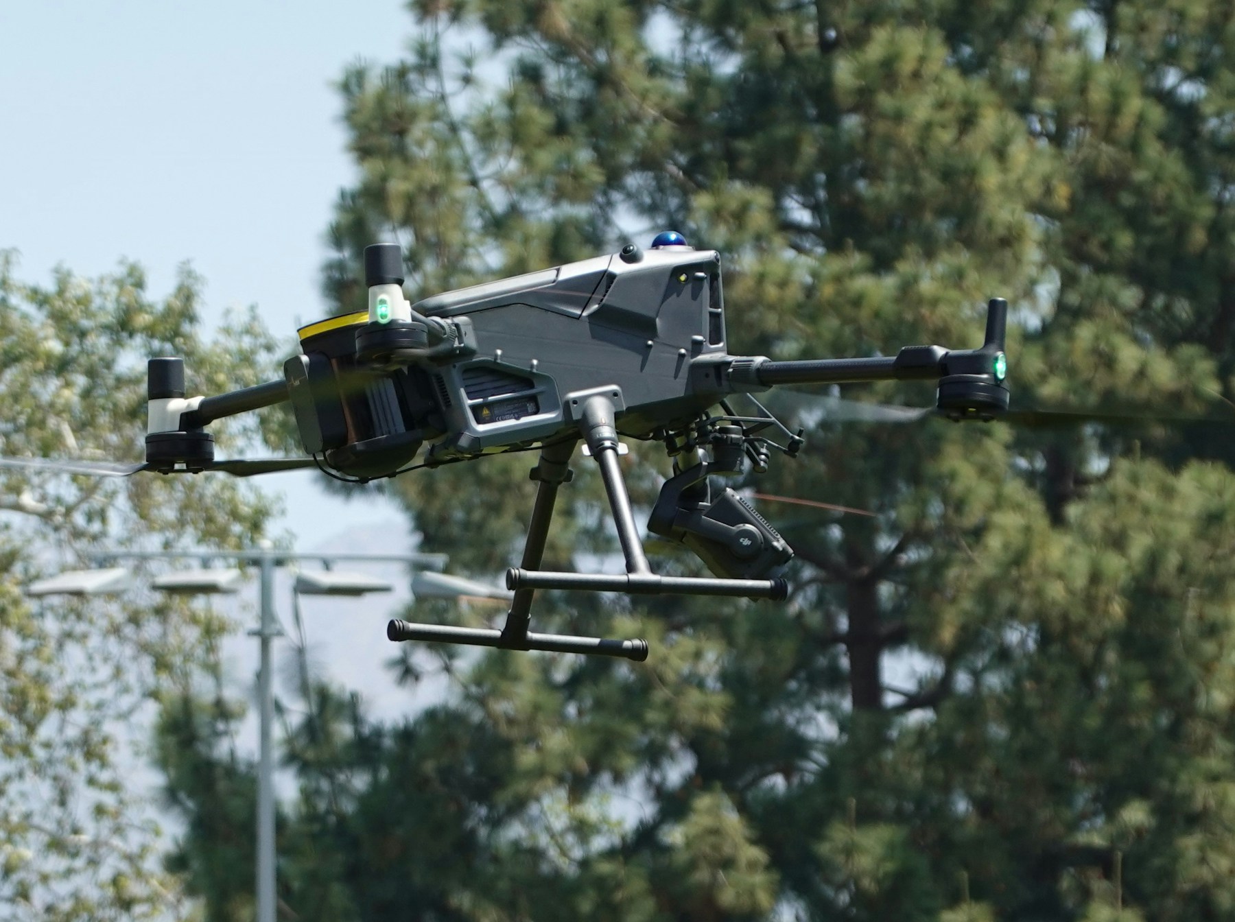
Essential equipment and sensors
Camera selection forms the foundation of successful mapping operations. Most commercial mapping relies on RGB (red, green, blue) cameras that capture standard color imagery. These cameras work well for general mapping applications where visual detail and measurement accuracy are primary requirements.
Higher-end operations often incorporate specialized sensors. Multispectral cameras capture light beyond visible wavelengths, providing valuable data for agricultural applications and vegetation analysis. Thermal sensors detect heat signatures useful for building inspections and energy audits.
LiDAR sensors represent the premium mapping option. These active sensors emit laser pulses and measure return times to calculate precise distance measurements. LiDAR excels in challenging conditions where traditional photography struggles - dense vegetation, low-light environments, or areas requiring extremely high accuracy.
Camera specifications matter significantly:
- Resolution determines the ground sampling distance (GSD) - how much real-world area each pixel represents
- Lens quality affects image sharpness and geometric accuracy
- Sensor size influences low-light performance and depth of field
- Mechanical shutter reduces motion blur during rapid flight operations
Ground control points (GCPs) provide reference coordinates that improve mapping accuracy. These precisely surveyed markers appear in captured imagery, allowing processing software to georeference maps to real-world coordinate systems. Professional operations typically place GCPs throughout the survey area before flight operations begin.
GNSS/RTK systems enhance positioning accuracy during data collection. Real-time kinematic positioning can achieve centimeter-level accuracy, reducing dependence on ground control points for some applications.
Flight planning considerations
Successful mapping missions require careful flight planning that balances coverage requirements, weather conditions, and equipment limitations. Most mapping software includes automated flight planning tools, but understanding the underlying principles helps operators make informed decisions. Comprehensive flight planning strategies ensure efficient data collection and optimal results.
Altitude selection directly affects ground sampling distance and flight efficiency. Lower altitudes produce higher resolution imagery but require more flight time to cover equivalent areas. Higher altitudes reduce detail but improve operational efficiency for large-scale mapping projects.
Key flight planning parameters include:
- Forward overlap: Typically 80-85% between consecutive images along flight lines
- Side overlap: Usually 70-75% between parallel flight strips
- Flight speed: Balanced to prevent motion blur while maintaining efficiency
- Gimbal settings: Camera angle and stabilization parameters
- Battery planning: Flight duration limits based on equipment specifications
Weather conditions significantly impact mapping quality. Strong winds can cause image blur and positioning errors. Understanding METAR weather reports helps operators interpret aviation weather data for planning decisions. Overcast skies often provide ideal lighting conditions by eliminating harsh shadows and ensuring consistent illumination across the survey area.
Solar angle affects image quality and processing results. Midday flights generally produce the most consistent lighting, though early morning or late afternoon operations might be necessary to avoid restricted airspace or operational constraints.
Flight pattern selection depends on terrain characteristics and mapping objectives. Grid patterns work well for flat terrain and general mapping applications. Terrain-following flights maintain consistent ground sampling distance over varied topography but require more sophisticated planning software.
Data processing workflow
Raw imagery from mapping flights requires substantial processing to generate useful mapping products. This workflow typically involves several distinct phases, each with specific quality control requirements.
Initial processing begins with image assessment and quality control. Operators review captured imagery for blur, exposure problems, or coverage gaps that might affect final results. Poor-quality images should be identified and potentially excluded from processing workflows.
The georeferencing phase aligns images with real-world coordinate systems. Software identifies ground control points in imagery and uses their known coordinates to establish spatial reference frames. This step critically affects the absolute accuracy of final mapping products.
Dense point cloud generation creates detailed 3D representations of surveyed areas. Processing software identifies millions of matching points across overlapping images and calculates their 3D coordinates. Point cloud density directly affects the resolution of derivative products like digital elevation models.
Common processing outputs include:
| Product type | Description | Typical applications |
|---|---|---|
| Orthomosaic | Geometrically corrected aerial photograph | Visual inspection, measurement |
| Digital elevation model | 3D terrain surface representation | Volume calculations, drainage analysis |
| Contour map | Lines connecting points of equal elevation | Topographic analysis, grading plans |
| Point cloud | Collection of 3D coordinate points | Detailed measurements, 3D modeling |
| 3D mesh | Textured surface model | Visualization, presentations |
Processing time varies significantly based on image count, processing parameters, and available computing resources. Large mapping projects might require days of processing time on standard workstations, though cloud-based processing services can reduce turnaround times substantially.
Quality control throughout the processing workflow prevents errors from propagating to final products. Operators should verify ground control point accuracy, check for processing artifacts, and validate measurements against known reference data when possible.
Mapping accuracy and precision
Understanding accuracy limitations helps set realistic expectations for mapping projects and ensures appropriate applications for generated products. Drone mapping accuracy depends on numerous factors, from equipment specifications to environmental conditions during data collection.
Ground sampling distance represents the theoretical limit of mapping resolution. A camera capturing 2cm GSD imagery cannot reliably detect features smaller than approximately 4-6cm in the final mapping products. This relationship between GSD and feature detection capability guides equipment selection for specific applications.
Absolute accuracy describes how closely mapped coordinates match real-world positions. Professional mapping operations typically achieve accuracies between 1-5cm horizontally and 2-10cm vertically when using proper ground control point networks and appropriate processing techniques.
Relative accuracy measures how well mapped features maintain their spatial relationships within the surveyed area. Drone mapping often achieves better relative accuracy than absolute accuracy, making it well-suited for applications requiring precise measurements between features rather than exact global positioning.
Factors affecting mapping accuracy:
- Ground control point quantity, distribution, and survey accuracy
- Image overlap percentages and consistency
- Camera calibration quality and lens distortion correction
- Atmospheric conditions during flight operations
- GNSS positioning accuracy during image capture
- Processing software quality and parameter selection
Accuracy validation requires independent check measurements to verify mapping product quality. Professional operations often establish check points - precisely surveyed locations not used during processing - to assess final product accuracy objectively.
Error sources can compound throughout the mapping workflow. Camera calibration errors, poor ground control point distribution, or inadequate image overlap can each introduce systematic errors that affect entire mapping products. Understanding these potential error sources helps operators implement appropriate quality control measures.
Industry applications
Construction operations have embraced drone mapping for progress monitoring, volume calculations, and site documentation. Regular mapping flights track earthwork progress, identify potential drainage issues, and provide updated topographic information for ongoing projects. Detailed construction inspections leverage mapping data for comprehensive site analysis.
Stockpile volume calculations represent a common construction application. Drone-generated elevation models enable accurate volume measurements for aggregate, soil, or debris piles without requiring dangerous manual measurements or expensive surveying equipment.
Agricultural operations use mapping data for precision farming applications. Multispectral imagery reveals crop health variations, irrigation inefficiencies, and pest or disease problems that might not be visible to ground-based observation. This information guides variable-rate application of fertilizers, pesticides, or water resources.
Land surveying professionals increasingly incorporate drone mapping into traditional workflows. While drones cannot completely replace conventional surveying techniques, they excel at providing rapid area coverage and detailed topographic information for preliminary planning or supplementary documentation.
Mining operations rely on mapping data for haul road planning, environmental monitoring, and safety compliance. Regular mapping flights track pit progression, monitor slope stability, and document reclamation activities required by regulatory agencies.
Infrastructure inspection applications use mapping data to document asset conditions and track maintenance requirements. Specialized applications include power line inspections, wind turbine inspections, and general asset inspection workflows. Bridge inspections, pipeline monitoring, and utility corridor surveys benefit from detailed aerial imagery and precise geometric measurements.
Environmental monitoring projects use mapping data to track habitat changes, monitor restoration projects, and document compliance with environmental regulations. Applications like forestry inspections demonstrate the versatility of mapping technology. Repeat mapping flights can quantify changes over time and identify trends requiring management attention.
Regulatory compliance
Commercial drone mapping operations must comply with aviation regulations that vary significantly between countries and operational contexts. Understanding applicable regulations prevents costly violations and ensures safe integration with manned aviation. Comprehensive compliance management systems help operators track regulatory requirements.
Part 107 regulations in the United States establish basic operational requirements for commercial drone operations. These include pilot certification requirements, aircraft registration, operational limitations, and airspace restrictions that affect mapping mission planning. Professional pilot training ensures operators understand regulatory requirements.
Visual line of sight requirements limit the distance between pilots and aircraft during operations. While these requirements can restrict mapping coverage areas, they exist to prevent conflicts with manned aviation and maintain operational safety standards. Advanced operations like BVLOS require special approvals.
Airspace restrictions affect where mapping operations can occur legally. Understanding airspace classifications and no-fly zones prevents regulatory violations. Controlled airspace near airports requires prior authorization through established processes. Operators may need to file NOTAMs for certain operations. Temporary flight restrictions, military operations areas, and other special-use airspace can prohibit drone operations entirely.
Key regulatory considerations include:
- Pilot certification and recency requirements
- Aircraft registration and identification markings
- Operational altitude limitations (typically 400 feet AGL)
- Daylight operations requirements
- Weather minimums for safe operations
- Required documentation and record-keeping
International operations introduce additional regulatory complexity. Each country maintains its own drone regulations, pilot licensing requirements, and operational restrictions. Cross-border operations require careful research and often extensive permitting processes.
Remote identification requirements are expanding globally, requiring aircraft to broadcast identification and location information during operations. These systems help aviation authorities track drone operations and identify potential conflicts with manned aviation.
Privacy and data protection regulations can affect how mapping data is collected, stored, and shared. Some jurisdictions restrict aerial photography over private property or require specific consent processes before data collection activities.
Common challenges and solutions
Weather conditions frequently disrupt mapping operations and can significantly impact data quality. Wind speeds above equipment specifications can cause camera shake and positioning errors that compromise final accuracy. Strong winds also create safety hazards that might require mission postponement.
Battery life limitations constrain flight duration and coverage area for individual missions. Understanding drone flight time helps operators plan realistic coverage areas. Cold weather reduces battery performance substantially, while hot conditions can trigger thermal protection systems that limit flight operations. Operators typically plan for reduced performance margins and carry spare batteries to complete planned coverage areas.
Processing resource requirements can overwhelm standard computing systems when dealing with large datasets. Mapping projects involving thousands of high-resolution images might require days of processing time on standard workstations. Cloud-based processing services offer scalable alternatives but introduce data transfer and cost considerations.
Solutions for common operational challenges:
- Weather monitoring systems that provide real-time conditions and forecasts
- Battery management protocols including spare capacity and environmental considerations
- Scalable processing workflows using cloud computing resources
- Backup equipment redundancy for critical mission components
- Pre-flight checklists that catch problems early in workflows
- Risk assessment procedures for complex mapping missions
Ground control point logistics can complicate mapping operations, particularly on large sites or in remote locations. Establishing sufficient GCP networks requires additional personnel, survey equipment, and time that increases project costs and complexity.
Airspace restrictions limit operational flexibility and can prevent access to optimal mapping locations. Complex airspace authorization processes might require weeks of advance planning for operations near airports or in controlled airspace areas.
Data storage and management become significant challenges as mapping operations scale. High-resolution imagery datasets can consume terabytes of storage space, requiring robust backup systems and efficient file management protocols.
Choosing mapping software
Software selection significantly affects processing capabilities, workflow efficiency, and final product quality. Professional mapping software ranges from specialized photogrammetry packages to integrated platforms that combine flight planning, processing, and analysis capabilities.
Processing capability represents the primary differentiator between software options. Professional photogrammetry software typically offers advanced algorithms, extensive parameter controls, and specialized features for challenging processing scenarios. Consumer-oriented packages prioritize ease of use but might lack advanced processing capabilities.
Workflow integration affects operational efficiency and data management practices. Some software packages include flight planning tools, data management systems, and integration with external analysis software. These integrated approaches can streamline operations but might limit flexibility for operators using specialized tools.
Key software evaluation criteria:
- Processing algorithm quality and customization options
- Supported camera types and calibration capabilities
- Ground control point workflow and accuracy assessment tools
- Output format compatibility and data export options
- Hardware requirements and processing performance
- Technical support quality and user community resources
Cloud-based processing services offer scalable alternatives to local software installations. These services can handle large datasets efficiently and often include automatic software updates and technical support. However, they require reliable internet connectivity and introduce ongoing subscription costs.
License models vary significantly between software vendors. Some packages require substantial upfront investments with annual maintenance fees, while others offer subscription-based pricing that includes regular updates and support services.
Training requirements differ substantially between software packages. Professional photogrammetry software often requires extensive training to achieve optimal results, while simplified packages might be accessible to operators with minimal specialized knowledge.
Cost considerations
Equipment costs represent the largest initial investment for most mapping operations. Professional-grade aircraft with appropriate sensors can cost tens of thousands of dollars, though entry-level systems suitable for basic mapping applications are available for much less.
Software licensing adds ongoing operational costs that vary based on processing requirements and feature needs. Professional photogrammetry software typically requires annual licenses costing several thousand dollars, while cloud-based processing services charge per project or data volume processed.
Personnel costs include pilot training, certification maintenance, and technical skill development for data processing and analysis. These indirect costs are often underestimated but represent substantial ongoing investments for professional operations.
Typical cost categories for mapping operations:
| Cost category | One-time costs | Ongoing costs |
|---|---|---|
| Equipment | Aircraft, sensors, ground control | Maintenance, repairs, upgrades |
| Software | License purchases | Annual maintenance, subscriptions |
| Personnel | Initial training, certification | Recurrent training, skill development |
| Operations | Insurance, registration | Fuel, transportation, consumables |
Project-specific costs include ground control point establishment, data storage, and quality control activities. Large mapping projects might require substantial ground survey work to establish adequate reference networks, adding significant costs to individual missions.
Return on investment calculations should consider both direct cost savings and indirect benefits from improved data quality and operational efficiency. Many organizations find that drone mapping reduces overall project costs while providing better information than traditional alternatives.
Scaling considerations affect cost structures as mapping operations expand. Fixed costs like equipment purchases and software licenses can be amortized across larger project volumes, while variable costs like personnel time and processing resources scale with project complexity.
Implementation Considerations
Professional drone mapping has transformed how organizations collect and analyze spatial data. The technology offers unprecedented combinations of accuracy, efficiency, and cost-effectiveness for applications ranging from construction progress monitoring to agricultural management.
Organizations implementing mapping programs benefit from understanding equipment capabilities, processing requirements, and regulatory constraints before investing in systems. Successful implementations typically start with comprehensive pilot training, systematic maintenance protocols, and robust compliance frameworks.
Fleet management systems help organizations coordinate multiple aircraft and operators efficiently. Mission planning tools reduce preparation time while improving consistency across operations.
In Summary
Mastering drone mapping demands technical expertise, systematic workflows, and attention to regulatory compliance. From equipment selection and flight planning to data processing and accuracy validation, comprehensive mapping strategies produce reliable results for professional applications.
The complexity of professional mapping requires understanding photogrammetry principles, sensor capabilities, processing algorithms, and quality control procedures. As technology advances and applications expand, operators who master these fundamentals position themselves for sustained success in commercial mapping operations.
Organizations implementing systematic mapping procedures today are establishing capabilities that support diverse applications from construction monitoring to environmental analysis. The integration of professional equipment with rigorous operational protocols creates the foundation for accurate, reliable spatial data collection.
Ready to Enhance Your Mapping Operations?
Join commercial operators who have streamlined their mapping workflows through comprehensive operations management systems. Whether you're conducting site surveys, monitoring infrastructure, or analyzing agricultural fields, systematic foundations enable consistent results and operational efficiency.
Start your free trial today — no credit card required. Or book a demo to see how DroneBundle integrates flight planning, compliance tracking, maintenance protocols, and data monitoring in a platform designed specifically for professional mapping operations.