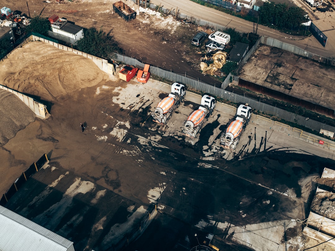
Drone construction monitoring uses UAVs equipped with high-resolution cameras and sensors to capture recurring aerial data of a job site, enabling project managers to track progress, verify earthwork quantities, spot safety hazards, and compare as-built conditions against design models. Companies using drones for construction monitoring report 30 to 50 percent reductions in inspection costs and data collection speeds up to 60 times faster than traditional ground surveys.
That sounds impressive on paper. In practice, the value of drone monitoring depends almost entirely on how well you plan the flight cadence, process the data, and get actionable reports into the right hands before problems compound. A single drone flight over a construction site is aerial photography. A structured monitoring program tied to construction phases, with consistent flight paths and automated deliverables, is what actually keeps projects on schedule.
This guide covers the operational details that most resources skip: how often to fly, how to coordinate monitoring across multiple sites, what the client reporting pipeline actually looks like, and how to price these services profitably.
Table of contents
- What drone construction monitoring actually involves
- Monitoring frequency by construction phase
- The flight-to-deliverable pipeline
- Managing monitoring across multiple sites
- Equipment and sensor selection
- Regulatory requirements for construction sites
- Insurance and risk management on active sites
- Pricing construction monitoring services
- Frequently asked questions
What drone construction monitoring actually involves
Drone construction monitoring is the practice of flying scheduled, repeatable drone missions over a construction site to collect aerial imagery, generate orthomosaic maps, 3D models, and volumetric calculations, then delivering those outputs to stakeholders in a format that drives decisions. It goes well beyond taking a few photos from the air.
A proper monitoring program captures data from the same flight path at regular intervals so teams can overlay images and measure changes over time. This consistency is what separates monitoring from ad hoc drone photography. When you fly the same route every week, you can create time-lapse comparisons, calculate cut-and-fill volumes between visits, and flag deviations from the design model before they become expensive rework.
The core deliverables from a construction monitoring flight typically include:
- Orthomosaic maps showing the entire site stitched from hundreds of overlapping images
- 3D point clouds and surface models for volumetric measurements
- Thermal imagery to detect moisture intrusion, insulation gaps, or equipment overheating
- Design overlay comparisons that highlight discrepancies between as-built and planned conditions
- Time-series progress documentation for stakeholder reporting and dispute resolution
These deliverables serve multiple audiences. Project managers verify subcontractor progress claims. General contractors demonstrate milestone completion to owners and investors. Safety teams identify hazards. And the data becomes part of the permanent project record for warranty claims, insurance documentation, and regulatory compliance years after the project finishes. For a broader look at how drones are transforming the industry, see our guide on drone use in construction.
Monitoring frequency by construction phase
The right flight frequency depends on the construction phase. Flying too often wastes budget. Flying too infrequently means you miss critical changes.
Most competitors gloss over this point with generic advice like "fly regularly." Here is a practical framework based on how construction actually progresses:
Pre-construction and site preparation (weekly flights)
This phase moves fast. Grading, excavation, and utility installation can change the site dramatically in a matter of days. Weekly flights let you track earthwork volumes accurately, verify that grading meets design specifications, and document existing conditions for baseline comparisons. Ground control points placed during this phase establish the accuracy benchmarks for all future flights.
Foundation and substructure (weekly to biweekly)
Concrete pours, rebar placement, and waterproofing happen on tight schedules. Missing a documentation window here means you cannot verify what was installed before it gets covered up. Weekly flights during active pours, shifting to biweekly during curing periods, keeps documentation complete without overflying.
Structural framing and vertical construction (biweekly)
The pace of visible change slows somewhat during framing, but height introduces new complexity. Oblique camera angles become important for documenting facade progress and structural connections. Biweekly flights capture meaningful change without redundancy. This is also when quality assurance protocols become essential to catch structural defects early.
Mechanical, electrical, and plumbing (monthly)
Much of this work happens inside the building, limiting what aerial monitoring can capture. Monthly flights still document exterior progress, rooftop mechanical equipment placement, and site logistics. Thermal imaging during this phase can detect insulation gaps and HVAC system issues.
Finishing and closeout (biweekly, then final documentation)
Exterior finishing, landscaping, and punch list work warrant a return to biweekly monitoring. The final documentation flight produces the as-built record that serves the owner for the life of the building. These flights often support digital twin creation for ongoing facility management.
| Construction Phase | Recommended Frequency | Primary Deliverables | Key Stakeholders |
|---|---|---|---|
| Site preparation | Weekly | Volumetrics, grading verification | Civil engineer, GC |
| Foundation | Weekly to biweekly | Pour documentation, as-built overlay | Structural engineer, inspector |
| Structural framing | Biweekly | Progress photos, 3D model updates | Owner, architect |
| MEP rough-in | Monthly | Exterior progress, thermal scans | MEP subcontractors, PM |
| Finishing/closeout | Biweekly + final | As-built documentation, punch list support | Owner, facility manager |
The flight-to-deliverable pipeline
The flight itself is the easy part. What happens after the drone lands determines whether your monitoring program delivers real value or just produces pretty pictures nobody acts on. Post-processing typically takes longer than the flight itself, and most operators underestimate this.
Step 1: Automated flight execution and data capture (15 to 45 minutes)
Use waypoint-based flight planning software to ensure repeatable paths. The same flight plan runs every visit, producing consistent data that can be compared across time. A single monitoring flight generates 200 to 500 images depending on site size and overlap settings. Proper drone data processing workflows, including immediate backup to local storage and cloud, prevent costly re-flights.
Step 2: Processing and analysis (3 to 10 hours)
Photogrammetry software stitches overlapping images into orthomosaics, point clouds, and 3D meshes. For operations running multiple sites, batch processing overnight keeps the pipeline flowing. Once processed, overlay current orthomosaics against previous captures to measure progress, quantify cut-and-fill volumes, and flag deviations from plans. Drone mapping software designed for construction automates much of this comparison work.
Step 3: Reporting, distribution, and archival (30 minutes to 1 hour)
Package findings into client-ready reports with annotated aerial images, progress percentages, volume calculations, and flagged issues. A client portal gives stakeholders self-service access to current and historical site data. Every flight's raw data, processed outputs, and reports become part of the permanent project record for disputes, warranty claims, and regulatory audits.
Managing monitoring across multiple sites
Here is where most drone monitoring programs break down. Flying one construction site is straightforward. Coordinating weekly or biweekly monitoring across five, ten, or twenty active projects introduces logistical complexity that spreadsheets cannot handle.
The challenges compound quickly. Different sites are in different construction phases with different flight frequencies. Weather cancellations cascade through the week's schedule. Each site has its own client contacts, deliverable requirements, and access procedures. Equipment and pilots need to be routed efficiently across geographically dispersed locations.
Professional monitoring operations solve these problems with systematic project management. Each site gets its own project with defined phases, assigned pilots, and documented access procedures. Flight planning templates standardize the mission so any qualified pilot can execute without site-specific tribal knowledge.
Fleet management software becomes essential at this scale. You need visibility into which drones and pilots are assigned where, what maintenance is due, and which batteries are charged and available. When a pilot calls in sick, you need to reassign their route within minutes, not hours.
DroneBundle's construction and infrastructure tools are built specifically for this multi-site workflow. Create project folders for each site, define inspection phases, assign recurring flights, and track progress across your entire portfolio from a single dashboard. The platform's live tracking capabilities let operations managers monitor field teams in real time across all active sites.
For teams managing growing construction monitoring operations, our guide on scaling a drone business covers the operational systems you need beyond just the flying.
Equipment and sensor selection
The right equipment depends on what deliverables your clients need and the size of the sites you are monitoring.
For standard progress documentation and orthomosaic generation, a 20+ megapixel RGB camera with a mechanical shutter produces the sharpest results. Mechanical shutters eliminate rolling shutter distortion during mapping flights, which matters for photogrammetric accuracy.
Thermal cameras add value during MEP phases and building envelope completion, detecting moisture intrusion, insulation deficiencies, and underground utility locations. Choose a radiometric thermal camera that records absolute temperature values, not just relative heat maps.
LiDAR sensors deliver better results than photogrammetry alone for sites with heavy tree cover or complex topography. The cost is higher, but the accuracy improvement is significant for earthwork volume calculations.
Real-time kinematic (RTK) or post-processed kinematic (PPK) positioning delivers centimeter-level accuracy without ground control points on every flight. The initial investment is substantial, but it saves significant time on recurring monitoring missions where placing GCPs every visit is impractical.
Regulatory requirements for construction sites
Every commercial drone flight over a construction site requires FAA Part 107 certification for the remote pilot in command. This is non-negotiable. The Part 107 certificate requires passing an aeronautical knowledge exam and completing recurrent training every 24 months.
Beyond the pilot certificate, construction site monitoring involves several regulatory considerations that are easy to overlook:
Airspace authorization
Many construction projects sit within controlled airspace near airports. Operations in Class B, C, D, or surface-level Class E airspace require LAANC authorization or a manual airspace waiver before flying. Check airspace classifications during the project bid phase, not the day of the first flight.
Remote ID compliance
As of 2026, all drone operations must comply with Remote ID requirements, which broadcast the drone's identification and location in real time. Most newer drones have Remote ID built in, but older aircraft may need a broadcast module. Check the FAA website for the latest Remote ID guidance.
Operations over people
Active construction sites have workers on the ground. Flying over people requires either a Category 1, 2, 3, or 4 drone classification under Part 107.39, or you need to restrict workers from the flight zone during operations. Practically, most monitoring operators coordinate with the site superintendent to clear the flight area for 15 to 30 minutes.
Night operations
Winter schedules and early morning flights may require night operations capabilities. Part 107 now allows night flights without a waiver, provided the drone has anti-collision lighting visible for 3 statute miles. Managing compliance tracking across multiple pilots, sites, and regulatory requirements is where platform-level tools save significant administrative time.
Insurance and risk management on active sites
Active construction sites present hazards that standard aeronautical charts do not show: cranes, scaffolding, material hoists, dust, debris, and high winds near tall structures.
Most general contractors require a minimum of $1 million in commercial general liability insurance before granting site access, with some larger projects requiring $5 million. Your drone insurance policy needs to specifically cover construction site operations, as some policies exclude active construction zones. Expect to pay $500 to $2,000 annually.
Every site deserves its own risk assessment before the first flight. Document crane locations and swing radii, identify no-fly zones around active work areas, note powerline locations, and establish emergency landing areas. Update this assessment as the site evolves through construction phases.
Your drone operations must integrate with the site's existing safety plan per OSHA construction safety standards. This means attending safety briefings, understanding the site's communication protocols, and knowing the emergency procedures. Many sites require drone operators to complete site-specific safety orientation before flying. Maintain flight logs for every visit to create the audit trail that protects you during incident investigations, and use weather integration tools to reschedule proactively rather than showing up grounded by wind or rain.
Pricing construction monitoring services
Construction monitoring commands premium pricing because it delivers measurable value. Unlike one-off aerial photography, monitoring contracts provide recurring revenue and long-term client relationships.
Here are the common pricing models for 2026:
Per-flight pricing: $500 to $1,500 per visit
Best for smaller projects or clients testing drone monitoring for the first time. Price depends on site acreage, deliverable complexity, and travel distance. A straightforward progress photo package at the low end; full orthomosaic, 3D model, and volumetric report at the high end.
Monthly retainer: $2,000 to $5,000 per site
For ongoing monitoring relationships, monthly retainers bundle a defined number of flights with standard deliverables. This model works well for general contractors who want predictable costs and guaranteed scheduling priority. It also provides predictable revenue for the drone operator.
Per-acre or project-duration pricing
Large earthwork projects often use per-acre pricing: $5 to $15 per acre for 2D orthomosaics, plus $3 to $8 per acre for 3D modeling. For the highest contract value, tie monitoring services to the full construction timeline. A 12 to 18 month project with biweekly flights generates substantial recurring revenue while reducing business development overhead.
Whichever model you choose, account for post-processing time. A 30-minute flight might require 4 to 6 hours of processing, analysis, and report generation. Operators who price based on flight time alone consistently undercharge.
DroneBundle helps construction monitoring operators manage the full workflow, from flight planning and pilot scheduling to client deliverable tracking and compliance documentation. Start a free trial or book a live demo to see how the platform handles multi-site construction monitoring at scale.
Frequently asked questions
How often should drones monitor a construction site?
Flight frequency should match the construction phase. Weekly flights during earthwork and foundation phases capture rapid changes. Biweekly flights work well for structural framing. Monthly flights suffice during interior MEP rough-in when most changes happen inside the building. The key is consistency: flying the same path at regular intervals produces the time-series data that makes monitoring valuable.
What does drone construction monitoring cost?
Per-flight pricing ranges from $500 to $1,500 depending on site size and deliverables. Monthly retainer contracts typically run $2,000 to $5,000 per site with a defined number of flights included. Large earthwork projects often use per-acre pricing of $5 to $15 for 2D orthomosaics, with 3D modeling adding $3 to $8 per acre. Post-processing time is the hidden cost most operators underestimate.
Do I need special permits to fly drones over construction sites?
You need an FAA Part 107 Remote Pilot Certificate for any commercial drone operation. If the site falls within controlled airspace, you also need LAANC authorization or a manual airspace waiver. Remote ID compliance is mandatory as of 2026. Most general contractors also require proof of liability insurance ($1M minimum) and completion of site safety orientation before granting access.
Can drone monitoring replace traditional site inspections?
Drones supplement rather than replace ground-level inspections. Aerial monitoring excels at progress documentation, volumetric measurement, and identifying large-scale deviations from design. But close-range structural inspections, material testing, and code compliance verification still require boots on the ground. The combination of aerial monitoring with targeted ground inspections produces the most complete picture of project health.