What is LAANC Airspace Authorization?
LAANC (Low Altitude Authorization and Notification Capability) is an FAA automated system that provides near-real-time airspace authorization for drone operations in controlled airspace around airports, replacing the previous manual approval process that took weeks with instant authorizations delivered in seconds through FAA-approved service providers using standardized UAS Facility Maps that define maximum allowable altitudes based on air traffic patterns.
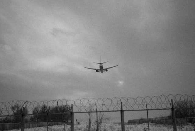
Commercial drone operations frequently require flights in controlled airspace near airports, where air traffic control coordinates manned aircraft movements. Before LAANC, obtaining airspace authorization required submitting manual applications through the FAA's Section 333 exemption process, often waiting 60-90 days for approvals. This timeline made responsive commercial operations nearly impossible.
LAANC transformed this landscape when the FAA launched the system in 2017, expanding to 726 airports covering 81% of controlled airspace by 2025. The system enables commercial operators to receive airspace authorizations in seconds rather than months, fundamentally changing how drone businesses serve clients in urban and suburban markets where airports create controlled airspace.
Understanding LAANC mechanics, service provider options, UAS Facility Map grid systems, and approval workflows enables commercial operators to plan flights confidently and serve clients reliably in controlled airspace environments. This comprehensive guide covers every essential aspect of using LAANC effectively for professional drone operations.
Table of contents
- What is LAANC and why it matters
- How LAANC transformed airspace authorization
- Understanding UAS Facility Maps and grid altitudes
- LAANC coverage: Airports and facilities
- FAA-approved LAANC service providers
- Step-by-step: How to request LAANC authorization
- Instant approval versus further coordination
- When LAANC doesn't work: DroneZone alternative
- Common LAANC mistakes and best practices
- Frequently Asked Questions
- Implementation considerations
- In summary
What is LAANC and why it matters
LAANC represents the FAA's Low Altitude Authorization and Notification Capability, an automated system connecting drone operators with air traffic facilities for airspace authorization. The system integrates UAS Facility Maps (UASFM) that define maximum altitudes where instant approvals are available around each participating airport.
The system operates through FAA-approved UAS Service Suppliers (USS) that provide software interfaces connecting operators with the LAANC infrastructure. These providers submit authorization requests to air traffic facilities on behalf of pilots, receive approvals or denials, and communicate decisions back to operators.
LAANC addresses the fundamental challenge of safely integrating unmanned aircraft operations into the national airspace system while maintaining air traffic control awareness and safety standards. Prior to LAANC, commercial operations in controlled airspace faced prohibitive approval timelines that made many projects economically unviable.
Commercial drone businesses benefit significantly from LAANC capabilities. Construction documentation in urban areas, real estate photography near airports, infrastructure inspections of facilities under approach paths, and emergency response operations all frequently require controlled airspace access. LAANC makes these services practical and responsive.
The legal foundation for LAANC comes from 14 CFR Part 107.41, which requires drone operators to obtain ATC authorization before operating in Class B, C, D, or E surface area controlled airspace. LAANC provides the mechanism for obtaining this legally required authorization efficiently.
How LAANC transformed airspace authorization
Before LAANC implementation in 2017, commercial operators seeking controlled airspace authorization submitted applications through the Section 333 exemption process or later through the Part 107 waiver system. Processing times typically ranged from 60-90 days, with some applications requiring 120+ days for approval.
This timeline created significant operational challenges. Clients scheduling drone services months in advance faced uncertainty about airspace approval. Weather-dependent operations couldn't wait 90 days for authorization, missing optimal conditions. Emergency response applications for search and rescue or disaster assessment couldn't accommodate multi-month approval processes.
The manual review process required FAA personnel to individually assess each application, coordinate with relevant air traffic facilities, evaluate proposed operations against safety standards, and document decisions. This approach didn't scale with increasing commercial drone activity.
LAANC automation eliminated most manual review for routine operations. When operators request authorization at or below UAS Facility Map altitudes, air traffic systems automatically evaluate the request against current and forecasted traffic, instantly approving or denying based on standardized criteria. This automation reduced average authorization time from weeks to seconds.
The transformation enabled new business models. Same-day commercial drone services became practical in controlled airspace. Operators could confidently schedule client work knowing authorization timelines measured in minutes rather than months. Responsive operations for time-sensitive applications became feasible.
Commercial operators report that LAANC availability fundamentally changed their serviceable market geography. Areas previously excluded due to controlled airspace now represent viable service territories. Projects near airports that would have been declined due to authorization uncertainty now proceed routinely with LAANC instant approvals.
Understanding UAS Facility Maps and grid altitudes
UAS Facility Maps form the foundation of LAANC's automated approval capability. These maps divide controlled airspace around participating airports into grid squares measuring approximately 30 seconds of latitude by 30 seconds of longitude, with each grid square assigned a maximum altitude for potential instant approval.
Air traffic facilities develop grid altitudes based on traffic patterns, approach procedures, departure routes, and operational requirements specific to each airport. A grid square directly under an instrument approach path might show 0 feet (prohibited for LAANC), while a square offset from traffic patterns might allow 300 feet AGL. These determinations reflect air traffic control's assessment of safe integration altitudes.
Grid altitudes represent potential approval ceilings, not guaranteed permissions. Even at or below grid altitude, air traffic facilities can deny LAANC requests based on current traffic, special events, temporary flight restrictions, or other operational factors. The grid shows where automation applies, not where approval is automatic.
Understanding grid altitude limitations proves essential for flight planning. Operators must recognize that grid altitudes measure Above Ground Level (AGL), not Mean Sea Level (MSL). In areas with significant terrain elevation, MSL altitude calculations must account for ground elevation to determine AGL compliance with grid ceilings.
Grid boundaries don't follow political boundaries or property lines. A single construction site might span multiple grid squares with different altitude ceilings. Flight plans must account for grid variations across the operational area, potentially requiring multiple LAANC authorizations for different altitudes in different grid squares.
Grid altitude determination reflects conservative safety margins. Air traffic facilities generally set ceilings well below altitudes where drone operations would actually conflict with manned traffic. This conservatism enables automated approvals while maintaining robust safety margins.
LAANC service provider applications typically display UAS Facility Maps overlaid on satellite imagery or aeronautical charts, showing grid boundaries and altitude ceilings color-coded for easy interpretation. Pre-flight planning tools integrate these maps to verify operational areas fall within authorized altitudes.
LAANC coverage: Airports and facilities
As of 2025, LAANC covers 726 airports representing 81% of controlled airspace where commercial drone operations commonly occur. The FAA maintains a complete list of LAANC-enabled facilities showing airport identifiers, air traffic facility names, and enablement dates.
Coverage includes all major commercial airports in Class B, C, and D airspace where commercial drone activity concentrates. The 133 facilities added in late 2024 expanded coverage to smaller regional airports and contract towers, addressing geographic gaps in LAANC availability.
However, not all airports participate in LAANC. Small airports without air traffic control towers, military installations with special security considerations, and certain airports with unique operational complexities remain outside the LAANC system. Operations near these facilities still require traditional DroneZone authorization applications.
Coverage verification represents a critical pre-flight planning step. Before scheduling client operations, confirm the relevant airport participates in LAANC. Service provider applications typically indicate LAANC availability when operators enter proposed flight locations.
Geographic LAANC coverage correlates strongly with commercial drone activity density. Urban and suburban areas with commercial airports generally have LAANC access, while rural regions with smaller non-towered airports may lack coverage. This distribution aligns with where controlled airspace authorization is most frequently needed.
International operations face different authorization systems. LAANC operates exclusively within the United States. Operators conducting international commercial work must research airspace authorization procedures specific to each country, which vary significantly in requirements and timelines.
FAA-approved LAANC service providers
The FAA's UAS Data Exchange program certifies UAS Service Suppliers to provide LAANC access to drone operators. As of 2025, over 15 approved providers offer LAANC capabilities through web applications, mobile apps, and API integrations.
Major LAANC providers include Aloft, which powers approximately two-thirds of all LAANC authorizations through white-label partnerships with other platforms. AirMap, Skyward, Kittyhawk, and Airspace Link each serve significant user bases through dedicated applications and enterprise integrations.
Provider selection considerations include interface usability, additional features beyond basic LAANC, integration with existing workflows, pricing models, and platform reliability. Some providers offer free LAANC access supported by premium feature subscriptions, while others charge per authorization or monthly subscription fees.
Integration capabilities matter for commercial operations. Providers that integrate LAANC with weather checking, equipment management, and compliance documentation create more efficient workflows than standalone LAANC tools. Evaluating how LAANC fits into broader operational systems helps guide provider selection.
Multiple providers support standardized data formats, enabling operators to switch services if needed. However, authorization history and saved locations may not transfer between providers. Commercial operations software that maintains independent records of LAANC authorizations provides continuity regardless of USS provider changes.
Several providers offer both LAANC authorization and B4UFLY airspace awareness capabilities in integrated applications. This consolidation simplifies pre-flight checks by combining airspace classification awareness with authorization request workflows in single platforms.
Enterprise drone programs often negotiate volume pricing or white-label integrations with LAANC providers. Large operations with hundreds or thousands of monthly authorizations benefit from dedicated support and customized pricing structures that per-authorization fees don't accommodate.
Step-by-step: How to request LAANC authorization
LAANC authorization begins with verifying Part 107 certification status. The system requires valid remote pilot certificates for commercial operations. Recreational flyers following 44809 requirements can also access LAANC through specific providers, though commercial operators represent the primary user base.
Step one involves selecting an FAA-approved LAANC service provider and creating an account. Account setup typically requires entering pilot certificate information, contact details, and accepting terms of service. Some providers verify certificate status against FAA databases during registration.
Step two requires entering flight details including location coordinates, maximum altitude, date, and time window. Location entry methods vary by provider, from map selection to address search to manual coordinate entry. Precise location specification matters because grid squares can have different altitude ceilings across small distances.
Step three involves reviewing the UAS Facility Map for the proposed location. Provider applications display the relevant grid square and maximum altitude ceiling. If the proposed altitude exceeds the grid ceiling, the system indicates further coordination will be required rather than instant approval.
Step four submits the authorization request to the air traffic facility. For instant approval scenarios (at or below grid altitude, daylight operations), the system typically returns authorization or denial within seconds. The application displays approval with an authorization number, valid time period, and maximum altitude.
Denied requests require understanding the denial reason. Common causes include proposed altitude exceeding grid ceiling (requiring further coordination instead), conflicts with current air traffic, active temporary flight restrictions, or system connectivity issues. Denied instant approvals often succeed when resubmitted with lower altitudes matching grid ceilings.
Approved authorizations include specific validity periods typically spanning the requested flight window. Authorization numbers must be available during flight operations to provide to authorities if requested. Many operators screenshot authorizations or save PDF copies as part of comprehensive flight logs.
Further coordination requests for altitudes above grid ceilings require additional information including detailed operation descriptions and pilot certification documentation. These requests follow different workflows with longer processing times, discussed in the next section.
Instant approval versus further coordination
Instant approval represents LAANC's primary value proposition - near-real-time authorization for routine operations. Requests at or below UAS Facility Map grid altitudes, during daylight hours, up to 400 feet AGL, receive automated processing with approval or denial typically within 30 seconds.
Further coordination applies when operators request altitudes above grid ceilings but still below Part 107's 400-foot limit. These requests require manual review by air traffic facility personnel who evaluate the specific operation against current and forecasted traffic patterns, coordination with other facilities if needed, and safety assessments.
Further coordination processing times average 1-2 weeks, though complex requests near major airports can require longer review. The FAA allows further coordination requests up to 90 days in advance but requires submission at least 72 hours before proposed operations. This advance requirement prevents last-minute coordination requests.
Only Part 107 certificated commercial pilots can request further coordination authorizations. Recreational flyers operating under 44809 limitations must operate at or below grid altitudes, accessing only instant approval capabilities. This restriction reflects additional coordination complexity requiring commercial pilot qualifications.
Strategic altitude planning enables instant approval when possible. Many commercial operations function effectively at grid ceiling altitudes. A construction site with a 200-foot grid ceiling might accommodate most documentation needs, eliminating further coordination requirements. Understanding grid altitudes during client consultations helps set realistic operation parameters.
Some operations inherently require further coordination. Large-scale mapping projects covering extensive areas, tall structure inspections, or specialized applications may need altitudes exceeding grid ceilings. Planning timelines must accommodate the 1-2 week further coordination review period for these operations.
Authorization validity periods differ between instant approval and further coordination. Instant approvals typically cover specific 4-hour windows, while further coordination authorizations may span multiple days or recurring time periods. This flexibility accommodates project-based work requiring extended or repeated access.
When LAANC doesn't work: DroneZone alternative
FAADroneZone provides manual authorization processing for scenarios where LAANC doesn't apply. Airports not participating in LAANC, operations requiring both waivers and airspace authorization, night operations, and flights above 400 feet all require DroneZone applications rather than LAANC requests.
DroneZone processing follows traditional manual review workflows with FAA personnel evaluating applications, coordinating with air traffic facilities, and documenting decisions. Processing times average 30 days but can extend to 90 days for complex operations or high-traffic airports. This timeline demands advance planning impossible for responsive commercial services.
Combined waiver and authorization requests must use DroneZone exclusively. Operations requiring night flight waivers plus controlled airspace authorization, operations over people waivers in controlled airspace, or beyond visual line of sight operations all exceed LAANC's scope and require comprehensive DroneZone applications.
Some operators maintain both LAANC and DroneZone authorizations for flexibility. Standing DroneZone authorizations covering extended periods can provide backup when LAANC instant approvals face unexpected denials. However, maintaining dual authorizations requires careful record-keeping to ensure operations occur under appropriate authorities.
DroneZone applications require significantly more documentation than LAANC requests. Detailed operation descriptions, risk assessments, pilot qualifications, aircraft specifications, and safety protocols all support manual review processes. Complete applications improve approval likelihood and may accelerate processing compared to incomplete submissions requiring additional information requests.
Professional drone businesses serving clients in areas without LAANC coverage must build DroneZone timelines into project planning. The 30-90 day authorization window limits operational flexibility but remains the only option for certain airspace authorization requirements.
Common LAANC mistakes and best practices
Location accuracy represents a frequent error source. LAANC authorizations are location-specific based on grid squares. Operating outside authorized grid boundaries, even by small distances, violates authorization terms. Using GPS-enabled flight planning tools helps operators maintain awareness of grid boundaries during operations.
Altitude confusion between AGL and MSL causes compliance problems. LAANC authorizations specify AGL limits, but aircraft altimeters may display MSL. In elevated terrain, failing to account for ground elevation when interpreting altimeter readings can result in exceeding authorized AGL altitudes. Setting proper altitude references before takeoff prevents this error.
Time window violations occur when operators begin flights before authorization start times or continue beyond expiration. LAANC authorizations specify exact validity periods. Operations outside these windows lack authorization regardless of previous approval. Verifying authorization remains current before each flight prevents time-based violations.
Attempting LAANC for operations requiring waivers wastes time. LAANC only provides airspace authorization, not operational waivers. Night operations, flights over people, or operations beyond visual line of sight all require separate waiver applications even when controlled airspace authorization comes through LAANC.
Ignoring temporary flight restrictions negates LAANC authorizations. Active TFRs, NOTAMs, or emergency restrictions override LAANC approvals. Checking current airspace restrictions compliance as part of pre-flight planning identifies limitations that LAANC authorization alone doesn't address.
Best practices include requesting authorizations shortly before operations rather than days in advance. Last-minute airspace situations can invalidate authorizations approved days earlier. Requesting closer to flight time increases likelihood that authorization remains valid under current airspace conditions.
Maintaining authorization documentation throughout operations provides evidence of compliance if questioned. Screenshot approvals, save authorization emails, or use provider apps that store approval history. Having authorization proof readily available demonstrates compliance professionalism.
Integrating LAANC requests into standardized operational checklists ensures consistent authorization verification. Treating LAANC as a routine checklist item rather than an occasional consideration prevents operating without authorization due to oversight.
Frequently Asked Questions
How much does LAANC authorization cost?
LAANC authorization itself is free from the FAA perspective. However, LAANC service providers determine their own pricing models. Many providers offer free basic LAANC access supported by premium feature subscriptions. Some charge per authorization ($1-$5 per request) while others use monthly subscription models ($10-$50/month for unlimited authorizations). Enterprise operations may negotiate volume pricing. The authorization itself costs nothing beyond service provider fees for accessing the system.
Can I get LAANC authorization for night operations?
No. LAANC only supports daylight operations under standard Part 107 rules. Night operations require an operational waiver under Part 107.29 plus separate airspace authorization. These combined requirements must be processed through FAADroneZone, not LAANC. Processing times for night operation waivers plus airspace authorization typically require 30-90 days. Operators frequently conducting night work in controlled airspace should apply for standing authorizations covering extended periods.
What happens if my LAANC request is denied?
Denied LAANC requests typically indicate altitude conflicts, active airspace restrictions, or system issues. Review the denial reason provided by the LAANC service provider. Common solutions include requesting lower altitudes at or below the UAS Facility Map grid ceiling, adjusting flight times to avoid peak traffic periods, or confirming no temporary flight restrictions are active. If instant approval at grid altitude is denied, consider submitting a further coordination request for manual review, or use FAADroneZone for manual authorization processing with longer timelines.
How far in advance can I request LAANC authorization?
Instant approval LAANC requests can typically be submitted shortly before operations, as the system processes them in real time. However, some service providers allow scheduling requests days in advance. Further coordination requests can be submitted up to 90 days before proposed operations but must be submitted at least 72 hours in advance. For responsive commercial operations, requesting authorization 1-24 hours before flights balances advance planning with current airspace conditions.
Implementation considerations
Successful LAANC integration requires selecting appropriate service providers matching operational needs and workflows. Operators conducting frequent authorizations benefit from providers offering unlimited monthly subscriptions rather than per-request pricing. Those requiring integration with fleet management platforms should prioritize providers with API capabilities or existing integrations.
Pre-flight planning workflows should incorporate LAANC authorization as standard checklist items alongside weather evaluation, equipment preparation, and site assessment. Treating authorization as routine rather than exceptional prevents overlooked requests that delay operations or result in unauthorized flights.
Record-keeping systems must capture authorization history for compliance documentation and business analytics. Storing LAANC approvals with associated project records, flight logs, and client deliverables creates complete operational documentation supporting regulatory compliance and client confidence.
Team operations require clarifying authorization responsibilities. Designating who submits LAANC requests, how authorization information communicates to field pilots, and where authorization documentation is stored prevents confusion during multi-pilot operations. Clear protocols ensure all team members access required authorization information.
Understanding geographic service area limitations helps set realistic client expectations. Operators serving areas without LAANC coverage must communicate DroneZone timeline requirements during client consultations. Managing expectations about authorization timelines prevents project delays and client dissatisfaction.
Training new pilots on LAANC procedures ensures consistent authorization practices across team members. Documented procedures covering provider selection, request submission, approval verification, and documentation storage support consistent operations as teams scale.
In summary
LAANC transformed controlled airspace authorization from a weeks-long manual process into near-instantaneous automated approvals, fundamentally changing commercial drone operations near airports. The system's coverage of 726 airports representing 81% of controlled airspace enables responsive service delivery in urban and suburban markets where controlled airspace previously created prohibitive operational barriers.
Understanding UAS Facility Maps, grid altitude systems, and the distinction between instant approval and further coordination enables operators to plan flights confidently and meet client commitments reliably. The automated instant approval process delivers authorizations in seconds for routine operations, while further coordination handles complex requests requiring manual review.
Selecting appropriate LAANC service providers, integrating authorization into pre-flight workflows, and maintaining comprehensive documentation creates professional operational practices that support regulatory compliance and business growth. Avoiding common mistakes like location errors, altitude confusion, and time window violations demonstrates operational competency.
LAANC represents essential infrastructure for commercial drone businesses serving clients in controlled airspace. Mastering the system's capabilities, limitations, and best practices positions operators to deliver professional services across broader geographic markets than pre-LAANC limitations allowed. The system continues expanding coverage and capabilities, further integrating unmanned aircraft into the national airspace system safely and efficiently.
Complete Pre-Flight Planning for Commercial Operators
Professional drone operations in controlled airspace require integrated workflows combining airspace authorization, weather assessment, and compliance documentation. DroneBundle provides comprehensive operational management designed specifically for commercial operators conducting LAANC-authorized flights.
Check airspace classifications and LAANC grids, analyze real-time weather and flight safety scores, track LAANC authorizations and approval history, store approval documentation and flight records, save frequently used LAANC locations for faster requests, and link authorizations to specific projects and jobs for complete operational transparency.
Stop juggling multiple apps for airspace checking, weather analysis, and authorization tracking. DroneBundle integrates the tools commercial operators need for professional controlled airspace operations.
Start your free trial today - no credit card required.
Or book a demo to see how DroneBundle helps operators manage professional controlled airspace operations with integrated airspace and weather tools.