Drones for emergency response give incident commanders overhead situational awareness in minutes instead of hours, but the limiting factor is almost never the aircraft. It is airspace access, crew readiness and the ability to prove afterwards what you flew, when, and why.
Most guides about drones for emergency response describe what the aircraft can see. Thermal payloads finding people in debris fields. Mapping flights producing damage assessments. Payload drops getting a radio to a stranded hiker. All true, all well documented elsewhere.
None of that is what stops agencies on scene.
What stops them is a temporary flight restriction that went up over their own incident forty minutes ago, a pilot whose certificate lapsed last month, a medevac helicopter inbound that nobody told the drone team about, and a request from counsel six months later for every frame of video from a scene that has since become litigation. This guide covers those problems, in that order, because they are the ones that actually ground emergency response drone programs.
Table of contents
- What drones for emergency response are used for
- The airspace problem: TFRs over your own incident
- How the FAA SGI process actually works
- Part 107 or a public COA: the fork every agency hits
- The first 30 minutes: a deployment playbook
- Deconfliction with manned aircraft on scene
- Weather and the go/no-go call under pressure
- Evidence, records retention and public disclosure
- Multi-agency and mutual aid coordination
- Europe: the state aircraft carve-out nobody mentions
- What an emergency response drone program actually costs
- Frequently asked questions
What drones for emergency response are used for
Drones for emergency response serve five core mission types: scene size-up, search and rescue, hazard assessment, damage mapping and post-incident documentation. Each demands a different payload, flight profile and data product, and most agencies discover they need at least three of the five within the first year.
Scene size-up is the highest-frequency mission and the simplest. An aircraft climbs, gives the incident commander a top-down view of a structure fire, multi-vehicle collision or crowd event, and streams it to a tablet. The value is entirely in speed.
Search and rescue is the mission that justifies most program budgets. A thermal drone covering a riverbank at night does in twenty minutes what a ground team does in three hours, without putting searchers into moving water or unstable terrain. Thermal is not magic, though. Contrast collapses in mid-afternoon heat, wet vegetation masks signatures, and a person under tree canopy is invisible from above regardless of sensor quality.
Hazard assessment covers hazmat releases, gas leaks, structural collapse and post-blast scenes, keeping people out of the hot zone during the first look. Damage mapping is the one that funds recovery: orthomosaics and 3D models of a tornado track or flood zone feed FEMA submissions, insurance claims and public works planning. Mapping is a different discipline from live response flying, needing planned grids, consistent overlap and processing time.
Post-incident documentation is the quiet one. A fire investigator wants the roof structure captured before overhaul destroys it. A crash reconstruction team wants the scene before the roadway reopens. Short flights, low drama, and they generate the records most likely to end up in court.
| Mission type | Typical payload | Time-critical? | Primary output |
|---|---|---|---|
| Scene size-up | Visual + zoom | Yes | Live video to command |
| Search and rescue | Thermal + spotlight | Yes | Live video, GPS coordinates |
| Hazard assessment | Visual, thermal, sensor | Yes | Standoff imagery, readings |
| Damage mapping | Mapping camera | No | Orthomosaic, 3D model |
| Scene documentation | Visual, high resolution | No | Evidence-grade stills, logs |
The airspace problem: TFRs over your own incident
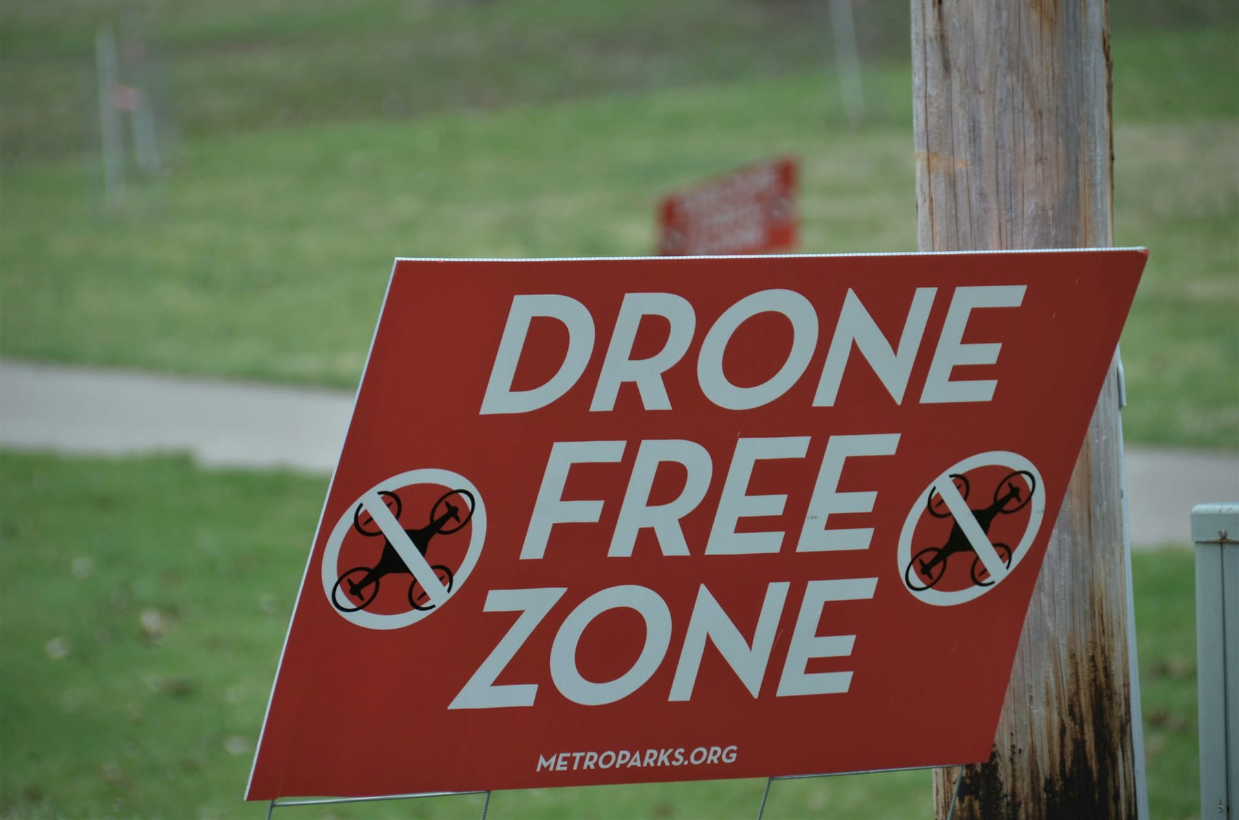
The single most common reason emergency response drone crews cannot launch is a temporary flight restriction issued over the incident they were dispatched to. TFRs under 14 CFR 91.137 go up around disaster and hazard areas specifically to keep aircraft out, and by default that includes yours.
This catches new programs badly. The mental model is "we are the emergency services, so the restriction is for other people." It is not. A 91.137 TFR restricts the airspace; being a responding agency does not automatically place you inside the approved list. Wildfire TFRs are the sharpest example: they are typically cylinders of a few nautical miles radius extending thousands of feet up, they stay active around the clock until cancelled, and aerial firefighting stops the moment an unidentified aircraft is spotted inside.
The US Forest Service runs an entire campaign on this, If You Fly, We Can't, because a single unauthorized drone sends air tankers back to base for an hour or more. Congress has authorized civil penalties against operators who interfere with wildfire suppression or emergency response, and interference with firefighting on public lands can also be prosecuted criminally. Those penalties are aimed at bystanders, but an agency crew launching into a TFR without authorization is in the same airspace with the same consequences for the air attack.
Two practical habits fix most of this. First, check tfr.faa.gov and the FAA's TFR guidance for drone pilots as part of dispatch, not as part of preflight. By preflight you are already on scene and committed. Second, understand that TFR status changes during a response. An incident that had clear airspace at 14:00 can be inside a fresh restriction by 15:30 because a state helicopter got tasked. Somebody on the team needs to own re-checking.
Standing restrictions matter too. Stadiums, prisons, power plants and national security sites generate permanent or recurring no-fly zones and restricted areas that do not disappear because an emergency is underway. Knowing which classes of airspace your response area sits under, and where the controlled airspace boundaries fall, is the difference between a LAANC authorization that clears in seconds and a phone call that takes an hour.
How the FAA SGI process actually works
The Special Governmental Interest process is the FAA's expedited path for emergency drone operations, and approvals for genuine emergencies are often returned within about an hour. It is the mechanism that lets a public safety crew fly inside a TFR or outside normal Part 107 limits when an incident demands it.
Eligibility is narrower than people assume. You must already hold a current Part 107 remote pilot certificate or an existing Certificate of Waiver or Authorization. The FAA does not grant emergency approval to uncertificated or recreational operators, which means the time to sort out certification is long before the call comes in. The FAA's emergency situations page hosts the Emergency Operation Request Form and the current submission instructions.
The request goes to the FAA System Operations Support Center. Email submissions go to the SOSC inbox, and for genuinely time-critical operations there is a phone line, 202-267-8276, for real-time coordination. If approved, the FAA issues an amendment to your existing certificate or COA authorizing the specific operation under specific conditions: a defined area, a defined altitude, a defined window.
What separates programs that get fast approvals from programs that do not is preparation, not urgency. The form asks for details you cannot invent under pressure: aircraft registration, pilot certificate numbers, the exact operating area, altitudes, the nature of the emergency and the mitigations you have in place. Agencies that keep this information current in one place fill the form in minutes. Agencies that keep it across three spreadsheets and a filing cabinet lose the window.
Keep the SGI path distinct from routine waivers. If your program regularly needs to fly beyond visual line of sight or over people, the right answer is a standing FAA waiver obtained in advance, not an emergency request each time. The waiver process is slow and deliberate, which is exactly why it should not be running on incident timelines. SGI is for the unforeseeable. Waivers are for the foreseeable.
One more detail worth knowing: if the incident sits in controlled airspace and you need an airspace authorization rather than a rule waiver, the routing differs. And if your operation warrants notifying other aircraft, understand how to file a NOTAM and when it applies to your operation.
Part 107 or a public COA: the fork every agency hits
Public agencies can fly drones either under Part 107 as civil operations or under a public aircraft operations Certificate of Waiver or Authorization, and the choice shapes everything downstream. Most competitor guides skip this entirely, which is unfortunate, because it is the first real decision a fire department or sheriff's office has to make.
Part 107 is the faster start. Pilots pass the knowledge test, the agency registers aircraft, and flying can begin within weeks. Operations stay inside the Part 107 rule set: visual line of sight, 400 feet, daylight or lit night operations, no operations over people unless the aircraft qualifies. Waivers extend those limits case by case.
A public COA is slower to obtain but grants an agency broader latitude for missions tied to a governmental function, with the agency itself taking on responsibility for airworthiness determinations and pilot competency standards. That last part is the trade nobody explains well. Under Part 107, the FAA defines competency through the certificate. Under a public COA, your agency defines it, documents it and defends it. The regulatory flexibility comes with an internal record-keeping obligation that a filing cabinet will not satisfy.
The hybrid approach is common and sensible: get pilots Part 107 certificated so the program can start flying, and pursue the COA in parallel for the operations Part 107 will not cover. The FAA's public safety and government resources lay out the eligibility conditions.
Either way, pilot certification and currency tracking becomes a compliance function rather than an administrative one. An expired certificate does not just create a paperwork problem. It invalidates the SGI eligibility you were counting on, and it surfaces in discovery when the flight becomes evidence. Programs running more than three or four pilots typically need automated expiry alerts on certificates, medicals where applicable, currency requirements and internal type sign-offs.
The first 30 minutes: a deployment playbook
The first 30 minutes of an emergency drone deployment follow a fixed sequence: confirm authority to fly, confirm airspace, confirm crew, launch, then integrate with command. Programs that improvise this sequence lose time exactly when time matters most.
Here is a workable structure, adapted from how experienced public safety programs run it:
- Dispatch triggers the drone team, not the drone team monitoring the radio. If activation depends on a pilot happening to hear the call, response times are random. Put drone activation criteria into dispatch protocols.
- Airspace check while rolling. TFR status, controlled airspace, standing restrictions. This is a two-minute task and it determines whether the rest of the sequence proceeds or shifts to an SGI request.
- Confirm the flying pilot is current and authorized for this mission type. Night operations, operations over people and BVLOS all have different answers. This should be a lookup, not a discussion.
- Check-in with the incident commander before launch. The drone works for the incident, not the drone program. Confirm what the IC wants to see and on what device.
- Manned aircraft query. Ask explicitly whether medevac, law enforcement air support or air attack is inbound. Do not assume the absence of information means the absence of aircraft.
- Run the preflight anyway. Under pressure, this is the step people skip. A structured pre-flight checklist takes ninety seconds and prevents the failure that ends the deployment.
- Launch, then log. Takeoff time, crew, aircraft, mission objective. If logging happens later from memory, the record will be wrong in the ways that matter.
- Handover discipline. Battery swaps mean pilot fatigue at hour three. Decide in advance who relieves whom and how the log reflects the change.
Two refinements separate mature programs. The first is pre-built mission templates for common incident types, so the crew is not defining objectives, altitudes and hazard notes from scratch at 03:00. The second is live tracking that shows the command post where every crew and aircraft is right now, which becomes essential the moment a second aircraft joins.
Note the distinction between this and a drone-as-first-responder program, where aircraft launch autonomously from rooftop docks on dispatch and reach scenes in around two minutes. DFR is a different operational model with different infrastructure and waiver requirements. Most agencies build conventional response capability first and add DFR later.
Deconfliction with manned aircraft on scene
Manned aircraft deconfliction is the highest-consequence risk in emergency response drone operations, and it is handled by explicit communication rather than by technology. Medevac helicopters, law enforcement aviation, news aircraft and firefighting tankers all converge on the same scenes drones are dispatched to.
The failure mode is predictable. A drone launches for scene size-up. Fifteen minutes later a patient deteriorates and a helicopter is requested. The pilot flying the drone is focused on the screen, the incident commander is managing twelve other things, and nobody closes the loop.
Fixes that work in practice:
- A single radio channel the drone crew monitors continuously, and a standing instruction that any inbound aircraft is announced on it.
- A pre-briefed landing zone and an immediate descent protocol. "Aircraft inbound" should produce an immediate, unambiguous action, not a discussion about altitude separation.
- A visual observer whose only job is looking up. The pilot is looking at a screen. Someone must be watching the sky.
- Altitude discipline well below likely helicopter approach paths, with the understanding that helicopters can and do operate below 400 feet on approach to a scene.
- Remote ID broadcasting, which lets other aircraft and authorities identify your aircraft rather than treating it as an unknown intruder. If your program is unclear on this, review what Remote ID requires.
For agencies running several aircraft at a large incident, multi-drone operations management becomes its own discipline: separate altitude blocks, separate sectors, one person with overall airspace picture. This is where informal coordination breaks down and a shared operational view earns its keep.
Weather and the go/no-go call under pressure
Weather limits do not relax because an incident is serious, and the go/no-go decision needs to be made against written thresholds rather than adrenaline. This is the most common place where emergency drone programs make decisions they later regret.
The specific pressures are worth naming. Structure fires produce thermal columns and turbulence directly over the area you most want to see. Flood response happens during and immediately after the weather that caused the flood. Wildfire generates its own wind. Night search operations coincide with falling temperatures and dew point convergence that puts moisture on airframes and lenses.
Practical thresholds a program should write down in advance:
- Maximum sustained wind and gust values per airframe, with a stated margin below the manufacturer figure
- Minimum visibility and cloud clearance appropriate to the operating rule set
- Temperature limits for battery performance, and the expectation that cold cuts usable flight time significantly
- Precipitation policy, including whether any airframe in the fleet is rated for it
- A named person authorized to say no, who is not the pilot under pressure from command
The value of weather integration in an operations platform is that it turns this into a scored answer rather than a judgment call. Pulling METAR and forecast conditions for the launch point, comparing them to configured limits and producing a go/no-go recommendation takes the argument out of the field. Broader guidance on weather considerations for professional drone operations applies here with one addition: emergency work removes the option to reschedule, which makes written limits more important, not less.
Evidence, records retention and public disclosure
Every emergency response drone flight creates a record that may be subpoenaed, requested under public records law or reviewed by an oversight body, and most agencies design their data handling only after the first request arrives. This is the gap that costs programs the most and gets written about the least.
Three separate obligations sit on top of each other.
Chain of custody. If footage may support a criminal case, fire investigation or crash reconstruction, it needs verifiable provenance: which aircraft, which pilot, which timestamps, where the file has been and who touched it. Original files should be preserved unaltered, with derivatives handled separately. Telemetry matters as much as video, because a 3D flight replay reconstructing exactly where the aircraft was and what it was pointing at frequently answers questions the footage alone cannot.
Retention. Different data classes carry different retention periods, often set by state law or agency policy rather than aviation regulation. Scene size-up video from a routine call may have a short retention clock. Footage connected to an open investigation may need indefinite preservation with a legal hold. The failure mode is uniform treatment: either deleting something under a hold, or keeping everything forever and expanding disclosure exposure with each passing year.
Public disclosure. Public safety drone footage is frequently subject to public records requests. Agencies need to know in advance what is releasable, what is exempt, what requires redaction, and who decides. Overhead imagery captures uninvolved parties, private property and residential interiors through windows in ways ground cameras do not, and that difference drives most of the public concern around police drone operations. Having a written policy on incidental capture, retention and release before deployment is far easier than writing one during a controversy.
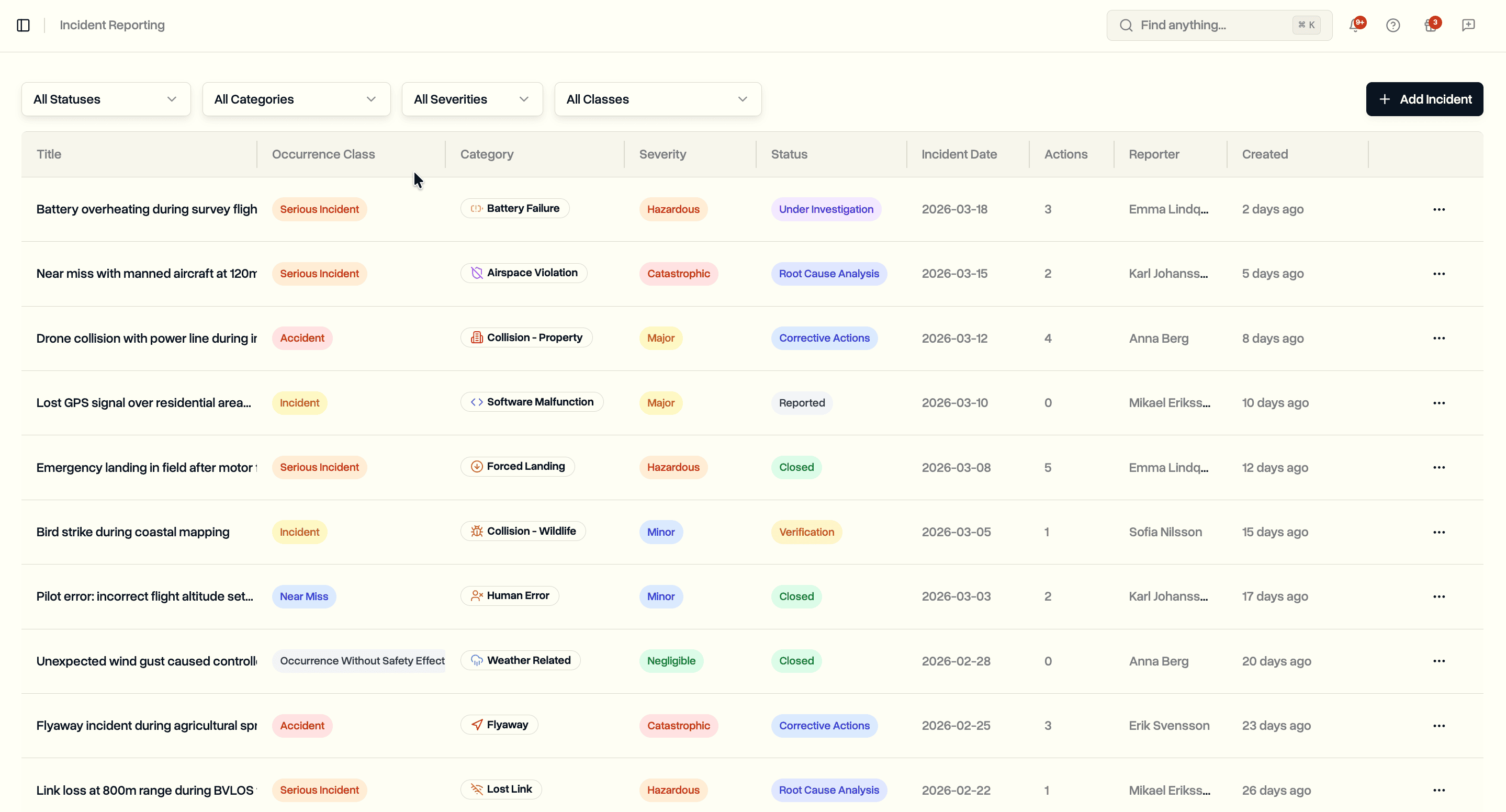
Alongside these, ordinary aviation record-keeping still applies. Incident reporting for any occurrence, accurate flight hour tracking for currency and maintenance, and a documented risk assessment for the operation type. Insurers ask for all of it, and so does anyone reviewing whether an operation was reasonable. Coverage terms and claim outcomes turn on documentation quality more than on the incident itself.
This is exactly the workload our public safety and emergency operations tooling is built around: logs syncing automatically from the controller and matching to the right mission, evidence stored against the mission record, timestamped exports for legal submission and role-based access so departments see only what they should.
Multi-agency and mutual aid coordination
Multi-agency drone operations fail on information access, not on airmanship. When a county sheriff, a city fire department and a state emergency management agency all fly the same incident, the coordination problem is who can see which records and under what authority.
The recurring issues:
- Duplicate coverage. Two agencies mapping the same quadrant while a third is uncovered, because there is no shared picture of what has been flown.
- Incompatible records. Agency A logs in one system, Agency B in another, and the after-action report has to reconcile them manually weeks later.
- Access that is either too open or too closed. Either everyone can see everything, which creates disclosure problems, or nobody can see anything, which defeats the purpose of mutual aid.
- Unclear authority. Under whose COA or certificate is a mutual aid crew operating when they cross a jurisdictional line?
Solve the authority question in the mutual aid agreement, in writing, before the incident. Solve the records question with controlled sharing: a single mission record another agency can be granted access to for a defined scope, with the full file exportable afterwards. Our MobiLysis case study covers the civil version of this problem, coordinating six pilots across seven locations on a single project with 200 flight logs, and the coordination mechanics translate directly to multi-agency response.
Larger programs eventually need proper drone fleet management underneath all of this: which aircraft are serviceable right now, which batteries are cycled, which pilots are current, all visible before dispatch rather than discovered at the scene.
Europe: the state aircraft carve-out nobody mentions
European emergency services drone operations often fall entirely outside EASA drone rules, and operators who assume otherwise apply the wrong regulatory framework. Under Article 2(3)(a) of Regulation (EU) 2018/1139, activities including police, customs, search and rescue, firefighting, border control and coastguard, carried out by or on behalf of a body vested with public authority, are excluded from the scope of EU civil aviation law.
The practical consequence: a fire service flying for firefighting purposes in an EU member state is generally governed by national law, not by the Open and Specific categories that apply to commercial operators. Member states may opt in and apply the EU rules to these operations, and several have done so in various forms, so the answer genuinely depends on which country you are in and sometimes on which mission you are flying.
This creates a strange split inside single organisations. A fire service flying a live incident may sit outside EASA scope. The same service flying a training exercise, a public event or a commercial-style survey may sit inside it, under the Open or Specific category rules with the corresponding SORA risk assessment obligations. Get written confirmation from your national aviation authority about where each of your mission types lands. EASA's civil drones pages cover the civil side; your NAA covers the rest.
What an emergency response drone program actually costs
An emergency response drone program's aircraft budget is usually the smallest line item. Airframes and payloads are typically a minority of the multi-year total, with training, certification, currency flying and administration making up the rest.
Realistic budget categories:
- Aircraft and payloads. A capable thermal-equipped platform for public safety work, plus batteries, spare props and a hardened case per aircraft.
- Certification. Test fees and study time per pilot, plus recurrent training. Certification cost per pilot is modest; the staff hours are not.
- Currency flying. The recurring cost most programs underestimate. Skills decay without practice, and search patterns at night are not something to attempt for the first time on a real call.
- Software. Flight logging, compliance tracking, evidence storage and airspace checking. This is where a DroneBundle plan sits, and for most agencies it costs less annually than a single set of replacement batteries across the fleet.
- Insurance. Even where sovereign immunity limits some exposure, hull coverage and non-owned liability generally remain worth carrying.
- Administrative overhead. Public records responses, policy maintenance, oversight reporting. Real hours, rarely budgeted.
The honest framing for a budget request is not cost savings versus a helicopter. It is capability that did not previously exist at a price that fits a municipal budget, plus a documented record of every deployment that reduces liability exposure. Programs that can show the second part tend to get their next funding round approved.
Frequently asked questions
Do first responders need a Part 107 license to fly drones in an emergency?
Yes, in nearly all cases. Public safety drone pilots in the US must either hold a Part 107 remote pilot certificate or operate under their agency's public aircraft Certificate of Waiver or Authorization. There is no general emergency exception that lets an uncertificated person fly. This matters most for the SGI process, which requires an existing Part 107 certificate or COA as a precondition for expedited approval. The certification work has to happen before the emergency, not during it.
Can emergency responders fly drones inside a TFR?
Only with authorization. A temporary flight restriction issued under 14 CFR 91.137 restricts the airspace over a disaster or hazard area for all aircraft, including responding agencies, unless they are specifically authorized. The route in is the FAA's Special Governmental Interest process through the System Operations Support Center, which for genuine emergencies can return an answer within roughly an hour. Some incidents also have an air operations branch that controls access to the restricted airspace directly, so check the incident structure as well as the FAA path.
How fast can a drone reach an emergency scene?
Conventional response drones typically arrive when the crew arrives, which is dispatch time plus travel plus setup, often 10 to 20 minutes. Drone-as-first-responder programs launching autonomously from fixed docks reach scenes far faster; Chula Vista Police Department, which ran the first US DFR program, has reported average arrival times of around two and a half minutes across thousands of calls. The difference is infrastructure and waiver posture, not aircraft speed.
What happens to emergency drone footage after the incident?
It depends on classification, and that should be decided by policy rather than case by case. Footage connected to an investigation or litigation needs preserved originals, documented chain of custody and often an indefinite legal hold. Routine size-up video usually falls under a shorter agency retention schedule. In both cases the footage may be subject to public records requests, so agencies need a written position on what is releasable, what needs redaction and who approves release. Storing flight logs, telemetry and media against a single mission record makes answering these requests a lookup instead of an excavation.
Run emergency drone operations you can defend afterwards
The aircraft is the easy part. What makes an emergency response drone program sustainable is being able to answer, months later, who flew, under what authority, in what conditions, and where the evidence is.
DroneBundle handles that layer. Pre-built mission templates so crews are not designing a response flight at 03:00. Airspace and weather go/no-go checks before launch. Flight logs syncing automatically from the controller and matching to the right mission, with 3D replay. Certification expiry alerts so nobody discovers a lapsed certificate during an SGI request. Evidence and documents stored against the mission record, with controlled access across departments and agencies and timestamped exports when legal asks.
Start a free trial and set up your first response mission template, or book a live demo and we will walk through how your agency's incident workflow maps onto the platform.
Whatever tooling you choose, decide your airspace path, your currency standard and your retention policy before the next call. Those three decisions determine whether your drone program is an asset on scene or a liability afterwards.