What are Weather Considerations for Drone Operations?
Weather considerations for drone operations encompass the systematic assessment and management of environmental conditions—including wind, temperature, humidity, precipitation, visibility, and atmospheric pressure—that directly impact flight safety, equipment performance, and mission success. Professional operators must evaluate these factors before and during operations to ensure regulatory compliance and prevent equipment damage or flight incidents.
Professional drone operations depend on one fundamental factor that can make or break any mission: weather. While pilots spend considerable time mastering technical skills and regulatory compliance, environmental conditions remain the ultimate arbiter of flight success. Weather doesn't just influence flight quality—it determines whether operations can proceed safely at all.
Weather affects every aspect of drone performance, from battery efficiency to data accuracy. Understanding these relationships becomes critical for commercial operators who need consistent, reliable results. The stakes rise significantly when operations involve expensive drone equipment, tight deadlines, or safety-critical applications.
Table of contents
- Wind effects on drone stability and control
- Temperature impacts on battery performance
- Humidity and moisture considerations
- Precipitation and water damage risks
- Visibility and cloud cover challenges
- Solar angle and shadow effects
- Atmospheric pressure variations
- Seasonal weather patterns
- Pre-flight weather assessment
- Weather monitoring tools and resources
- Operational limits and safety margins
- Weather contingency planning
- Frequently asked questions
- Implementation considerations
- In summary
Wind effects on drone stability and control
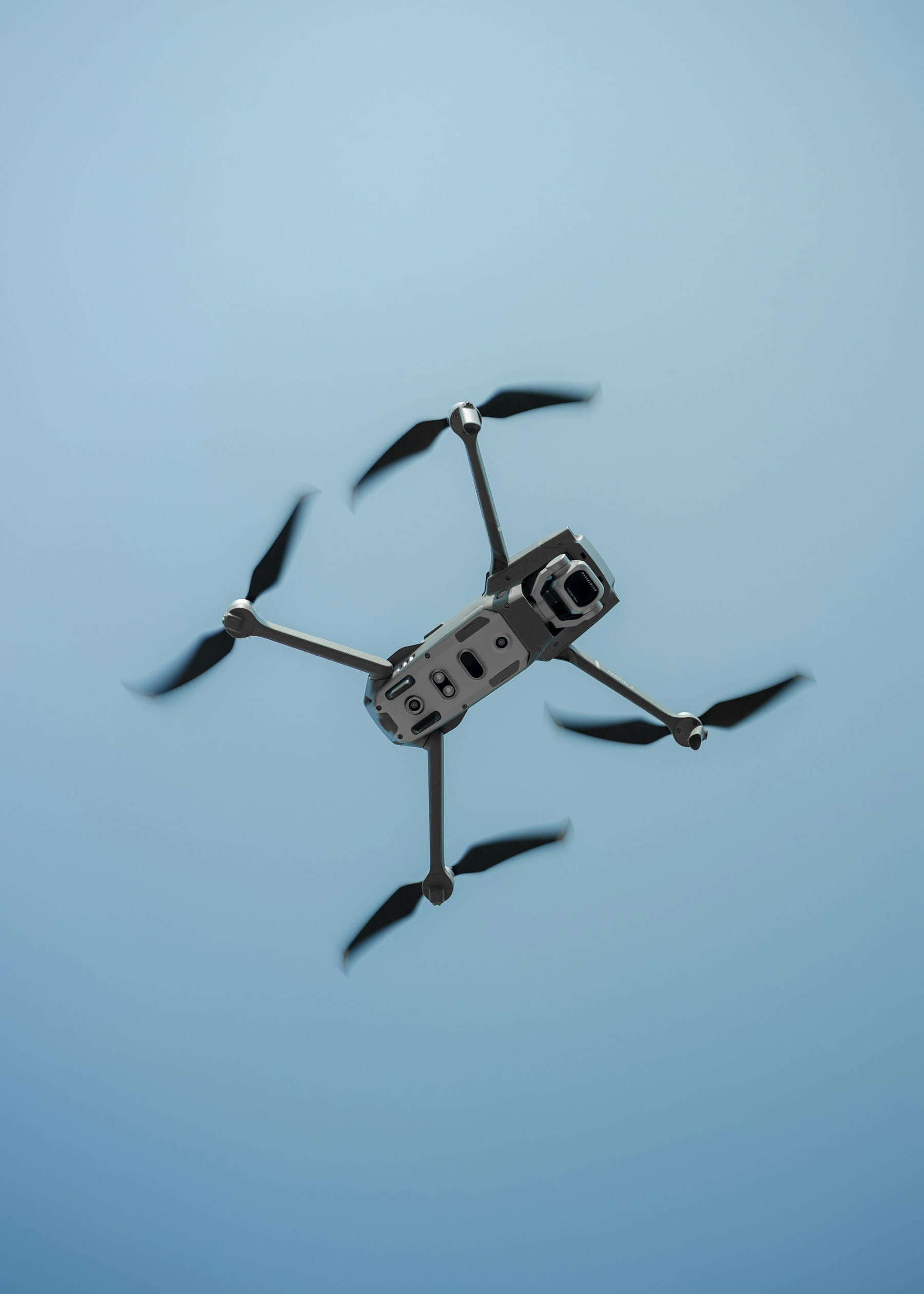
Wind represents the most immediate threat to drone operations. Most consumer and commercial drones specify maximum wind speed tolerances between 15-25 mph, but these ratings reflect ideal conditions with experienced pilots.
Gusty conditions prove more dangerous than steady winds. A drone might handle 20 mph constant wind reasonably well, but 15 mph gusts can cause sudden altitude changes and positional drift. These variations stress motors, drain batteries faster, and compromise image stabilization systems.
Crosswinds present particular challenges during takeoff and landing phases. The drone experiences maximum vulnerability when transitioning between ground effect and free flight. Ground obstacles like buildings and trees create turbulence patterns that extend well beyond their physical boundaries.
Wind direction changes throughout the day as thermal patterns develop. Morning flights often benefit from calmer conditions, while afternoon thermal activity increases turbulence. Coastal areas experience predictable wind pattern shifts as land and sea temperature differentials change.
Key wind considerations include:
- Maximum rated wind speed for your specific drone model
- Gust factors that can exceed steady wind measurements
- Turbulence patterns around buildings, hills, and vegetation
- Seasonal wind pattern variations in your operating area
- Battery consumption increases in windy conditions
Smart operators maintain detailed wind logs for their regular flying locations. These records help identify optimal flying windows and seasonal patterns that affect mission planning.
Temperature impacts on battery performance
Temperature directly affects lithium-polymer battery chemistry used in most drones. Cold weather reduces battery capacity significantly—sometimes by 50% or more in freezing conditions. The chemical reactions that generate electrical power slow down as temperatures drop.
Battery voltage sags more pronounced in cold weather, triggering low-battery warnings earlier than expected. This can force premature landings and incomplete missions. Some drones automatically reduce power output to protect batteries, limiting performance even further.
Hot weather creates different problems. Excessive heat can cause batteries to swell, potentially damaging internal components or creating fire hazards. Battery management systems may shut down operations to prevent thermal runaway conditions.
The following table shows typical battery performance at various temperatures:
| Temperature Range | Expected Capacity | Performance Notes |
|---|---|---|
| -10°C to 0°C (14°F to 32°F) | 40-60% | Significant voltage sag, early warnings |
| 0°C to 10°C (32°F to 50°F) | 70-85% | Reduced flight time, slower charging |
| 10°C to 25°C (50°F to 77°F) | 95-100% | Optimal performance range |
| 25°C to 35°C (77°F to 95°F) | 90-95% | Slight capacity reduction |
| Above 35°C (95°F) | 70-90% | Risk of thermal protection activation |
Battery preconditioning helps mitigate temperature effects. Keeping spare batteries at body temperature during cold weather operations extends usable flight time. Some operators use insulated battery cases or hand warmers to maintain optimal temperatures.
Storage temperatures matter as much as operating temperatures. Batteries stored in hot vehicles or cold garages suffer permanent capacity loss over time. Proper equipment management includes maintaining optimal storage conditions between 10-25°C for battery longevity.
Humidity and moisture considerations
High humidity affects drone performance in subtle but important ways. Moisture can condense on camera lenses, creating blurry images that require mission restarts. Electronic components become more susceptible to corrosion and malfunction in humid environments.
Humidity levels above 70% create condensation risks, particularly when temperature differentials exist between ground level and flight altitudes. Morning flights after cool nights present higher condensation risks as equipment warms up.
Gimbal systems show particular sensitivity to humidity changes. Moisture can interfere with precise stabilization motors, causing jittery footage or calibration errors. Some gimbals require recalibration after exposure to high humidity conditions.
Salt air in coastal environments compounds humidity effects. Salt particles accelerate corrosion of metal components and can interfere with electronic connections. Regular maintenance becomes more critical for operators working near oceans or large salt water bodies.
Humidity management strategies:
- Use lens hoods and UV filters to minimize condensation exposure
- Allow equipment to acclimate to temperature changes gradually
- Carry microfiber cloths for cleaning condensation during flights
- Consider silica gel packs in equipment cases for moisture control
- Schedule flights during lower humidity periods when possible
Operators working in consistently humid environments benefit from investing in weather-sealed equipment or protective housings for sensitive components.
Precipitation and water damage risks
Rain represents an absolute no-fly condition for most drone operations. Water penetration can cause immediate electrical failures or create delayed problems through corrosion. Even light mist can compromise safety systems and navigation accuracy.
The risk extends beyond active precipitation. Flying through recent rain clouds can expose aircraft to water droplets that appear invisible to pilots. Fog and low-hanging clouds contain enough moisture to trigger water damage in non-sealed systems.
Snow creates unique challenges beyond typical precipitation concerns. Accumulated snow can interfere with propeller balance and add weight that affects flight characteristics. Melting snow during flight can create water intrusion as temperatures change with altitude.
Ground conditions after precipitation affect takeoff and landing safety. Wet surfaces reduce traction for landing gear and can create mud that fouls motors or sensors. Puddles can splash water onto equipment during landing sequences.
Some drones feature water-resistant ratings (IP ratings), but these specifications rarely cover full immersion or sustained exposure. IP53 ratings protect against light rain, while IP67 ratings allow brief submersion. However, propeller wash can drive water into areas not covered by these ratings.
Recovery procedures for water exposure vary by drone model and exposure duration. Immediate power-down prevents short circuits, but moisture trapped in components may require professional service to prevent long-term damage.
Visibility and cloud cover challenges
Visibility directly impacts pilot ability to maintain visual line of sight and execute safe operations. Dense cloud cover reduces available light for cameras and creates hazardous flying conditions for VLOS operations.
Overcast conditions flatten image contrast and reduce color saturation in photographs. Survey and mapping missions suffer from poor image quality that may require post-processing correction or complete mission restarts.
Cloud ceiling heights determine available flight altitudes for legal operations. Low-hanging clouds force operations into congested airspace near ground obstacles. Rapidly changing cloud conditions can trap aircraft above safe landing zones.
Fog presents particular dangers because it can develop quickly and reduce visibility to near zero. Coastal areas and river valleys experience frequent fog formation that can strand aircraft or force emergency landings.
Visibility assessment factors:
- Horizontal visibility distance in current conditions
- Vertical cloud ceiling measurements
- Rate of visibility change and weather front movement
- Local terrain effects on cloud formation
- Backup landing site visibility during flights
Modern weather services provide detailed visibility forecasts, but local conditions can vary significantly from regional predictions. Ground observers at remote sites provide valuable real-time visibility reports for extended operations.
Solar angle and shadow effects
Sun position dramatically affects image quality and data consistency in survey operations. High sun angles create short shadows that may hide important ground features. Low sun angles produce long shadows that can obscure large areas of interest.
Golden hour lighting provides excellent contrast for photography but creates challenges for precise mapping operations. Shadow lengths change rapidly during these periods, making consistent image overlap difficult to achieve.
Solar glare can interfere with camera sensors and pilot vision when operating in certain directions. Bright reflections from water, snow, or metal surfaces can overwhelm camera sensors or create hazardous flying conditions.
Seasonal sun angle changes affect optimal flight times throughout the year. Summer operations benefit from longer daylight hours but suffer from harsh midday lighting. Winter operations have shorter windows but potentially better lighting angles for certain applications.
The following considerations help optimize solar conditions:
- Plan survey flights for consistent sun angles across the mission area
- Avoid flying directly into or away from the sun when possible
- Use polarizing filters to reduce glare and improve contrast
- Schedule missions during optimal lighting for specific applications
- Account for seasonal changes in daylight hours and sun position
Professional mapping operations often require multiple flights at different times to capture complete data sets without shadow interference.
Atmospheric pressure variations
Barometric pressure changes affect drone altitude readings and performance characteristics. Most drones use barometric altimeters that reference sea-level pressure, but local pressure variations can cause significant altitude errors.
Weather fronts bring pressure changes that can shift indicated altitude readings by hundreds of feet. Pilots relying on barometric altitude for obstacle clearance may find themselves closer to terrain than expected during construction inspections or infrastructure surveys.
High-altitude operations face additional challenges from reduced air density. Propeller efficiency decreases with altitude, requiring higher motor speeds to maintain lift. Battery consumption increases accordingly, reducing flight time.
Rapid pressure changes during flight can confuse altitude sensors and trigger erratic behavior from flight control systems. Some drones require recalibration after significant pressure changes.
GPS altitude provides more consistent references than barometric readings, but GPS vertical accuracy remains less precise than horizontal positioning. Combining multiple altitude references improves safety margins.
Pressure-related considerations:
- Calibrate altimeter before each flight session
- Monitor weather reports for pressure trend information
- Account for altitude performance losses at high elevations
- Use GPS altitude as backup reference for critical operations
- Understand manufacturer specifications for pressure altitude limits
Operators working across varied elevations benefit from understanding local pressure patterns and their effects on equipment performance.
Seasonal weather patterns
Seasonal variations create predictable patterns that affect flight planning and equipment selection. Understanding these cycles helps operators prepare for changing conditions and optimize mission scheduling.
Spring weather features frequent storms and rapid changes that can catch operators unprepared. Temperature fluctuations stress equipment and create challenging flying conditions. However, spring often provides excellent visibility and moderate temperatures between weather systems.
Summer operations face heat-related challenges but benefit from stable high-pressure systems and predictable daily patterns. Thermal activity increases during midday hours, creating turbulence that affects flight stability.
Fall conditions often provide ideal flying weather with stable temperatures and clear skies. However, shorter daylight hours limit operational windows. Leaf coverage changes can affect ground visibility for survey operations.
Winter presents the most challenging conditions with cold temperatures, reduced daylight, and frequent precipitation. Battery performance suffers significantly, but clear air after storms can provide exceptional visibility for certain applications.
Seasonal preparation strategies:
- Adjust equipment selections based on expected seasonal conditions
- Modify battery management procedures for temperature extremes
- Plan mission schedules around seasonal daylight variations
- Prepare backup equipment for challenging seasonal conditions
- Train crews for seasonal hazards and operational limitations
Long-term weather pattern tracking helps operators identify optimal seasonal windows for specific types of missions through proper flight data monitoring.
Pre-flight weather assessment
Systematic weather evaluation prevents most weather-related incidents and mission failures. Professional operators develop standardized assessment procedures that cover all relevant meteorological factors as part of their pre-flight checklist.
Current conditions provide the starting point, but weather trends and forecasts determine flight feasibility. Conditions can change rapidly, particularly during unstable weather patterns.
Multiple weather sources provide different perspectives on local conditions. National weather services offer broad regional forecasts, while automated weather stations provide site-specific current readings. The NWS Aviation Weather Services provides comprehensive METAR and TAF reports essential for professional operations.
Essential pre-flight weather checks:
- Wind speed and direction at surface and forecast altitudes
- Temperature ranges expected during flight operations
- Precipitation probability and timing predictions
- Visibility forecasts and cloud ceiling predictions
- Pressure trends and significant weather warnings
Weather briefing forms help standardize the assessment process and create documentation for operational records. These forms typically include go/no-go decision criteria based on specific operational requirements and Part 107 weather minimums.
Site-specific weather observations improve decision accuracy for remote operations. Temporary weather stations or trained ground observers provide real-time condition reports from actual operating locations.
Weather monitoring tools and resources
Modern weather monitoring combines traditional meteorological data with specialized aviation resources. Professional drone operations require access to multiple information sources for comprehensive weather awareness.
Automated Surface Observing Systems (ASOS) and Automated Weather Observing Systems (AWOS) provide precise local weather data at airports and other facilities. These systems update frequently and include specialized aviation parameters.
Weather radar shows precipitation patterns and storm movement in real-time. Modern radar systems can detect light precipitation and moisture that might not be visible to ground observers. NOAA's National Weather Service provides comprehensive data for aviation operations.
Satellite imagery reveals cloud patterns, storm development, and large-scale weather systems that affect regional operations. Time-lapse satellite views show weather system movement and development trends.
Useful weather monitoring resources:
- National weather service aviation forecasts and warnings
- Commercial weather services with drone-specific products
- Mobile weather applications with location-based alerts
- Portable weather stations for remote site monitoring
- Weather radio broadcasts for immediate warning information
Integration of multiple weather sources provides redundancy and helps identify discrepancies that might indicate rapidly changing conditions. Understanding METAR weather reports is essential for professional aviation operations.
Operational limits and safety margins
Manufacturer specifications provide baseline weather limits, but real-world operations require additional safety margins. Published limits assume ideal conditions with experienced operators and well-maintained equipment.
Conservative weather limits protect equipment and personnel while maintaining operational reliability. These limits should account for pilot experience levels, mission criticality, and equipment value as part of comprehensive risk assessment.
Risk assessment helps establish appropriate weather limits for different operation types. Survey missions might accept higher wind speeds than inspection work that requires precise positioning.
Recommended safety margins:
- Reduce published wind limits by 20-30% for normal operations
- Allow additional temperature margins for battery performance variations
- Plan for visibility requirements 50% above minimum legal standards
- Establish abort criteria for deteriorating conditions during flight
- Create backup plans for weather delays and mission rescheduling
Documentation of weather-related decisions helps build operational experience and supports safety management systems for fleet operations.
Weather contingency planning
Weather contingencies should address both predicted and unexpected condition changes. Flexible planning accommodates weather delays while maintaining mission objectives and client expectations.
Backup dates provide options when primary mission windows close due to weather. However, backup planning must consider seasonal weather patterns and equipment availability.
Alternative mission profiles can salvage partial results when full missions become impossible. Lower altitude operations or reduced coverage areas might provide useful data despite weather limitations.
Equipment redundancy helps manage weather-related failures or performance degradation. Backup batteries perform better in temperature extremes, while backup aircraft can replace units affected by moisture exposure.
Contingency planning elements:
- Alternative mission dates with weather backup windows
- Modified mission profiles for marginal weather conditions
- Equipment staging at multiple locations for weather flexibility
- Communication protocols for weather-related mission changes
- Client notification procedures for weather delays
Effective contingency planning balances operational flexibility with cost control and client service requirements. Documenting contingency decisions in flight reports creates valuable operational intelligence.
Frequently asked questions
What are the minimum weather requirements for Part 107 drone operations?
Part 107 requires minimum visibility of 3 statute miles from the control station and operations below cloud ceiling. You cannot fly within 500 feet of cloud base without a waiver. These minimums ensure pilots maintain adequate visual reference and situational awareness during operations.
How does cold weather affect drone flight time?
Cold weather can reduce flight time by 30-50% compared to optimal temperatures. Battery capacity drops significantly below 10°C (50°F), with voltage sag causing early low-battery warnings. Preconditioning batteries and using insulated cases helps maintain performance in cold conditions.
Can I fly my drone in light rain or mist?
Most drones should not fly in any precipitation unless specifically rated for water resistance. Even light mist can cause water damage to electronics, sensors, and motors. Check your specific drone's IP rating, but generally avoid all moisture exposure to prevent equipment damage and ensure flight safety.
What weather resources should I check before every flight?
Check the NWS Aviation Weather Services for METAR/TAF reports, local weather service forecasts for visibility and precipitation, wind speed/direction measurements at planned altitude, and any weather warnings or advisories. Using a comprehensive pre-flight checklist ensures you don't miss critical weather factors.
Implementation considerations
Professional weather management requires integrating multiple data sources into your operational workflow. Start by identifying the most reliable weather information sources for your typical operating areas, then develop standardized procedures for accessing and interpreting this data.
Consider investing in portable weather stations for remote operations where real-time local data isn't readily available. These devices provide accurate wind, temperature, humidity, and pressure readings directly from your launch site, eliminating uncertainty from regional forecasts.
Training your team to interpret weather data correctly is as important as having access to information. Regular training sessions on reading METAR reports, understanding weather radar, and recognizing deteriorating conditions builds operational competence and safety awareness.
Develop weather-specific standard operating procedures that define clear go/no-go criteria for different mission types. Construction monitoring missions might tolerate different conditions than precision surveying work, so tailor your limits appropriately.
Integration with operations software streamlines weather assessment by centralizing data sources and automating decision support. Modern platforms can pull weather data directly into mission planning workflows, flagging potential issues before crews deploy to sites.
In summary
Weather remains the most significant variable affecting drone operations, influencing everything from flight safety to mission success and equipment longevity. Understanding how wind, temperature, humidity, precipitation, visibility, and atmospheric pressure impact operations enables informed decision-making that protects both people and equipment.
Successful weather management combines comprehensive pre-flight assessment with continuous monitoring during operations and flexible contingency planning. Conservative operational limits provide safety margins that account for rapidly changing conditions and equipment variations.
Professional operators treat weather monitoring as a core competency rather than an afterthought. The investment in proper weather tools, training, and standardized procedures pays dividends through reduced incidents, improved mission success rates, and enhanced client confidence in your operational capabilities.
Ready to streamline your weather planning and flight operations?
Managing weather considerations across multiple missions and locations requires robust operational systems that integrate weather data with flight planning, crew scheduling, and equipment management. Professional drone operations demand more than scattered weather checks—they need systematic approaches that ensure safety and efficiency.
DroneBundle provides comprehensive weather integration features that streamline pre-flight assessments and support informed operational decisions. Track weather patterns across your operating locations, integrate real-time conditions into mission planning, and maintain detailed records for compliance and continuous improvement.
Start your free trial today — no credit card required.
Or book a demo to see how DroneBundle simplifies weather monitoring and mission planning for professional operators.