3D Scans
Turn drone photos into client-ready results.
Build maps and 3D models from the photos on your job. Measure the site, record findings with photo evidence, and deliver an inspection report. From the first upload to the client handover, it all stays in DroneBundle.
Included with Enterprise and every free trial.
One set of job photos. The output you need.
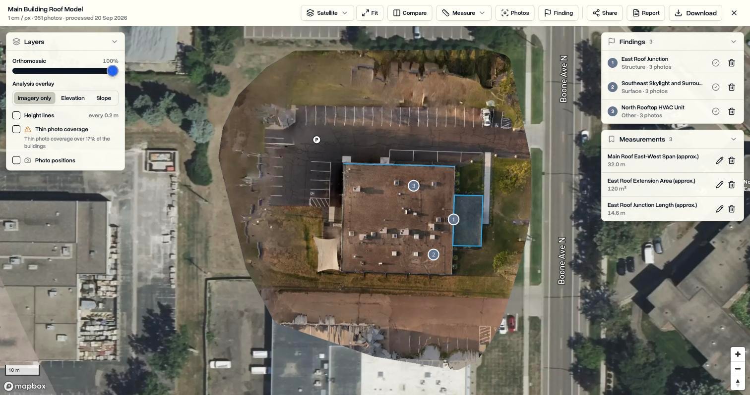
Choose your photos, select an output, and start processing. ZIP uploads are unpacked into the job, and a notification tells you when the results are ready.
- Map and measurements
- A detailed top-down map with elevation and slope information. Measure roofs, sites and volumes, and save the results to the job.
- 3D model and map
- All the map outputs, plus a textured model you can orbit. Explore the building, roof levels and site from different angles.
- Thermal map
- Build a temperature map from supported DJI thermal photos. Inspect temperature patterns and compare them with a visible-light scan.
Get the measurements the job needs.
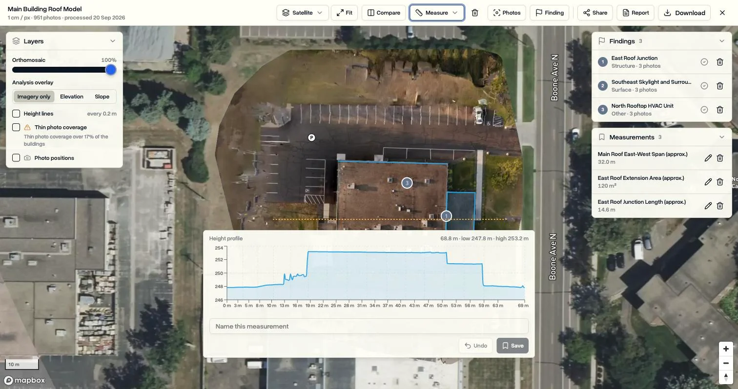
Trace a roof area, measure an equipment clearance, or draw a height profile across the building. Distance, area, height, profile, roof and volume tools turn the scan into answers you can save and revisit.
Saved measurements stay with the scan and can be included in your inspection report.
Keep every observation close to its evidence.
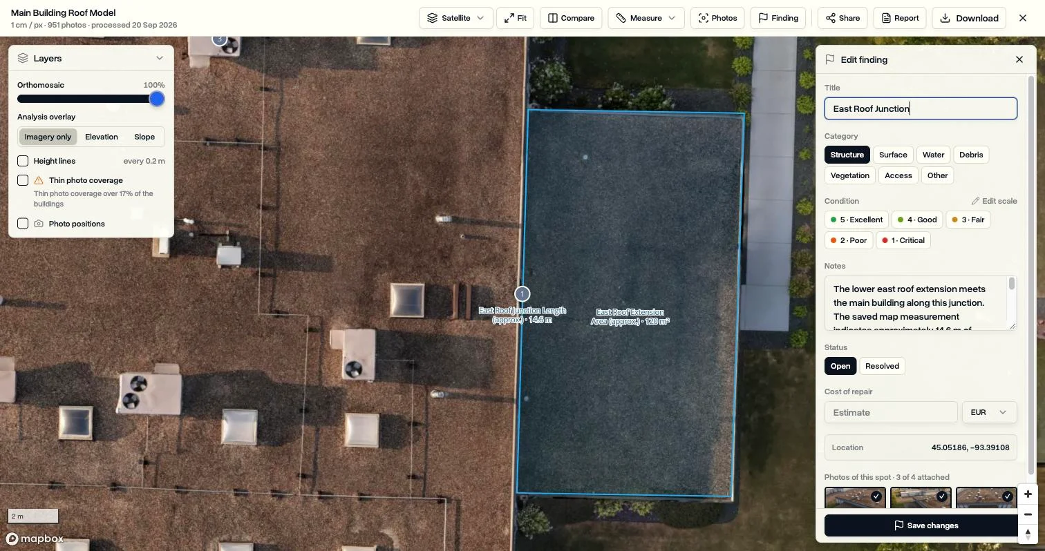
Click a spot to find the original photos that captured it. Pin a finding or outline an area, add notes and a condition rating, and track its status and estimated repair cost. Relevant photos are attached automatically.
Your team can use its own categories and condition scales for different inspection work.
Give the client a report or a place to explore.
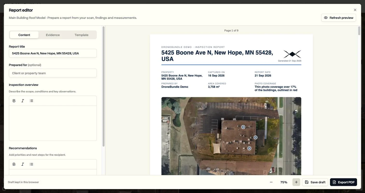
Bring measurements, findings and photographs into a PDF with your overview and recommendations. Preview the pages before exporting, and apply your company branding. Or share a browser link so the client can explore the scan without signing in.
Choose whether a shared link permits downloads, and remove the link when access is no longer needed.
See what changed between visits.
Compare two scans of the same site with a sliding divider. Pan and zoom them together to review a repair, a new roof surface or construction progress.
Keep the files behind the result.
Generated maps, models and point clouds are saved as ordinary job files. Download them for other tools or mirror them to your own storage with Data Ownership.
Try it with your next flight.
3D Scans is included with Enterprise and every free trial. Enterprise includes 200 processing credits per month. Your free trial includes 20 credits.
One credit covers up to 100 photos per scan, rounded up. A 951-photo scan uses 10 credits. You see the credit cost before processing starts.
Before your first scan
What photos can I use?
Start with overlapping drone photos of the same site, with location metadata. A scan accepts 10 to 1,500 photos. Upload them to a job individually or in ZIP archives. Thermal maps require supported DJI thermal photos containing temperature data.
How long does processing take?
Processing time depends on the photo set and selected output. Small sets can finish in minutes; a building captured in around a thousand photos can take a few hours. You can leave the page and receive a notification when the scan is ready.
How accurate are the measurements?
Accuracy depends on the source photography, image overlap, positioning and reconstruction quality. Image resolution is not a guarantee of survey accuracy. Thin photo coverage is flagged in the viewer. Check critical dimensions against suitable ground references before using them for design, procurement or repairs.
Can I download the results?
Yes. Generated maps, point clouds, surface and terrain models, textured 3D models and processing reports are saved as ordinary job files. Download the outputs you generated in standard formats for use in compatible tools. They also mirror to your own cloud storage when Data Ownership is enabled.