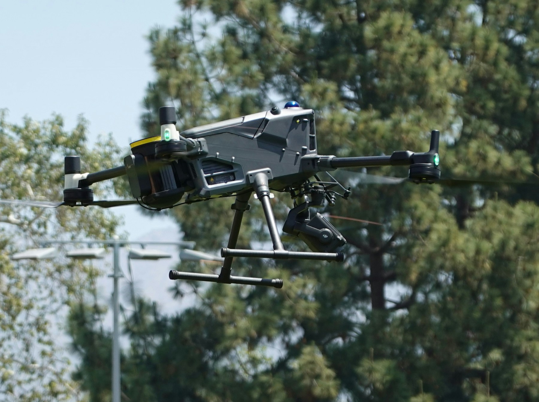
What is a LiDAR Drone?
A LiDAR drone is an unmanned aerial vehicle equipped with Light Detection and Ranging sensors that emit laser pulses to measure distances and create precise 3D point cloud maps. These systems achieve centimeter-level accuracy and can penetrate vegetation to capture ground-level terrain data, making them essential tools for professional surveying, construction monitoring, and environmental mapping.
Table of contents
- Why choose a LiDAR drone for surveying
- Key specifications to evaluate
- Best LiDAR drone platforms in 2026
- Top LiDAR sensors for drone integration
- LiDAR drone accuracy standards
- Pricing breakdown and total cost of ownership
- LiDAR drone applications by industry
- Frequently asked questions
- Implementation considerations
- In summary
Why choose a LiDAR drone for surveying
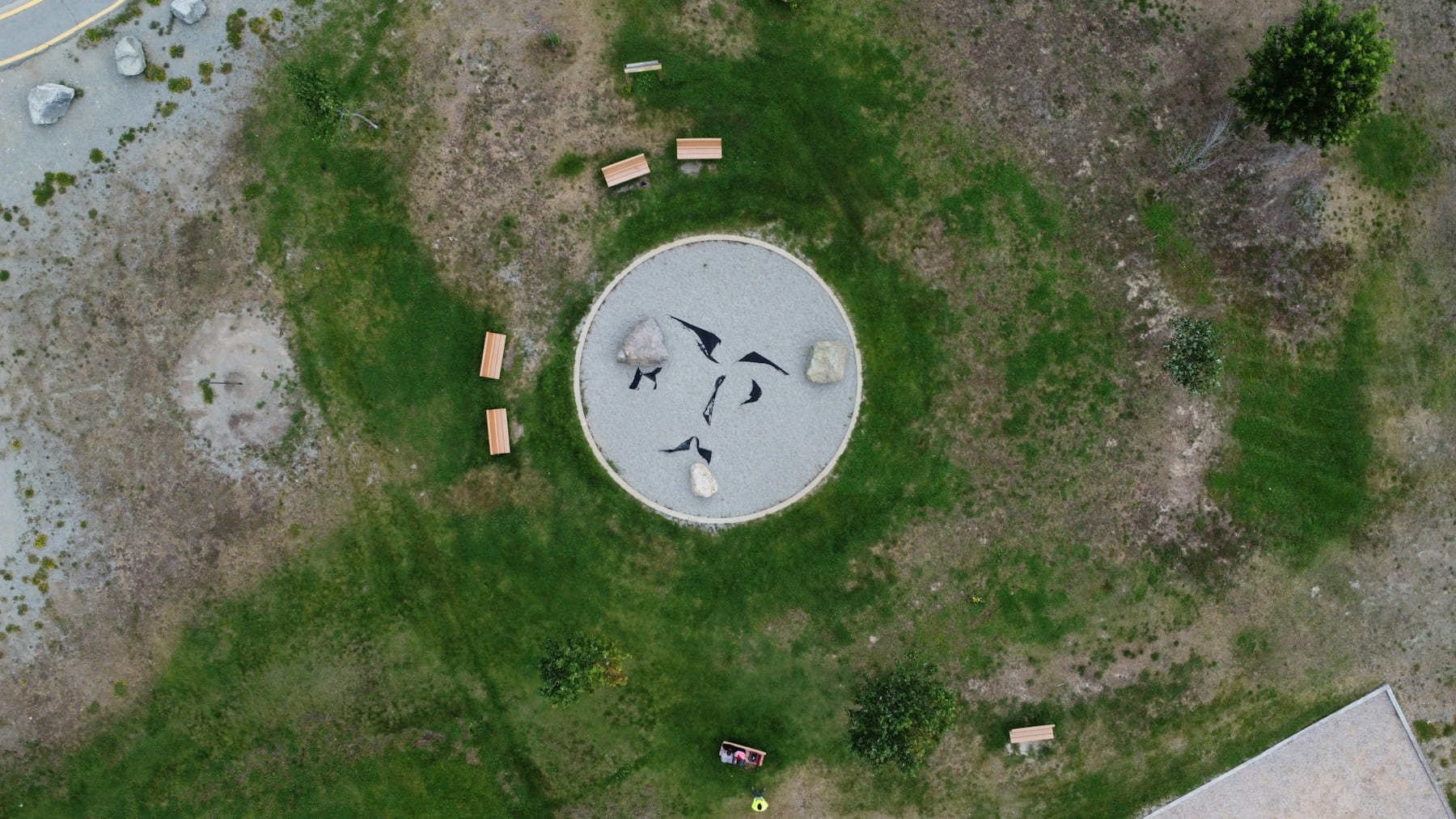
Traditional ground surveys require crews to physically traverse terrain, set up equipment at multiple stations, and spend days or weeks collecting measurements. A LiDAR drone completes the same work in hours while capturing millions of data points that ground methods simply cannot match.
The technology fires up to 1.5 million laser pulses per second, with each pulse recording precise distance measurements. Combined with RTK positioning systems, modern LiDAR drones achieve vertical accuracies of 2-5 centimeters and horizontal accuracies of 5-10 centimeters in optimal conditions.
Unlike photogrammetry, LiDAR works in challenging conditions. Dense vegetation, low light, and uniform surfaces that cause photogrammetry to fail present no obstacle to laser scanning. The technology penetrates tree canopies to capture bare-earth terrain models, a capability that makes it indispensable for forestry inspections and environmental monitoring.
For professional surveying operations, the productivity gains are substantial. A single LiDAR drone flight can cover 100+ acres in under an hour with survey-grade accuracy. This efficiency translates directly to faster project timelines and reduced labor costs.
Key specifications to evaluate
When selecting a LiDAR drone system, several technical specifications determine whether the equipment meets your project requirements.
Points per second
Point density directly impacts data quality. Entry-level systems capture 100,000-300,000 points per second, suitable for basic terrain mapping. Professional surveying and inspection applications typically require 500,000+ points per second for adequate detail.
Range and altitude
Maximum sensor range determines operational flexibility. Systems with 200-300 meter range support higher flight altitudes, increasing coverage area per flight. Short-range sensors (under 100 meters) require lower flights with more flight lines to cover the same area.
Accuracy specifications
Absolute accuracy measures how closely measurements match real-world coordinates. Relative accuracy indicates measurement consistency within a single dataset. Both specifications matter, but absolute accuracy requires proper ground control points and RTK correction.
| Accuracy Class | Vertical RMSE | Horizontal RMSE | Typical Use Case |
|---|---|---|---|
| Survey-grade | 2-5 cm | 5-10 cm | Engineering, construction |
| Mapping-grade | 5-15 cm | 10-30 cm | Corridor mapping, forestry |
| Planning-grade | 15-30 cm | 30-50 cm | Preliminary surveys, reconnaissance |
Weight and payload
LiDAR sensors range from 400 grams for compact units to over 3 kilograms for high-performance systems. Heavier payloads reduce flight time and require larger drone platforms with greater lift capacity.
Multi-return capability
Professional LiDAR sensors record multiple returns from each pulse. When a laser beam hits vegetation, it reflects partially from leaves while continuing through to lower surfaces. Multi-return sensors capture these separate reflections, enabling vegetation penetration and more complete ground models.
Best LiDAR drone platforms in 2026
The drone platform carrying your LiDAR sensor affects flight time, stability, payload capacity, and overall system cost. Here are the leading options for professional surveying operations.
DJI Matrice 350 RTK
The M350 RTK has become the industry standard for enterprise drone operations. With 55 minutes of flight time and 2.7 kg payload capacity, it handles most professional LiDAR sensors. Built-in RTK positioning and robust construction make it reliable for demanding construction and infrastructure projects.
The aircraft integrates seamlessly with DJI's ecosystem including the DJI FlySafe geofencing system and enterprise fleet management tools. For teams already using DJI equipment, the M350 offers familiar operation and simplified training.
DJI Matrice 300 RTK
Though superseded by the M350, the M300 RTK remains widely deployed and well-supported. Many LiDAR manufacturers have optimized their sensor integrations for this platform. Used systems offer good value for operations with tighter budgets.
Freefly Astro
The Astro platform provides 40+ minutes of flight time with a focus on cinema and mapping applications. Its modular design accepts various third-party LiDAR sensors and gimbals. The open architecture appeals to operators who prefer flexibility over closed ecosystems.
WingtraOne Gen II
For large-area mapping, fixed-wing VTOL platforms like the WingtraOne offer dramatically increased coverage. The Gen II achieves 59 minutes of flight time and covers 400+ hectares per flight at mapping-grade accuracy. The vertical takeoff and landing capability eliminates the need for runways while providing fixed-wing efficiency.
Hybrid platforms
Long-endurance hybrid drones combine fuel engines with electric propulsion for extended flight times exceeding 2 hours. These specialized platforms suit corridor mapping projects like power line inspections and pipeline surveys where range matters more than maneuverability.
Top LiDAR sensors for drone integration
LiDAR sensors represent the largest single investment in most systems. Choosing between integrated solutions and separate sensors depends on operational requirements and budget constraints.
Integrated systems
DJI Zenmuse L2: DJI's latest integrated LiDAR solution achieves 5 cm vertical accuracy with a 250-meter range. The plug-and-play integration with Matrice platforms simplifies deployment while the combined RGB camera enables automatic point cloud colorization. Price: approximately $15,000.
YellowScan Mapper+: A complete mapping solution designed for surveyors, the Mapper+ delivers 2-3 cm accuracy with 300,000 points per second. The system includes processing software and training. Price: approximately $40,000-50,000.
ROCK R3 Pro: The R3 Pro offers 1.2 million points per second with dual-return capability. Its lightweight design (850g) extends flight times while maintaining professional accuracy. Price: approximately $25,000-35,000.
High-performance sensors
Riegl miniVUX series: Industry-leading accuracy and range characterize these Austrian-made sensors. The miniVUX-3UAV achieves millimeter-level precision for the most demanding utilities and energy inspection applications. Price: $100,000+.
Phoenix LiDAR RECON-XT: A solid-state design eliminates moving parts for improved reliability. The compact form factor fits smaller drones while delivering 500,000+ points per second. Price: approximately $45,000.
Hesai XT32: Originally designed for autonomous vehicles, this sensor offers excellent value for mapping applications at approximately $10,000. Point density and accuracy suit many commercial projects without the premium price of specialized survey units.
Comparison table
| Sensor | Points/Sec | Range | Weight | Accuracy | Price Range |
|---|---|---|---|---|---|
| DJI Zenmuse L2 | 240,000 | 250m | 905g | 5 cm | $15,000 |
| YellowScan Mapper+ | 300,000 | 200m | 1.6 kg | 2-3 cm | $45,000 |
| ROCK R3 Pro | 1,200,000 | 450m | 850g | 2 cm | $30,000 |
| Riegl miniVUX-3 | 200,000 | 250m | 1.6 kg | <1 cm | $100,000+ |
| Phoenix RECON-XT | 500,000 | 200m | 750g | 3 cm | $45,000 |
LiDAR drone accuracy standards
Understanding accuracy standards helps you specify equipment that meets project requirements without over-investing in unnecessary precision.
The American Society for Photogrammetry and Remote Sensing (ASPRS) publishes the definitive accuracy standards for geospatial data in the United States. Edition 2 of the ASPRS Positional Accuracy Standards (adopted June 2024) establishes guidelines for reporting and validating LiDAR accuracy.
Key requirements from ASPRS Edition 2 include:
- Minimum 30 checkpoints for accuracy assessment
- Separate reporting of vegetated and non-vegetated vertical accuracy
- Three-dimensional positional accuracy as a new reporting metric
The USGS 3D Elevation Program (3DEP) defines quality levels for federal mapping projects. Quality Level 1 (QL1) requires 8 points per square meter with vertical accuracy under 10 cm RMSE. Many state and local agencies reference these standards for public works projects.
For commercial applications, accuracy requirements vary by use case. Drone inspection software for asset monitoring may accept 10-15 cm accuracy for change detection, while engineering surveys require 2-5 cm for design work.
Factors affecting field accuracy
Achieving published sensor accuracy requires proper operational procedures:
Ground control: Survey-grade ground control points tied to established benchmarks provide the reference for absolute accuracy. Even with RTK positioning, GCPs remain essential for quality assurance and adjustment.
IMU calibration: The inertial measurement unit tracking drone orientation requires regular calibration. Temperature changes and mechanical stress affect IMU performance over time.
Flight parameters: Altitude, speed, and overlap settings impact point density and accuracy. Lower, slower flights with higher overlap produce better results at the cost of coverage efficiency.
Environmental conditions: Wind affects aircraft stability and thus data quality. Temperature extremes impact sensor performance. Post-processed kinematic (PPK) solutions can recover accuracy lost during challenging conditions.
Pricing breakdown and total cost of ownership
LiDAR drone investment requires understanding both upfront costs and ongoing operational expenses. A realistic budget prevents surprises and ensures sustainable operations.
Initial equipment costs
| Component | Entry-Level | Professional | Enterprise |
|---|---|---|---|
| Drone platform | $5,000-15,000 | $15,000-35,000 | $35,000-80,000 |
| LiDAR sensor | $10,000-20,000 | $30,000-60,000 | $80,000-150,000 |
| Processing software | $2,000-5,000 | $5,000-15,000 | $15,000-30,000 |
| Accessories | $2,000-5,000 | $5,000-10,000 | $10,000-20,000 |
| Total | $19,000-45,000 | $55,000-120,000 | $140,000-280,000 |
Annual operating costs
Ongoing expenses affect the true cost of ownership significantly:
Insurance: Commercial drone insurance for LiDAR operations typically costs $3,000-8,000 annually depending on coverage limits and operational scope.
Software subscriptions: Cloud processing services and software maintenance add $2,000-15,000 annually. Some vendors bundle processing credits with sensor purchases.
Training and certification: Initial Part 107 certification is the baseline requirement. Advanced training for LiDAR operations costs $2,000-5,000. Ongoing currency training may be required for certain contracts.
Maintenance: Sensor calibration, drone maintenance, and battery replacement add $3,000-10,000 annually depending on flight volume.
Regulatory compliance: Managing drone compliance requirements including registration, waivers, and airspace authorizations requires either staff time or consultant fees.
ROI considerations
Service providers typically charge $1,500-5,000 per day for LiDAR mapping services. At 100 billable days annually, a $100,000 system investment can generate substantial returns. Internal use cases generate ROI through time savings compared to traditional survey methods and reduced reliance on external contractors.
ROI calculations extend beyond direct revenue to include efficiency gains, safety improvements, and competitive advantages that strengthen market position.
LiDAR drone applications by industry
Different industries have specific requirements that influence LiDAR drone selection and deployment strategies.
Construction and engineering
Construction projects use LiDAR drones for site surveys, earthwork calculations, and progress monitoring. The technology provides accurate as-built documentation and volumetric measurements for material tracking.
Pre-construction surveys establish baseline topography for design work. Regular monitoring flights track earthwork progress and verify contractor quantities. The data integrates with BIM systems and digital twin platforms for comprehensive project documentation.
Utilities and energy
Power line corridor mapping represents one of the highest-value LiDAR applications. The technology measures vegetation encroachment, conductor sag, and clearance violations along transmission and distribution lines.
Solar farm developers use LiDAR for terrain analysis and panel layout optimization. Wind energy projects require detailed terrain models for turbine siting and wind turbine inspection programs.
Surveying and geomatics
Professional surveyors increasingly integrate LiDAR with traditional methods. The technology excels at capturing topographic detail over large areas while conventional total stations provide control and boundary evidence.
Cadastral surveys, topographic mapping, and engineering surveys all benefit from LiDAR efficiency. The data supports land development, infrastructure design, and regulatory compliance documentation.
Mining and aggregates
Stockpile volume measurement was among the earliest commercial LiDAR drone applications. Regular flights provide accurate inventory data for materials management and financial reporting.
Pit progression monitoring tracks extraction rates and reclamation requirements. Asset inspection applications include monitoring haul roads, berms, and drainage structures.
Agriculture and forestry
LiDAR penetrates crop canopies to measure terrain for drainage planning and irrigation design. The technology supports precision agriculture and environmental monitoring through detailed elevation models that identify low spots and drainage issues.
Agricultural drone applications extend to crop height measurement and biomass estimation. Forest inventory programs use LiDAR to measure tree heights, canopy density, and timber volume across large areas.
Frequently asked questions
How much does a LiDAR drone cost?
Complete LiDAR drone systems range from $20,000 for entry-level mapping setups to over $200,000 for enterprise-grade survey systems. The sensor typically represents 50-70% of total system cost. Budget $50,000-80,000 for a professional system capable of survey-grade accuracy.
Can I add LiDAR to my existing drone?
Some enterprise drones accept third-party LiDAR payloads, but integration complexity varies significantly. DJI Matrice platforms and other commercial aircraft support modular payloads. Consumer drones generally lack the payload capacity, power supply, and integration options needed for professional LiDAR sensors.
What accuracy can I expect from a LiDAR drone?
Modern survey-grade LiDAR drones achieve 2-5 cm vertical accuracy and 5-10 cm horizontal accuracy under optimal conditions with proper ground control. Mapping-grade systems deliver 5-15 cm vertical accuracy suitable for many commercial applications. Actual field accuracy depends on calibration, flight parameters, and environmental conditions.
Do I need special training to operate a LiDAR drone?
Beyond the FAA Part 107 certification required for all commercial drone operations, LiDAR operations benefit from specialized training. Understanding sensor operation, mission planning for optimal data capture, and processing workflows requires additional knowledge. Most sensor manufacturers offer training programs, and organizations like ASPRS provide professional development resources.
Implementation considerations
Starting a LiDAR drone program requires careful planning beyond equipment selection. Consider these factors before committing to a system.
Staff capabilities: Evaluate whether existing team members can operate the equipment or whether hiring specialized personnel makes more sense. The learning curve for LiDAR operations exceeds standard drone piloting, and tracking pilot certifications becomes critical as programs scale.
Processing infrastructure: LiDAR datasets require significant storage and computing resources. A single project can generate hundreds of gigabytes of raw data. Cloud processing services offer scalability but add ongoing costs. Local processing requires workstations with high-end GPUs and substantial RAM.
Integration requirements: Consider how LiDAR data will flow into existing workflows. CAD integration, GIS compatibility, and data export capabilities vary between processing platforms. Verify compatibility before selecting a system.
Support and service: Equipment failures during critical projects create significant problems. Evaluate manufacturer support availability, repair turnaround times, and loaner equipment options. Local dealers may provide faster service than direct manufacturer support for some brands.
Professional drone fleet management software helps organize equipment, track maintenance schedules, and manage project documentation as operations grow.
In summary
Selecting the right LiDAR drone requires balancing accuracy requirements, operational needs, and budget constraints. Entry-level systems around $30,000-50,000 serve many commercial mapping applications effectively. Survey-grade systems costing $100,000+ deliver the precision needed for engineering and construction projects.
The DJI Matrice 350 RTK with Zenmuse L2 provides an accessible entry point for organizations new to LiDAR. Professional surveying operations benefit from higher-performance sensors like the YellowScan Mapper+ or ROCK R3 Pro. Enterprise applications demanding the highest accuracy justify investment in Riegl or similar premium sensors.
Beyond equipment selection, successful LiDAR programs require trained operators, robust data processing workflows, and proper quality control procedures. The technology transforms surveying productivity, but realizing that potential requires commitment to operational excellence.
Ready to integrate LiDAR into your drone operations?
LiDAR drone technology delivers unprecedented surveying efficiency and accuracy. Whether you are expanding existing drone operations or building a new program, the right equipment and workflows unlock significant productivity gains.
Start your free trial today - no credit card required.
Or book a demo to see how DroneBundle helps manage LiDAR operations with integrated flight planning and equipment tracking.