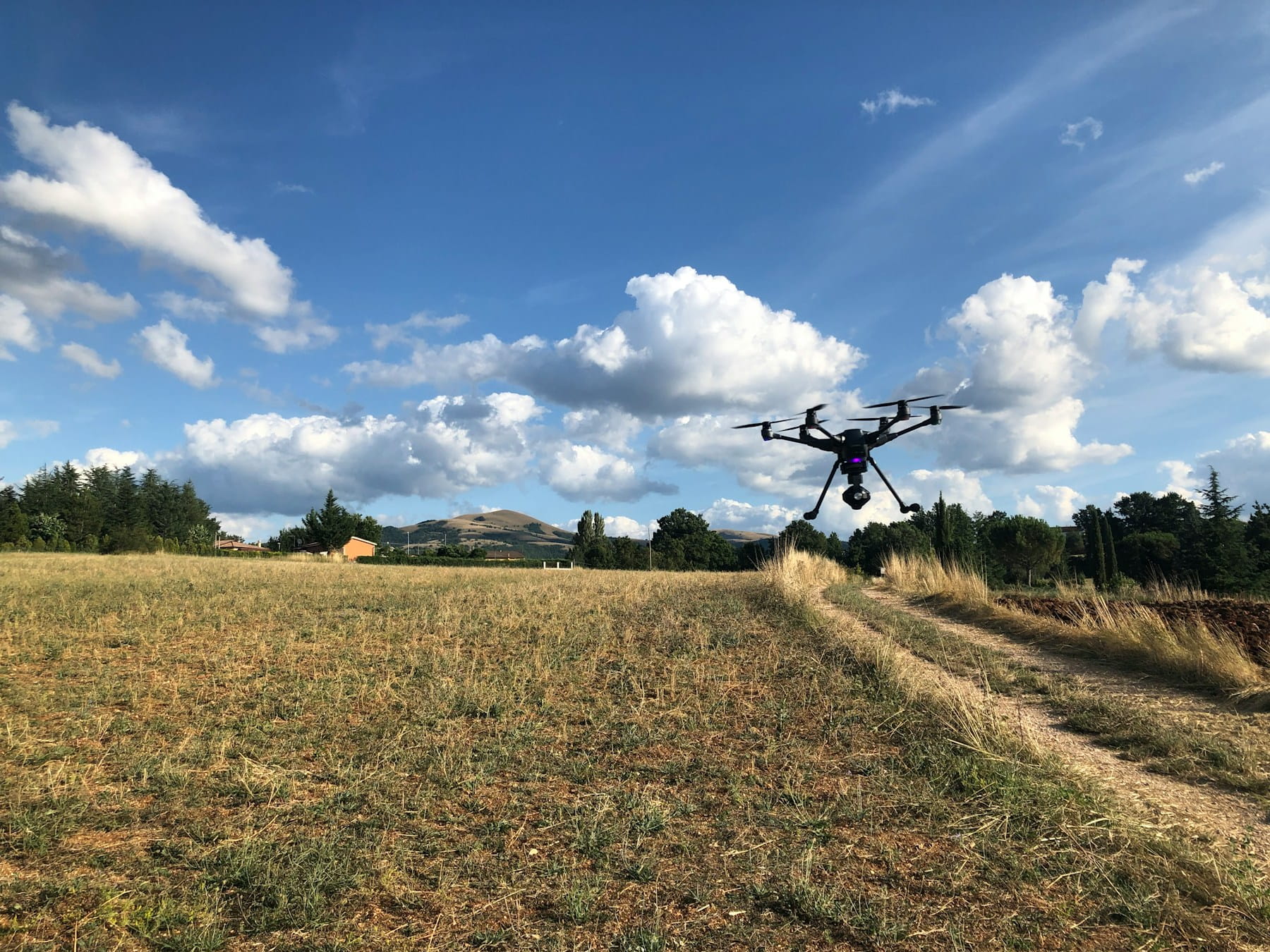
What are Agricultural Drones?
Agricultural drones are specialized unmanned aircraft systems equipped with advanced sensors and imaging technology designed specifically for farming applications. These aircraft collect critical crop data, monitor field conditions, and perform targeted treatments across agricultural land, enabling farmers to make data-driven decisions that improve yields, reduce input costs, and optimize resource usage through precision agriculture practices.
Farmers face mounting pressure to feed a growing global population while managing rising operational costs and environmental concerns. Traditional farming methods, though time-tested, often lack the precision and efficiency needed to meet these modern challenges. Agricultural drones have emerged as a practical solution, offering farmers detailed crop insights, precise application capabilities, and significant time savings.
These unmanned aircraft systems represent a fundamental shift in how agricultural operations can be monitored, managed, and optimized. From small family farms to large commercial operations, drones are proving their worth through measurable improvements in crop yields, resource efficiency, and operational effectiveness.
Table of contents
- What are agricultural drones
- Key applications in farming operations
- Technology components and sensors
- Benefits for modern farming
- Types of agricultural drones
- Data processing and analysis
- Implementation considerations
- Regulatory requirements
- Cost analysis and ROI
- Frequently asked questions
- In summary
What are agricultural drones
Agricultural drones are specialized unmanned aircraft designed specifically for farming applications. These aircraft carry various sensors and equipment to collect data, monitor crops, and perform targeted treatments across agricultural land. Unlike recreational drones, agricultural models are built to withstand harsh outdoor conditions and carry heavier payloads.
The technology combines traditional aviation principles with modern sensor technology, GPS guidance systems, and data processing capabilities. Most agricultural drones operate autonomously following pre-programmed flight paths, though manual control remains available when needed.
Farm drones typically feature weather-resistant construction, extended battery life, and modular payload systems that can be configured for different tasks. Some models can carry up to 10 kilograms of equipment or treatment materials, making them suitable for both data collection and active field treatments.
Professional agricultural drones differ significantly from consumer models in their durability, precision, and specialized software integration. They're designed to operate in dusty, humid, and variable weather conditions that would challenge standard consumer aircraft.
Key applications in farming operations
Crop monitoring and health assessment
Drones equipped with specialized cameras can identify crop stress, disease outbreaks, and pest infestations before they become visible to the naked eye. This early detection capability allows farmers to take targeted action, preventing small problems from becoming field-wide disasters.
Multispectral imaging reveals plant health through different light wavelengths, showing variations in chlorophyll content, water stress, and nutrient deficiencies. According to recent research on drone-based multispectral imaging, strong correlations exist between NDVI values and crop parameters like leaf area index (LAI) and leaf nitrogen content, with accuracy improving from R² values of 0.78-0.86 at flowering to 0.88-0.90 at grain filling stages.
Regular aerial surveys create detailed maps showing crop development patterns across entire fields. This information helps identify underperforming areas that may need special attention or reveal optimal growing conditions that can be replicated elsewhere.
Precision agriculture applications
Variable rate application represents one of the most valuable uses of agricultural drones. Instead of applying fertilizers, pesticides, or seeds uniformly across a field, drones can target specific areas based on actual need, reducing waste and environmental impact.
Farmonaut's 2025 analysis shows that precision applications cut fertilizer and pesticide use by 20-50% on average, reducing both environmental impact and operational costs. Spray drones can apply treatments with remarkable precision, reaching areas that might be difficult to access with ground-based equipment.
Planting drones plant seeds in precise patterns and depths, optimizing spacing for maximum yield. This technology is particularly useful in difficult terrain or areas where traditional planting equipment cannot operate effectively.
Field mapping and surveying
Agricultural drones create highly accurate topographical maps that help farmers understand water flow patterns, elevation changes, and soil variations. This information is valuable for planning drainage systems, irrigation networks, and field layouts.
Boundary mapping helps establish precise field edges for legal documentation, insurance purposes, and operational planning. GPS-enabled drones can map property lines with centimeter-level accuracy, creating detailed records of farmed areas.
Crop counting applications use computer vision algorithms to count individual plants, estimate population density, and calculate expected yields. This data helps farmers make decisions about harvesting schedules and marketing strategies.
Technology components and sensors
Camera systems
Standard RGB cameras provide basic visual information for crop monitoring and general field assessment. These cameras capture high-resolution images that can be processed to create detailed maps and identify obvious problems like bare spots or equipment damage.
The DJI Mavic 3 Multispectral pairs a 20MP RGB camera with four multispectral sensors (Green, Red, Red Edge, NIR), each at 5MP, providing comprehensive data for vegetation analysis. Multispectral cameras capture data across multiple light wavelengths, revealing information invisible to standard cameras.
Thermal imaging cameras detect temperature variations that indicate irrigation problems, equipment malfunctions, or plant stress. These cameras are particularly useful for monitoring livestock and identifying areas with poor drainage or excessive moisture.
GPS and navigation systems
Real-Time Kinematic (RTK) GPS provides centimeter-level positioning accuracy, allowing drones to return to exact locations for comparative analysis over time. This precision is critical for monitoring specific plants or field areas throughout growing seasons.
Automated flight planning software creates efficient survey patterns that ensure complete field coverage while minimizing battery usage and flight time. These systems can account for weather conditions, obstacle avoidance, and optimal camera angles.
Ground control points help calibrate drone positioning and ensure accurate mapping results. These physical markers placed throughout fields serve as reference points for processing aerial imagery.
Communication systems
Radio frequency systems provide reliable communication between drones and ground control stations, even in areas with poor cellular coverage. These systems maintain connection throughout entire flight operations.
Cellular connectivity allows real-time data transmission and remote monitoring capabilities. Farmers can receive immediate alerts about crop conditions or equipment status while away from the field.
Data logging systems record flight parameters, sensor data, and operational information for later analysis and regulatory compliance. This information helps optimize future flights and troubleshoot any issues.
Benefits for modern farming
Increased operational efficiency
Drone surveys can cover hundreds of acres in a single flight, providing comprehensive field assessment in a fraction of the time required for ground-based scouting. What might take days of walking through fields can be completed in hours from the air.
According to 2025 agricultural technology data, drones can survey and map up to 1,000 acres of farmland in under 24 hours, and agricultural drone usage is projected to increase crop monitoring efficiency by up to 70% in 2025.
Automated flight patterns reduce labor requirements and eliminate human error in data collection. Consistent flight altitudes and speeds ensure reliable, comparable data across multiple survey dates.
Improved crop yields
Early problem detection allows farmers to address issues before they significantly impact crop production. Targeted treatments based on drone data can prevent yield losses that might otherwise go unnoticed.
Optimized input application based on actual field conditions reduces both over-application and under-application problems. This precision leads to healthier crops and higher yields while reducing input costs.
Better timing of agricultural operations based on current crop conditions helps maximize the effectiveness of treatments and harvesting activities. Drones provide objective data about crop readiness that supplements farmer experience and judgment.
Environmental benefits
Reduced chemical usage through precision application decreases environmental impact while maintaining crop protection effectiveness. Targeted treatments minimize runoff and reduce exposure to non-target organisms.
Optimized irrigation based on actual plant water stress reduces water usage and prevents over-watering that can lead to nutrient leaching and soil erosion.
Carbon footprint reduction comes from decreased fuel usage for field scouting and more efficient application of inputs. Drones use significantly less energy than ground-based equipment for many monitoring tasks.
Types of agricultural drones
Fixed-wing aircraft
Fixed-wing agricultural drones excel at covering large areas efficiently, making them ideal for extensive crop monitoring and mapping operations. These aircraft can fly for extended periods, typically 45-90 minutes per flight, and cover several hundred acres in a single mission.
Wing-mounted sensors provide stable platforms for high-quality imaging, and the aircraft's forward motion helps ensure consistent image overlap for accurate mapping. Fixed-wing drones typically fly at higher altitudes, providing broader coverage but potentially less detailed information than lower-flying alternatives.
Multi-rotor helicopters
Quadcopter and hexacopter designs offer superior maneuverability and hovering capabilities, making them ideal for detailed inspections and precise treatment applications. These aircraft can take off and land vertically, requiring minimal ground space.
Multi-rotor aircraft provide excellent stability for high-resolution photography and can fly at variable speeds depending on mission requirements. Flight times typically range from 20-45 minutes depending on payload and conditions.
Hybrid designs
VTOL (Vertical Takeoff and Landing) aircraft combine advantages of both fixed-wing and multi-rotor designs. These aircraft take off like helicopters but transition to forward flight for efficient long-distance coverage, offering extended flight times while maintaining vertical takeoff and landing capabilities.
Data processing and analysis
Image processing workflows
Raw aerial imagery requires processing to extract useful agricultural information. Specialized data processing software analyzes color variations, calculates vegetation indices, and identifies problem areas within crop fields.
Orthomosaic creation combines multiple aerial images into seamless maps that provide accurate measurements and consistent perspective across entire fields. These maps serve as baseline references for tracking changes over time.
Digital elevation models generated from aerial imagery help farmers understand topography, water flow patterns, and drainage characteristics that affect crop growth and field management decisions.
Vegetation indices calculation
NDVI (Normalized Difference Vegetation Index) calculations reveal plant health and vigor by comparing red and near-infrared light reflectance. The NDVI scale quantifies vegetation health based on reflectance data, with higher values indicating healthier, more vigorous plant growth.
GNDVI (Green Normalized Difference Vegetation Index) provides similar information but uses green light instead of red, offering better sensitivity to chlorophyll variations in dense crop canopies. For most agricultural workflows, five bands—blue, green, red, red edge, and near-infrared—provide the data needed for comprehensive plant health monitoring.
Custom vegetation indices can be developed for specific crops or growing conditions, providing more targeted information about plant health and development status.
Data integration and mapping
GIS (Geographic Information System) integration allows drone data to be combined with other farm information, including soil maps, weather data, and historical yield records. This comprehensive approach provides deeper insights into field performance.
Prescription mapping uses drone data to create variable-rate application maps for fertilizers, pesticides, and other inputs. These maps guide equipment to apply materials precisely where needed.
Temporal analysis compares data collected at different times throughout the growing season, revealing trends and patterns that help optimize management decisions for current and future crops.
Implementation considerations
Planning and preparation
Flight planning software helps optimize survey patterns for specific field shapes and sizes while accounting for weather conditions, obstacles, and regulatory requirements. Proper planning reduces flight time and ensures complete coverage.
Weather monitoring is critical for safe and effective drone operations. Wind speed, precipitation, and visibility conditions all affect flight safety and data quality.
Equipment maintenance schedules help prevent operational failures and ensure consistent data quality. Regular calibration of sensors and GPS systems maintains accuracy standards.
Training and certification
Pilot certification requirements vary by location but typically include both written examinations and practical flight demonstrations. Commercial agricultural operations usually require more extensive certification than recreational use.
Ongoing training helps pilots stay current with changing regulations, new technology developments, and best practices for agricultural applications. Regular practice maintains flight skills and safety awareness.
Safety protocols should be established for all drone operations, including emergency procedures, communication plans, and equipment inspection routines.
Integration with existing systems
Farm management software integration allows drone data to be incorporated into existing record-keeping and decision-making systems. This integration maximizes the value of collected information.
Equipment compatibility considerations affect how drone data can be used with existing tractors, sprayers, and other farm machinery. Variable-rate application systems need compatible data formats.
Workflow development helps establish efficient routines for data collection, processing, and application that fit within existing farm operations schedules.
Regulatory requirements
Licensing and certification
Commercial drone operations require proper licensing from aviation authorities in most countries. In the United States, operators must obtain an FAA Part 107 remote pilot certificate, which involves written examinations covering aviation regulations, safety procedures, and operational limitations.
For agricultural drone operations specifically, additional requirements apply. According to 2025 FAA regulations, drones used for dispensing substances require exemptions from certain Part 107 sections as well as compliance with Part 137 agricultural aircraft operator requirements.
Insurance requirements for commercial drone operations protect against liability for property damage or personal injury. Agricultural operations may have specific insurance needs based on the types of treatments being applied.
Operational restrictions
Airspace limitations affect where and when agricultural drones can operate. Proximity to airports, military installations, and populated areas may restrict or prohibit drone flights.
Flight altitude limits typically restrict agricultural drones to specific maximum heights, usually between 120-150 meters above ground level. These limits help maintain separation from manned aircraft.
2025 regulatory updates include approvals for BVLOS (Beyond Visual Line of Sight) operations, nighttime flights, and higher altitude clearances for agricultural drones, making large-scale farming more efficient. The exemption process has been simplified, offering faster approvals and clearer application guidelines.
Privacy and data protection
Property boundary considerations affect where drones can collect data and images. Flights over neighboring properties may require permission or coordination with adjacent landowners.
Data storage and sharing regulations may apply to agricultural information collected by drones, particularly if the data includes information about neighboring properties or environmentally sensitive areas.
Record-keeping requirements for commercial drone operations typically include flight logs, maintenance records, and pilot certification documentation. These records may be subject to inspection by regulatory authorities.
Cost analysis and ROI
Equipment and operational costs
Initial equipment costs for agricultural drones vary widely, from basic systems under $10,000 to advanced platforms exceeding $100,000. The choice depends on farm size, required capabilities, and budget constraints.
Operating expenses include battery replacement, software subscriptions, maintenance costs, and pilot training. These ongoing costs should be factored into long-term budget planning.
Insurance and regulatory compliance costs add to the total investment but are necessary for legal commercial operations. These costs vary by location and operation scope.
Return on investment calculation
Yield improvements from early problem detection and precision treatments can generate significant returns. Even modest yield increases of 3-5% can justify drone investments on larger operations.
According to 2025 agricultural drone analysis, most agricultural drone investments pay for themselves within 1 to 2 cropping seasons, mainly via savings on chemicals, labor, and increased yields.
Input cost savings through precision application reduce fertilizer, pesticide, and seed expenses while maintaining or improving crop performance. These savings accumulate over multiple growing seasons.
Labor savings from automated monitoring reduce the time and cost of traditional field scouting methods. This benefit is particularly valuable for operations with high labor costs or limited workforce availability.
Financing options
Purchase agreements allow direct ownership of drone equipment with all associated benefits and responsibilities. This option works well for operations with sufficient capital and clear long-term needs.
Leasing arrangements reduce initial capital requirements and may include maintenance and support services. Leasing can be attractive for operations wanting to try drone technology before making long-term commitments.
Service providers offer drone services without requiring equipment ownership, suitable for smaller operations or those with occasional needs. This option reduces risk but may limit scheduling flexibility.
Frequently asked questions
What type of drone is best for my farm size?
For farms under 100 acres, multi-rotor drones (quadcopters/hexacopters) provide excellent maneuverability and detailed imaging with 20-45 minute flight times. Farms between 100-500 acres benefit from fixed-wing drones offering 45-90 minute flights covering several hundred acres per mission. Operations exceeding 500 acres should consider hybrid VTOL designs combining vertical takeoff with efficient long-distance coverage. Farm size and application needs directly influence the optimal drone configuration.
Do I need a special license for agricultural drone operations?
Yes, commercial agricultural drone operations in the United States require an FAA Part 107 remote pilot certificate obtained through written examination. Additionally, operations involving substance application (fertilizers, pesticides) require exemptions from Part 107.36 and compliance with Part 137 agricultural aircraft operator requirements. The 2025 exemption process has been simplified with faster approvals. Some states may have additional agricultural aviation licensing requirements beyond federal regulations.
How accurate are drone crop health assessments?
Drone-based crop health assessments using multispectral imaging achieve high accuracy levels. Research shows NDVI correlations with leaf area index (LAI) and leaf nitrogen content reach R² values of 0.88-0.90 during critical growth stages. RTK-equipped drones provide centimeter-level positioning accuracy, allowing precise comparisons across growing seasons. Accuracy depends on sensor quality, flight altitude, weather conditions, and proper calibration. Professional agricultural drones with five-band multispectral sensors provide the most reliable crop monitoring data.
What's the typical ROI timeline for agricultural drones?
Most agricultural drone investments achieve positive ROI within 1-2 cropping seasons through combined savings on chemicals (20-50% reduction), labor costs, and yield improvements (3-5% increase). Larger operations (500+ acres) typically see faster returns due to economies of scale. Precision application reduces input costs immediately, while yield improvements accumulate over time. ROI accelerates when drones replace expensive manned aircraft services or enable new precision agriculture capabilities previously unavailable to the operation.
In summary
Agricultural drones represent practical technology that addresses real farming challenges through improved efficiency, better decision-making, and reduced operational costs. The technology has matured significantly, with 2025 data showing crop monitoring efficiency increases up to 70% and over 60% of large farms globally integrating drone technology for precision management.
The key to successful implementation lies in choosing appropriate equipment for specific needs, developing efficient operational workflows, and integrating drone data with existing farm management systems. Modern agricultural drones equipped with multispectral sensors, RTK GPS, and AI-powered analytics provide farmers with unprecedented visibility into crop conditions and field performance.
As regulatory frameworks evolve to support agricultural aviation and technology costs continue decreasing, drone adoption will likely expand across farming operations of all sizes. The combination of precise data collection, targeted application capabilities, and significant resource savings positions agricultural drones as essential tools for sustainable, profitable farming in the coming decades.
Ready to streamline your agricultural drone operations?
DroneBundle provides comprehensive flight planning and operations management tools specifically designed for agriculture and environmental operations. The platform helps farmers and agricultural service providers manage complex survey missions, process crop data efficiently, and maintain regulatory compliance throughout seasonal operations.
Track flight hours systematically, manage equipment maintenance schedules, coordinate pilot activities, and maintain detailed operational records that satisfy regulatory requirements. DroneBundle's integrated approach helps agricultural professionals maximize their drone investments while maintaining the documentation and systematic procedures that precision agriculture demands.
Start your free trial today — no credit card required.
Or book a demo to see how DroneBundle optimizes agricultural workflows with integrated operations management and comprehensive data reporting.