New FeatureNew
3D Measuring: Measure Walls and Roofs on the Drone Model
3d-measuringmapping3d-modelmeasurementsroof-measurementcad-export
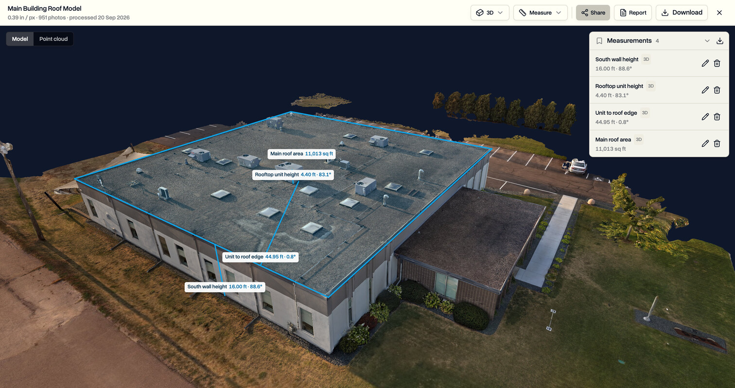
Measure directly on a 3D model. Get wall and rooftop unit heights, true lengths, slopes, and roof areas from the model itself, save them to the job, and send them in the client report or download them as a CAD drawing.
Measure on the Model
- Distance, Area, Height, Profile, Roof, and Volume all work on the 3D model
- Distance shows the true length, the flat distance, the height difference, and the slope
- Area shows the surface area, the footprint, the perimeter, and the length of every side
- Height shows the elevation of any point, and its height above the ground where the ground level can be worked out
- Roof warns you when an outline crosses more than one slope
- On a map with a roof outline, points snap to its corners and edges
Easier Drawing, on the Model and the Map
- Keep clicking to measure a run of edges, and click the first point to close a loop
- Click the last point of a finished line to carry on drawing
- Drag a point to adjust it, and undo if you change your mind
Saved and Shared
- Save a measurement with a name and it stays with the map
- Measurements saved on the map show on the model too, and the other way round
- Saved measurements go into the client report and appear on share links, including in the 3D view
Download
- Download measurements as a spreadsheet (CSV), a CAD drawing (DXF), or GeoJSON
- The spreadsheet follows your unit setting
- Lines measured in 3D stay in 3D in the CAD drawing
Where It Lives
- Open any map with a 3D model and switch the view to 3D model
- On every plan and every free trial, with nothing to set up, and maps you have already built work as they are
- Workspace owners and project managers save and edit measurements