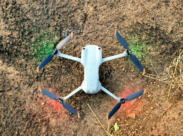
What is a VTOL Drone?
A VTOL drone (Vertical Takeoff and Landing) is an unmanned aircraft that combines helicopter-style vertical takeoff with fixed-wing forward flight efficiency. These hybrid systems launch and land vertically like multirotors but transition to aerodynamic wing-borne flight for extended range and endurance, typically achieving 1.5x to 3x longer flight times than conventional quadcopters while covering significantly more ground per mission.
The VTOL drone represents one of the most significant advances in commercial unmanned aircraft technology. By eliminating the need for runways while maintaining fixed-wing efficiency, these hybrid platforms have transformed large-area mapping, corridor inspection, and long-range surveillance operations.
Traditional fixed-wing drones offer superior endurance but require launch catapults or runways. Standard multirotors provide vertical flight capability but sacrifice range and efficiency. A VTOL drone bridges this gap, delivering the best characteristics of both configurations in a single platform that professional operators increasingly prefer for demanding commercial applications.
Table of contents
- How VTOL drone technology works
- Types of VTOL configurations
- VTOL drone vs multirotor comparison
- Top VTOL drones for commercial operations
- VTOL drone applications by industry
- Regulations and certification requirements
- Cost considerations and ROI
- Frequently asked questions
- Implementation considerations
- In summary
How VTOL drone technology works
VTOL drones integrate multiple propulsion systems to enable both vertical and horizontal flight modes. Understanding this technology helps operators select appropriate platforms and plan effective missions.
Vertical flight phase
During takeoff and landing, VTOL drones operate similarly to multirotor aircraft. Vertical lift motors spin up to generate thrust that exceeds the aircraft weight, allowing controlled ascent. The flight controller manages motor speeds to maintain stability and orientation during this phase.
Most VTOL systems use dedicated lift motors positioned around the airframe specifically for vertical flight. These motors may be fixed or may tilt to contribute to forward flight after transition.
Transition phase
The transition between vertical and horizontal flight represents the most complex phase of VTOL operation. As the aircraft gains forward speed, aerodynamic lift from the wings begins supporting the aircraft weight. The flight controller gradually reduces lift motor power while increasing forward thrust.
Modern flight planning software handles transitions automatically, calculating optimal altitudes and speeds for safe mode changes. Pilots monitor the process but rarely intervene during properly planned missions.
Cruise phase
Once transitioned, the VTOL drone flies like a conventional fixed-wing aircraft. Wings generate lift through forward motion, requiring far less power than hover flight. This aerodynamic efficiency explains why VTOL platforms achieve dramatically longer flight times than multirotors of similar weight.
During cruise, the aircraft typically flies at 40-80 km/h depending on the platform and mission requirements. Higher speeds increase coverage area but may reduce data quality for mapping applications that require specific image overlap.
Types of VTOL configurations
Manufacturers have developed several approaches to VTOL design, each offering distinct advantages for specific applications.
Tilt-rotor VTOL
Tilt-rotor designs use motors that physically rotate between vertical and horizontal orientations. During hover, propellers point upward for lift. For forward flight, motors tilt forward to provide thrust while wings generate lift.
The Autel Dragonfish exemplifies this configuration, offering exceptional endurance of up to 158 minutes with smooth transitions between flight modes. Tilt-rotor systems typically provide the most efficient cruise performance but require more complex mechanical systems.
Tail-sitter VTOL
Tail-sitter aircraft launch vertically with the entire airframe pointed upward, then pitch forward into horizontal flight. The WingtraOne series uses this approach, achieving reliable transitions without the mechanical complexity of tilting components.
This configuration simplifies maintenance since fewer moving parts exist. However, tail-sitters require more precise wind management during vertical operations as the full wing area presents significant surface area to crosswinds.
Quadplane VTOL
Quadplane designs mount separate motor systems for vertical and horizontal flight. Dedicated lift motors handle takeoff and landing while a pusher or tractor propeller provides forward thrust. This approach allows optimization of each system independently.
The Quantum Systems Trinity F90+ uses this configuration, offering flexibility in payload options and straightforward maintenance. Quadplanes may carry slightly more weight due to redundant propulsion systems but provide clear separation between flight modes.
Hybrid lift designs
Some VTOL platforms combine elements of multiple configurations. These hybrid approaches may use tilting motors that also provide some lift during cruise or vectoring exhaust systems for attitude control. Advanced designs continue emerging as manufacturers refine the technology.
VTOL drone vs multirotor comparison
Selecting between VTOL and multirotor platforms depends on mission requirements, operational environment, and budget constraints.
Endurance and range
VTOL drones dramatically outperform multirotors in endurance. Where a typical mapping quadcopter achieves 30-45 minutes of flight time, VTOL platforms routinely exceed 90 minutes with some models surpassing 150 minutes.
| Platform Type | Typical Flight Time | Coverage per Flight |
|---|---|---|
| Multirotor | 25-45 minutes | 50-150 acres |
| VTOL | 60-180 minutes | 200-1,000+ acres |
This endurance advantage translates directly to operational efficiency. One VTOL mapping mission can replace multiple multirotor sorties, reducing battery swaps, launch site relocations, and crew coordination requirements.
Operational flexibility
Multirotors excel in confined spaces and situations requiring precise positioning. Their ability to hover indefinitely and move in any direction makes them superior for detailed asset inspections and work in cluttered environments.
VTOL drones require more open areas for transition maneuvers. While they take off and land vertically, the shift to forward flight needs clear airspace. Most manufacturers recommend minimum transition altitudes of 30-50 meters and clear areas of 100+ meters for the transition path.
Data quality considerations
For surveying applications, both platforms can achieve professional accuracy when properly equipped with RTK positioning systems. The choice often comes down to project scale rather than inherent accuracy differences.
Multirotors provide more flexibility in flight speed and camera angles. VTOL platforms typically capture nadir imagery at fixed speeds, which suits large-area orthomosaic production but may limit options for oblique photography or variable GSD requirements.
Pilot skill requirements
VTOL systems demand higher pilot proficiency than basic multirotors. Understanding transition dynamics, managing wind effects during vertical phases, and planning appropriate mission profiles requires additional training. However, modern autopilot systems automate most complex operations.
Many VTOL manufacturers offer comprehensive training programs covering both flight operations and equipment management best practices. Investment in proper training pays dividends through safer operations and reduced equipment damage.
Top VTOL drones for commercial operations
Several VTOL platforms have established strong reputations for professional surveying, mapping, and inspection work.
WingtraOne GEN II
The WingtraOne GEN II has become an industry standard for survey-grade mapping. Its tail-sitter design provides reliable operation across diverse conditions.
Key specifications:
- Flight time: 59 minutes
- Coverage: 400+ hectares per flight
- Camera: Sony 61MP full-frame sensor
- Positioning: PPK with centimeter accuracy
- IP54 weather resistance rating
The platform integrates well with professional photogrammetry workflows and supports various camera payloads including multispectral sensors for agricultural applications.
Quantum Systems Trinity F90+
The Trinity F90+ offers exceptional versatility with multiple payload options and industry-leading flight time exceeding 90 minutes.
Key specifications:
- Flight time: 90+ minutes
- Range: 15 kilometers
- Positioning: PPK via iBase Ground Reference Station
- Payloads: RGB, multispectral, thermal, and LiDAR options
- NDAA compliant with Remote ID
This platform suits operations requiring payload flexibility, from standard RGB mapping to thermal inspections and LiDAR surveys.
Autel Dragonfish Pro
The Dragonfish Pro delivers exceptional endurance with manual flight capability that most VTOL platforms lack.
Key specifications:
- Flight time: up to 158 minutes
- Control range: 45 kilometers
- Payloads: Triple-sensor gimbal with 50x optical zoom
- Features: Dual RTK, ADS-B, redundant systems
- Approximate price: $100,000
The manual flight option distinguishes this platform for operators needing flexibility beyond autonomous mapping missions. Dual-frequency telemetry ensures reliable connections across extended ranges.
JOUAV CW Series
JOUAV offers a range of VTOL platforms from compact mappers to heavy-lift long-endurance systems.
The CW-30E achieves up to 10 hours of flight time with payloads up to 10kg, supporting simultaneous ortho camera, gimbal camera, and LiDAR sensor operation. This capability suits large-scale infrastructure monitoring and power line inspection programs.
VTOL drone applications by industry
VTOL technology has found adoption across industries where extended range and efficient coverage provide competitive advantages.
Surveying and mapping
Large-area topographic surveys represent the primary application for commercial VTOL drones. Professional surveying and inspection operations benefit from reduced field time and consistent data quality across extensive project areas.
A single VTOL platform can map areas that would require multiple days with multirotor systems. This efficiency reduces project costs while meeting tight delivery schedules for construction and development projects.
Agriculture and environmental monitoring
Agricultural operations spanning thousands of acres require efficient coverage that VTOL platforms deliver. Multispectral imaging combined with extended flight times enables comprehensive crop health assessment in single missions.
Environmental monitoring programs use VTOL drones for wildlife surveys, habitat mapping, and vegetation analysis across large preserves. The technology penetrates remote areas inaccessible by ground vehicles while covering terrain faster than manned aircraft.
Utilities and infrastructure
Corridor inspection represents an ideal VTOL application. Utilities and energy companies use these platforms for transmission line monitoring, pipeline patrol, and right-of-way vegetation management.
The ability to cover 50+ kilometer corridors in single flights transforms inspection economics. Compliance documentation generated from regular surveys supports regulatory requirements while identifying maintenance needs before failures occur.
Emergency response
Search and rescue operations benefit from VTOL endurance when covering large search areas. The platforms can remain airborne for extended periods while systematically scanning terrain that would exhaust multirotor batteries.
Disaster assessment missions use VTOL drones to document damage across affected regions quickly, providing information for resource allocation and recovery planning.
Regulations and certification requirements
Operating VTOL drones commercially requires understanding applicable regulations and obtaining appropriate certifications.
Current FAA requirements
In the United States, commercial VTOL operations require FAA Part 107 certification at minimum. Standard Part 107 rules apply including visual line of sight requirements, altitude limitations, and operational restrictions.
The FAA's BVLOS framework is evolving to accommodate VTOL operations that leverage the technology's extended range capabilities. New Part 108 rules proposed in August 2025 establish pathways for beyond visual line of sight operations using qualified drone systems.
Part 108 BVLOS certification
Under proposed Part 108 rules, operators must use drone systems with a declaration of compliance confirming BVLOS capability. Requirements include:
- Detect and yield capability for ADS-B equipped aircraft
- Approved safety management programs
- Enhanced pilot certification
- Operational documentation meeting FAA standards
VTOL platforms are well-suited for BVLOS certification due to their extended range, redundant systems, and stable cruise characteristics. Manufacturers are preparing compliance declarations for commercial platforms.
International considerations
European operators must comply with EASA regulations, which have established specific categories for VTOL operations. Other jurisdictions maintain varying requirements. International operations should verify local regulations before deploying VTOL systems.
Proper drone insurance coverage becomes especially important for VTOL operations given the higher equipment values and extended operational ranges involved.
Cost considerations and ROI
VTOL drone investment requires careful analysis of equipment costs against operational benefits.
Equipment pricing
VTOL platforms command premium prices reflecting their advanced technology:
| Category | Price Range | Examples |
|---|---|---|
| Entry commercial | $10,000-25,000 | Basic mapping VTOL |
| Professional mapping | $25,000-50,000 | WingtraOne, Trinity F90+ |
| Enterprise/industrial | $50,000-150,000 | Dragonfish, JOUAV CW-30E |
These prices typically include the aircraft, controller, and basic payload. Additional cameras, sensors, and processing software add to total system costs.
Operational economics
Despite higher purchase prices, VTOL platforms often deliver superior return on investment for appropriate applications. The calculation depends on project characteristics:
Favorable for VTOL:
- Projects exceeding 200 acres
- Linear corridor work (pipelines, transmission lines)
- Remote locations with difficult access
- Time-sensitive deliverables
Favorable for multirotor:
- Detailed inspections of specific assets
- Projects under 100 acres
- Urban environments with airspace constraints
- Budgets limiting initial equipment investment
Service providers should evaluate their typical project mix when selecting platforms. Drone business operators serving diverse clients may maintain both platform types to address varying requirements optimally.
Maintenance costs
VTOL maintenance requirements typically exceed those of simpler multirotors. More moving parts, complex transition mechanisms, and higher component stresses increase service needs.
Budget for regular calibration, motor replacements, and potential repairs when calculating total cost of ownership. Manufacturer support availability should factor into platform selection, particularly for operations in remote areas.
Frequently asked questions
What is the difference between VTOL and multirotor drones?
VTOL drones combine vertical takeoff capability with fixed-wing forward flight, while multirotors rely entirely on rotor thrust for both lift and propulsion. VTOL platforms achieve 1.5-3x longer flight times through aerodynamic efficiency but require more complex systems and higher pilot skill. Multirotors offer simpler operation and better maneuverability for detailed work in confined spaces.
How much does a commercial VTOL drone cost?
Commercial VTOL drones range from $10,000 for entry-level mapping platforms to over $100,000 for enterprise systems with advanced sensors and extended endurance. Professional survey-grade systems like the WingtraOne and Trinity F90+ typically cost $25,000-50,000. Fleet management considerations should include maintenance, training, and payload costs beyond base aircraft pricing.
Do I need special certification to fly a VTOL drone?
Standard FAA Part 107 certification covers most commercial VTOL operations within visual line of sight. Extended range operations beyond visual line of sight require additional authorization through waivers or upcoming Part 108 certification. Manufacturers often provide platform-specific training that, while not legally required, significantly improves operational safety and efficiency.
Can VTOL drones carry LiDAR sensors?
Many commercial VTOL platforms support LiDAR payloads for professional surveying applications. The combination of extended flight time and precision positioning makes VTOL an excellent platform for large-area LiDAR mapping. Verify payload compatibility and weight limits with specific manufacturers, as sensor integration requirements vary between platforms.
Implementation considerations
Adopting VTOL technology requires planning beyond simple equipment purchase. Organizations should evaluate operational readiness, training requirements, and workflow integration before deployment.
Start by assessing typical project characteristics to confirm VTOL suitability. If most work involves small sites or detailed inspections, multirotor platforms may serve better despite lower per-flight coverage. VTOL advantages materialize primarily on larger projects where endurance matters.
Training investment proves critical for safe VTOL operations. Budget for manufacturer training programs and plan supervised practice flights before commercial deployment. The transition phase demands understanding that differs substantially from pure multirotor or fixed-wing experience.
Consider ground control point strategies appropriate for large-area work. While PPK positioning reduces GCP requirements, some projects still benefit from distributed control for quality assurance. Planning GCP logistics for VTOL-scale projects differs from typical multirotor work.
Workflow integration should address data volume increases that accompany larger coverage areas. Processing capabilities, storage infrastructure, and delivery pipelines must scale to handle datasets that may be significantly larger than previous multirotor projects generated.
In summary
VTOL drone technology delivers exceptional capabilities for operations requiring extended range and efficient coverage. By combining vertical takeoff convenience with fixed-wing endurance, these platforms have opened new possibilities for surveying, infrastructure inspection, and environmental monitoring at scales previously impractical with unmanned systems.
Selecting the right VTOL platform depends on matching aircraft capabilities to operational requirements. Professional mapping platforms like the WingtraOne and Trinity F90+ suit survey-focused operations. Multi-mission platforms like the Dragonfish address varied requirements including manual flight needs. Specialized long-endurance systems serve infrastructure monitoring and extended surveillance applications.
The regulatory environment continues evolving to accommodate VTOL capabilities. As Part 108 rules finalize, operators who develop BVLOS-ready programs will be positioned to leverage these platforms' full potential. Organizations investing in VTOL technology today build experience and capabilities that will prove valuable as expanded operations become standard practice.
Ready to expand your aerial survey capabilities?
VTOL drone technology enables coverage and efficiency that transforms project economics for large-area mapping and corridor inspection work. Whether upgrading existing operations or building new capabilities, proper platform selection and operational planning ensure successful deployment.
Start your free trial today - no credit card required.
Or book a demo to see how DroneBundle helps manage VTOL operations with integrated mission planning and fleet tracking.