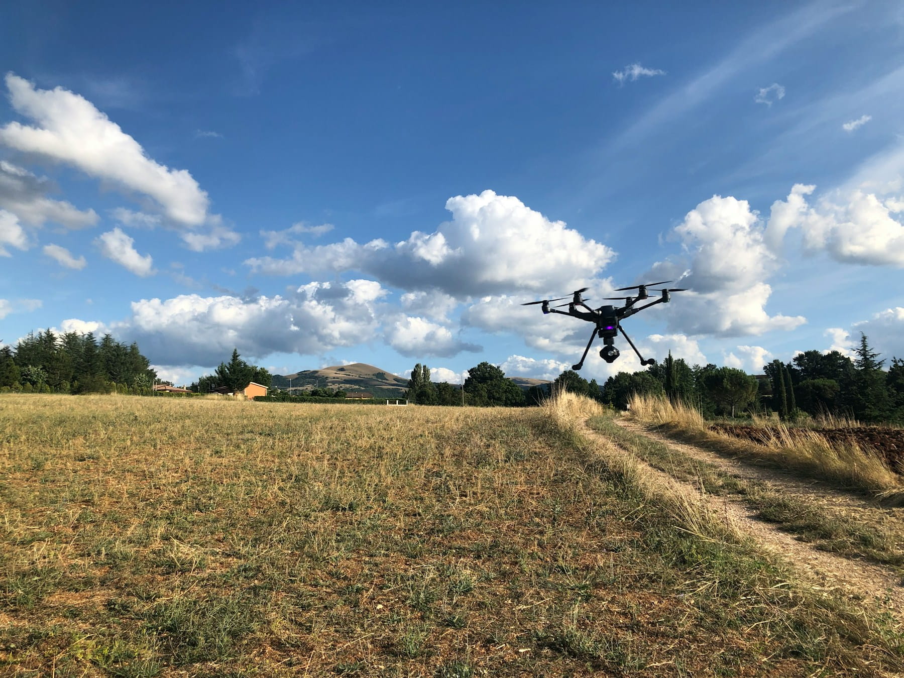
What are Agricultural Drones?
Agricultural drones are unmanned aerial systems equipped with specialized sensors and imaging technology that allow farmers to monitor crop health, apply inputs with precision, and collect field data for data-driven decision-making. These platforms improve farming efficiency by identifying issues early, reducing input costs, and optimizing resource management across agricultural operations.
Farmers face mounting pressure to produce more food with fewer resources while managing costs and environmental impact. Traditional farming methods, though proven over centuries, often fall short of meeting these demands. Agricultural drones represent a technological shift that addresses these challenges.
These unmanned aerial systems have moved beyond experimental status to become practical tools for crop monitoring, precision application, and data collection supported by USDA research initiatives. The agricultural sector has embraced drone technology faster than many predicted, with adoption rates climbing steadily across farm operations of all sizes.
The convergence of GPS technology, advanced sensors, and data analytics has created opportunities for farmers to make informed decisions based on real-time field conditions. This technological integration transforms how agricultural professionals approach crop management, resource allocation, and yield optimization.
Table of contents
- Current applications of drones in farming operations
- Types of agricultural drones and their capabilities
- Sensor technology for crop monitoring
- Benefits of drone integration in agriculture
- Precision agriculture and data-driven farming
- Challenges and limitations of agricultural drones
- Economic considerations for drone adoption
- Regulatory framework for agricultural drone operations
- Technology trends shaping agricultural aviation
- Implementation strategies for farm operations
- Frequently Asked Questions
- Implementation considerations
- In summary
Current applications of drones in farming operations
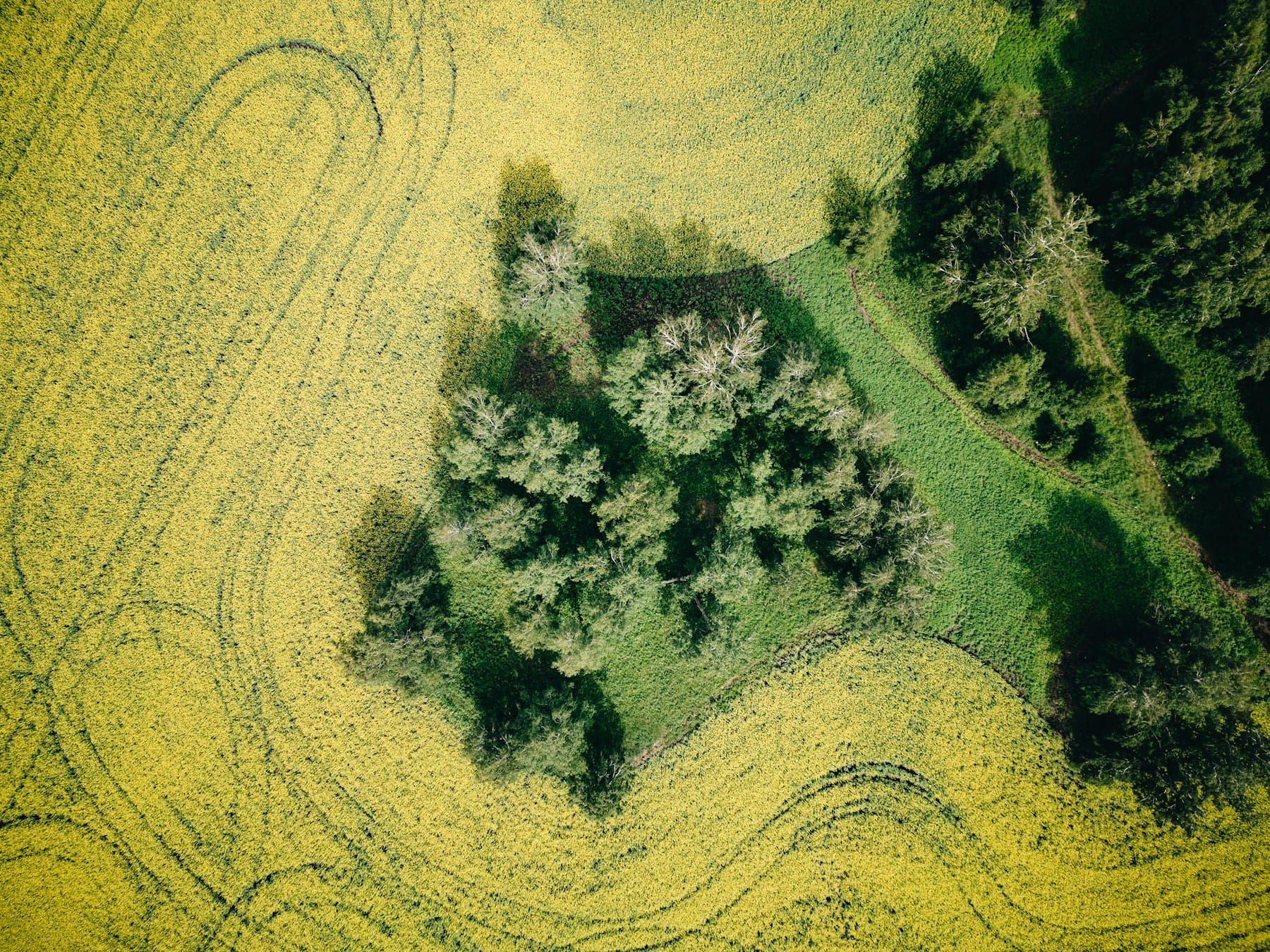
Agricultural drones serve multiple functions across different stages of crop production. Crop monitoring represents one of the most widespread applications, allowing farmers to assess plant health, identify stress indicators, and detect pest infestations before they spread throughout fields.
These aerial platforms capture high-resolution imagery that reveals variations in crop development across large areas. Farmers can spot irrigation issues, nutrient deficiencies, and disease outbreaks that might go unnoticed during ground-based inspections. The bird's-eye view provides context that ground-level observations often miss.
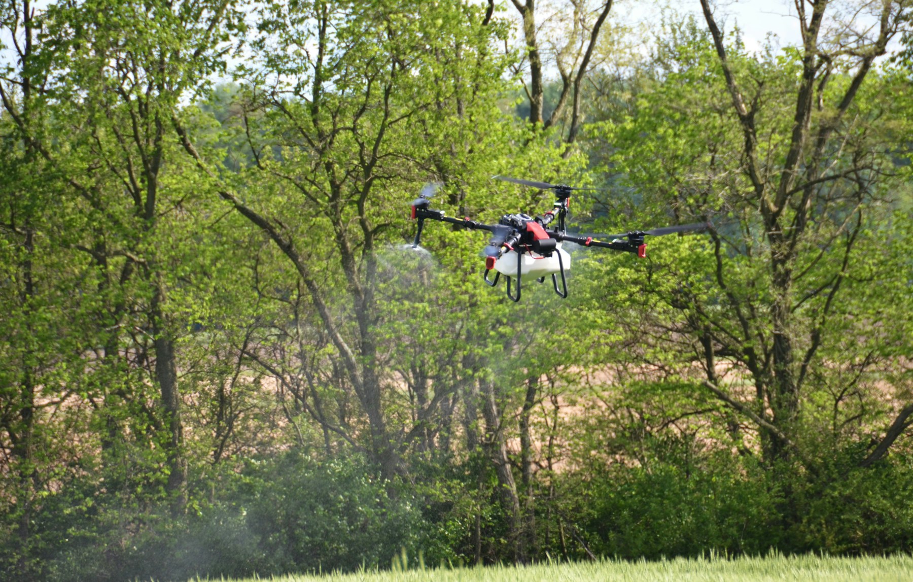
Precision spraying has emerged as another significant application. Drones equipped with spray systems can target specific areas with fertilizers, pesticides, or herbicides, reducing chemical usage while maintaining treatment effectiveness. This targeted approach minimizes environmental impact and reduces input costs.
Field mapping and surveying represent foundational applications that support other farming activities. Drones create detailed topographic maps, monitor drainage patterns, and assess field conditions after extreme weather events. These maps inform planting decisions, irrigation system design, and field improvement projects.
Livestock monitoring has found particular value in large-scale ranching operations. Drones help track animal movements, identify sick or injured livestock, and monitor grazing patterns across extensive pastures. This application proves especially valuable in remote or difficult-to-access areas.
Crop counting and yield estimation provide farmers with data to make informed marketing and storage decisions. Drones can assess plant populations, estimate fruit or grain yields, and identify areas of the field that may require different harvesting approaches.
Types of agricultural drones and their capabilities
Fixed-wing drones excel in covering large agricultural areas. These platforms can survey hundreds of acres in a single flight, making them suitable for extensive crop monitoring operations. Their aerodynamic design allows for longer flight times and better wind resistance compared to multirotor alternatives.
The trade-off for coverage area comes in maneuverability and deployment flexibility. Fixed-wing drones require more space for takeoff and landing, and they cannot hover over specific locations for detailed inspections. However, for broad-area surveillance and mapping, they offer unmatched efficiency.
Multirotor drones provide precision and versatility that fixed-wing platforms cannot match. These systems can hover, move in any direction, and maintain stable positions for detailed imaging or precision applications. Their ability to take off and land vertically makes them suitable for smaller farm operations or areas with limited open space.
Battery life represents the primary limitation of multirotor designs, typically restricting flight times to 20-30 minutes. This constraint requires careful flight planning and potentially multiple flights to cover larger areas. Despite this limitation, their precision capabilities make them popular for targeted applications.
Hybrid designs attempt to capture benefits from both configurations. These platforms can transition between fixed-wing efficiency for coverage and multirotor precision for specific tasks. While promising, hybrid systems often involve higher complexity and costs that may not justify their benefits for many farming operations.
Payload capacity varies significantly across drone types and directly impacts their agricultural applications. Smaller drones might carry only cameras and basic sensors, while larger platforms can accommodate spray systems, soil sampling equipment, or multiple sensor types simultaneously.
The following table outlines key specifications for different agricultural drone categories:
| Drone Type | Coverage Area | Flight Time | Payload Capacity | Best Applications |
|---|---|---|---|---|
| Fixed-wing | 500-2000 acres | 60-90 minutes | 2-10 kg | Large-scale monitoring, mapping |
| Multirotor | 50-200 acres | 20-30 minutes | 1-5 kg | Precision spraying, detailed inspections |
| Hybrid | 200-800 acres | 45-75 minutes | 3-8 kg | Mixed operations, versatile applications |
Sensor technology for crop monitoring
Multispectral sensors capture light across multiple wavelength bands, revealing information invisible to the human eye. These sensors detect variations in plant health, stress levels, and growth patterns by analyzing how crops reflect different types of light. The technology provides early warning indicators for problems that might not become visible until significant damage has occurred.
Near-infrared (NIR) wavelengths prove particularly valuable for assessing plant vigor and biomass. Healthy vegetation reflects NIR light strongly, while stressed or diseased plants show reduced reflection. This creates clear contrast in imagery that helps farmers identify problem areas quickly using drone data processing workflows.
Thermal sensors detect heat signatures that indicate irrigation issues, plant stress, or disease presence. Water-stressed crops typically run hotter than well-irrigated plants, making thermal imaging an effective tool for irrigation management. These sensors also help identify areas where pests or diseases may be developing.
RGB cameras provide familiar color imagery that serves multiple purposes in agricultural monitoring. High-resolution RGB imagery helps with crop counting, growth stage assessment, and general field condition evaluation. When combined with specialized sensors, RGB data adds context and verification for other measurements.
LiDAR sensors measure crop height, canopy structure, and biomass with remarkable precision. This LiDAR technology proves valuable for yield estimation, growth monitoring, and identifying areas with different planting densities. LiDAR data also supports precision agriculture applications by providing detailed field topography.
Hyperspectral sensors represent the most advanced option, capturing dozens or hundreds of narrow wavelength bands. This detailed spectral information can identify specific diseases, nutrient deficiencies, or stress factors with high accuracy. However, hyperspectral systems typically cost significantly more than multispectral alternatives.
Gas sensors detect emissions from soil and plants that indicate various agricultural conditions. These sensors can identify nitrogen levels, methane emissions, or other gases that provide insights into soil health and crop conditions.
Benefits of drone integration in agriculture
Cost reduction emerges as one of the most tangible benefits of agricultural drone adoption. Traditional aerial surveys using manned aircraft or helicopters cost significantly more per acre than drone operations. Farmers can conduct multiple surveys throughout the growing season at a fraction of the previous cost.
Labor efficiency improves dramatically when drones replace manual field scouting activities. A single operator can survey hundreds of acres in the time it would take multiple people to inspect on foot. This efficiency becomes particularly valuable during critical periods when timing affects crop outcomes.
Early problem detection prevents minor issues from becoming major crop losses. Drones can identify pest infestations, disease outbreaks, or irrigation problems days or weeks before they become apparent through traditional monitoring methods. This early warning capability allows for targeted interventions that minimize damage and treatment costs.
Precision application of inputs reduces waste and environmental impact while maintaining treatment effectiveness. Instead of treating entire fields uniformly, farmers can apply fertilizers, pesticides, or other inputs only where needed. This targeted approach often reduces total chemical usage by 20-30% while achieving better results.
Data collection and analysis capabilities provide farmers with detailed records of field conditions over time. This information supports better decision-making for crop rotation, variety selection, and input timing. The data also provides documentation for regulatory compliance and certification programs.
Access to remote or difficult areas becomes feasible with drone technology. Fields with challenging terrain, wet conditions, or dense crop canopies that limit ground access can be monitored regularly from the air. This capability prevents neglect of difficult areas that might harbor problems.
Crop yield estimation improves planning and marketing decisions. Accurate yield predictions help farmers make informed choices about harvest timing, storage requirements, and marketing strategies. This information can significantly impact profitability, especially for operations that market crops throughout the year.
Precision agriculture and data-driven farming
Variable rate application represents one of the most practical applications of drone-generated data. Information about crop conditions across fields allows farmers to adjust seed rates, fertilizer applications, and other inputs based on specific field zones rather than uniform field-wide applications.
This approach optimizes input usage by applying more resources where crops can benefit most while reducing applications in areas with lower potential. The result often includes both cost savings and improved crop performance across the field.
Yield mapping integration creates detailed records that guide future management decisions. When drone monitoring data combines with harvest yield information, farmers gain insights into which management practices work best in different areas of their fields.
Soil sampling strategies benefit from aerial imaging that identifies zones with different characteristics. Rather than taking uniform grid samples across fields, farmers can use drones for surveying to focus sampling efforts on areas that appear different in aerial imagery. This targeted approach often provides better information while reducing sampling costs.
Irrigation management becomes more precise with regular thermal and multispectral monitoring. Farmers can identify areas that dry out faster, have different water requirements, or experience irrigation system problems. This information supports both immediate adjustments and long-term irrigation system improvements.
Pest and disease management strategies improve when based on regular aerial monitoring. Instead of preventive treatments across entire fields, farmers can target applications to areas showing early signs of problems. This approach reduces treatment costs and minimizes environmental impact.
Weather damage assessment helps farmers document losses for insurance purposes and make informed decisions about replanting or salvage operations. Drone imagery provides objective evidence of damage extent and severity that supports insurance claims and guides recovery planning.
Challenges and limitations of agricultural drones
Weather dependencies limit drone operations during critical periods when information might be most needed. Understanding weather considerations helps farmers plan operations around high winds, precipitation, and extreme temperatures that can ground aircraft.
Technical expertise requirements present barriers for some operations. Effective agricultural applications require understanding of flight operations, data processing, and result interpretation. Converting raw imagery into actionable insights requires software, processing power, and analytical skills that may exceed some farming operations' capabilities.
Regulatory compliance adds complexity and costs. Agricultural drone operators must meet aviation regulations, maintain proper certifications, and comply with operational restrictions. Initial investment costs can be substantial when considering complete drone systems, sensors, software, and training.
Battery life limitations restrict coverage area and operational efficiency. Multiple flights may be required to cover large fields, while cold weather operation can further reduce battery performance. Agricultural environments expose drones to dust, moisture, and physical hazards. Establishing proper drone maintenance procedures and managing drone fleet operations ensures maximum uptime and reliability.
Economic considerations for drone adoption
Return on investment calculations must account for both cost savings and productivity improvements. Successful agricultural drone programs typically show benefits through reduced input costs, improved yields, labor savings, and better decision-making.
Scale considerations significantly impact economic feasibility. Larger operations can spread fixed costs across more acres, improving the economic case for drone adoption. Smaller farms may need to focus on specific high-value applications or consider service providers rather than equipment ownership.
Service provider options offer alternatives to equipment ownership. Custom drone services can provide monitoring, mapping, and application services without requiring farmers to invest in equipment or develop technical expertise. This approach works well for farms that need occasional services or want to evaluate drone benefits before investing.
Key economic factors include field size and total acreage under management, crop types and monitoring requirements, frequency of needed observations, labor costs for alternative methods, input costs and potential precision application savings, technology adoption capabilities, and access to data processing services.
Regulatory framework for agricultural drone operations
Aviation regulations govern all drone operations, including agricultural applications. Operators must understand airspace restrictions, flight altitude limits, and operational requirements that apply to their specific locations and activities. These regulations continue to evolve as drone technology and applications develop.
Commercial drone operations require appropriate certifications and compliance with operational rules. Agricultural drone operators conducting business activities must hold commercial drone pilot certificates and follow commercial operation regulations. This requirement applies whether operating their own equipment or providing services to others.
Pesticide application regulations add another layer of compliance for agricultural drone programs. When drones apply pesticides, herbicides, or other regulated chemicals, operators must comply with both aviation and pesticide regulations under FAA Part 137. This typically requires additional certifications and operational procedures.
Local restrictions may limit drone operations even when federal regulations permit them. Some areas have local ordinances that restrict drone flights, require permits, or impose additional operational requirements. Agricultural operations must research and comply with all applicable local regulations.
Privacy considerations affect drone operations near residential areas or property boundaries. While agricultural operations typically have legitimate business purposes for drone flights, operators should be aware of privacy concerns and maintain appropriate flight patterns and altitudes.
Insurance requirements protect operators and landowners from liability associated with drone operations. Agricultural drone programs should include appropriate insurance coverage for equipment, operations, and potential third-party liability. Insurance requirements may vary based on operational scope and local regulations.
Record keeping requirements apply to commercial drone operations and may be required for compliance with various agricultural programs. Operators should maintain flight logs, maintenance records, and operational documentation as required by regulations and good business practices.
Technology trends shaping agricultural aviation
Artificial intelligence integration transforms drone data processing and interpretation capabilities. AI systems can automatically identify crop problems, count plants, estimate yields, and generate management recommendations from drone imagery, reducing the technical expertise required for effective drone programs.
Autonomous flight capabilities and improved battery technology address current limitations. Advanced drones execute pre-planned missions with minimal operator intervention, while longer flight times improve coverage efficiency for large-scale operations.
Integration with farm management software creates seamless workflows from data collection through implementation. Direct connections between drone platforms and management systems reduce manual data transfer and improve decision-making speed. Edge computing capabilities allow drones to process data during flight, providing immediate feedback about field conditions.
Implementation strategies for farm operations
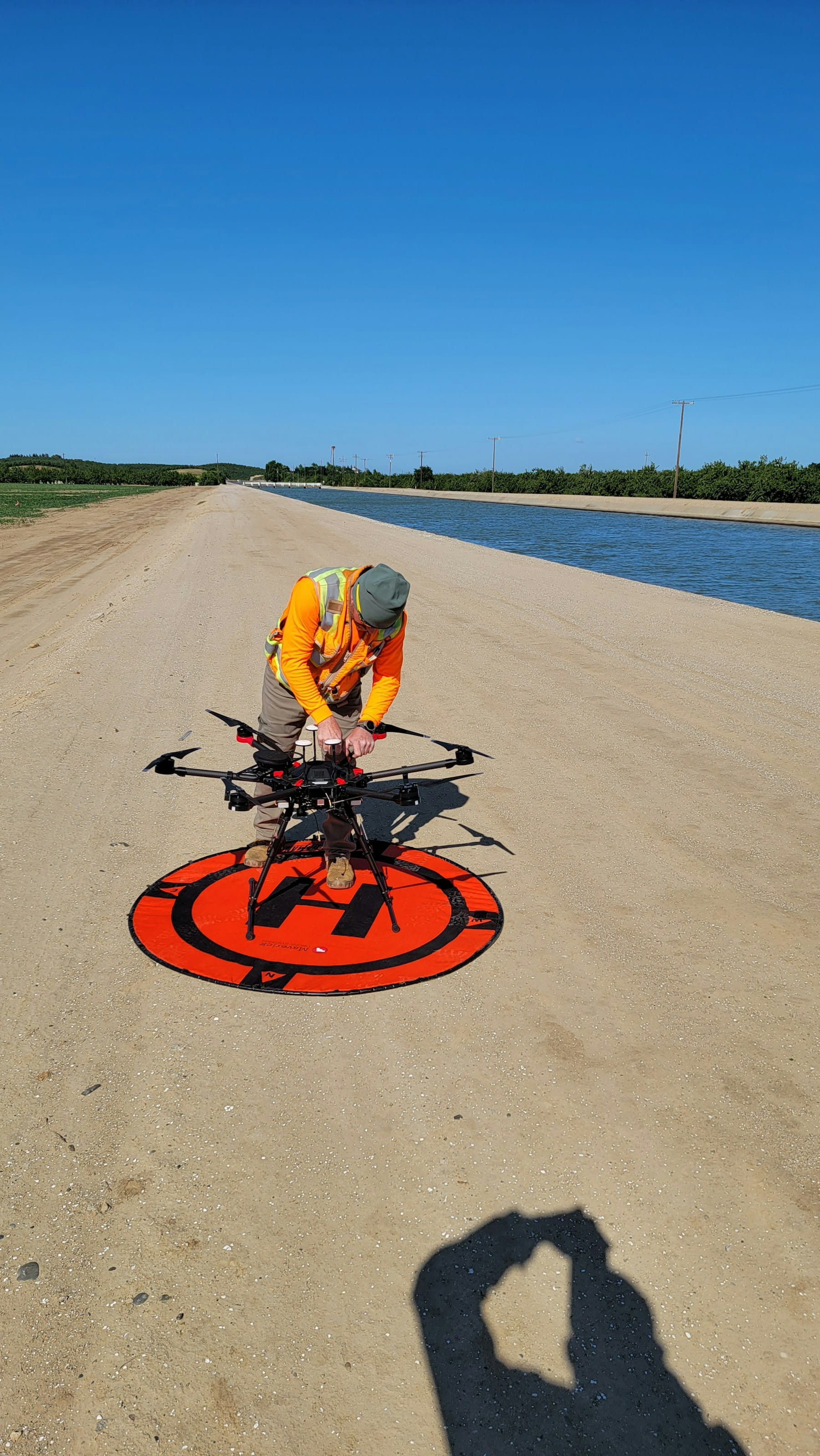
Phased adoption approaches help farms integrate drone technology gradually while building expertise and demonstrating value. Starting with basic monitoring applications allows operations to develop skills and evaluate benefits before investing in more advanced capabilities or larger systems. Proper flight planning becomes important as operations scale.
Pilot program development provides opportunities to test drone applications on limited acreage before full-scale implementation. These programs help identify operational procedures, training needs, and potential challenges while minimizing risks and investments. Implementing standardized pre-flight checklists ensures consistent operational safety.
Partnership opportunities with service providers, equipment dealers, or other farms can reduce individual costs and risks while providing access to expertise and equipment. Collaborative approaches work particularly well for smaller operations or those wanting to evaluate drone benefits before making major investments.
Training and skill development programs prepare operators for successful drone programs. Effective training covers flight operations, data processing, result interpretation, and regulatory compliance through UAS pilot training programs. Many equipment manufacturers, universities, and industry organizations offer training programs tailored to agricultural applications.
Integration planning ensures drone programs complement existing farm management systems and workflows. Successful implementations consider how drone data will be processed, stored, and used in decision-making processes. This planning prevents data silos and maximizes the value of collected information.
Technology selection should match operational needs, technical capabilities, and budget constraints. Farmers should evaluate different drone platforms, sensors, and software options based on their specific applications. Proper equipment management supports long-term operational success.
The implementation process typically follows these stages:
- Assessment and planning - Evaluate operational needs, technical requirements, and economic feasibility
- Technology selection - Choose appropriate drone platforms, sensors, and supporting software
- Training and certification - Develop operational skills and meet regulatory requirements
- Pilot testing - Conduct limited operations to refine procedures and validate benefits
- Full deployment - Implement drone programs across operations
- Continuous improvement - Refine procedures, upgrade technology, and expand applications
Frequently Asked Questions
What type of drone is best for agricultural operations?
The best drone type depends on your specific needs. Fixed-wing drones excel at covering large areas (500-2000 acres per flight), making them ideal for extensive crop monitoring. Multirotor drones offer precision and versatility for smaller operations (50-200 acres), allowing detailed inspections and targeted applications. Consider your farm size, crop types, and primary applications when selecting equipment.
Do I need a special license to operate agricultural drones?
Yes. Commercial agricultural drone operations require Part 107 certification from the FAA. If you plan to spray pesticides or other chemicals, you'll also need Part 137 certification and compliance with additional regulations. These requirements apply whether you're operating drones on your own farm or providing services to others.
How much does it cost to implement an agricultural drone program?
Initial costs vary significantly based on equipment, sensors, and software requirements. Basic monitoring systems start around $5,000-$10,000, while complete programs with advanced sensors and spray capabilities can exceed $50,000. Consider cost-per-acre analysis and potential ROI from reduced inputs, improved yields, and labor savings when evaluating program economics.
What data can agricultural drones collect?
Agricultural drones collect multispectral imagery showing crop health, thermal data indicating irrigation issues, RGB images for crop counting, and LiDAR measurements for canopy structure. This data helps identify pest infestations, nutrient deficiencies, disease outbreaks, and yield variations across fields. Advanced sensors can detect specific plant stresses before they become visible to the human eye.
Implementation considerations
Successful agricultural drone integration requires careful planning beyond equipment purchase. Start by identifying specific problems your operation faces, whether crop disease detection, irrigation management, or yield estimation, then select technology that addresses those needs. Many farms benefit from pilot programs on limited acreage to validate benefits and refine procedures before full-scale deployment.
Infrastructure requirements extend beyond the drone itself. Ensure adequate data processing capabilities, storage systems, and network connectivity to handle large imagery files. Consider whether in-house processing makes sense or if third-party services better suit your operation's technical capabilities and workflow requirements.
Regulatory compliance and risk assessment form critical implementation factors. Beyond basic Part 107 certification, agricultural operations often need Part 137 approval for chemical applications, local permits, and appropriate insurance coverage. Factor these ongoing compliance costs and administrative requirements into your implementation timeline and budget.
In summary
Agricultural drones have evolved from experimental technology to practical farm management tools that deliver measurable value through improved crop monitoring, precision input application, and data-driven decision-making. The technology allows farmers to identify problems early, optimize resource use, and make informed management decisions that directly impact profitability and sustainability.
Successful agricultural drone programs balance technology capabilities with operational realities. The most effective implementations focus on solving specific problems rather than adopting technology for its own sake. Whether monitoring crop health, managing irrigation, or documenting field conditions, drones provide aerial perspective and data collection capabilities that complement traditional farming practices.
The agricultural drone sector continues advancing through improved sensors, longer flight times, better automation, and more accessible data processing. Farmers who thoughtfully integrate these technologies into existing operations position themselves to benefit from efficiency gains, cost reductions, and improved crop outcomes that define modern precision agriculture.
Ready to optimize your agricultural drone operations?
Managing agricultural drone programs requires integrated systems for flight planning, data management, and regulatory compliance. DroneBundle provides tools designed specifically for agricultural operations, helping farmers streamline drone workflows, maintain compliance, and maximize return on investment.
Start your free trial today - no credit card required.
Or book a demo to see how DroneBundle simplifies agricultural drone operations and equipment management for precision farming.