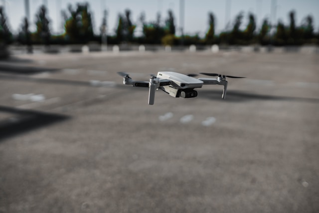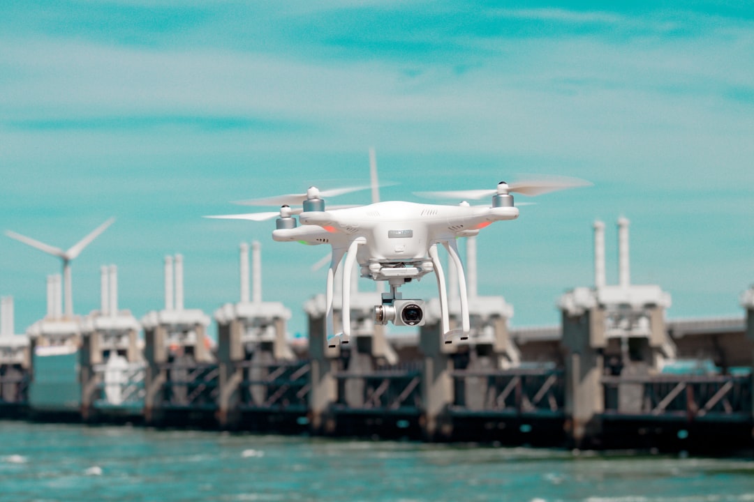
Drone inspection services use unmanned aerial vehicles equipped with high-resolution cameras, thermal sensors, and LiDAR to examine infrastructure, buildings, and industrial assets faster, safer, and often cheaper than traditional manual methods. The global drone inspection and monitoring market reached $15.5 billion in 2025 and is projected to hit $18.4 billion in 2026, growing at roughly 19% annually according to MarketsandMarkets.
Whether you are a facility manager evaluating vendors, a drone operator considering the inspection vertical, or a project manager weighing drone inspections against rope access teams, this guide covers the practical details that most resources skip. You will find real pricing benchmarks by industry, a vendor vetting checklist, honest limitations of drone inspections, and the operational realities that determine whether a drone inspection program actually saves money or just looks good on paper.
Table of contents
- What are drone inspection services?
- Industries that rely on drone inspections
- How much do drone inspection services cost?
- How a drone inspection actually works
- Sensors and payloads used in drone inspections
- When drones are not the right choice
- How to choose a drone inspection provider
- Regulatory requirements for drone inspections
- Data security and confidentiality
- Weather and scheduling realities
- Building vs. outsourcing an inspection drone program
- FAQ
- Next steps for your inspection program
What are drone inspection services?
Drone inspection services are commercial operations where certified pilots fly UAVs equipped with specialized sensors to collect visual, thermal, or geospatial data on physical assets. The service typically includes flight planning, data capture, post-processing, defect analysis, and a deliverable report with findings and recommendations.
The core value proposition is simple. Drones reach places that are dangerous, expensive, or time-consuming for humans to access. A cell tower that requires a two-person climbing crew, half a day of rigging, and fall protection equipment can be inspected by a drone in 30 to 45 minutes. A wind turbine blade inspection that once required rope access technicians rappelling at 300 feet now takes a single pilot and a thermal-equipped drone roughly 90 minutes per turbine.
But the real shift is not just speed. It is data density. A single drone inspection flight can capture thousands of high-resolution images, thermal anomaly maps, and 3D point clouds. That data lives in a digital record that can be compared against future inspections to track degradation over time. Manual inspections rarely produce that level of documentation.
To put concrete numbers on this: a mid-size solar operator running quarterly thermal scans across 12 sites switched from ground-based thermography crews to drone inspections in 2024. Their inspection cost per megawatt dropped from $1,100 to $380, turnaround time from 14 days to 3 days per site, and their defect detection rate increased by 34% because the aerial perspective catches cell-level anomalies that ground-based IR guns miss at oblique angles. That combination of faster, cheaper, and more accurate is why the inspection vertical is growing faster than any other commercial drone application.
For drone operators looking to enter this space, our guide on starting a drone inspection business covers equipment, pricing strategies, and client acquisition in detail. For asset owners evaluating the technology, read on.
Industries that rely on drone inspections
Drone inspection services have moved well past the early-adopter phase. Nine industries currently drive the majority of commercial inspection demand.
Energy and utilities
Power line inspections represent one of the largest drone inspection verticals. Utilities use drones to scan transmission and distribution lines for vegetation encroachment, damaged insulators, corroded hardware, and sagging conductors. Thermal cameras detect hotspots that indicate failing connections before they cause outages.
Solar farm inspections have exploded alongside solar capacity growth. Drones with radiometric thermal cameras identify cell-level defects, bypass diode failures, and soiling patterns across panels that would take ground crews weeks to cover manually.
Wind turbine blade inspections eliminate the need for rope access teams working at extreme heights. Drones capture blade surface imagery at resolutions fine enough to detect cracks, erosion, and lightning strike damage.
Construction and infrastructure
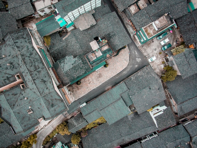
Construction sites use drone inspections for progress monitoring, safety audits, and structural assessments. Regular flyovers create orthomosaic maps that track earthwork volumes, verify grade elevations, and document conditions for dispute resolution. Our construction inspection guide covers the workflow in depth.
Bridge inspections are a growing application. The Federal Highway Administration requires regular inspection of the nation's 620,000+ bridges, and drones can access underdecks, abutments, and bearing seats without lane closures or snooper trucks.
Telecommunications
Cell tower inspections reduce climbing risks, which is significant given that tower climbing remains one of the most dangerous occupations in the United States. Drones capture 360-degree tower imagery, identify antenna alignment issues, and document equipment for lease audits.
Roofing and insurance
Drone roof inspections serve roofing contractors, insurance adjusters, and property managers. A residential roof inspection that takes a contractor 45 minutes of ladder work and risk can be completed by a drone in 10 to 15 minutes with better documentation.
Oil and gas
Refineries, storage tanks, pipelines, and flare stacks all benefit from aerial asset inspections. Confined space drone inspections eliminate the need for scaffolding inside tanks and vessels, reducing shutdown time from days to hours.
Agriculture
Crop health monitoring, irrigation system checks, and field boundary verification use multispectral and NDVI sensors. While not traditionally called "inspections," these services follow the same operational model.
For operators serving multiple verticals, DroneBundle's surveying and inspection industry tools provide templates, client folders, and automated reporting across different inspection types.
How much do drone inspection services cost?
Drone inspection pricing varies widely based on asset type, complexity, sensor requirements, and deliverable expectations. Here are current market benchmarks based on 2026 industry data.
| Inspection Type | Typical Price Range | What's Included |
|---|---|---|
| Residential roof | $150 to $600 | RGB imagery, condition report, annotated photos |
| Commercial roof | $500 to $2,500 | Thermal + RGB, detailed report, CAD overlay |
| Cell tower | $300 to $2,500 | 360-degree imagery, equipment audit, defect tagging |
| Solar farm (per MW) | $300 to $500 | Thermal scan, hotspot map, defect classification |
| Wind turbine (per turbine) | $800 to $2,000 | Blade imagery, defect annotations, severity ratings |
| Power line (per mile) | $200 to $600 | Corridor scan, vegetation analysis, thermal hotspots |
| Bridge | $1,500 to $5,000 | Underdeck imagery, crack mapping, condition assessment |
| Construction progress | $500 to $2,000/visit | Orthomosaic, 3D model, volume calculations |
Several factors push prices higher. Thermal and LiDAR payloads cost more than standard RGB cameras. BVLOS (beyond visual line of sight) operations require additional waivers and sometimes relay pilots. Sites in controlled airspace need LAANC authorization, which adds planning time. Emergency or rush inspections often carry a 50% to 100% premium.
Recurring contracts typically offer 15% to 25% discounts over one-off inspections. A monthly construction monitoring contract might run $1,500 to $4,000 per site depending on frequency and deliverables. Quarterly utility corridor inspections are often priced per linear mile with volume breakdowns.
For operators trying to price their own services, the key is understanding that clients are not paying for flight time. They are paying for the deliverable and the risk reduction it provides. A thermal inspection priced at $1,200 that prevents a $50,000 equipment failure is easy to justify. For more on building inspection pricing models, see our guide on the drone inspection business.
How a drone inspection actually works
A professional drone inspection follows a structured workflow regardless of the asset type. Understanding this process helps both clients set expectations and operators maintain consistency.
Pre-inspection planning
The process starts well before the drone leaves the case. The operator reviews the scope of work, identifies the asset to be inspected, and assesses site conditions. This includes checking airspace classifications for restrictions, reviewing weather forecasts, and confirming that all required authorizations are in place.
A site survey, either in person or via satellite imagery, identifies obstacles, launch/recovery points, and any hazards like overhead wires or RF interference sources. The operator builds a flight plan that covers the entire asset with sufficient overlap for photogrammetry or 3D reconstruction if needed.
This phase is where inexperienced operators lose money. Quoting a cell tower job without checking the airspace first means discovering on-site that you need LAANC authorization in Class D airspace, which adds a day of lead time and potentially a wasted truck roll. Checking a satellite view without visiting the site means missing the 150-foot pine trees 80 meters south of the tower that block your planned orbit path. The pre-inspection survey is not overhead. It is the difference between a profitable job and a write-off.
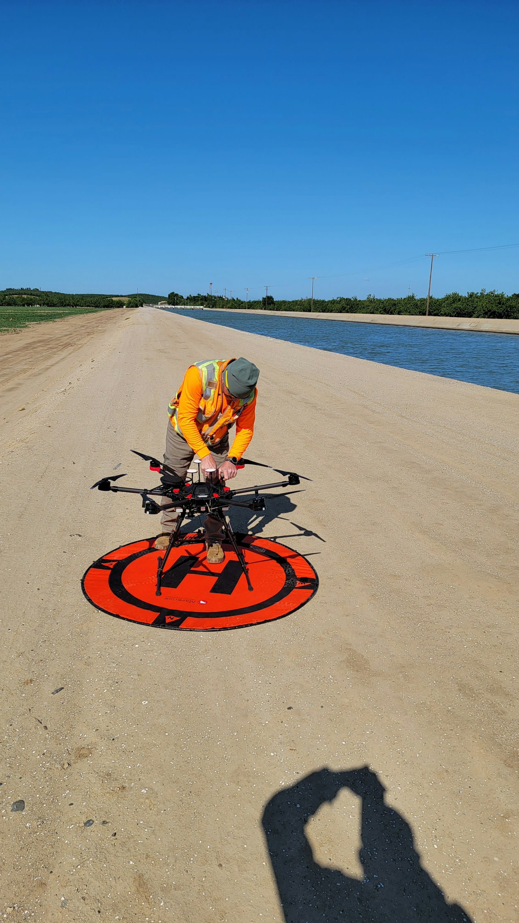
Day-of operations
The pilot arrives on site, conducts a pre-flight checklist, and briefs any on-site personnel about the operation. Batteries are checked. Sensors are calibrated. The pilot confirms GPS lock, compass calibration, and communications link integrity.
Flight execution follows the pre-planned route, though experienced pilots adjust in real time based on conditions. Wind gusts, unexpected obstacles, or areas of particular interest may require deviation from the original plan. The pilot monitors telemetry throughout, watching battery levels, signal strength, and weather conditions.
Data capture
Depending on the inspection type, the drone captures some combination of high-resolution RGB photos, radiometric thermal images, LiDAR point clouds, or video. Overlap between images typically ranges from 70% to 80% for photogrammetric processing. Thermal scans follow specific protocols, often requiring particular angles of incidence and solar irradiance conditions.
A single inspection flight can generate anywhere from 500 images for a residential roof to 50,000+ images for a large solar farm. That raw data needs organized storage and processing, which is where drone inspection software becomes essential.
Post-processing and reporting
Raw imagery goes through processing pipelines that may include stitching orthomosaics, generating 3D models, classifying thermal anomalies, or running AI defect detection algorithms. The operator analyzes the processed data, identifies defects or areas of concern, and annotates findings with GPS coordinates and severity ratings.
The final deliverable is typically a written report with annotated imagery, defect maps, recommended actions, and priority ratings. Some clients receive raw data files for their own analysis. Others want a simple pass/fail summary. Setting clear deliverable expectations upfront prevents scope creep and client disputes.
A common mistake is underestimating post-processing time. Operators who quote jobs based on flight time alone forget that a 45-minute cell tower flight generates 400 to 600 images that need sorting, defect tagging, and report writing. That post-processing can take four to six hours for a thorough deliverable. The ratio of desk time to flight time in inspection work is typically 3:1 or 4:1, and operators who do not price for it end up working for well below their target hourly rate.
For operators managing multiple inspection projects simultaneously, flight data monitoring tools help track quality metrics across all active engagements.
Sensors and payloads used in drone inspections
The sensor payload determines what a drone inspection can detect. Different inspection types demand different technology.
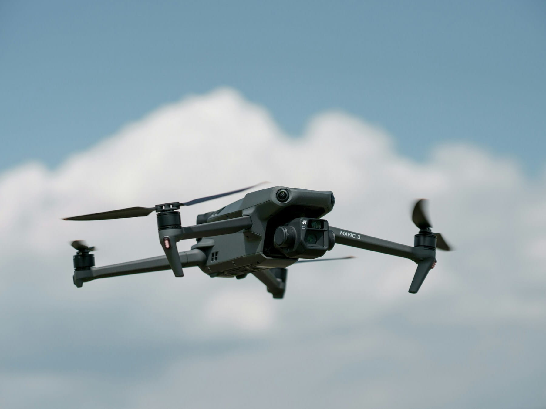
RGB cameras are the baseline. High-resolution visible-light cameras (20MP+) capture surface conditions, structural details, and overall asset appearance. Most inspection drones carry these as their primary payload. Models like the DJI Matrice 350 RTK with a Zenmuse P1 deliver 45MP full-frame imagery suitable for crack detection at centimeter-level resolution.
Thermal cameras detect temperature differentials invisible to the naked eye. Radiometric thermal sensors measure absolute surface temperatures, not just relative differences. This matters for inspections governed by standards like IEC 62446-3 for solar panels. Common thermal payloads include the DJI Zenmuse H30T and FLIR Vue Pro R.
LiDAR sensors generate precise 3D point clouds by measuring laser return times. LiDAR excels at vegetation management around power lines, volumetric measurements for construction, and structural modeling. Our guide on LiDAR for drones covers applications and equipment selection.
Multispectral cameras capture data across multiple light wavelengths beyond what the human eye can see. These sensors are primarily used in agricultural inspections for crop health assessment and in environmental monitoring for water quality analysis.
Ultrasonic thickness gauges are emerging payloads that measure metal wall thickness without physical contact. These are used in oil and gas inspections to detect corrosion-related thinning in tanks and pipelines.
Optical gas imaging (OGI) cameras detect methane and other gas leaks from pipelines, wellheads, and processing equipment. These specialized sensors are increasingly required by EPA methane emission regulations for monitoring at oil and gas facilities.
The trend is toward multi-sensor payloads that capture RGB, thermal, and LiDAR data simultaneously in a single flight. This reduces flight time, increases data correlation accuracy, and lowers per-inspection costs.
When drones are not the right choice
Drones are not a universal replacement for traditional inspection methods. Understanding their limitations helps both operators and clients make honest assessments about when alternative approaches are better.
Confined interior spaces with no GPS present challenges for standard drones. While specialized indoor drones like the Flyability Elios 3 exist, they are expensive ($50,000+) and require specific training. If the inspection target is inside a boiler, tank, or tunnel, a ground-based robot or manual inspection may be more practical unless you already own the specialized equipment.
Contact-based testing cannot be done by most drones. Ultrasonic thickness measurements, paint adhesion tests, and hammer sounding all require physical contact with the surface. Drone-mounted contact sensors exist in limited applications, but they are far from mainstream.
Small, simple assets may not justify the mobilization cost. Inspecting a single residential chimney or a short fence line is often faster and cheaper with a ladder and a camera phone. The overhead of flight planning, airspace checks, and post-processing does not always pencil out for small jobs. Operators who chase every $200 residential job end up burning more on drive time and setup than the job pays. The minimum viable inspection engagement, after factoring mobilization and post-processing, is typically around $500 to $600. Below that, someone with a ladder is the right answer.
Heavy RF interference zones can degrade GPS and control signals. Substations, broadcast facilities, and some industrial environments create electromagnetic conditions that challenge drone navigation systems. Experienced pilots can often work around these issues, but they add risk and time.
Dense urban environments with tall structures create GPS multipath errors and limited line-of-sight conditions. Flying near reflective glass buildings can confuse the drone's positioning systems. Controlled airspace restrictions around urban airports add another layer of complexity.
Sustained high winds above 25 mph ground most commercial inspection drones. If the inspection site is in a location that regularly experiences high winds, like exposed ridgelines or coastal structures, scheduling flexibility becomes critical. This limitation is not temporary; it is structural to how rotary-wing aircraft operate.
The honest answer is that drones complement traditional inspection methods more than they replace them entirely. The best inspection programs use drones for the 80% of work they excel at and traditional methods for the 20% where drones fall short.
How to choose a drone inspection provider
Choosing the wrong drone inspection provider wastes money and potentially creates liability. Most businesses evaluating drone inspection services for the first time do not know what questions to ask. Here is a practical vetting framework.
Certifications and insurance
Every commercial drone operator in the United States must hold an FAA Part 107 Remote Pilot Certificate. Ask to see it. Verify it is current (recurrent training is required every 24 calendar months). For operations in Europe, the equivalent is an EASA Specific Category authorization.
Liability insurance should be a minimum of $1 million per occurrence. Many commercial clients and municipalities require $2 million to $5 million. Ask for a certificate of insurance (COI) naming your organization as an additional insured. Our guide on drone insurance costs explains standard coverage levels.
Industry-specific experience
A pilot who excels at real estate photography may struggle with a cell tower inspection. Ask for examples of completed inspections on similar asset types. Request sample reports. If the provider has never inspected your specific asset type, they may still be qualified, but they should be transparent about their experience level and willing to adjust pricing accordingly.
Equipment and redundancy
Ask what primary and backup aircraft the provider operates. A single-drone operation has no redundancy if equipment fails on site. Professional inspection companies maintain backup aircraft, spare batteries, and replacement sensors.
For thermal inspections, ask whether the camera is radiometric (measures absolute temperature) or non-radiometric (shows relative differences only). This distinction matters for compliance-driven inspections that require specific temperature readings.
Data handling and deliverables
Clarify what deliverables are included before signing a contract. Some providers include only raw imagery. Others deliver fully processed reports with defect annotations, severity ratings, and recommended actions. The gap between these two deliverable levels can represent thousands of dollars in value.
Ask about data retention policies. How long does the provider store your inspection data? Who owns the data? Can you request deletion after the project concludes? For sensitive infrastructure, these questions matter. More on this in the data security section below.
References and track record
Ask for three references from clients in your industry. Call them. Ask about turnaround time, communication quality, report accuracy, and whether the provider met the agreed scope without surprise charges. The drone industry is young enough that reputation travels fast, both good and bad.
One question that separates serious providers from hobbyists with a Part 107: "What happens if weather cancels your flight day and my asset needs inspection before a regulatory deadline?" A professional operator has a weather delay policy, backup scheduling windows, and possibly subcontractor relationships for surge capacity. An operator who hesitates on that question has not thought past the flight itself.
Vendor vetting checklist
Use this checklist when evaluating any drone inspection provider:
- Current FAA Part 107 certificate (or EASA equivalent)
- Liability insurance minimum $1M (COI available)
- Portfolio of similar inspection work
- Sample report for your asset type
- Backup aircraft and equipment plan
- Radiometric thermal capability (if needed)
- Clear deliverable specification in writing
- Data ownership and retention policy
- Three verifiable client references
- Written safety protocol and incident response plan
Regulatory requirements for drone inspections
Commercial drone inspections in the United States fall under 14 CFR Part 107, which governs all small unmanned aircraft systems (sUAS) weighing under 55 pounds.
Key Part 107 requirements that apply to inspection operations:
- Remote Pilot Certificate: The pilot in command must pass the FAA Aeronautical Knowledge Test and hold a current certificate. Recurrent training is required every 24 months. Our Part 107 guide covers the full process.
- Visual line of sight (VLOS): The pilot must maintain visual contact with the drone at all times unless operating under a BVLOS waiver. This limits range for linear asset inspections like pipelines and power lines.
- Altitude limit: Maximum 400 feet AGL, or higher if within 400 feet of a structure and not above that structure's highest point. Most building and tower inspections operate within this envelope.
- Daylight operations: Flights are permitted during civil twilight and daylight. Night operations require anti-collision lighting visible for 3 statute miles.
- Airspace authorization: Operations in controlled airspace (Class B, C, D, and some E) require LAANC authorization or a manual airspace waiver.
- Remote ID: All drones must broadcast Remote ID information during flight, either through a built-in module or an external broadcast module.
For operations that need to exceed Part 107 limitations, operators can apply for FAA waivers. Common inspection-related waivers include operations over people, BVLOS, and operations from moving vehicles.
European operators face a different regulatory framework under EASA regulations. The Specific Category requires an operational authorization based on a risk assessment (SORA), and the requirements vary by member state.
Operators managing compliance across multiple jurisdictions benefit from systematic compliance tracking that automates certificate renewals, airspace checks, and regulatory updates.
Data security and confidentiality
This is the section most drone inspection guides skip entirely, and it is increasingly the section that enterprise clients care about most.
Drone inspections collect detailed imagery of critical infrastructure, proprietary facilities, and sometimes sensitive government assets. That data has security implications that extend well beyond the inspection itself.
Data in transit: Images and video should be encrypted during transfer from the drone's SD card to the operator's processing systems and again when delivered to the client. Unsecured FTP transfers of infrastructure imagery create unnecessary exposure.
Data at rest: Processed inspection data should be stored in encrypted, access-controlled environments. Cloud storage is convenient but raises questions about jurisdiction and data residency. Some clients, particularly in defense and energy, require data to remain within specific geographic boundaries.
Data ownership: The contract should clearly state who owns the inspection data. In most arrangements, the client owns the data and grants the operator a limited license to use anonymized imagery for training or marketing purposes. But if this is not explicitly stated, disputes arise.
Third-party processing: If the operator uses cloud-based processing platforms like DroneDeploy, Pix4D, or Propeller Aero, the client's data passes through third-party servers. Some enterprise clients prohibit this. Operators should be transparent about their processing pipeline and offer on-premise processing options when needed.
Retention and destruction: Establish clear timelines for how long inspection data is retained and how it is destroyed after the retention period expires. A simple email confirmation of data deletion is insufficient for regulated industries. Certificates of destruction may be required.
Personnel screening: For inspections of critical infrastructure covered under CFATS (Chemical Facility Anti-Terrorism Standards) or similar programs, drone pilots may need background checks or security clearances beyond what Part 107 requires.
Operators who treat data security as a differentiator, rather than an afterthought, win higher-value contracts. Building a documented data handling policy is a low-cost investment that signals professionalism and opens doors to enterprise and government clients.
Weather and scheduling realities
Every drone inspection guide mentions weather as a factor. Few explain how it actually impacts operations, schedules, and budgets in practice.
Wind is the primary constraint. Most commercial inspection drones operate safely up to 20 to 25 mph sustained winds. But "safe to fly" and "able to capture usable inspection data" are different thresholds. Thermal images captured in gusty conditions show motion blur. LiDAR point clouds lose accuracy when the platform is unstable. Operators often set their own operational wind limits 5 to 10 mph below the drone manufacturer's stated maximum.
Rain grounds all operations. Consumer-grade DJI drones are not waterproof. Even enterprise platforms like the Matrice 350 RTK carry an IP55 rating that tolerates light rain, not sustained precipitation. More importantly, wet surfaces create false readings on thermal sensors and degrade RGB image quality.
Temperature extremes affect battery performance. LiPo batteries lose 10% to 30% of their capacity in cold weather (below 40°F/5°C). This reduces flight time and may require additional battery swaps, extending the overall inspection timeline. Hot conditions above 95°F/35°C stress motors and electronics, also reducing safe operating margins.
Solar angle matters for thermal inspections. IEC 62446-3 compliant solar panel inspections require specific irradiance conditions, typically above 600 W/m2. This limits inspection windows to roughly 10 AM to 3 PM on clear days, excluding the first and last hours of daylight. Cloud cover can push thermal inspections out by days.
What this means for scheduling
Realistic scheduling accounts for a 20% to 30% weather delay factor. A five-day inspection program should be quoted with seven to eight calendar days of availability. Contracts should specify weather delay policies: who bears the cost of standby time, how rescheduling works, and what constitutes a valid weather cancellation.
For insights on integrating weather data into inspection planning, see our guide on weather considerations for drone operations. DroneBundle's weather integration tools provide multi-source forecasts tied directly to mission planning, so operators can identify viable flight windows days in advance.
Building vs. outsourcing an inspection drone program
Organizations with recurring inspection needs eventually face a build-or-buy decision. Both paths have legitimate advantages.
When outsourcing makes sense
Outsourcing works best when inspections are infrequent (quarterly or less), span multiple asset types requiring different equipment, or involve regulatory complexity the organization does not want to manage internally. It also makes sense during the evaluation phase, before committing capital to equipment and training.
The cost of a capable inspection drone platform (aircraft, thermal camera, batteries, software) starts around $15,000 for basic setups and can exceed $50,000 for enterprise configurations. Training a pilot through Part 107 certification and type-specific inspection training adds another $2,000 to $5,000. These costs must be amortized against the volume of inspections to determine breakeven.
Here is what the math looks like for a utility company running thermal inspections on solar assets, comparing outsourced versus in-house costs over a 12-month period:
| Cost Category | Outsourced (150 flights/yr) | In-House (150 flights/yr) |
|---|---|---|
| Equipment (drone, thermal camera, batteries, spares) | $0 | $38,000 (year 1) |
| Software (inspection + fleet management) | $0 | $3,600/yr |
| Pilot salary (50% allocated to inspections) | $0 | $42,000 |
| Part 107 + thermal certification | $0 | $3,500 (year 1) |
| Insurance (hull + liability) | $0 | $4,200/yr |
| Per-inspection cost (avg. $1,200 outsourced) | $180,000 | $0 |
| Year 1 total | $180,000 | $91,300 |
| Year 2 total | $180,000 | $49,800 |
| Per-flight cost | $1,200 | $608 (yr 1) / $332 (yr 2) |
The breakeven point in this scenario is around 75 flights in year one. By year two, with equipment costs amortized, the in-house program runs at roughly 28% of the outsourced cost. The numbers shift depending on equipment tier, pilot compensation, and flight volume, but the pattern holds: high-volume programs pay for themselves fast.
When building in-house makes sense
In-house programs become cost-effective when inspection volume exceeds roughly 100 to 150 flights per year. At that volume, the per-flight cost of an internal program drops below typical outsourced pricing. Internal programs also offer faster response times, deeper institutional knowledge of the assets being inspected, and tighter integration with maintenance workflows.
Organizations running in-house programs need systematic fleet management to track aircraft maintenance, pilot certifications, battery health, and regulatory compliance across their fleet. Spreadsheets break down quickly once you are managing more than two or three aircraft.
The hybrid approach
Many organizations start by outsourcing, learn the operational requirements, and then build internal capability for their highest-volume inspection types while continuing to outsource specialized or infrequent work. This staged approach reduces risk and allows the organization to validate ROI before committing capital.
DroneBundle supports both models. Outsourced providers use the client portal to share inspection results and manage ongoing relationships. In-house teams use flight planning, risk assessment, and compliance tracking tools to run professional operations from day one. See all features or request a live demo to evaluate the platform for your inspection workflow.
FAQ
How much does a drone inspection cost?
Drone inspection costs range from $150 for a simple residential roof scan to $5,000+ for complex bridge or industrial inspections. Solar farm inspections typically run $300 to $500 per megawatt. Cell tower inspections range from $300 to $2,500 depending on the level of detail required. Pricing depends on asset type, sensor requirements, deliverable complexity, and whether the work is a one-off engagement or part of a recurring contract.
Do I need a Part 107 license to hire a drone inspection service?
No. The drone operator is responsible for holding the FAA Part 107 Remote Pilot Certificate and maintaining all required authorizations. As the client, your responsibility is to verify that the provider holds current certification and adequate insurance. You should also ensure the operator has permission to fly on or near your property and coordinates with any relevant site safety protocols.
How long does a typical drone inspection take?
A residential roof inspection takes 15 to 30 minutes of flight time plus setup and teardown. A cell tower inspection runs 30 to 60 minutes. A 100-acre solar farm requires one to two days for comprehensive thermal scanning. Large infrastructure projects like bridge inspections or multi-mile power line corridors may take three to five days. Post-processing and report delivery typically add two to seven business days depending on complexity.
Are drone inspections as accurate as traditional manual inspections?
For visual and thermal defect detection, drone inspections often exceed the accuracy of manual methods because they capture more data points and produce permanent records. A trained inspector on a roof might miss subtle cracking, but a 20MP drone camera at consistent altitude captures every square foot at uniform resolution. However, drones cannot perform contact-based testing like ultrasonic thickness measurements or adhesion tests without specialized (and still uncommon) payloads. The most thorough inspection programs combine drone aerial surveys with targeted manual follow-up on flagged areas.
Next steps for your inspection program
Drone inspection services deliver measurable value when matched to the right applications and executed by qualified providers. The technology is mature, the regulatory framework is established, and pricing has stabilized enough to make informed budget decisions.
If you are evaluating drone inspections for the first time, start with a pilot project on a single asset type. Compare the cost, turnaround time, and data quality against your current inspection method. That real-world comparison is worth more than any market research report.
For drone operators building or scaling inspection services, the operational backbone matters as much as the aircraft. Managing flight plans, tracking pilot certifications, organizing client deliverables, and maintaining quality assurance standards across dozens of concurrent projects requires purpose-built tools.
Start your free trial of DroneBundle to see how the platform handles inspection workflows end to end, or book a live demo to walk through your specific use case with our team.