Beyond visual line of sight (BVLOS) drone operations allow pilots to fly unmanned aircraft outside their direct visual range, using onboard sensors, telemetry, and detect-and-avoid systems to navigate safely. BVLOS is transforming commercial drone economics by cutting mission costs by up to 80% for infrastructure inspection, delivery, and large-scale surveying.
If you have been flying drones commercially under standard visual line of sight rules, you already know the frustration. You drive two hours to a remote site, launch, fly 1,200 feet in one direction, land, pack up, drive to the next launch point, and repeat. For a 20-mile pipeline survey, that means dozens of separate flights across multiple days with a full ground crew at every stop.
Beyond visual line of sight changes that equation completely. One launch. One flight. Twenty miles of data captured in a single mission while a single operator monitors the aircraft from a ground control station. The crew shrinks from six people to two. The timeline compresses from days to hours.
That is why every serious commercial drone operator is either planning for BVLOS or already pursuing approval. The technology exists. The regulatory framework is catching up. And the operators who move first are locking in contracts that VLOS-only competitors simply cannot serve.
Table of contents
- What does beyond visual line of sight mean?
- VLOS vs EVLOS vs BVLOS: understanding the three categories
- The economics of beyond visual line of sight
- Industries driving BVLOS adoption
- How to transition from VLOS to BVLOS
- Regulatory pathways in 2026
- Technology requirements for BVLOS flight
- Insurance and liability for BVLOS operations
- Managing BVLOS operations at scale
- Frequently asked questions
What does beyond visual line of sight mean?
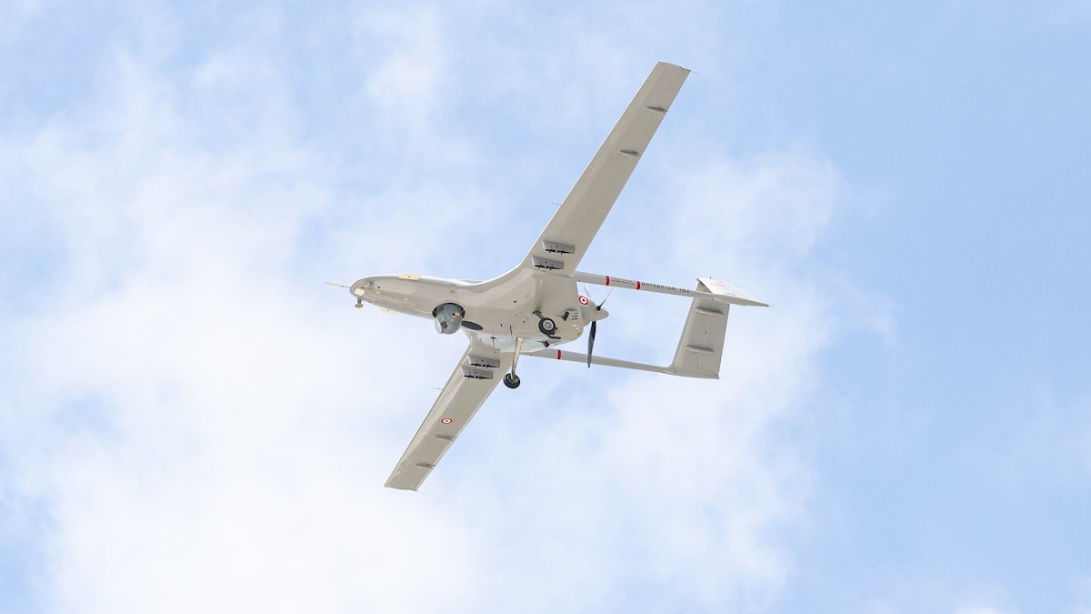
Beyond visual line of sight means operating a drone outside the pilot's direct visual range. Instead of watching the aircraft with unaided eyes, the operator relies on GPS telemetry, live camera feeds, and onboard detect-and-avoid (DAA) systems transmitted to a ground control station. The acronym BVLOS is used interchangeably with the full phrase across regulatory documents and industry publications.
Under standard rules like FAA Part 107, section 107.31 requires the remote pilot in command to see the drone at all times during flight. That visual contact typically limits operations to roughly 1,000 to 1,500 feet from the pilot, depending on aircraft size and conditions. BVLOS removes that limitation entirely, enabling flights that cover tens of kilometers from a single launch point.
The distinction matters because visual contact is not just a convenience. It is the primary safety mechanism in standard drone operations. The pilot's eyes detect other aircraft, spot obstacles, and assess the drone's orientation. When you remove that visual link, every one of those safety functions must be replaced by technology: radar, ADS-B receivers, electro-optical cameras, LiDAR, and autonomous collision avoidance software.
Every aviation authority in the world treats beyond visual line of sight as a higher-risk category that requires explicit approval. In the United States, operators need either a Part 107 waiver or approval under the forthcoming Part 108 framework. European operators work through EASA's Specific category using the SORA methodology. The approval process is rigorous, but the operational payoff is substantial.
VLOS vs EVLOS vs BVLOS: understanding the three categories
Three operational categories define how far a drone can fly from its pilot. Each carries different regulatory requirements, crew structures, and cost profiles.
| Category | Visual contact | Typical range | Crew needed | Regulatory path |
|---|---|---|---|---|
| VLOS | Pilot sees drone directly | Up to ~1,500 ft | 1 pilot + optional VO | Part 107 or EASA Open category |
| EVLOS | Visual observers relay sight | 1,500 ft to several km | 1 pilot + 3-8 VOs | Waivers or national provisions |
| BVLOS | No visual contact required | Tens of kilometers | 1-2 operators at GCS | Part 108, waivers, or EASA Specific |
EVLOS sits in the middle ground. The pilot cannot see the drone directly, but trained visual observers stationed along the route maintain visual contact and communicate with the pilot. Some operators use EVLOS as a stepping stone, building operational history and safety data that strengthens a future BVLOS application. The downside is crew cost. A 10-kilometer route might need six to eight observers, which erodes the cost advantage you are trying to achieve.
The real operational leap happens with full BVLOS. No visual observers means fewer personnel, lower per-mission costs, and the ability to operate in locations where stationing ground crews is impractical or dangerous. That is why utility companies, pipeline operators, and delivery services are investing heavily in BVLOS capability rather than settling for extended visual operations.
The economics of beyond visual line of sight
Beyond visual line of sight operations do not just extend range. They fundamentally restructure the cost model for commercial drone services. The numbers are stark.
Infrastructure inspection costs. Manned helicopter inspections of power lines and pipelines run $40 to $700 per mile depending on terrain and complexity. BVLOS drone inspections bring that down to $10 to $25 per mile. For a utility company inspecting 10,000 miles of transmission lines annually, that translates to $1.5 million or more in first-year savings compared to traditional methods.
Crew reduction. A standard VLOS or EVLOS operation covering a linear corridor requires a pilot, visual observers spaced along the route, a vehicle driver, and possibly a safety officer. That is four to eight people per mission. A BVLOS operation with approved detect-and-avoid capability needs one to two operators at a ground control station. At average loaded labor costs of $60 to $80 per hour per person, the crew savings alone can justify the transition.
Time compression. A power line inspection that takes three days under VLOS rules, with constant repositioning and relaunching, can be completed in a single morning under BVLOS. More flights per day means more revenue per pilot, faster client delivery, and the ability to serve larger geographic areas without adding headcount.
Vehicle and logistics savings. Fewer launch sites means fewer vehicle movements, less fuel, and less wear on support equipment. For operations in remote terrain, the logistics savings can exceed the direct flight cost savings.
The initial investment is real. BVLOS-capable aircraft with integrated DAA systems cost $50,000 to $250,000 or more. Ground control stations, redundant communication links, and the waiver application process add to startup costs. But for operators running regular, repeatable missions, the payback period typically falls between 6 and 18 months depending on mission frequency and contract values.
The global BVLOS drone market reflects this economic pull. Valued at roughly $1.3 billion in 2025, the market is projected to grow at 20% to 26% annually through the early 2030s.
Industries driving BVLOS adoption
Beyond visual line of sight capability is not equally valuable across all drone applications. The industries investing most aggressively share a common profile: large geographic coverage requirements, repetitive inspection cycles, and high costs for traditional methods.
Utilities and energy
Power line and pipeline operators were among the earliest BVLOS adopters, and for good reason. Their assets stretch hundreds or thousands of miles across terrain that is expensive and sometimes dangerous to access on foot or by helicopter. Wind turbine inspections offshore and cell tower surveys in mountainous areas are natural BVLOS use cases where the alternative is scaffolding, rope access, or grounding the asset for extended periods.
Public safety and emergency response
Drone-as-first-responder (DFR) programs deploy BVLOS aircraft from rooftop or ground-based stations to reach emergency scenes before patrol cars. Fremont, California's DFR program reports that drones can cover roughly a third of the missions that traditional units handle. Public safety agencies benefit from the FAA's streamlined shielded operations pathway, which offers a faster route to BVLOS approval for operations below building height.
Agriculture
Crop monitoring, precision spraying, and field mapping across large acreage demand coverage that VLOS operations cannot deliver efficiently. A 5,000-acre farm that requires weekly monitoring would need dozens of VLOS flights or a single BVLOS mission covering the entire property.
Delivery and logistics
Companies like Zipline, Wing, and Matternet have built entire business models around BVLOS delivery. Medical supply delivery in remote areas, last-mile package delivery in suburban corridors, and inter-facility logistics within campus environments all require beyond visual line of sight authority to be commercially viable.
How to transition from VLOS to BVLOS
Moving from visual line of sight to beyond visual line of sight operations is not a single leap. It is a progression that most successful operators complete over 12 to 24 months. Here is a practical roadmap based on how operators actually make the transition.
Step 1: Build your VLOS safety record
Regulators evaluate your operational history when reviewing BVLOS applications. A clean safety record with documented flights, thorough pre-flight checklists, and zero incidents strengthens your case. Use flight planning software to log every mission systematically, because you will need that data later.
Step 2: Start with EVLOS operations
If your jurisdiction allows extended visual line of sight operations, use them to build experience managing aircraft beyond your personal visual range. EVLOS operations teach crew coordination, handoff procedures, and communication protocols that directly translate to BVLOS. The risk assessment documentation you develop for EVLOS forms the foundation of your BVLOS safety case.
Step 3: Pursue shielded BVLOS first
Shielded operations, where physical terrain or structures contain the drone within a defined area, carry the lowest documentation burden. Industrial sites, canyons, and areas below tree canopy height qualify. The FAA's standardized 200-foot shielded operations checklist provides a clear template. Winning a shielded approval gives you operational BVLOS experience and an approval on record, both of which strengthen future applications for unrestricted BVLOS.
Step 4: Invest in DAA-equipped aircraft
When you are ready for full beyond visual line of sight operations without terrain shielding or visual observers, you need a BVLOS-capable drone with integrated detect-and-avoid systems. Start the aircraft evaluation and procurement process early, because integrating new equipment into your operations, training pilots, and validating system performance takes months.
Step 5: Submit your waiver or Part 108 application
Write your Concept of Operations (CONOPS) document, complete the risk analysis, and submit through the FAA's waiver process or the Part 108 pathway once it becomes available. Processing times run 90 to 120 days for complete applications. Read the full BVLOS waiver guide for detailed instructions on what makes an application succeed or fail.
Regulatory pathways in 2026
The regulatory landscape for beyond visual line of sight operations is shifting faster in 2026 than at any point in the past decade.
United States: Part 107 waivers and Part 108
Currently, U.S. operators access BVLOS through Part 107 waivers to section 107.31. The FAA approved 203 BVLOS waivers in 2024, representing 25% of all Part 107 waivers issued that year. That is a significant increase from earlier years when approval rates hovered below 2%.
The bigger shift is Part 108, the FAA's proposed framework for normalizing BVLOS operations. Published as a Notice of Proposed Rulemaking in August 2025, Part 108 replaces the slow, case-by-case waiver system with standardized approval categories. The comment period closed in October 2025 with over 3,000 responses, and the FAA reopened comments in January 2026 on two unresolved elements: electronic conspicuity and right-of-way rules. The final rule is expected in spring 2026.
Key Part 108 provisions include two approval levels (Permitted Operations for lower-risk and Certificated Operations for higher-risk missions), five risk categories based on population density, and aircraft weight limits up to 1,320 pounds. For a detailed breakdown, read the Part 108 requirements checklist.
Europe: EASA Specific category and SORA
European operators pursue BVLOS through EASA's Specific category using the Specific Operations Risk Assessment (SORA) methodology. SORA classifies operations by ground risk and air risk, producing a Specific Assurance and Integrity Level (SAIL) that determines documentation requirements. The process is well-defined but documentation-heavy. Operators in the EU should review our EASA compliance guide for the full framework.
Canada
Transport Canada introduced standardized BVLOS pathways starting April 1, 2025, making Canada one of the first major markets to move beyond case-by-case approvals. Processing times average around 60 days for well-prepared applications.
Technology requirements for BVLOS flight
Flying beyond visual line of sight requires technology that replaces every safety function the pilot's eyes normally provide. Here are the non-negotiable systems.
Detect-and-avoid (DAA). The most critical technology. DAA systems must detect both cooperative traffic (aircraft broadcasting ADS-B or transponder signals) and non-cooperative traffic (aircraft without electronic signatures, birds, other drones). Leading platforms combine ADS-B In receivers, radar, and electro-optical cameras with AI-based detection for layered redundancy.
Redundant command-and-control links. If the communication link drops during a BVLOS flight, the pilot cannot see or control the aircraft. Most BVLOS platforms use a primary RF link paired with a cellular (4G/5G) backup, with some adding satellite communication as a third layer. The FAA's Part 108 NPRM requires sufficient bandwidth for telemetry, video, and control inputs simultaneously, with latency below 500 milliseconds.
Remote ID broadcast. All BVLOS drones must broadcast identification and location data. Remote ID is already required for all drones under current FAA rules, but BVLOS operations face stricter enforcement because the aircraft operates outside the pilot's visual awareness.
Autonomous navigation and fail-safes. GPS/GNSS navigation is the baseline, supplemented by inertial navigation units, visual positioning systems, and terrain-following sensors for GPS-degraded environments. Fail-safe behaviors must include automated return-to-home on lost link, forced landing on critical battery, and hard geofence enforcement.
Ground control station. A purpose-built GCS displays real-time telemetry, video feeds, airspace information, and weather data in a unified interface. This is the pilot's window into the operation. Read our mission planning software guide for a comparison of platforms that support BVLOS GCS workflows.
Insurance and liability for BVLOS operations
Beyond visual line of sight operations create an insurance profile that differs significantly from standard VLOS coverage. This is an area most operators underestimate during transition planning.
BVLOS premiums run two to five times higher than equivalent VLOS policies. Underwriters price the increased risk of operating without direct visual contact, longer exposure times per flight, and the expanded geographic footprint of each mission. Annual hull and liability premiums for a BVLOS operation typically range from $15,000 to $50,000 depending on aircraft value, mission type, and operational area.
What underwriters look for when evaluating BVLOS applications:
- Regulatory approval documentation. An active FAA waiver or Part 108 authorization is the baseline. No approval, no policy.
- DAA system specifications. Underwriters want to know exactly what detect-and-avoid technology the aircraft carries and its demonstrated detection range.
- Pilot experience and training records. Hours logged on the specific platform, BVLOS-specific training certifications, and any simulator time.
- Operational procedures. Your CONOPS, emergency procedures, lost-link protocols, and risk register.
- Claims history. A clean safety record with documented flight logs reduces premiums significantly.
For a broader look at drone coverage options, see our guide to drone insurance costs and liability coverage for commercial operations.
Managing BVLOS operations at scale
Running one beyond visual line of sight mission is a milestone. Running them daily across multiple sites with multiple aircraft is a different challenge entirely.
Fleet management complexity increases nonlinearly with BVLOS. Each aircraft operates independently over large areas, generating telemetry data that must be monitored in real time. Battery states, communication link quality, airspace conflicts, and weather changes across the entire flight corridor need constant attention. A single operator monitoring a ground control station for one aircraft is manageable. Coordinating three simultaneous BVLOS missions across different corridors requires systematic tooling.
Live tracking becomes essential rather than optional. When an aircraft is 15 kilometers from the launch point and invisible to the naked eye, the ground control station's position display is your only source of truth. Any latency or gap in that tracking data creates a window where you have lost situational awareness of an aircraft operating in shared airspace.
Compliance tracking also scales in complexity. Each BVLOS mission generates documentation requirements: flight logs, DAA system status records, communication link performance data, and weather conditions at the time of operation. Multiply that across dozens of daily flights and the paperwork becomes unmanageable without automated systems.
Platforms like DroneBundle consolidate flight planning, live tracking, compliance documentation, and fleet oversight into a single dashboard. For operations scaling beyond a handful of BVLOS missions per week, integrated management software is not a luxury. It is an operational requirement.
Frequently asked questions
What is the difference between BVLOS and VLOS?
VLOS (visual line of sight) requires the pilot to see the drone at all times during flight, typically limiting range to about 1,500 feet. BVLOS (beyond visual line of sight) allows the drone to fly outside the pilot's visual range, relying instead on onboard sensors, GPS telemetry, and detect-and-avoid systems. BVLOS operations require explicit regulatory approval through waivers or dedicated frameworks like Part 108.
How far can a BVLOS drone fly?
Range depends on the aircraft, communication links, and battery or fuel capacity. Most commercial BVLOS drones cover 15 to 50 kilometers per flight, with some fixed-wing platforms exceeding 100 kilometers. The regulatory approval defines the authorized operating area rather than a fixed distance limit. Read our BVLOS drone guide for a comparison of current platform ranges.
How much does it cost to start BVLOS operations?
Initial investment ranges from $75,000 to $300,000 or more, covering a DAA-equipped aircraft ($50,000 to $250,000), ground control station ($5,000 to $25,000), redundant communication systems, insurance, and the waiver application process. Ongoing costs are lower per mission than VLOS alternatives, with most operators reaching payback within 6 to 18 months on repeatable contracts.
Do I need a special license for beyond visual line of sight?
In the United States, you need a valid Part 107 certificate plus a BVLOS waiver or (once available) a Part 108 authorization. Some operations also require FAA drone registration under specific weight categories. European operators need EASA Specific category authorization through the SORA process. Additional training specific to BVLOS procedures and the detect-and-avoid systems you use is expected by both regulators and insurers.
Beyond visual line of sight is not a distant future capability. It is happening now, with hundreds of operators already flying approved BVLOS missions daily across the United States and Europe. The regulatory pathway is clearer than it has ever been, the technology is mature, and the economics strongly favor operators who make the transition.
The question is not whether BVLOS will become standard for commercial drone operations. It is whether your operation will be ready when your competitors are already there.
Ready to manage beyond visual line of sight operations? Start your free trial to see how DroneBundle handles BVLOS flight planning, live tracking, and compliance documentation in one platform. Or book a live demo to walk through BVLOS workflows with our team.