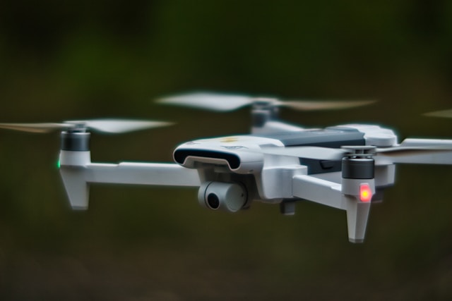
What is a Surveillance Drone?
A surveillance drone is an unmanned aerial vehicle designed for persistent monitoring, reconnaissance, and intelligence gathering using advanced sensors including thermal cameras, high-zoom optics, and AI-powered detection systems. Unlike consumer drones built for recreation, surveillance drones are engineered for extended flight times, autonomous operation, real-time video streaming, and all-weather performance to support law enforcement, security, and infrastructure monitoring missions.
The surveillance drone has evolved from a military technology into a widely adopted tool for law enforcement, commercial security, and industrial monitoring. "Drone as First Responder" programs expanded significantly across U.S. cities in 2025, with departments deploying autonomous surveillance drones that launch from patrol vehicles in under 40 seconds to provide aerial intelligence before officers arrive on scene.
Modern surveillance drones combine thermal imaging, optical zoom up to 56x, and AI-powered object detection to deliver capabilities that were previously available only through manned helicopters costing thousands of dollars per hour. Organizations increasingly pair surveillance drones with autonomous security systems to create comprehensive aerial monitoring solutions.
This guide explains how surveillance drones work, the leading platforms available, key applications across industries, and the privacy and regulatory considerations every operator must understand.
Table of contents
- Types of surveillance drones
- Key surveillance drone technologies
- Popular surveillance drone models
- Surveillance drone applications
- Privacy and legal considerations
- FAA regulations for surveillance drones
- Frequently asked questions
- Implementation considerations
- In summary
Types of surveillance drones
Surveillance drones fall into several categories based on their operational profile and intended use case.
Law enforcement and public safety drones
Police departments and emergency services represent the fastest-growing segment of surveillance drone adoption. These platforms deploy rapidly from vehicles or fixed locations to provide real-time aerial intelligence for active incidents, search and rescue operations, and nighttime operations. The DJI Matrice 30T has become the most widely adopted law enforcement model due to its thermal camera, rapid deployment, and 41-minute flight time.
Commercial and industrial surveillance drones
Businesses deploy surveillance drones for site security, perimeter monitoring, and asset protection. These systems often operate autonomously from drone-in-a-box docking stations, patrolling corporate campuses, warehouses, and construction sites on scheduled routes or in response to triggered alarms.
Tethered surveillance drones
Tethered systems like the Elistair Orion connect to a ground-based power supply via cable, enabling 50+ hours of continuous flight. By eliminating battery constraints, tethered drones provide persistent aerial surveillance for high-value area protection, event security, and military base monitoring.
VTOL and fixed-wing surveillance platforms
VTOL hybrid drones combine vertical takeoff with fixed-wing efficiency, covering larger areas on a single flight. These platforms serve border patrol, pipeline monitoring, and large-property surveillance where extended range and endurance matter more than hover capability.
Key surveillance drone technologies
The effectiveness of a surveillance drone depends on its sensor suite, data processing capabilities, and autonomous flight systems.
Thermal and infrared imaging
Thermal cameras detect heat signatures from people, vehicles, and equipment regardless of lighting conditions. Standard surveillance drones feature 640x512 pixel thermal resolution capable of detecting humans from 300+ meters. This technology is critical for nighttime operations, search and rescue, and thermal imaging business applications including wildfire detection and industrial equipment monitoring.
High-zoom optics
Enterprise surveillance drones offer 10x to 56x hybrid zoom, allowing operators to identify subjects and read details from hundreds of meters away. The DJI Matrice 350 RTK provides 56x hybrid zoom with a 40 MP sensor, while the Autel EVO Max 4T V2 delivers 8K resolution with 10x lossless zoom. These capabilities enable surveillance from distances that keep the drone unobtrusive.
AI-powered detection and tracking
Onboard AI algorithms detect, classify, and track people, vehicles, and vessels in real time. These systems filter out false positives from animals, wind-blown debris, and environmental movement, surfacing only genuine threats to operators. Advanced platforms support custom detection models for specialized applications like perimeter breach detection or crowd density analysis.
Real-time streaming and data relay
Modern surveillance drones stream multi-camera feeds simultaneously over encrypted links at distances exceeding 20 km. DJI's O3 Enterprise transmission system supports triple-channel 1080p HD streaming with WPA2 AES encryption. This allows security operations centers to monitor live footage and coordinate response in real time.
Popular surveillance drone models
The following platforms represent the leading options for surveillance operations across different use cases and budgets.
| Model | Flight Time | Key Sensor | Zoom | Transmission Range | Best For |
|---|---|---|---|---|---|
| DJI Matrice 30T | 41 min | 640x512 thermal | Enterprise zoom | 20+ km | Law enforcement |
| DJI Matrice 350 RTK | 55 min | 640x512 thermal | 56x hybrid | 20 km | Industrial surveillance |
| Skydio X10 | 35 min | Thermal + visual | AI-enhanced | 12 km (radio) | Autonomous operations |
| Autel EVO Max 4T V2 | 42 min | 8K + thermal + radar | 10x lossless | 15+ km | All-weather surveillance |
| Parrot ANAFI USA | 32 min | FLIR thermal | 32x optical | 4 km | Government/NDAA-compliant |
| Elistair Orion 2.2 TE | 50+ hours | EO camera | Configurable | Tethered | Persistent surveillance |
The Parrot ANAFI USA deserves special attention for government operations: it weighs only 500 grams, deploys in 55 seconds, and features 512-bit AES-XTS encryption with full NDAA and TAA compliance, making it the preferred choice for agencies restricted from using Chinese-manufactured equipment.
Surveillance drone applications
Surveillance drones serve diverse sectors, each leveraging different combinations of sensors, autonomy, and operational profiles.
Law enforcement and public safety
Public safety organizations use surveillance drones for search and rescue, crime scene documentation, traffic accident investigation, and active incident support. "Drone as First Responder" programs deploy aircraft automatically from real-time crime centers, providing aerial video to dispatchers and officers before ground units arrive. These programs reduce response times and improve situational awareness for safer officer deployment.
Critical infrastructure monitoring
Power line inspections, pipeline surveillance, and solar farm monitoring represent high-value surveillance applications. Utilities and energy companies deploy drones to detect equipment anomalies, unauthorized access, and environmental hazards across vast service territories. Thermal imaging identifies overheating electrical components before they fail, while visual inspection catches structural damage that ground crews might miss.
Private security and facility protection
Corporate campuses, data centers, and construction sites use surveillance drones for after-hours patrol, alarm verification, and perimeter monitoring. Autonomous systems fly pre-programmed routes and respond to sensor triggers, providing drone inspection capabilities combined with security coverage in a single platform.
Environmental and border monitoring
Wildlife tracking, wildfire detection, wetland surveys, and border patrol all leverage the persistent aerial coverage that surveillance drones provide. Border agencies integrate small-UAS programs with existing radar and ground sensor networks for comprehensive situational awareness, using flight planning tools to coordinate large-area coverage.
Privacy and legal considerations
Surveillance drone technology raises significant privacy questions that operators must address. The legal landscape varies significantly by jurisdiction and use case.
Fourth Amendment protections
Courts continue to refine how Fourth Amendment protections apply to aerial surveillance technology. While activities visible from public airspace have traditionally lacked strong privacy protections, the persistence and precision of drone surveillance challenges existing legal frameworks. The Brookings Institution notes that legislatures, not courts, are driving the most significant privacy protections for drone surveillance.
State warrant requirements
Eighteen states now require law enforcement to obtain a search warrant before conducting drone surveillance: Alaska, Florida, Idaho, Illinois, Indiana, Iowa, Maine, Montana, Nevada, North Carolina, North Dakota, Oregon, Tennessee, Texas, Utah, Vermont, Virginia, and Wisconsin. These laws include exceptions for exigent circumstances such as active emergencies or imminent threats.
Several states have enacted additional restrictions in 2025. California imposed strict limits on facial recognition and audio capture by law enforcement drones. New York criminalized the use of aerial imaging to covertly observe individuals in private settings. Maintaining regulatory compliance requires understanding both federal and state-specific requirements.
Recording and consent laws
Federal wiretap laws and state recording consent statutes apply to surveillance drones equipped with audio capture. Two-party consent states including California, Pennsylvania, and Florida require all parties to agree before audio recording. Most surveillance drone operations focus on visual data collection, but operators must verify their equipment and practices comply with local recording laws.
The ACLU and EFF actively monitor drone surveillance practices and advocate for transparency requirements in government drone programs.
Airspace and property rights
Operators must respect restricted airspace zones and understand the distinction between public and private airspace. Property owners have limited but evolving rights regarding drones operating above their land, and trespass claims remain unsettled in many jurisdictions.
FAA regulations for surveillance drones
All commercial and government surveillance drone operations in the United States must comply with FAA regulations.
Part 107 requirements
FAA Part 107 establishes the baseline rules for commercial drone operations: visual line of sight with the aircraft, 400-foot altitude ceiling, daylight operations (civil twilight with anti-collision lighting), and restrictions on flights over people. All operators must hold a valid remote pilot certificate.
BVLOS operations
Most meaningful surveillance operations require beyond visual line of sight (BVLOS) capability. Currently, operators must obtain individual FAA waivers through the Aviation Safety Hub, with a 90-day target review window. Three approved approaches exist: visual observer networks, shielding (using natural obstructions), and detect-and-avoid (DAA) systems.
The FAA's proposed Part 108 BVLOS framework, expected to be finalized by March 2026, will replace the waiver process with standardized operational permits, significantly expanding access to routine surveillance drone operations.
Remote ID compliance
All drones over 0.55 lbs must broadcast Remote ID signals during flight, enabling authorities to identify and locate aircraft in real time. This requirement has been in effect since March 2024 and applies to all surveillance operations regardless of operator type.
Frequently asked questions
Are surveillance drones legal?
Yes, surveillance drones are legal in the United States when operated in compliance with FAA regulations and applicable state laws. Commercial operators need a Part 107 remote pilot certificate, and law enforcement agencies in 18 states must obtain warrants before conducting surveillance. Private individuals using drones to monitor others may violate state privacy, trespass, or voyeurism laws depending on the jurisdiction.
How far can a surveillance drone see?
Detection range depends on the camera and zoom capabilities. Enterprise models with 56x hybrid zoom (DJI Matrice 350 RTK) can identify subjects from several hundred meters away. Thermal cameras detect human-sized heat signatures at 300+ meters. The Parrot ANAFI USA's 32x zoom provides usable detail at approximately 5 km distance, though atmospheric conditions affect clarity at longer ranges.
Can surveillance drones operate at night?
Yes. Thermal-equipped surveillance drones operate effectively in complete darkness by detecting heat signatures rather than visible light. The Skydio X10 is specifically designed for zero-light environments with GPS-denied navigation capability. FAA Part 107 allows nighttime operations with appropriate anti-collision lighting without requiring a waiver.
How long can a surveillance drone stay in the air?
Battery-powered surveillance drones typically fly 32-55 minutes per charge. The DJI Matrice 350 RTK leads this category at 55 minutes. Tethered systems like the Elistair Orion eliminate battery constraints entirely, achieving 50+ hours of continuous flight through a ground-based power cable, making them ideal for persistent surveillance of fixed locations.
Implementation considerations
Deploying surveillance drones requires balancing operational capability with legal compliance and community expectations. Start by defining the specific surveillance requirements: area size, persistence needed, lighting conditions, and sensor resolution. These factors determine whether a battery-powered multirotor, tethered system, or VTOL platform best fits the mission.
Conduct a thorough operational risk assessment before deployment. Address FAA compliance, state privacy laws, data handling procedures, and community notification policies. Organizations deploying surveillance drones for security purposes should establish clear policies governing when and how aerial surveillance is conducted, who has access to recorded footage, and how long data is retained.
Training operators on both the technical platform and the legal framework ensures effective and compliant operations. Invest in regular proficiency training, scenario exercises, and policy reviews as regulations continue to evolve at both federal and state levels.
In summary
Surveillance drones have transitioned from specialized military technology to essential tools for law enforcement, commercial security, and infrastructure monitoring. Modern platforms combine thermal imaging, high-zoom optics, AI detection, and autonomous flight to deliver aerial intelligence capabilities previously available only through manned aircraft at far greater cost.
The technology continues advancing rapidly: 8K resolution, millimeter-wave radar, 50+ hour tethered endurance, and sub-40-second deployment times are now commercially available. As the FAA finalizes Part 108 BVLOS regulations and more agencies adopt "Drone as First Responder" programs, surveillance drone deployment will accelerate further.
Operators who invest in understanding both the technology and the evolving legal landscape position themselves to leverage these capabilities effectively while maintaining compliance and community trust.
Ready to manage your surveillance drone operations?
Surveillance operations demand rigorous flight logging, compliance documentation, maintenance tracking, and real-time fleet oversight. DroneBundle provides the complete operational platform for managing surveillance drone programs across agencies and organizations.
Start your free trial today - no credit card required.
Or book a demo to see how DroneBundle supports surveillance operations with real-time fleet monitoring and comprehensive compliance management.